2.3.1 Appropriate Assessment (AA)
2.3.1 Appropriate Assessment (AA)
Under the EU Habitats Directive Member States are required to ensure the protection,
conservation, and management of the habitats and species of conservation in all European
sites.
The draft NCN Plan has undergone AA screening during its preparation and an AA Screening
was prepared. The conclusion of the AA Screening6 was:
“At this strategic stage these corridors are intentionally wide to enable detailed design work
to be undertaken to capture the most appropriate route.
Given this is and the multiple potential impacts associated with constructing new or
updating existing cycle routes, it is impossible to draw a conclusion of ‘no likely significant
effect’ in relation to the NCN Plan. Therefore, it is necessary to proceed to the next stage
5 Soil Information System 6 AECOM (2022).
Prepared for: Transport Infrastructure Ireland AECOM
National Cycle Network Plan SEA Adoption Statement
of Appropriate Assessment. All potential NCN route corridors are screened in for the
Appropriate Assessment.”
The draft NCN Plan was then subject to a “Stage 2 AA” as required by Article 6(3) of the
Habitats Directive (92/43/EEC) and a Natura Impact Report (NIR) was prepared and placed
on public display.
The preparation of the draft NCN Plan, SEA and AA has taken place concurrently and the
findings of the AA have informed both the Plan and the SEA. The NIR concluded:
“Given the flexibility of design of the proposed cycle routes and with the addition of
recommendations made, it can be concluded that the NCN would not have an adverse
effect on European sites alone.”
“Additionally, an in-combination assessment was also undertaken of relevant plans and
projects… …it can be concluded that the NCN Plan and the proposed cycle routes would
not have an adverse effect on the integrity of European sites, either alone or in-combination
with other plans and projects.” [Hold Point - TBC]
2.4 Consideration of Alternatives
Consideration of the environmental effects arising from a variety of different alternatives for
the NCN Plan (Section 4.3) has contributed towards the protection and management of the
environment within the NCN Plan.
2.5 Integration of Individual Measures into the NCN Plan
The SEA and AA processes that have been undertaken alongside the preparation of the NCN
Plan. These processes have brought about changes to the emerging NCN Plan, which will
support the avoidance and mitigation of potential negative effects during the Plan’s
implementation. Table 5.1 sets out the proposed monitoring programme for the SEA.
Prepared for: Transport Infrastructure Ireland AECOM
National Cycle Network Plan SEA Adoption Statement
3. Environmental Report and Submissions / Observations
3.1 Introduction
This section details how both the SEA Environmental Report and submissions made to TII on
the Environmental Report and SEA process have been taken into account during the
preparation of the NCN Plan.
3.2 Submissions on the SEA Scoping Report
SEA Scoping submissions were made by the following environmental authorities and
transboundary consultees (Northern Ireland):
Department of Environment, Climate and Communications (DECC). (Environmental
Protection and Circular Economy - Materials Management Divisions).
Geological Survey Ireland (GSI) under DECC.
Environmental Protection Agency (EPA).
Department of Agriculture, Environment and Rural Affairs (DAERA): Northern Ireland
Environment Agency (NIEA).
Department for Communities (DfC): Historic Environment Division (HED).
A submission from DECC7 was for the inclusion of the Whole of Government Circular Economy
Strategy 20218 amongst the plans and policies referenced in the SEA.
A submission from Geological Survey Ireland, provided information and suggestions
including the following topics that informed the preparation of the Draft NCN Plan and SEA:
data sets and maps to use during the SEA process;
culture and tourism sites that would benefit from the cycle network;
consideration for groundwater, geohazards, natural resources, soils, surface water,
sediments, historic mines, marine and coasts, coastal vulnerability etc.; and
relevant guidelines.
A submission from the Environmental Protection Agency provided information and
recommendations on the following:
7 Environmental Protection and Circular Economy - Materials Management Divisions 8 Department of Environment, Climate and Communities (2021).
Prepared for: Transport Infrastructure Ireland AECOM
National Cycle Network Plan SEA Adoption Statement
State of the Environment Report - Ireland’s Environment 2020, noting
recommendations, key issues and challenges described in the report;
the transition to a low carbon climate resilient economy and society;
the NCN Plan’s commitment to monitoring, reviewing and reporting;
the Plan should identify any significant data and knowledge gaps;
the Plan and SEA should alignment with other key plans and programmes;
the Plan should commit to protecting designated national and European sites;
the scope of the SEA and the NCN Plan; and
available / useful guidance and resources for the SEA process.
A submission from the Northern Ireland Environment Agency9 provided information and
recommendations on the following:
advise that transboundary issues are taken into account in the SEA Environmental
Report;
the SEA should consider all potential impacts including those which may impact
Northern Ireland (NI) both directly and indirectly;
NI baseline conditions and relevant plans and programmes need consideration;
mitigation and monitoring will need to be implemented;
data sets, information sources, web-links to use during the SEA process; and
comments from the Climate Change Unit, Drinking Water Inspectorate and the Water
Management Unit.
A submission from the Historic Environment Division10 provided information and
suggestions on the following:
consideration and assessment of likely impacts on transboundary heritage assets will
therefore be required in relation to this topic in the SEA Environmental Report;
cultural heritage assets on the border, which have the potential to be benefit from cycle
routes;
opportunities to enhance understanding of local heritage along cycle routes; and
international conventions, legislation, regional strategies and policies.
9 Department of Agriculture, Environment and Rural Affairs 10 Department for Communities
Prepared for: Transport Infrastructure Ireland AECOM
National Cycle Network Plan SEA Adoption Statement
Appendix A presents a full summary of the submissions received from the environmental
authorities and transboundary consultees at scoping stage.
3.3 Submissions on the Draft NCN Plan and SEA Environmental Report
Submissions were made on the draft NCN Plan and accompanying draft SEA Environmental
Report while on public display (May / June 2022). The Natura Impact Report (NIR) was also
made available for public consultation. The submissions resulted in updates being made to
the above reports. Submissions were received from the following environmental authorities:
Environment Protection Agency (EPA).
Department for Communities: Historic Environment Division (HED).
Department of Agriculture, Environment and Rural Affairs (DAERA): Northern Ireland
Environment Agency (NIEA).
Geological Survey Ireland (GSI) under DECC.
National Parks and Wildlife Services (NPWS) under Department of Housing, Local
Government and Heritage (DHLGH).
A number of submissions were also made by the public during this consultation period.
Updates to the SEA Environmental Report were made to reflect comments received through
these submissions and are detailed in Table 3.1.
3.4 SEA Environmental Report
As previously noted, the draft NCN Plan, SEA Environmental Report and Natura Impact Report
(NIR) were placed on public display. Recommendations / suggestions made during public
consultation were considered by the Plan makers.
The SEA Environmental Report was updated to reflect comments made in consultation
submissions. These comments, and how they have been considered / addressed through the
SEA process, are presented in Table 3.1.
TII have taken into account the findings of all relevant SEA outputs during the development of
the NCN Plan and before the Plan was adopted. In this respect the SEA has formed an integral
part of the evidence base for the NCN Plan.
Prepared for: Transport Infrastructure Ireland AECOM
National Cycle Network Plan SEA Adoption Statement
Table 3.1: Summary of SEA Environmental Report Submissions
Environmental Authority
Summary of Submission Response / Comment
Overview The EPA recognises the importance of promoting and implementing a shift to more sustainable modes of transport, including cycling. A key element of effective SEA is to ensure that the key environmental issues, mitigation measures and any recommendations from the SEA Environmental Report are integrated into the plan.
Comments are noted.
The SEA Environmental Report states that due to the high-level nature of the cycle corridors proposed for the NCN, it is not possible to propose specific mitigation measures for each corridor. The SEA Environmental Report could refer to tiering in environmental assessments. EPA project - “Tiering in Environmental Assessments” and the associated guidance document with the research. Available at: https://www.epa.ie/publications/research/eparesearch-2030-reports/Research_Report_391.pdf Research identifies that SEAs and their associated plans should provide guidance, mitigation and monitoring recommendations for lower tier environmental assessments, i.e., environmental impact assessments (EIAs).
Suggestion for guidance has been considered for tiering in environmental assessments.
SEA ER updated. Review of Relevant Plans is now Chapter 3 of SEA ER. Environmental Baseline is now Chapter 4 of SEA ER.
General Comments Reorganise layout to follow the flow of information listed in the Schedule 2 of the SEA Regulation (S.I. No. 435 of 2004 as amended). Baseline and relationship between other NCN and other plans would merit from the inclusion in the main body of the report.
- Environment Protection Agency (EPA)
Non-Technical Summary (NTS) An NTS has been completed. In accordance with Schedule 2 of the S.I. No. 435 of 2001, as amended, the SEA ER should include a NTS.
Scope / Geographical Coverage of the NCN Plan The NCN should take into account future projections of population growth, and in particular specific areas where it is expected that settlements will exceed 5,000 inhabitants within the lifetime of the plan. Refer to the NPF and the RSES.
Key settlements and destinations for inclusion on the NCN were identified based on a range of criteria as part of the network development stage.
Alignment with Plans and Programmes Ensure the NCN aligns with key relevant higher-level plans and programmes and is consistent with the relevant objectives and policy commitments including the Climate Action Plan 2021, the draft River Basin Management Plan 2022-2027. The NCN must be consistent with the NPF (in particular NPO 22, 27 and 462) and the three RSES. The NCN and SEA should include a schematic showing the relevant plan hierarchy for EU and national transport related plans. EPA welcomes reference to the UN Sustainable Development Goals and recommends discussing the relevance of particular goals and their links with the NCN SEA. The NCN Plan should take account of the National Biodiversity Action Plan which is currently under review.
A policy review for the NCN Plan has been undertaken to assess alignment of the Plan with these plans and programmes.
Alignment with Plans and Programmes The NCN and SEA should include a schematic showing the relevant plan hierarchy for EU and national transport related plans.
Suggestion for schematic is noted. This has been added to Section 2.2 of the SEA ER.
National Cycle Network Plan
Environmental Authority
Summary of Submission Response / Comment
Alignment with Plans and Programmes EPA welcomes reference to the UN Sustainable Development Goals and recommends discussing the relevance of particular goals and their links with the NCN SEA.
Suggestion for the UN Sustainable Development is noted. This has been added to Section 3.1.1 of the SEA ER.
Alignment with Plans and Programmes The NCN Plan should take account of the National Biodiversity Action Plan which is currently under review
A policy review for the NCN Plan has been undertaken to assess alignment of the Plan with this plan.
Relevant Aspects of Current State of the Environment Water Quality / WFD Hydromorphology is the second most significant pressure on water quality in Ireland. This pressure relates to damage to habitat and natural river or lake processes, through physical modification. The River Hydromorphology Assessment Technique (RHAT) is used to determine the hydromorphological condition of our rivers and the natural quality of the riparian zone.
Comment on potential hydromorphological is noted.
Section 4.6.3 of the SEA ER has been updated.
Relevant Aspects of Current State of the Environment Any developments associated with the NCN Plan, within the riparian zone of rivers and lakes should therefore carefully consider their long-term future impact on water quality and in particular hydromorphology, within this context. The NCN should also ensure the wider WFD objectives are adhered to and not compromised during implementation.
Any development as a result of the Plan, will consider the long-term future impact on WQ, including hydromorphology and the WFD objectives.
SEA Objectives Population and Human Health The assessment question “Promote the use of healthier modes of travel?” could be amended to refer to the “…use and benefits…”.
Suggestion for update of SEO is welcomed.Table 5.1 of the SEA ER has been updated.
SEA Objectives Water Amend objective to “Protect, restore and where necessary improve and maintain water quality (surface waters and ground waters) to meet the objectives of the Water Framework Directive”. Amend assessment question to “minimising any hydromorphological impacts”.
Suggestion for update of SEO is welcomed. Table 5.1 of the SEA ER has been updated.
Alternatives EPA acknowledge the detailed analysis of alternatives for the various cycle, it is not clear how this analysis of the different route options will be reflected in the final NCN. There would be merits in describing the alternatives considered, the methodology applied, and the preferred corridors selected in the NCN. These should be accompanied by relevant figures showing the preferred corridors. The alternatives should be assessed against the ‘SEO’s’, identified in the SEA ER.
The analysis has been considered by plan makers, including in light of consultation responses received on the NCN Plan. The alternatives considered and preferred corridors were set out in the Environmental Report and Updated Environmental Report. The SEO and associated assessment questions have been used as a basis of the assessment but presented through the SEA themes to enhance the accessibility of reporting.
National Cycle Network Plan
Environmental Authority
Summary of Submission Response / Comment
Mitigation The examples of mitigation and enhancement measures proposed in Section 5.3 of the report could be incorporated into the NCN as a set of high-level environmental criteria to which projects developed under the NCN could adhere.
The Plan will incorporate environmental mitigation from the SEA ER into the final NCN Plan.
Mitigation There is also merit in including a measure relating to promoting the co-benefits that could be gained for air quality, noise and greenhouse gas emissions as part of the shift to sustainable and active modes of travel.
The Plan will incorporate environmental mitigation from the SEA ER into the final NCN Plan.
Integration of SEA into the NCN The mitigation measures from the SEA Environmental Report should be incorporated into the NCN. The SEA Environmental Report states that due to the high-level nature of the nature of the corridors proposed for the NCN, it is not possible to propose specific mitigation measures for each corridor. The SEA Environmental Report could refer to tiering in environmental assessments - “Tiering in Environmental Assessments” and the associated guidance document with the research. The research identifies that SEAs and their associated plans should provide guidance, mitigation and monitoring recommendations for lower tier environmental assessments.
The Plan will incorporate environmental mitigation from the SEA ER into the final NCN Plan.
Monitoring Monitoring programme should be flexible to take account of specific environmental issues and unforeseen adverse impacts and deal with the possibility of cumulative effects. Monitoring of positive and negative effects should be considered. Monitoring programme should set out data sources, monitoring frequencies, responsibilities and reporting. Should adverse impacts be identified during implementation, TII should ensure that suitable and effective remedial action is taken.
A monitoring programme has been set out in Section 5 of this SEA Adoption Statement.
Monitoring The NCN should include provisions for annual reporting on implementation of the NCN commitments. Align the NCN implementation, reporting and monitoring with environmental monitoring and reporting requirements under the SEA legislation. Guidance on SEA-related monitoring is available on the EPA website.
The Plan will include implementation monitoring framework. Comment on the SEA-related monitoring is noted.
Future amendments to the NCN Plan Future amendments to the NCN should be screened for likely significant environmental effects, using the same method of assessment applied.
Future amendments to the Plan will be screened for likely significant environmental effects.
SEA Statement – “Information on the Decision” Prepare an SEA Statement once NCN Plan is finalised including: How environmental considerations have been integrated; ─ How the Environmental Report, submissions, observations and consultations have been taken into account during the preparation; ─ The reasons for choosing the NCN Plan adopted in the light of other reasonable alternatives dealt with; and ─ The measures decided upon to monitor the significant environmental effects of implementation of the NCN. ─ A copy of the SEA Statement with the above information should be sent to any EA’s consulted during the SEA process.
The SEA Statement has prepared and is issued to the EA’s with the Final NCN Plan.
The NCN Plan Comments Include a schematic outlining the hierarchy of relevant EU and national plans to which the NCN relates.
Comments are noted and have been incorporated into the Final NCN Plan.
National Cycle Network Plan
Environmental Authority
Summary of Submission Response / Comment
Include clarity on the lifespan of the plan - will there be a review. Consider aligning any proposed reviews of the plan with reviews of other relevant plans, e.g., Climate Action Plan. Vision The Plan should make reference to the targets in the Climate Action Plan 2021. Peatlands and People LIFE project Consult with the project coordinators in relation to the development of the peatland’s cycleways. https://peatlandsandpeople.ie/ Environmental Pressures The NCN would benefit from a more explicit explanation in terms of environmental pressures that it will address. Integration of Environmental Assessments The NCN Plan would benefit from the inclusion of a section or chapter related to “Environmental Assessment” showing how the assessment process and the SEA recommendations have been integrated into the NCN. Include clear commitments in the NCN to implement the recommendations and mitigation and monitoring measures identified in the SEA. Monitoring and Implementation The NCN would benefit from the inclusion of a chapter relating to monitoring and implementation. Set out how the NCN will be implemented and reviewed over its lifetime. A set timeframe for review. Also include provisions for collaboration with relevant public authorities and stakeholders during the implementation stage. Recommend aligning the implementation monitoring/reporting of the NCN with the environmental monitoring required under the SEA legislation. The requirements for SEA and AA should also be considered in future reviews of the NCN. Key Chapters Consult relevant chapters of Ireland’s Environment - An Integrated Assessment 2020. Chapter 2. Chapter 11. Chapter 14. These chapters should be consulted along with the related Key Messages prior to finalising the NCN Plan and the SEA process.
HED welcomes their comments to the Scoping report have been addressed. HED welcomes the potential of the Plan to make the historic environment more accessible to the public through sustainable transport means. Recognise opportunities to better reveal the significance of heritage assets. HED accepts the appraisal of findings for cross border corridor route options on cultural heritage as uncertain
Comments on the SEA ER are noted.
- Department for Communities: Historic Environment Division (HED)
Comments are noted. Objectives of the NCN Plan include incorporating existing greenways, disused railways, canals, bypassed national roads, regional and local roads, long distance trails, as appropriate.
To conserve or reuse heritage assets as ancillary facilities for cyclists, would serve to meet Cultural Heritage Objectives. Opportunities to enhance understanding of local heritage along cycle routes is encouraged. Recommend aligning new sections of cycle routes along historic routeways, townland borders, field boundaries, and retaining and utilising local features to conserve and enhance historic landscape character, and the inter-relationship of transboundary cultural heritage.
National Cycle Network Plan
Environmental Authority
Summary of Submission Response / Comment
Suggestion has been noted and this has been updated in Section 4.11 of the SEA ER.
Adjust reference to NI statistics report which has now been updated for 2022. Table C4. Link. Northern Ireland Environmental Statistics Report (daera-ni.gov.uk).
Designated and non-designated heritage assets were considered throughout the assessment.
In considering the potential transboundary effects, the SEA should take into account impacts on both designated and non-designated heritage assets.
HED welcomes that the Historic Environment Map viewer has been acknowledged. Comment on the Historic Environment Map is noted.
DAERA SEA Team is content that the environmental report and the process of consultation follow the SEA Directive. A description of the current state of the environment and how this relates to the proposed Framework is included within the environmental report.
Comments on the SEA ER are noted.
Appropriate environmental objectives / targets / indicators for each of the likely environmental receptors is addressed including consideration of alternatives, an assessment of significant impact and complemented with mitigation measures and monitoring programme.
Comments on the environmental objectives / targets / indicators are noted.
NIEA Natural Environment Division works to ensure that Northern Ireland’s special natural environment, including its flora and fauna and landscapes, is conserved, enhanced and managed for the benefit of this and future generations, thereby contributing to sustainable development. NED welcome that transboundary issues for the natural environment / heritage and transboundary issues for NI designated sites has been given consideration. NED welcome the proposed monitoring and mitigation and provided it will be applied to transboundary cases and engagement with NI continues NED are content. NED notes that some of the cycle routes extend into NI and welcome that Environmental Impact Assessment and Appropriate Assessment will be carried out as appropriate at project level and we advise continued and early engagement with the relevant bodies in NI as appropriate and should there be any potential transboundary effects on NI.
Comments on the natural environment / heritage and transboundary issues in the SEA ER are noted.
- Department of Agriculture, Environment and Rural Affairs (DAERA): Northern Ireland Environment Agency (NIEA)
Water Management Unit (WMU) Welcomes recognition of the issue of water management in NI through transboundary consideration.
Comments on water management are noted.
Water Management Unit (WMU) Detailed mitigation measures should be developed and embedded in any EIA, AA and scheme proposal to be undertaken where potential likely significant effects relating to the aquatic environment are identified.
Suggestions for detailed mitigation measures are noted.
Water Management Unit (WMU) The final SEA Adoption Statement will include the measures decided upon to monitor the significant environmental effects of implementing of the plan.
Comments on the SEA Adoption Statement are welcomed. Monitoring is included in Section 5.
Water Management Unit (WMU) The implementation of the Plan must be considered against the most appropriate monitoring measures in relation to both water quality and quantity.
Suggestions on appropriate monitoring measures for both water quality and quantity are welcomed. Monitoring is included in Section 5.
National Cycle Network Plan
Environmental Authority
Summary of Submission Response / Comment
WMU consider it essential that associated trigger actions and interventions (including plan revisions where required) are undertaken if any unforeseen or adverse environmental effects to the aquatic environment are identified as a result of the Plan.
Drinking Water Inspectorate (DWI) Although there is a mention of Protected Areas under the WFD, there is no discussion with respect to how these may be impacted and any relevant protection.
The high-level strategic nature of the NCN Plan does not lend itself to assessment at this level of detail.
Drinking Water Inspectorate (DWI) We would encourage consultation with Northern Ireland Water Limited to discuss the location of the Cycle Network to ensure there is negligible impact to drinking water protected areas. This will be important with respect to the annual report on sustainable water - a long term water strategy for Northern Ireland (2015 – 2040).
The high-level strategic nature of the NCN Plan would not enable detailed discussions to take place on this basis.
Climate Change Mitigation Branch Revise recently passed Climate Change Bill (Northern Ireland) 2022.
Suggestion to update reference is noted and this has been added to the SEA ER.
Marine Plan Team (MPT) It is noted that while the NCN Plan does not include specific or detailed routes, it does identify broad corridors through which interventions should be targeted.
Comment has been noted.
Marine Plan Team (MPT) SEA ER – the MPT were concerned not to see any corresponding information on relevant documents applicable to the immediately adjoining NI waters. The MPT would consider that by not including the relevant marine aspects within this iterative ER, then it appears that the opportunities for the marine area and potential associated transboundary issues have not been considered. The MPT have reviewed the brief transboundary section on pg 98 and suggest it would have been beneficial to have had a more comprehensive section that specifically listed and analysed potential transboundary effects, whilst recognising the strategic level of the NCN Plan.
Marine designations have been considered for the potential NCN corridors which may affect them.
Marine Plan Team (MPT) Suggest that the following NI relevant legislation and plans are included: the Marine and Coastal Access Act 2009; ─ the Marine Act (Northern Ireland) 2013; ─ the UK Marine Policy Statement (MPS); and ─ the draft Marine Plan for Northern Ireland. ─
Suggestion to include list of NI legislation is noted and has been included in Table 3.4 of the SEA ER.
Marine Plan Team (MPT) The UK Marine Policy Statement 2011 and the draft Marine Plan for Northern Ireland published in April 2018 are both available on the DAERA website. The DAERA Marine Viewer (see link below) contains relevant NI marine mapping on a range of marine topics which you may find useful www.daera-ni.gov.uk/services/marine-mapviewer
Comments are on UK policy / plan is noted and these have been added to Section 3.4 of the SEA ER. Suggestion for dataset is welcomed.
National Cycle Network Plan SEA Adoption Statement
Environmental Authority
Summary of Submission Response / Comment
Noted. These datasets have been considered in the SEA and planning process.
We recommend using these various data sets, when conducting the EIAR, SEA, planning and scoping processes.
- Geological Survey Ireland (GSI)
Comment on GSI maps and data is Use of our data or maps should be attributed correctly to ‘Geological Survey Ireland’. noted.
In Table 1: ‘Summary of Scoping Submissions’, we note the listing of our datasets in our previous submission 22/70 and would welcome Datasets have been considered. their inclusion in the final SEA Report.
The observations are not exhaustive and are offered to assist Transport Infrastructure Ireland (TII) in meeting its obligations in relation to nature conservation, European sites, biodiversity and environmental protection in the context of the National Cycle Network Plan (NCN).
Comment on submission is noted.
Whilst it is stated in the SEA Environmental Report (ER) that the Development Applications Unit (DAU) was consulted at the scoping stage in the SEA process under article 11 of the European Communities (Environmental Assessment of Certain Plans and Programmes) Regulations 2004, S.I. No.435 of 2004, as amended, the DAU does not appear to have received a scoping consultation request.
Comment on submission is noted.
In addition, DAU did not receive a request to provide submissions on the Draft NCN and the SEA ER but acknowledges that the TII has Comment on submission is noted. provided an opportunity for the NPWS to provide observations on these documents.
The Department is available to meet the TII to clarify any of the observations made below before the final NCN Plan is approved. Suggestion on consultation is noted.
Comments on the Draft NCN Plan Whilst the NCN is welcomed, there is a need to identify and address the same risks to biodiversity that are associated with cycle network developments as with any other road or infrastructure development. The Department wish to highlight the importance of identifying, describing and assessing the ecological constraints early in the development of design proposals that are likely to have significant effects to European or Nationally important sites. Appropriate ecological expertise should be available early in this design process. The protection of these linear and continuous features of the landscape are essential for improving the ecological coherence of the Natura 2000 network, and for the migration, dispersal and genetic exchange of wild species.
- Department of Housing, Local Government and Heritage - National Parks and Wildlife Services (NPWS)
Comment has been noted.
Comments on the Draft NCN Plan The Draft NCN outlines 5 policy goals and 19 plan objectives. Whilst NCN Plan Objective 1.2 states “Enhance local environments and biodiversity where possible (e.g., pollinator plans, green corridors)”, it is felt that this does not reflect the strong commitments made in the National Biodiversity Action Plan whereby the mainstreaming biodiversity into decision-making in all sectors is a key objective.
Comment has been noted.
Comments on the Draft NCN Plan The Department recommends that a new policy goal and a series of objectives is included to ensure that TII can meet its International, European and National obligations in relation to the protection and restoration of biodiversity, the Department recommends that the plan is updated to include a clear biodiversity protection policy with clear and robust objectives:
Comment has been noted and requirements have been incorporated into the NCN Plan implementation approach.
Recommended Biodiversity policy goal: Ensure the protection and enhancement of biodiversity is embedded in all cycleway infrastructure proposals. Recommended NCN biodiversity objectives:
National Cycle Network Plan SEA Adoption Statement
Environmental Authority
Summary of Submission Response / Comment
All cycleway developments arising or funded under the NCN plan will undergo a robust route selection process to ensure ─ environmental constraints are avoided. All plans and projects arising or funded under the NCN plan will be informed by appropriate ecological expertise early in the process; ─ from strategic planning, route selection to final project design and implementation. All plans and projects arising or funded under the NCN plan will be subject to the statutory requirements to undergo the relevant ─ environmental assessments (SEA, EIA and AA). Where developments, arising from this NCN plan, do not require statutory Environmental Impact Assessment, impacts to biodiversity ─ will be assessed by the preparation of a Ecological Impact Assessment (EcIA) Report which will inform the detailed design, construction and operation of the development. All plans and projects arising or funded under the NCN plan will include measures to protect existing biodiversity features and to promote biodiversity enhancement.
Comments on the SEA Environmental Report Section 3.2 Key Sustainability issues notes that “New strategic cycle infrastructure has the potential to lead to habitat loss, the disturbance of species and fragmentation of ecological networks” and also that “The development of a NCN also offers opportunities for enhancing linkages between habitats and delivering net gains for biodiversity.” The SEA process should include a scientific evaluation of both of these constraints and opportunities for each of the corridors that have been appraised. Such an assessment should have used environmental sensitivity mapping to generate greater clarity onto the magnitude and significance of the impacts for each of the routes.
Due to the high-level nature of plan proposals are such that a scientific evaluation is not appropriate. A strategic level assessment which meets the requirements of the SEA Regulations has been undertaken, in recognition of the high-level nature of the NCN Plan.
Comments on the SEA Environmental Report It is noted within Section 5.3 Mitigation Measures of the ER that “given the high-level nature of the corridors proposed for the NCN, it is not possible to propose specific mitigation measures for each corridor. It is also not possible to propose specific enhancement measures.” However, examples of mitigation and enhancement measures have been outlined in the ER and the Department recommends that these are integrated into the text of the final plan and wherever possible, are tailored for each of the proposed corridors so that if they are progressed at subsequent stages, they will be obliged to adopt the recommended mitigation stated in the adopted version of the NCN.
Comment has been noted and mitigation measures have been incorporated into the Final NCN Plan.
Comments on the SEA Environmental Report An appraisal has been carried out for each of the identified 90 route corridors within Appendix D: Corridor options assessment tables. Impacts on European sites is described as being “uncertain”. It is not clear why there is uncertainty as it would have been possible to list the types of impacts that could arise –based on an assumption that development could take place anywhere within the corridor. It is recommended that the adopted Plan presents the preferred corridors and describes them fully in terms of the types of impacts that may arise and the appropriate strategic mitigation measures that will be employed at subsequent stages to avoid impacts on European sites. The adopted Plan and the SEA Statement must clearly state how biodiversity will be protected and enhanced during subsequent stages of plan implementation.
The high-level nature of plan proposals mean that effects are uncertain, especially with the precautionary principle applied.
Comments on the SEA Environmental Report The adopted Plan and the SEA Statement must clearly state how biodiversity will be protected and enhanced during subsequent stages of plan implementation.
The SEA Statements outlines a recommended monitoring programme. A strategic level assessment which meets the requirements of the SEA Regulations has been undertaken, in
National Cycle Network Plan SEA Adoption Statement
Environmental Authority
Summary of Submission Response / Comment
recognition of the high-level nature of the NCN Plan.
Comments on the SEA Environmental Report Section 5.3 Mitigation Measures within the ER provides examples of mitigation and enhancement measures for consideration during development schemes, however, these measures have not been considered or incorporated into the appraisal of each route corridor as outlined in Appendix D. It is understood that specific impacts and mitigation measures for each route will be assessed at project stage, but it is imperative that the adopted plan provides a basis on how to avoid, reduce or minimize impacts to biodiversity at a strategic level.
The assessment has taken a policy off approach given detailed measures will be worked up as detailed schemes progress and are developed. The NCN Plan provides an appropriate framework for avoidance and mitigation measures related to biodiversity to be implemented at a lower level of the plan/project hierarchy.
Comments on the SEA Environmental Report Cycleways, if designed with appropriate biodiversity protection and enhancement measures, have the potential to benefit biodiversity and this is acknowledged in the ER. The Department recommends that the adopted plan includes data relating to the preferred route corridor to identify how biodiversity will be protected and enhanced during plan implementation.
Comment has been noted.
Comments on the SEA Environmental Report Monitoring is an important step in the SEA process and a requirement under Article 10 of the Strategic Environmental Assessment (SEA) Directive 2001/42/EC. The Department notes that the measures required to monitor the environmental effects of the NCN plan will be included within the SEA statement and are not currently available for observations.
The SEA Adoption Statement includes monitoring measures in Section 5.
Comments on the SEA Environmental Report The Department recommends, when considering monitoring measures, that impacts to biodiversity, both in terms of biodiversity loss and biodiversity enhancement, are adequately measured.
The SEA Adoption Statement includes monitoring measures in Section 5
Comments on the SEA Environmental Report A robust monitoring plan will ensure TII can meet its International, European and National obligations in relation to biodiversity and ensure there is no net contribution to biodiversity losses or deterioration due to plan implementation. The proposed monitoring programme must also include proposals for corrective actions that will be implemented if impacts to European sites are recorded arising from developments supported by the Plan.
Comments on monitoring is noted. The SEA Adoption Statement includes Monitoring measures in Section 5.
Comments on likely significant effects on European sites The NPWS has provided comments on individual proposals for cycleway developments, many of which pass through or close to European sites. Some European sites are particularly vulnerable to the impacts of the construction and operation of cycleway developments due to their location, (e.g., European sites that cover river and coastal habitats) makes them attractive places to select as cycle routes. The most recent NPWS, 2019, on European protected habitats and species in Ireland, identified recreational infrastructure and leisure activities as a substantial threat and pressure to a large number of European sites. Many of these European sites overlap with, or ecologically linked to, a number of proposed cycle corridors mapped within the Draft NCN plan and the SEA ER.
An NIR has been prepared for the Plan.
National Cycle Network Plan SEA Adoption Statement
Environmental Authority
Summary of Submission Response / Comment
It is noted that, at the time of writing, the process of determining if the Draft NCN requires an appropriate assessment (AA) under the EU Habitats Directive has not been concluded.
Comments on likely significant effects on European sites The Department advises that where there are clearly identified locations for potential developments identified in a strategic plan (such as the proposed corridors) and where likely significant effects of those developments on European sites cannot be ruled out, then it is necessary to explore the proposed developments at a strategic stage in the form of an AA.
An NIR has been prepared for the Plan.
Comments on likely significant effects on European sites The SEA ER has identified and mapped 90 route corridors which run across or adjacent to a large number of European sites. In the context of undertaking screening for AA the Department would like to reiterate the importance of TII applying the precautionary principal, i.e., if likely significant effects on any European site, either individually or in combination with other plans or projects, cannot be ruled out at the screening stage then the plan should subject to appropriate assessment. This is particularly relevant to the outcome of the corridor options assessments presented in Appendix D of the ER where impacts on biodiversity are described as being “uncertain”.
An NIR has been prepared for the Plan.
Comments on likely significant effects on European sites Some of these corridors may not be capable of passing the “AA test” at the project stage due to the sensitivities of the European sites through which they pass and therefore such considerations should be made at the strategic stage where other corridors are available to assess. In cases where a preferred corridor may have adverse effects on the integrity of the European site but the proponent still wishes to progress it, it may only be given consent if none of the other alternative corridors are less damaging in terms of the European sites, as well as fulfilling the other strict tests listed under Article 6(4) of the EU Habitats Directive.
An NIR has been prepared for the Plan.
Comments on likely significant effects on European sites In Appendix D in the SEA ER, the corridor options assessment repeatedly states that “Any works within or adjacent to the designated sites could result in potential significant impacts” and “These designated sites and key sensitivities associated with the designations would need to be considered when determining the final route during scheme development”, it is therefore, apparent that a risk of likely significant effects on European sites has already been identified (albeit as part of the SEA process) and therefore that the draft Plan will require an AA.
An NIR has been prepared for the Plan.
Comments on likely significant effects on European sites “NED are in agreement and welcome the completion of a Habitats Regulations Assessment (AA) in parallel to the SEA.”
An NIR has been prepared for the Plan.
Comments on likely significant effects on European sites As stated above, we would welcome the opportunity to meet with you to discuss some of the point raised above and to discuss some of the ecological issues that have been encountered during the scrutiny of proposal cycle network developments across Ireland in the last few years.
Comment has been noted.
National Cycle Network Plan
SEA Adoption Statement
4. Summary of Alternatives Considered
4.1 Introduction
Article 5 of the SEA Directive requires the consideration of reasonable alternatives, taking into
account the objectives and the geographical scope of the plan or programme and the
significant environmental effects of the alternatives proposed. Consideration and evaluation
of the likely environmental consequences of alternative plan approaches is an important
aspect of the SEA process.
The SEA Regulations are not prescriptive about what constitutes a reasonable alternative,
stating only that the Environmental Report should “…identify, describe and evaluate the likely
significant effects on the environment of implementing the plan or programme…and
reasonable alternatives taking account of the objectives and the geographical scope of the
plan or programme.”
The NCN Plan alternatives were subject to environmental assessment and the results of this
can be found in Chapter 6 of the SEA ER.
4.2 Limitations in Available Alternatives
It is important to acknowledge the limitations of the approach undertaken for the assessment.
These limitations relate to both the scope and coverage of the corridor options and the nature
of the SEA process.
The following considerations apply to the assessment:
High level nature of corridor options: The corridor options are not designed to set
out detailed routes for cycle infrastructure. They are instead intended to identify broad
corridors through which interventions should subsequently be targeted. In this respect
the assessment focusses on the key environmental constraints which may affect each
corridor option, without going into significant detail of likely impacts. This approach
reflects the high-level nature of the corridors being proposed.
Subsequent scheme definition and design: Likely scheme definition and the
subsequent scheme design activities can lead to uncertainties as to the resultant
impact. In such situations it is recognised that potential impacts identified in the SEA
may be avoided or mitigated during subsequent scheme design activities.
Embedded mitigation: Linked to the above, potential impacts on environmental
receptors may be reduced with the application of embedded mitigation required by
national legislative and regulatory provisions during the design phase. With the
Prepared for: Transport Infrastructure Ireland AECOM
National Cycle Network Plan
SEA Adoption Statement
incorporation of embedded mitigation measures there would likely be opportunities to
reduce any potential significant negative impacts that may arise. In this respect the
assessments of the corridor options do not seek to apply embedded mitigation which
is likely to be required.
4.3 Assessment of Reasonable Alternatives for the NCN Plan
This stage centred on fulfilling the key requirement of the SEA Directive: “Where an
environmental assessment is required… an environmental report shall be prepared in which
the likely significant effects on the environment of implementing the plan or programme, and
reasonable alternatives taking into account the objectives and the geographical scope of the
plan or programme, are identified, described and evaluated”.
A key focus during the development of the NCN Plan was on the establishment of broad
corridors approximately 4km wide through which interventions should subsequently be
targeted.
A range of options were considered as potential corridors. The corridor options (totalling in the
region of 90 options) had regard to the NCN objectives and feasible connections between two
nodes (defined destinations). Specifically, the options were assessed based on estimated
demand, safety, integration with existing and planned cycle infrastructure, social inclusion, and
connectivity to smaller settlements, transport modes and tourist attractions.
To support the consideration of these corridor options, the options were assessed through the
SEA process as reasonable alternatives. The purpose of this exercise was to identify, at a high
level, the likely environmental constraints and considerations that would need to be taken into
account if a potential corridor was subsequently taken forward as part of the NCN Plan.
The findings of the assessment of reasonable alternatives were then presented in the SEA
Environmental Report, which accompanied consultation on the draft NCN Plan in May 2022.
4.4 Summary of Evaluation of Alternatives
Section 6.5 of the SEA Environmental Report provides a summary of the evaluation of
alternatives.
Prepared for: Transport Infrastructure Ireland AECOM
National Cycle Network Plan
SEA Adoption Statement
5. Monitoring Measures
5.1 Introduction
Article 10 of the SEA Directive 2001/42/EC requires that monitoring be carried out in order to
identify early on any unforeseen adverse effects due to the implementation of the plan and to
be able to undertake appropriate remedial action.
This section details the measures that will be used in order to monitor the likely and potential
significant effects of implementing the NCN Plan.It has been guided by EPA guidance,
Guidance on SEA Statements and Monitoring11.
Monitoring is a key element of the effective implementation of a plan. Monitoring allows for
cross checking of significant effects which may arise during the implementation stage of the
plan against those predicted during the plan preparation stage. Monitoring shall be based on
environmental objectives, target and indicators.
Given the high-level nature of the corridors proposed for the NCN Plan, it is not possible to
propose specific mitigation measures for each corridor. It is also not possible to propose
specific enhancement measures. Detailed mitigation and enhancement opportunities would
instead be developed as part of the design and consenting process at the scheme level, and
embedded mitigation measures will be required alongside scheme development. In addition,
where appropriate, project level Environmental Impact Assessment (EIA) and Appropriate
Assessment (AA) would be undertaken for individual schemes where likely significant effects
arise; these will also identify appropriate scheme-level mitigation measures.
In this respect monitoring of the NCN Plan will be linked to its implementation through scheme
development. As such the recommended monitoring programme below (Table 5.1) sets out
suggestions for the types of indicators that can be monitored as the NCN Plan is implemented.
Both the positive and negative effects of the Plan on the environment are to be considered in
the monitoring programme. If monitoring identifies a regular frequency of a negative significant
environmental effect, then more frequent monitoring and reporting may be required to
determine if remedial action is effective in addressing the negative effect.
5.2 Indicators
Monitoring is based around indicators which allow quantitative measures of trends and
progress over time relating to the Strategic Environmental Objectives (SEOs) identified in the
SEA Environmental Report and used in the evaluation. Indicators which measure changes in
11 EPA (2020). Guidance on SEA Statements and Monitoring.
Prepared for: Transport Infrastructure Ireland AECOM
National Cycle Network Plan
SEA Adoption Statement
the environment, especially changes which are critical in terms of environmental quality, for
example water or air pollution levels.
Environmental indicator assessment during monitoring can show positive / neutral impacts or
negative impacts on the environment. Where an indicator value highlights a positive / neutral
impact on the environment, it is likely that this element of the Plan is well defined with regard
to the environment. Equally, where the Plan has a negative impact on the environment, it may
be necessary to review the Plan or to take some other form of intervention. A list of
recommended environmental indicators is provided in Table 5.1.
5.3 Targets
Each indicator to be monitored is accompanied by target(s) which were identified with regard
to the relevant strategic actions. Environmental indicators are used to track the process in
achieving the targets. Table 5.1 sets out the targets that have been recommended for
monitoring the likely significant environmental effects of implementing the Plan, if unmitigated.
Monitoring is an ongoing process, and the programme allows for flexibility and the further
refinement of indicators and targets. Monitoring may also be updated to deal with specific
environmental issues.
TII is responsible for the ongoing review of targets and indicators, collating existing relevant
monitored data, the preparation of monitoring evaluation report(s), the publication of these
reports and, if necessary, the carrying out of corrective action.
5.4 Sources, Reporting and Frequency
Measurements for indicators generally come from existing monitoring sources. Existing
monitoring sources include those maintained by the relevant authorities including the:
Environmental Protection Agency (EPA),
National Parks and Wildlife Service (NPWS); and
Central Statistics Office (CSO).
Table 5.1 sets out the targets, indicators and sources that are recommended for monitoring
the likely significant environmental effects of implementing the Plan. TII will be responsible for
the ongoing review of indicators and targets.
Prepared for: Transport Infrastructure Ireland AECOM
National Cycle Network Plan SEA Adoption Statement
Table 5.1: Targets, Indicators and Sources
SEA Theme Targets Indicators Sources and Frequency (if available)
Maintenance of favourable conservation status for all habitats and species protected under National and International legislation to be unaffected by implementation of the Plan
NPWS reporting Government National Monitoring Report for the Birds Directive under Article 12 (every 3 years) SEA Monitoring Programme reports for the land use plans of relevant local authorities Lower tier environmental assessment and decision making by local authorities Review of EPA Ecological Network Mapping (if available) CORINE mapping resurvey (every c. 5 years) County and City Development Plan Reporting (relevant to biodiversity) Biodiversity Action Plan Reporting NIEA / Local Councils: Local Biodiversity Action Plans NIEA: Conservation Action Plans DAERA reporting on Habitats and Species
Conservation status of habitats and species as assessed under Article 17 of the Habitats Directive
No reduction in habitat diversity or loss of species in non-designated sites as a result of implementing the NCN Plan
Area of direct impacts on European Sites affected by implementation of Plan
No significant impacts on the protection of listed species resulting from the Plan
Number of significant impacts on the protection of listed species
Biodiversity
Comply with the strategic objectives of the National Biodiversity Action Plan
Key findings and reporting of the National Biodiversity Action Plan
No significant impacts on locally important biodiversity Impact on biodiversity from Plan cycling schemes
Prevent the introduction of invasive species into new Any new records of invasive species reported areas
No unnecessary impacts on existing (local) hedgerows Biodiversity impacts on locally known species / trees
Increase in the proportion of people reporting cycling to cultural facilities, tourist destinations, services above 2016 CSO figures
Central Statistics Office (CSO) TII Road Safety Authority (RSA) Local Authorities Lower tier environmental assessment and decision making by local authorities Health Service Executive (HSE) NI Census population Department for Infrastructure (NI) Public Health Agency (PHA) Northern Ireland Statistics and Research Agency
Time taken to travel to cultural facilities, tourist destinations and services, including for disadvantage
Time taken to travel to work / school / college, including for disadvantaged
Increase in the proportion of people reporting regular cycling to school / work / college above 2016 CSO figures
Population and Human Health
Increases and improvements in quality of accessible public cycle routes User satisfaction surveys Extent of cycling networks delivered (km)
Improvement in access and availability of cycle routes
Mode split for cycling Increased numbers of cyclists Self-reported health statistic
EPA GSI CORINE mapping resurvey (every c. 5 years)
Land, Soils and Geology
Minimise damage or loss of soil resources and land Land cover changes use
National Cycle Network Plan
SEA Theme Indicators Sources and Frequency (if available)
Local Area Plans and Development Plan data (incl. SEA monitoring) SEA Monitoring Programme reports for the land use plans of relevant local authorities GSNI Reporting NIEA DAERA
Retain or increase the conservation status of important geological sites throughout the county
Impacts on designated geological and geomorphological sites by the Plan
Dispose of contaminated material in compliance with EPA guidance and waste management requirements
Number of incidences of non-compliant contamination breaches
No deterioration in the status of any waterbodies as reported by the EPA Water Monitoring Programme for the WFD Change of status of waterbodies
Not to cause deterioration in the status of any waterbodies or affect the ability of any waterbody to
EPA Monitoring Programme for WFD compliance Local Authorities Flood Risk Management Plans NIEA NI Water Data
No deterioration in WFD Register of Protected Areas Change of status to WFD Register of Protected Areas
Water
All waterbodies to meet targets set in River Basin
Implementation of the objectives of the of the River Basin Management Plan (and subsequent iterations as relevant
Flood risk Number, extent and location of flood events
No additional recorded occurrences of flooding as a result of the cycle network plan
Reduction in run-off pollution from motorised vehicles Applicable monitoring data
Compliance with Ambient Air Quality and Cleaner Air for Europe (CAFE) Directive and associated legislation
To contribute towards compliance with legislative air
EPA Monitoring and publications on Air Quality and Greenhouse gas emissions CSO County and City Development Plan Reporting (relevant to air and climate) Data from travel survey’s NIEA Air Quality NI DAERA Climate Change Committee
Greenhouse gas emissions from transport Air quality monitoring reports
Air Quality and Climate
To facilitate a reduction in greenhouse gas emissions
Changes in NOx, SOx, PM10 and PM2.5 as part of Ambient Air Quality Monitoring
Increase in the proportion of people reporting cycling to cultural facilities, tourist destinations, services above 2016 CSO figures
Percentage of population travelling to cultural facilities, tourist destinations and services
Change
Cycle infrastructure
No unauthorised adverse effects on archaeological heritage resulting from implementation of the Strategy
Percentage of entries to the Record of Monuments and Places protected from significant adverse effects arising from the Strategy
National Monument Services (NMS) / Record of Monuments and Places NIAH Heritage Ireland Local Authorities
Cultural Heritage
Ensure that the cultural heritage of the Plan is from damage or
Number of archaeological sites investigated/ number of planning applications screened
National Cycle Network Plan SEA Adoption Statement
SEA Theme Targets Indicators Sources and Frequency (if available)
County and City Development Plan Reporting (relevant to cultural heritage) EPA NIEA NI Heritage Built Heritage at Risk in Northern Ireland Historic Environment Division (HED
Number of additions / deletions / amendments to RPS Number of ACA’s adopted Number of Buildings at Risk files opened / closed
Protecting Built Heritage
EPA CORINE mapping resurvey (every c. 5 years) County and City Development Plan Reporting (relevant to landscape) National Landscape Strategy NIEA DAERA - Landscape Character of Northern Ireland
Landscape Minimise impacts on landscape and townscape Minimise impacts on landscape and townscape and Visual
National Cycle Network Plan
Appendix A Summary of Scoping Submissions
Prepared for: Transport Infrastructure Ireland
SEA of the National Cycle Network Plan SEA Adoption Statement
Table 1: Summary of Scoping Submissions
Environmental Authority Summary of Submission Response / Comment
- Department of Environment, Climate and Communications (DECC). (Environmental Protection and Circular Economy – Materials Management Divisions)
Strategy considered within the assessment. Specific comments are noted and addressed. Strategy has been considered and incorporated into the SEA Environmental Report as appropriate.
To include the Whole of Government Circular Economy Strategy 2022-2023 amongst the plans, policies referenced.
GSI recommend using these various data sets, when conducting the EIAR, SEA, planning and scoping processes. Use of our data or maps should be attributed correctly to ‘Geological Survey Ireland’ (GSI).
GSI would encourage use of and reference to our datasets.
A list of our publicly available datasets that may be useful to the environmental assessment and planning process.
GSI recommend that you review this list and refer to any datasets you consider relevant to your assessment. Geoheritage GSI welcome reference to our audited and unaudited geological heritage sites in Section 5.6.4.1 ‘Geological Heritage’, of the draft SEA Report.
Important geological and geomorphological sites throughout the country for designation as geological NHAs (Natural Heritage Areas). Addressed by the Geoheritage Programme in GSI.
Suggestions for datasources and guidelines and comments have been taken into account and considered through the assessment stages.
Currently 27 local authority areas have completed geological heritage audits, and a further three are currently under way, (Limerick, Cork County and Cork City), creating an almost national level of audited sites. Completed audits for other counties and local authority areas can be viewed on the Map viewer. Culture and Tourism Geoparks have bolstered tourism in various parts of Ireland and helped to increase its levels in areas that were previously not as popular with tourists. We would encourage TII to develop the promotion of the geological value of sites close to cycle infrastructure. Groundwater GSI has completed Groundwater Protection Schemes (GWPSs) in partnership with Local Authorities, and there is now national coverage of GWPS mapping. GSI recommend using the groundwater maps on the Map viewer.
- Geological Survey Ireland under DECC
GWClimate is a groundwater monitoring and modelling project. This data may be useful in relation to Flood Risk Assessment (FRA) and management plans. Maps and data are available on the Map viewer.
GSI has completed Groundwater Protection Schemes (GWPSs). Geological Mapping
Summary of Submission
GSI maintains online datasets of bedrock and subsoils geological mapping that are reliable and accessible.
GSI would encourage the use this data.
Information on the bedrock and Quaternary 3D models of Dublin is available.
Information and download instructions for the Quaternary 3D model of Cork is available. Geotechnical Database Resources GSI encourage the use of the national geotechnical database and viewer as part of any baseline geological assessment of the proposed development as it can provide invaluable baseline data for the region or vicinity of proposed development areas.
This information may be beneficial and cost saving for any site-specific investigations that may be designed as part of any cycle infrastructure development projects. Geohazards GSI recommend that geohazards be taken into consideration, especially when developing areas where these risks are prevalent, and we encourage the use of our data when doing so. GSI has information available on landslides in Ireland via the National Landslide Database and Landslide Susceptibility Map.
GSI has engaged in a national project on Groundwater Flooding. The data from this project may be useful in relation to Flood Risk Assessment (FRA) and management plans. Natural Resources (Minerals/Aggregates) GSI highlights the consideration of mineral resources and potential resources as a material asset which should be explicitly recognised within the environmental assessment process.
GSI provides data, maps, interpretations and advice on matters related to minerals, their use and their development.
The Active Quarries, Mineral Localities and the Aggregate Potential maps are available on the Map Viewer.
GSI would recommend use of the Aggregate Potential Mapping viewer to identify areas of High to Very High source aggregate potential within the area.
GSI would recommend use of our data and mapping viewers to identify and ensure that natural resources used in the proposed cycle infrastructure development projects are sustainably sourced from properly recognised and licensed facilities, and that consideration of future resource sterilization is considered. Geochemistry of Soils, Surface Waters and Sediments GSI note reference to potential issues to land, soil and geology in Section 5.6.6, and recommend use of the following datasets that may be of benefit.
GSI provides baseline geochemistry data for Ireland as part of the Tellus programme. Baseline geochemistry data can be used to assess the chemical status of soil and water at a regional scale and to support the assessment of existing or potential impacts of human activity on environmental chemical quality.
At present, mapping consists of the border, western and midland regions. Data is available at https://www.gsi.ie/enie/data-and-maps/Pages/Geochemistry.aspx . This page also hosts urban geochemistry mapping (Dublin SURGE
Summary of Submission
project), Geochemical Mapping of Agricultural and Grazing Land Soil of Europe (GEMAS) and lithogeochemistry (rock geochemistry) from southeast Ireland datasets. Geological Survey Ireland and partners are undertaking applied geochemistry projects to provide data for agriculture (Terra Soil), waste soil characterisation (Geochemically Appropriate Levels for Soil Recovery Facilities) and mineral exploration (Mineral Prospectivity Mapping). Historic Mines The EPA, GSI and the former Exploration & Mining Division undertook a joint project entitled “Historic Mine Site - Inventory and Risk Characterisation (HMS - IRC)”. This project carried out detailed site investigations and characterisation on priority historic mine sites in the country.
A final report and a GIS geodatabase was produced on completion of the project. The project provides an understanding of the impacts of historic mining sites in Ireland and their status at the time of the study. Reports and maps are available. Marine and Coastal Unit GSI Marine and Coastal Unit in partnership with the Marine Institute, jointly manages INFOMAR, Ireland’s national marine mapping programme; providing key baseline data for Ireland’s marine sector.
Of particular interest to tourism is the extensive database of shipwrecks mapped by the INFOMAR programme.
GSI recommend use of our Marine and Coastal Unit datasets available on our website and Map Viewer.
The Marine and Coastal Unit also participate in coastal change projects such as CHERISH (Climate, Heritage and Environments of Reefs, Islands, and Headlands) and are undertaking mapping in areas such as coastal vulnerability and coastal erosion. Further information is available. Coastal Vulnerability Index GSI is undertaking a new coastal vulnerability mapping initiative.
Maps produced provide an insight into the relative susceptibility of the Irish coast to adverse impacts of sea-level rise through the use of a Coastal Vulnerability Index (CVI). Currently the project is being carried out on the east coast and will be rolled out nationally. Physiographic Units Physiographic Units are cartographic representations of the broad-scale physical landscape of a region.
They are valuable for regional land-use planning, and in studies of the influence of physical landscape on the ecological environment.
This map is produced in support of the actions to be implemented in National Landscape Strategy for Ireland 2015- 2025.
Physiographic Units map data can be viewed online under the Physiographic Units tab on the online Map Viewer. Guidelines The following guidelines may also be of assistance:
Institute of Geologists of Ireland, 2013. Guidelines for the Preparation of the Soils, Geology and Hydrogeology Chapters of Geology in Environmental Impact Statements.
SEA of the National Cycle Network Plan SEA Adoption Statement
Environmental Authority Summary of Submission Response / Comment
National Roads Authority, 2009. Guidelines on Procedures for Assessment and Treatment of Geology, Hydrology and Hydrogeology for National Road Schemes. Other Comments Should development go ahead, GSI would much appreciate a copy of reports detailing any site investigations carried out.
The data would be added to GSI’s national database of site investigation boreholes, implemented to provide a better service to the civil engineering sector.
GSI’s Publicly Available Datasets Relevant to Planning, EIA and SEA processes, attached.
The EPA is one of the statutory environmental authorities under the SEA Regulations.
Our role is to focus on promoting the full and transparent integration of the findings of the Environmental Assessment into the Plan and advocating that the key environmental challenges for Ireland are addressed as relevant and appropriate to the plan.
State of the Environment Report has been reviewed and information included in the updated baseline overview.
Our functions as an SEA environmental authority do not include approving or enforcing SEAs or plans
Submission highlights some additional key plans and programmes for consideration (Appendix 1), as well as some comments on the SEA objectives and some additional resources (Appendix II) that may assist the SEA.
The EPA may provide additional comments upon receipt of the SEA Environmental Report and draft Plan at the next stage of the SEA process. State of the Environment Report – Ireland’s Environment 2020 In preparing the Plan and SEA, the recommendations, key issues and challenges described within our State of the Environment Report Ireland’s Environment – An Integrated Assessment 2020 (EPA, 2020) should be considered, in preparing the Plan and SEA as relevant and appropriate.
The monitoring programme for the SEA process will be developed following consultation on the NCN Plan and set out in the SEA Adoption Statement.
- Environmental Protection Agency (EPA)
Chapter 11 - Environment and Transport. A sustainable mobility transformation is required, with the next decade crucial, whereby necessary journeys are made by sustainable modes such as walking, cycling and public transport, followed by using electric vehicles where unavoidable. Shifting to these modes is an essential part of a sustainable and climate-neutral transition for the transport sector.
Limitations of the assessment process have been acknowledged in the Environmental Report.
Policy and plan review and baseline information has been updated to reflect comments.
Chapter 14 - Environment, Health and Wellbeing. Providing health-promoting environments is an essential requirement for healthy, thriving and inclusive communities. Providing integrated health-promoting environments in urban planning can promote more active travel, reduce air pollution through the use of fewer private vehicles, act as quiet areas buffered from environmental noise and improve the physical and mental health of those cycling.
Other comments have been considered in preparation of the Environmental Report and undertaking of the assessments.
Other chapters in the report relating to Air Quality (Chapter 3) and Noise (Chapter 4) may also be useful to consider in the preparation of the SEA.
Transition to a low carbon climate resilient economy and society. Monitoring, Review & Reporting: The Plan should include a commitment to implement the environmental monitoring programme and associated reporting. It would be useful to include a separate section on ‘Monitoring, Review and Reporting’ within the Plan, setting out the provisions for monitoring and reporting on the implementation of the Plan and any periodic reviews of
Summary of Submission
the Plan. There may be merits in aligning the periodic reviews of the Plan with existing cyclical reporting e.g., Ireland’s Environment, National Planning Framework, etc.
In between review periods for the Plan, we recommend that Plan-related implementation reports are published annually, or biennially, as appropriate. We recommend aligning this Plan related monitoring / reporting with the environmental monitoring required under the SEA legislation.
The SEA-related monitoring should address positive, negative and cumulative effects where they are likely to occur and should include provision for on-going review to facilitate an early response to any environmental issues that may arise.
The Environmental Report should specify the monitoring frequency and responsibilities and include provisions for reporting on the monitoring. To avoid duplication in data collection, the same indicators should be used for the planrelated and SEA-related monitoring where possible. Data & Knowledge Gaps The Plan should identify any significant data and knowledge gaps, include commitments to help address these on a priority basis during the implementation phase of the Plan. Alignment with other key plans and programmes We recommend including schematics in the Plan and SEA Environmental Report, showing the links and key interrelationships with other key relevant national, regional, sectoral and environmental plans.
The relevant objectives and policy commitments of the NPF, RSES should be aligned with and considered, as appropriate. In particular, the Plan should take account of the National Strategic objective in the NPF on Sustainable Mobility where investment will be made to progressively put in place sustainable alternatives to those currently available. Furthermore, the Plan should show clear connectivity between the objectives and goals of other national, regional and local transport strategies, e.g. metropolitan area transport strategies.
List of plans / programmes included in scoping report should be reviewed to ensure that it does not include legislation that has been revoked or previous versions of plans, e.g. All Ireland Pollinator Plan, River Basin Management Plan.
In addition to the plans and programmes listed, it may also be useful to consider the following in the SEA:
Fáilte Ireland Visitor Experience Development Plans; ─ Metropolitan Area Transport Plans; ─ Regional Tourism Plans (currently being developed by Fáilte Ireland); ─ Healthy Cities Project; ─ Clean Air Strategy – currently released for consultation ─ Proposed Solid Fuel Regs. ─ Dublin Action Plan for Nitrogen Dioxide (December 2021). ─ WHO Global Air Quality Guidelines 2021. ─ Urban Transport Related Air Pollution (UTRAP) Working Group. ─ Research
Summary of Submission
Department of Transport - Demand Management Study, 2021. This study helps to better understand what drives transport demand and how a greater shift to more sustainable ─ and healthier forms of travel can be encouraged in Ireland’s five largest urban centres. NEAR Health Research Project. The toolkit highlights (1) how people value and experience nature, health and wellbeing, (2) the barriers and ─ bridges to nature connection, (3) what people want from their healthy future environment and (4) how naturebased activities can benefit people’s health and wellbeing and enable them to develop a deeper connection with their wider community and with nature. Connecting with nature helps people to care more for the environment and promotes positive wellbeing. Green and Blue Spaces and Health: A Health-led approach. This research was based on a 12-month desk study that modelled, for identified sample sites, the relationships ─ between health indicators and the availability of green and blue infrastructure (GBI). Eco-Health: Ecosystem Benefits of Greenspace for Health.
The Eco-Health project seeks to inform public health and spatial planning policy and the important interlinkages ─ between environmental quality and health and well-being. Commitment Biodiversity The Plan should integrate available habitat mapping and take account of important green infrastructure/ecological corridors in the Plan area. A commitment should be included to protect designated national and European sites in implementing the Plan. Aspects such as recognising the need to control and manage the potential spread of invasive species should also be considered. Additionally, the National Biodiversity Action Plan and All-Island Pollinator Plan should be integrated into the Plan. Scope of the SEA The Plan should clearly set out the scope, remit and implementation related elements of the Plan. These will have implications for the SEA, in terms of guiding the level of assessment applicable at the appropriate level for the Plan. Where it is envisaged that measures proposed in the Plan will be implemented via other plans, which themselves have been or will be subject to SEA, this should be explained in the Environmental Report and taken into account in the assessment. Available Guidance & Resources SEA process guidance and checklists.
Inventory of spatial datasets relevant to SEA.
Topic specific SEA guidance (including Good practice guidance on Cumulative Effects Assessment (EPA, 2020), Guidance on SEA Statements and Monitoring (EPA, 2020), Integrating climatic factors into SEA (EPA, 2019), Developing and Assessing Alternatives in SEA (EPA, 2015), and Integrated Biodiversity Impact Assessment (EPA, 2012)).
Environmental Sensitivity Mapping (ESM) Webtool. Available at: www.enviromap.ie
SEA of the National Cycle Network Plan SEA Adoption Statement
Environmental Authority Summary of Submission Response / Comment
EPA SEA Search and Reporting Tool. Available at: https://gis.epa.ie/EPAMaps/SEA
EPA WFD Application. Available at: www.Catchments.ie.
EPA AA Geo Tool. Available at: https://gis.epa.ie/EPAMaps/AAGeoTool
DAERA would like the SEA Environmental Report to contain a clear statement indicating the opinion about whether or not the implementation of the of the strategy is likely to have a significant effect on Northern Ireland, in combination with any identified measures envisaged to prevent, reduce and as fully as possible offset any significant adverse effects on the environment. Natural Environment Division (NED) Comments NIEA NED works to ensure that Northern Ireland’s special natural environment, including its flora and fauna and landscapes, is conserved, enhanced and managed for the benefit of this and future generations, thereby contributing to sustainable development.
We note that it is proposed to integrate the network with NI as appropriate and that some of the broadly identified corridors will reach the border with NI and may have potential to have an effect on NI. Transboundary issues don’t appear to have been highlighted specifically within the scoping report.
Additional information relating to Northern Ireland’s environment has been included, including baseline information. Transboundary effects have been assessed and presented in the Environmental Report. Data sources have been considered through updates to the baseline information relating to Northern Ireland. Comments related to AA have been noted and fed back to AA team.
We advise that transboundary issues are taken into account in the Environmental report.
We would highlight consideration of the following issues including the potential disturbance to/impact on NI / ROI migratory/mobile species such as salmon, for example Lough Melvin Special Area of Conservation which lies within both NI and the ROI. Cross border designated sites, European sites in NI adjacent to or with pathways to/from the ROI, priority habitats, river basins, and other landscape types also require special attention as ecological functionality and ‘views’ of landscape cross political boundaries.
- Department of Agriculture, Environment and Rural Affairs (DAERA): Northern Ireland Environment Agency (NIEA)
The SEA should consider all potential impacts including those which may impact NI both directly and indirectly.
NI baseline conditions and relevant plans and programmes will need to be considered as part of the Environmental Report.
Other than the issues highlighted above NED are content with the overall approach to SEA and the issues that will be addressed including the consideration of how Environmental impacts will be addressed and mitigated, this should include potential impacts on NI.
NED are in agreement and welcome the completion of a Habitats Regulations Assessment (AA) in parallel to the SEA.
We welcome that mitigation and monitoring will be put in place in due course and look forward to the opportunity to comment further as the process develops. Data Worth Considering The Wildlife (NI) Order 1985 (as amended).
Wildlife and Natural Environment Act (NI) 2011.
The Conservation (Natural Habitats, etc.) Regulations (Northern Ireland) 1995 (as amended).
The Environment (NI) Order 2002.
SEA Adoption Statement
Summary of Submission Response / Comment
The Planning (Environmental Impact Assessment) Regulations (Northern Ireland) 2017.
The Strategic Planning Policy Statement (SPPS) for Northern Ireland.
Planning Policy Statements (PPS – in particular PPS2 and PPS18). It should be noted that the PPS’s will be superseded by Local Development Plans when they are adopted.
Biodiversity Strategy for NI to 2020 https://www.daera-ni.gov.uk/publications/biodiversity-strategy-northern-ireland- 2020-0
Draft Environment Strategy https://www.daera-ni.gov.uk/consultations/esni-public-discussion-document
The Draft NI peatland policy: https://www.daera-ni.gov.uk/consultations/ni-peatland-strategy-consultation
The Draft Green Growth Strategy.
Northern Ireland Energy Strategy 2050. Other useful information sources NI State of the Environment Reports: https://www.daera-ni.gov.uk/publications/state-environment-report-2013
NI Environmental Statistics Reports: https://www.daera-ni.gov.uk/articles/northern-ireland-environmental-statisticsreport Other Relevant Web-Links Designated Scientific Sites: www.daera-ni.gov.uk/landing-pages/protected-areas
Regional Landscape Character Map viewer: https://www.daera-ni.gov.uk/services/regional-landscape-characterareas-map-viewer
DAERA - map browser for NI protected sites and known priority habitat: www.daera-ni.gov.uk/services/naturalenvironment-map-viewer Natural Environment Datasets www.daera-ni.gov.uk/articles/download-digital-datasets
AA should refer to the status of habitats and species in the relevant reports available on the JNCC website as follows: UK Article 17 report for the Habitats Directive https://jncc.gov.uk/our-work/article-17-habitats-directive-report-2019/ and the UK Article 12 report for the Birds Directive https://jncc.gov.uk/our-work/european-reporting/#birds-directivereporting
Please note following the decision of the United Kingdom to leave the European Union, the collective term of “Natura 2000” sites the network of European protected sites are known as “National Site Network” sites within NI. Climate Change Unit comments Climate Change Mitigation Branch refers the Transport Infrastructure Ireland to the requirements laid out within the UK Climate Change Committee’s (CCC) Sixth Carbon Budget Link: https://www.theccc.org.uk/publication/sixth-carbon-budget/
SEA of the National Cycle Network Plan SEA Adoption Statement
Environmental Authority Summary of Submission Response / Comment
The CCC recently published its UK Climate Risk Independent Assessment 2021 which identifies the risk and opportunities posed by CC over the next five years. A summary for NI: https://www.ukclimaterisk.org/independentassessment-ccra3/national-summaries/ Drinking Water Inspectorate Comments We are appreciative of the consideration given to Article 7 of the WFD: areas designated for the abstraction of water intended for human consumption. Consultation with the NI primary water undertaker (Northern Ireland Water Ltd (NI Water)) is routinely encouraged as the nationwide basins are utilised by NI Water to provide the public supply of water. Consideration should be given to the location of any infrastructure and protection of Drinking Water Protected Areas.
If public drinking sources could be impacted, mitigation actions must be provided to ensure quality / sufficiency of supply.
Consultation with NI is also encouraged (early stage), in order to establish capability of the public water system infrastructure if required, e.g., increase in tourism leading to an increased demand for supply.
Furthermore, a development must not impact on either the quality or sufficiency of a private water supply, and mitigation measures must be put in place, where required, in the protection of such drinking water supplies. Quality standards for private supplies in Ireland are detailed in European Communities (Drinking Water) Regulations 2014 (S.I. 122 of 2014) which is already included in the scoping document. For works which extend to NI, The Private Water Supplies Regulations (Northern Ireland) 2017 regulate the water quality.
Dependent on the scale, type, location and the potential impacts the proposal may have on such supplies the developer should, if appropriate, undertake a scoping exercise to determine the location of any private water supplies. Details on undertaking a search for potential private water supplies in NI available at: Drinking Water Inspectorate Viewer (daera-ni.gov.uk) Water Management Unit Comments The SEA should consider all transboundary issues, including the potential disturbance to/impact on NI / ROI migratory / mobile species such as salmon, for example within the Lough Melvin Special Area of Conservation which lies within both NI and the ROI. Such species rely and can be impacted upon water quality and water resource issues.
Cross border river basins require special attention as ecological functionality cross jurisdictional boundaries. The SEA should consider all potential impacts including those which may impact NI both directly and indirectly.
HED operate via a Service Level Agreement with colleagues in DAERA in relation to SEA. HED welcomes that cultural heritage has been scoped in for assessment, and that the plan proposals seek to integrate with existing and proposed cycling infrastructure in NI. Consideration and assessment of likely impacts on transboundary heritage assets will therefore be required in relation to this topic in the Environmental Report.
Comments on transboundary elements noted.
- Department for Communities (DfC): Historic Environment Division (HED)
Comments on reuse rejuvenation of heritage assets noted and opportunities to enhance understanding of the historic environment considered throughout the assessment.
A large number of heritage assets predate the border itself and some, which have the potential to be utilized as cycle routes, such as canals, disused railways etc. The transboundary qualities such as the inter-relationships of sites, buildings and places and the potential effects with regard to impacts on their settings and the understanding and the experience of them should also be considered.
HED welcomes the intent of the plan to make the historic environment more accessible to the public through

Figure from page 490
SEA Adoption Statement
Summary of Submission Response / Comment
opportunities to conserve or reuse heritage assets, e.g., industrial or vernacular buildings/ structures as ancillary facilities for cyclists would serve to meet Cultural Heritage Objectives outlined in 5.10.7. Opportunities to enhance understanding of local heritage along cycle routes e.g., through information points, signage etc.
Additional policies and plans included in context review.
Acknowledging the NCN plan will identify, at a strategic-level, key corridors for interventions and set the framework for subsequent plans and projects which have the potential for significant effects on transboundary cultural heritage, the relevant international conventions. International Conventions Convention for the Protection of the Architectural Heritage of Europe (Granada, 1985).
Convention for the Protection of the Archaeological Heritage of Europe (Valletta, 1992). Legislation Fisheries Act 2020.
Planning Act (Northern Ireland) 2011.
Historic Monuments and Archaeological Objects (Northern Ireland) Order 1995.
Protection of Wrecks Act 1973. Regional Strategies and policies Regional Development Strategy 2035 (infrastructure-ni.gov.uk) - Spatial strategy for NI.
Archaeology 2030 - A Strategic Approach for Northern Ireland (niheritagedelivers.org).
Strategic Planning Policy Statement, Paragraphs 6.1-6.30 outlines the strategic planning policy around heritage assets in NI.
HED on behalf of DfC maintains and augments the Historic Environment Record of Northern Ireland (HERoNI), which includes records of designated and non-designated heritage assets. This information may aid understanding of the historic landscape context and heritage assets. This should be used to understand where there is a likelihood or potential for impact on cultural heritage, the associated constraints, and potential mitigation measures.
Datasets are available at Historic Environment Digital Datasets and can also be viewed through our historic environment map viewer Historic Environment Map Viewer.
SEA of the National Cycle Network Plan
aecom.com
Prepared for: Transport Infrastructure Ireland
Appendix I
Natura Impact Statement
Appropriate Assessment Screening and Natura Impact Statement
In support of the National Cycle Network Plan
Transport Infrastructure Ireland

Figure from page 494
September 2022
Prepared for:
Transport Infrastructure Ireland
Prepared by:
AECOM Limited Midpoint, Alencon Link Basingstoke Hampshire RG21 7PP United Kingdom aecom.com
© 2022 AECOM Limited. All Rights Reserved.
This document has been prepared by AECOM Limited (“AECOM”) for sole use of our client (the “Client”) in accordance with generally accepted consultancy principles, the budget for fees and the terms of reference agreed between AECOM and the Client. Any information provided by third parties and referred to herein has not been checked or verified by AECOM, unless otherwise expressly stated in the document. No third party may rely upon this document without the prior and express written agreement of AECOM.
Prepared for: Transport Infrastructure Ireland
Table of Contents
- Introduction … 5
Background to the National Cycle Network Plan … 5
Purpose of this Appropriate Assessment Screening and Appropriate Assessment … 6
Legislative Context … 6
Quality Assurance … 7 2. Methodology … 8
Sources of Guidance … 8
Relevant Case Law … 8
Overview of the Process from Screening to Appropriate Assessment… 9
Evidence Gathering … 9
Stage 1 – Appropriate Assessment Screening … 9
Stage 2 – Appropriate Assessment … 10
Stages 3 and 4 – No Alternatives and Imperative Reasons of Overriding Public Importance (IROPI) … 11
In Combination Scope of the Assessment … 11 3. Appropriate Assessment Screening … 14
Potential Impacts from the National Cycle Network … 14
European Sites Relevant to the Plan and Zone of Influence … 14
Appropriate Assessment Screening Conclusion… 16 4. Natura Impact Statement: Appropriate Assessment … 17
Mitigation Principles … 17
Airborne Pollution … 19
Disturbance of Qualifying Interests … 20
Noise Disturbance during Construction and Operation … 21
Visual Disturbance during Construction and Operation … 21
Recreational Pressure … 22
Waterborne Pollution … 26
Direct Loss of Habitat … 26
Loss of Functionally Linked Habitat … 43 5. In Combination Assessment … 46
National and Regional Plans … 46
County Development Plans … 47 6. Conclusions … 49 7. References … 52 Appendix A Background to European sites … 74 Appendix B National Cycle Network (NCN) Plan - Objectives for NCN Plan development … 404 Appendix C Detailed Appropriate Assessment of each NCN Corridor … 406 Appendix D European Sites and NCN Corridors … 607
Plates
Plate 1. Generalised model of traffic contribution to concentrations of pollutants at different distances from a road … 19
Prepared for: Transport Infrastructure Ireland
Tables
Table 1. Staff member details and experience … 7 Table 2. Case law relevant to the Appropriate Assessment of the Proposed National Cycle Network Plan … 8 Table 3. Potential categories of impact … 14 Table 4. Assessment of each corridor where direct land take could arise … 28 Table 5. Species-specific functionally-linked habitat buffer distances … 43 Table 6. Republic of Ireland European sites relevant to the NCN Plan and proposed 4km wide corridors… 75 Table 7. Northern Ireland European sites relevant to the NCN Plan and proposed 4km wide corridors… 400
Prepared for: Transport Infrastructure Ireland
1. Introduction
Background to the National Cycle Network Plan
1.1 Transport Infrastructure Ireland (TII) worked with key stakeholders to prepare the National Cycle Network Plan (‘NCN Plan’). The NCN Plan focuses on linking cities and towns of over 5,000 people with a safe, connected and inviting cycle network. It includes plans to create cycle routes to destinations such as transport hubs, centres of education, centres of employment, leisure and tourist destinations. It aims to optimise the potential for people to cycle as part of their daily activities, such as work or educational commuting. It also integrates with existing and proposed cycle infrastructure.
1.2 The NCN builds on previous work completed by TII and aligns with the work being undertaken by the National Transport Authority (NTA) in developing urban and county level cycle networks. It integrates with other cycle routes and networks in various stages of development, including the EuroVelo routes, greenways and the Strategic Plan for Greenways in Northern Ireland. The NCN plan complements these other cycling development projects and will provide a core spine that other networks and routes can connect to.
1.3 The NCN Plan sets out to: “Develop a safe, connected, and inviting cycle network between urban areas and key destinations to achieve accessible, sustainable, and high-quality routes that will help to reduce the carbon impact of transport and promote a healthy and inclusive society.”
1.4 The NCN will guide the development of cycle infrastructure in Ireland over the coming years. In setting out a proposed national cycle network, the current phase in the development of the NCN Plan focusses on the establishment of broad corridors approximately 4km wide within which interventions should subsequently be targeted. As such, the NCN Plan identifies a series of corridors which it is intended will form the NCN. In identifying these corridors, a range of options were considered as potential corridors. The corridor options have regard to the NCN objectives and feasible connections between two nodes (defined destinations). Specifically, the options were assessed based on estimated demand, safety, integration with existing and planned cycle infrastructure, environment and biodiversity, social inclusion, and connectivity to smaller settlements, transport modes and tourist attractions.
1.5 The NCN Plan also defines a high standard of infrastructure provision to provide safe, comfortable and inviting cycle routes for users. The standards are informed by a number of different guidelines and include various infrastructure types (e.g., greenways, segregated cycle tracks, shared road). It does not prescribe a specific infrastructure type for each corridor or section of the NCN, this will be determined at the project level as each section is brought forward.
1.6 The NCN will be delivered via a series of rolling, five-year phases. An initial assessment will identify corridors to be delivered in each implementation phase, the first implementation phase will run from 2023-2025 with subsequent phases running every five years – starting in 2026-2030.
1.7 To support the consideration of the network, the proposed corridors have been assessed through both the Appropriate Assessment (AA) and Strategic Environmental Assessment (SEA) processes. The purpose of these exercises is to identify, at a high level, any potential impacts that may arise and document, at a general level, appropriate strategic mitigation measures that could be used in future stages (e.g., route selection, planning, design and implementation) to avoid adverse effects on the integrity of European sites if a potential corridor was subsequently taken forward as part of the NCN. The NCN Plan is not necessary for the management of any European sites and is therefore not exempt from AA Screening or Appropriate Assessment.
1.8 The NCN Plan has been updated and amended based on input from both the AA and SEA processes and includes a framework to identify and mitigate for any potential significant effects on European sites, as well as an SEA adoption statement. The Natura Impact Statement and its conclusions have informed not only the plan but also the SEA report accompanying the plan, specifically informing the biodiversity assessment of the final SEA report.
Prepared for: Transport Infrastructure Ireland
Purpose of this Appropriate Assessment Screening and Appropriate Assessment
1.9 This Natura Impact Statement (NIS) has been prepared to provide evidence for the Appropriate Assessment Screening and Appropriate Assessment (AA) of the proposed NCN Plan and to inform the development of the proposed corridors making up the NCN. It will also provide a point of reference for future stages of the NCN (e.g., route selection, planning, design and implementation) which will be carried out by Transport Infrastructure Ireland (TII) and/ or other relevant entities when identified potential corridors are taken forward.
1.10 This strategic assessment does not provide consent for any future projects arising from the NCN Plan but demonstrates that the protection for the European site network has been considered and is achievable.
1.11 The Natura Impact Statement is structured as follows:
Chapter 1 – Introduction
Chapter 2 – Methodology
Chapter 3 – Appropriate Assessment Screening
Chapter 4 – Appropriate Assessment
Chapter 5 – In Combination Assessment
Chapter 6 – Conclusions
Appendix A – Background to European Sites
Appendix B – National Cycle Network Plan Interim Objectives
Appendix C – Detailed Appropriate Assessment of each NCN Corridor
Appendix D – European Sites and NCN Corridors
Legislative Context
1.12 Council Directive 92/43/EEC of 21 May 1992 on the conservation of natural habitats and of wild fauna and flora, which is more commonly known as ‘the Habitats Directive’, requires Member States of the European Union (EU) to take measures to maintain or restore, at favourable conservation status, natural habitats and wild species of fauna and flora of Community interest. The provisions of the Habitats Directive require that Member States designate SACs for habitats listed in Annex I and for species listed in Annex II. Similarly, Directive 2009/147/EC on the conservation of wild birds (more commonly known as ‘the Birds Directive’) provides a framework for the conservation and management of wild birds. It also requires Member States to identify and classify SPAs for rare or vulnerable species listed in Annex I of the Birds Directive, as well as for all regularly occurring migratory species. Collectively, SACs and SPAs are known as ‘European sites’.
1.13 Under article 6(3) of the Habitats Directive, any plan or project which is not directly connected with or necessary to the management of a European site but would be likely to have a significant effect on such a site, either individually or in combination with other plans or projects, must be subject to an Appropriate Assessment (AA) of its implications for the SAC / SPA in view of the site’s conservation objectives. The process of determining whether likely significant effects exist is called AA Screening.
1.14 In the Republic of Ireland, the requirements of Article 6(3) are transposed into national law through Part XAB of the Planning and Development Act 2000 (as amended) for planning matters, and by the European Communities (Birds and Natural Habitats) Regulations 2011 (as amended) in relation to other relevant approvals/consents.
1.15 The competent authority responsible for carrying out the AA is the relevant consenting body for a particular plan or project, which in this case is Transport Infrastructure Ireland (TII).
Prepared for: Transport Infrastructure Ireland
Quality Assurance
1.16 This NIS has been prepared in accordance with the AECOM Integrated Management System (IMS). Our IMS places emphasis on professionalism, technical excellence, quality, as well as covering health, safety, environment and sustainability management. All AECOM staff members are committed to maintaining our accreditation to those parts of BS EN ISO 9001:2015 and 14001:2015, as well as BS OHSAS 18001:2007 that are relevant to a consultancy service.
1.17 All ecologists and other specialists involved in the production of the NIS for the Proposed National Cycle Network Plan are members, at the appropriate level, of the Chartered Institute of Ecology and Environmental Management (CIEEM) and adhere to their strict Code of Professional Conduct. Further details are provided in Table 1.
Table 1. Staff member details and experience
Staff member Qualifications Experience
BSc (Hon); ACIEEM
Amelia has 8 years’ experience in ecological consultancy. For the last 4 years her work has focused on undertaking complex AAs of development documents in the UK. She has been involved in a wide range of projects, ranging from individual planning applications, Local Plans (in England) and strategic planning documents (e.g., Strategic Transport Projects Review 2 for Transport Scotland). Amelia has gained expertise in many emerging and important impact pathways, including nutrient neutrality, and disturbance impacts on birds along the coast.
Amelia Kent Senior Ecologist
Dr James Riley, Technical Director
PhD; CEnv; MCIEEM
James has seventeen years’ experience in ecological consultancy following his doctorate in habitat restoration and has led AECOM’s Appropriate Assessment business since 2010. He has worked on Appropriate Assessments throughout the UK, at both a local and national level and including both major developments and infrastructure projects and land use plans, including the Scottish National Planning Framework 4, national and regional transport plans and Local Plans for dozens of local planning authorities. He has also worked on numerous Irish Appropriate Assessments and Natura Impact Statements and Reports in an advisory and technical review capacity.
Prepared for: Transport Infrastructure Ireland
2. Methodology
Sources of Guidance
2.1 This Report has been prepared in accordance with the European Commission (EC) guidance document Assessment of Plans and Projects in Relation to Natura 2000 Sites – Methodological Guidance on Article 6(3) and 6(4) of the Habitats Directive 92/43/EEC (European Commission, 2021).
2.2 In addition, the following sources of guidance were also used when carrying out the appropriate assessment:
Appropriate Assessment of Plans and Projects in Ireland (DoEHLG, 2010);
Managing Natura 2000 Sites: the provisions of Article 6 of the ‘Habitats’ Directive 92/43/EEC (European Commission, 2019); and,
Appropriate Assessment under Article 6 of the Habitats Directive: Guidance for Planning Authorities. Circular Letter NPWS 1/10 & PSSP 2/10 (NPWS, 2010).
Relevant Case Law
2.3 A series of rulings of the Court of Justice of the European Union (CJEU) are relevant and are considered throughout this document. These rulings and their implications for this Appropriate Assessment are summarised in Table 2.
Table 2. Case law relevant to the Appropriate Assessment of the Proposed National Cycle Network Plan
Case Ruling Relevance to the AA of the Proposed National Cycle Network Plan
People Over Wind and Sweetman v Coillte Teoranta (C-323/17) (CJEU, 2018)
The ruling of the CJEU in this case requires that any conclusion of ‘no likely significant effect’ on a European site must be made prior to any consideration of measures to avoid or reduce harm to the European site. The determination of LSE should not, in the opinion of the CJEU, constitute an attempt at detailed technical analyses. This should be conducted as part of the AA.
It is necessary to distinguish between those measures which are intended to avoid or reduce harmful effects on a European site and those elements of a plan or project that may incidentally provide some degree of mitigation, but which are intrinsic or essential parts of the plan / project itself. If it can be concluded that the Proposed Plan will have no likely significant on a European site, in the absence of mitigation, the need for further detailed AA will be ‘screened out’.
Waddenzee (C- The ruling in this case clarified that AA must be conducted using best scientific knowledge, and 127/02) (CJEU, 2004) that there must be no reasonable scientific doubt in the conclusions drawn.
Adopting the precautionary principle, a ‘likely’ effect in this AA is interpreted as one which is ‘possible’ and cannot be objectively ruled out.
The test of significance of effects has been conducted with reference to the conservation objectives of relevant European sites.
The Waddenzee ruling also provided clarity on the definition of ‘significant effect’, which would be any effect from a plan or project which is likely to undermine the conservation objectives of any European site.
Commission of the European Communities v UK (C- 6/04) (CJEU, 2005)
The opinion of Advocate-General Kokott of 9th June 2005 in this case clarified that, while there must be no reasonable scientific doubt in the conclusions of Appropriate Assessment, “it would… hardly be proper to require a greater level of detail in preceding plans [rather than planning applications] or the abolition of multi-stage planning and approval procedures so that the assessment of implications can be concentrated at one point in the procedure. Rather, adverse effects on areas of conservation must be assessed at every relevant stage of the procedure to the extent possible on the basis of the precision of the plan. This assessment is to be updated with increasing specificity in subsequent stages of the procedure”.
A balance must be achieved when carrying out AA of high-level plans such as the Proposed Plan. In certain cases, it will be necessary for assessment to be carried out in greater detail at subsequent stages (e.g., during the design and consenting stage(s) of a particular project).
Holohan and Others v An Bord Pleanála (C- 461/17) (CJEU, 2018)
The conclusions of the Court in this case were that consideration must be given during AA to:
This relates to the concept of ‘functionally-linked habitat’, also known as ‘supporting habitat’ i.e., areas outside of the boundary of a European site
Prepared for: Transport Infrastructure Ireland
which supports its qualifying feature(s). In addition, consideration must be given to nonqualifying features upon which qualifying habitats and/or species rely.
effects on qualifying habitats and/or species of a SAC or SPA, even when occurring outside of the boundary of a European site, if these are relevant to the site meeting its conservation objectives; and, effects on non-qualifying habitats and/or species on which the qualifying habitats and/or species depend and which could result in adverse effects on the integrity of the European site.
T.C Briels and Others Minister van Infrastructuur en Milieu (C-521/12) (CJEU, 2014)
The ruling of the CJEU in this case determined that compensatory measures cannot be used to support a conclusion of no adverse effect on site integrity.
Compensation can only be considered at the relevant stage of AA and not during AA. Compensation must be delivered when appropriate assessment concludes that there will be adverse effects on site integrity.
Overview of the Process from Screening to Appropriate Assessment
2.4 The process required by Articles 6(3) and 6(4) of the Habitats Directive is stepwise and must be followed in sequence. The term ‘Appropriate Assessment’ is regularly used to describe both the overall process and a particular stage of that process. However, for clarity the term Appropriate Assessment (AA) Screening is used for the stage of determining whether likely significant effects will arise. When referring to the specific stage of Appropriate Assessment, it is referred to as the ‘stage of Appropriate Assessment’.
Evidence Gathering
2.5 The first task is to gather all of the information needed to inform the subsequent stages of the AA process. This includes collecting data on relevant European sites, as well their conservation objectives and any identified existing pressures upon them.
2.6 It is a legal requirement that the impacts of any land use plan being assessed are not considered in isolation but in combination with other plans and/or projects that may affect the European site(s) in question. One of the key activities in the evidence gathering stage is therefore to identify plans and/or projects which could act in combination with the NCN Plan to result in adverse effects on a European site.
2.7 The following data sources were used during the NIS of the NCN Plan, including:
The National Cycle Network Plan (including associated SEA Screening Report and SEA Environmental Report);
Information on individual European sites provided on the National Parks and Wildlife Service (NPWS) website (https://www.npws.ie/protected-sites); and,
Information on individual European sites in Northern Ireland provided on the Department of Agriculture, Environment and Rural Affairs (DAERA) website (https://www.daera-ni.gov.uk/landingpages/protected-areas).
Stage 1 – Appropriate Assessment Screening
2.8 Following evidence gathering, the first stage of an AA is a Likely Significant Effects (LSEs) test. This is essentially a risk assessment to decide whether the full stage of ‘Appropriate Assessment’, documented in a Natura Impact Statement (called a Natura Impact Report when applied to plans) is required. This first stage is commonly referred to as ‘Appropriate Assessment Screening’.
2.9 The objective is to ‘screen out’ those plans and projects that can, without any detailed appraisal, be concluded to be unlikely to result in significant adverse effects upon European sites, usually because there is no mechanism for an adverse interaction. This stage is undertaken in Chapter 3 of this report. European sites are provided in Appendix A.
Prepared for: Transport Infrastructure Ireland
Stage 2 – Appropriate Assessment
2.10 Where it is determined that a conclusion of ‘no LSEs’ cannot be drawn, the analysis must proceed to the stage of Appropriate Assessment. Case law has established that Appropriate Assessment is not a technical term. It refers to whatever level of assessment is appropriate to form a conclusion regarding effects on the integrity (coherence of structure and function) of European sites. As such, it has no pre-ordained methodology. The work involved is essentially identical to that of the Appropriate Assessment Screening stage but involves more detail and the methodology is tailored specifically to the impact pathways and the European sites being assessed.
2.11 The purpose of the stage of Appropriate Assessment is to further explore the potential impacts and effects and to determine whether a conclusion of no adverse effects on integrity can be drawn for any of the ‘screened in’ European sites. One of the key considerations during this stage is whether there is available mitigation that would entirely address potential effects.
2.12 The stage of Appropriate Assessment must also consider the potential effect(s) on European site integrity from the target plan or project alone and in-combination with other extant or forthcoming plans or projects. The Appropriate Assessment is undertaken in Chapter 4 of the document based on the information available at this early stage of developing the NCN (i.e., 4km wide corridors) to identify, at a high level, any potential effects and document, at a general level, appropriate strategic mitigation measures that could be used in future stages (e.g., route selection, planning, design and implementation).
Prepared for: Transport Infrastructure Ireland
Stages 3 and 4 – No Alternatives and Imperative Reasons of Overriding Public Importance (IROPI)
2.13 In the circumstances that the impacts of a plan or project on a European site cannot be mitigated, Article 6(4) of the Habitats Directive provides a derogation that enables their approval, provided that three tests are met. These tests must be interpreted strictly, and competent authorities are recommended to undertake early engagement with statutory nature conservation bodies to ensure that the tests are adequately addressed and documented. The following three tests must be met in full:
No feasible alternative solutions to deliver the objectives of the plan or project exist that would be less damaging;
IROPI for the plan or project to proceed exist;
Compensatory measures are secured to ensure that the overall coherence of the structure and function of European sites is maintained.
2.14 The purpose of testing reasonable alternatives is to ensure that there are no feasible alternative ways to deliver the overall objective of the plan / project that would be less damaging to European sites. Alternative scenarios, including the ‘Do Nothing’ option, must be considered objectively and broadly. This may include appraising different locations, routes, scales, construction methodologies and timings. Alternative solutions are limited to those which deliver the same overall outcome as the original proposal. It is the responsibility of the competent authority to undertake alternatives testing and refuse planning / adoption consent where less damaging alternatives are identified.
2.15 Provided that No Alternatives exist, the competent authority must demonstrate IROPI that justify the plan or project to proceed despite the environmental damages it will cause. Where a European site encompasses priority habitats or species, acceptable IROPI are limited to human health, public safety and beneficial environmental consequences of primary importance. For other European sites IROPI may additionally include those relating to social or economic benefits. Generally, IROPI must meet the key elements of ‘imperative’, ‘overriding’ and ‘public interest’. While plans or projects may be granted IROPI at all spatial scales, the ones most likely to fulfil the criteria will be those that are in line with national strategic plans or policies (e.g. National Policy Statements and the National Infrastructure Plan).
2.16 If the No Alternatives and IROPI tests are met, a plan or project must provide for adequate compensation (in agreement with statutory nature conservation bodies) to ensure the coherent ecological network of protected sites is safeguarded. In most cases compensatory measures would involve the re-creation of comparable habitat, either as an extension to an existing European site or with the potential to be designated in the future. A range of factors should be considered in identifying compensation, including distance to the affected site, time to full ecological functioning, technical feasibility and the time lag associated with the compensation delivery (i.e. compensation measures should be delivered before the adverse effect occurs).
2.17 Note that, although Stages 3 and 4 are included within this method section, TII confirms that no project contained within, or which falls results from, the NCN Plan will be progressed if an adverse effect on the integrity of any European site would arise.
In Combination Scope of the Assessment
2.18 It is a requirement of the Habitats Regulations that the impact of any land use plan being assessed is not considered in isolation but in-combination with other plans and projects that may also affect the European site(s) in question.
2.19 For example, in the context of the NCN Plan, a reasonable question might be whether the Local Area Plans of local authorities that fall within the spatial coverage of the NCN Plan, might have an in combination effect with the NCN Plan. This synergistic effect may potentially lead to higher recreational pressure in European sites.
2.20 When undertaking this part of the assessment it is essential to bear in mind the principal intention behind the legislation i.e., to ensure that those projects or plans (which in themselves may have minor impacts) are
Prepared for: Transport Infrastructure Ireland
not simply dismissed on that basis but are evaluated for any cumulative contribution they may make to an overall significant effect. In practice, in combination assessment is therefore of greatest relevance when the plan would otherwise be screened out because its individual contribution is inconsequential.
The NCN Plan will occur alongside the following other land use plans:
County Carlow Development Plan 2015 – 2021 (Carlow County Council, 2015) – 2,274 net new dwellings
Draft County Carlow Development Plan 2022 – 2028 (Carlow County Council, 2022) – No current housing targets. Issues Stage.
Draft Cavan County Development Plan 2022 – 2028 (Cavan County Council, 2021) – 3,996 net new dwelling
Draft Clare County Development Plan 2023 – 2029 (Clare County Council, 2021) – 4,500 net new dwellings
Cork County Development Plan 2022 – 2028 (Cork County Council, 2022) – 22,611 net new dwellings
Donegal County Development Plan 2018 – 2024 (Donegal County Council, 2018) – 5,174 net new dwellings
South Dublin County Development Plan 2022 – 2028 (South Dublin County Council, 2022) – 17,817 net new dwellings
Dún Laoghaire–Rathdown County Development Plan 2022 – 2028 (Dún Laoghaire–Rathdown County Council, 2022) – 15,225 net new dwellings
Draft Fingal County Development Plan 2023 – 2029 (Fingal County Council , 2022) – 16,245 net new dwellings
Draft Dublin City Development Plan 2022 – 2028 (Dublin City Council, 2022) – 40,000 net new dwellings
Draft Galway County Development Plan 2022 – 2028 (Galway County Council, 2022) – 11,511 net new dwellings
Draft Kerry County Development Plan 2022 – 2028 (Kerry County Council, 2022) – 7,000 net new dwellings
Draft Kildare County Development Plan 2023 – 2029 (Kildare County Council, 2022) – 9,144 net new dwellings
Kilkenny City and County Development Plan 2021 – 2027 (Kilkenny County Council, 2021) – 4,307 net new dwellings
Laois County Development Plan 2021 – 2027 (Laois County Council, 2022) – 3,998 net new dwellings
Draft Leitrim County Development Plan 2023 – 2029 (Leitrim County Council, 2022) – 1,677 net new dwellings
Draft Limerick County Development Plan 2022 -2028 (Limerick City and County Council, 2022) – 15,591 net new dwellings
Longford County Development Plan 2021 – 2027 (Longford County Council, 2021) – 2,586 net new dwellings
Louth County Development Plan 2021 – 2027 (Louth County Council, 2021) – 2,260 net new dwellings
Draft Mayo County Development Plan 2021 – 2027 (Mayo County Council, 2022) – 3,237 net new dwellings
Prepared for: Transport Infrastructure Ireland
Meath County Development Plan 2021 – 2027 (Meath County Council, 2021) – 20,671 net new dwellings
Monaghan County Development Plan 2019 – 2025 (Meath County Council, 2019) – 1,977 net new dwellings
Offaly County Development Plan 2021 – 2027 (Offaly County Council, 2021) – 3,978 net new dwellings
Roscommon County Development Plan 2022 – 2028 (Roscommon County Council, 2022) – 2,353 net new dwellings
Sligo County Development Plan 2017 – 2023 (Sligo County Council, 2017) – 3,705 net new dwellings
Draft Tipperary County Development Plan 2022 – 2028 (Tipperary County Council , 2022) – 5,917 net new dwellings
Draft Waterford City and County Development Plan 2022 – 2028 (Waterford City and County Council, 2022)
Westmeath County Development Plan 2021 – 2027 (Westmeath County Council, 2021) – 4,983 net new dwellings
Wexford County Development Plan 2021 – 2027 (Wexford County Council, 2021) – 6,488 net new dwellings
Wicklow County Development Plan 2021 – 2027 (Wicklow County Council, 2021) – 8,936 net new dwellings
Programme for Government: Our Shared Future
Project Ireland National Planning Framework 2040
National Development Plan 2021-2030
Climate Action Plan 2021 – Securing Our Future
National Investment Framework for Transport in Ireland (NIFTI) (2021)
Outdoor Recreational Plan for Public Lands and Waters in Ireland 2017-2021
Greater Dublin Area Draft Cycle Network Plan (2021)
As the NCN Plan is focused on providing a national level strategy (as per the National Development Plan) to develop an inter-urban cycle infrastructure, no specific projects have yet been identified for assessment ‘in combination’. The AA of the NCN Plan will similarly provide guidance for future specific projects as they are progressed and are subject to the relevant environmental processes.
Prepared for: Transport Infrastructure Ireland
3. Appropriate Assessment Screening
Potential Impacts from the National Cycle Network
3.1 Development of a particular type could give rise to various categories of impact. The broad categories of impact are set out in Table 3. Some of these impact pathways may only arise during a particular phase of NCN roll out. For example, airborne pollution impacts are only likely to occur during construction and may not arise even then depending on what is involved in creating a given stretch of the NCN.
Table 3. Potential categories of impact
IMPACT CATEGORY BRIEF DESCRIPTION
Direct loss of habitat The direct loss of habitat from within the boundary of a European site. This may include the loss of a habitat type which is itself a qualifying feature of a site, or the loss of habitat that is used by qualifying species for commuting, foraging and/or sheltering.
Loss of functionally-linked habitat The loss of habitat which is outside of the boundary of a European site, but which is critical to its functioning. For example, the loss of habitat outside of an SPA which is used for foraging, roosting purposes by qualifying bird species which also nest, roost or forage within the SPA.
Waterborne pollution Including, for example, suspended sediment or run-off of water containing other pollutants such as hydrocarbons or chemicals. Effluent discharges would also be included in this category.
Airborne pollution This encompasses both dust (i.e., particles of sufficiently large size to coat vegetation and interfere with photosynthesis) and atmospheric pollutants that can be toxic to vegetation or contribute to nitrogen deposition (and thus eutrophication). The latter mainly constitutes oxides of nitrogen (NOx) associated with combustion such as vehicle exhausts, and ammonia (NH3) associated particularly with industrial processes and agriculture but also with vehicle exhausts.
Hydrological changes Impacts which alter the hydrological conditions either within a European site or in an area used by the special conservation interests or qualifying interests of a European site. For example, reduced flows in a watercourse due to impoundment, or changes to groundwater flows or volumes due to abstraction. These changes can have multiple effects on habitats and species.
Disturbance of qualifying species This could be physical disturbance, for example due to the movement of vehicles in proximity to qualifying species, or due to noise and/or vibration. The latter may occur at greater distances. Disturbance could arise either during the construction or operational phase of a development. Recreational disturbance caused by increased human presence is also included in this category.
3.2 Each of the impact pathways are described fully within the Chapter 4 (Appropriate Assessment Screening)
European Sites Relevant to the Plan and Zone of Influence
3.3 There are no standard criteria applicable in all circumstances for determining the ultimate physical scope of an Appropriate Assessment Screening Report. Rather, the source-pathway-receptor model should be used to determine whether there is any potential pathway connecting development to European sites. The source-
Prepared for: Transport Infrastructure Ireland
pathway-receptor approach is a standard tool in environmental assessment (OPR, 2021). In order for an effect to occur, all three elements of this mechanism must be in place. The absence or removal of one of the elements of the mechanism means there is no likelihood for an effect to occur. Furthermore, even where an impact is predicted to occur, it may not result in significant effects.
3.4 In the case of the proposed NCN corridors, it was determined that it was necessary to consider all European sites wholly or partly within each 4km wide corridor. At this strategic stage the details of each route are not determined – they will be determined at the planning stage which will also involve all required environmental assessments. However, professional experience of linear infrastructure construction and operation leads AECOM to judge that it is very unlikely that impacts from cycle routes would occur further afield than 2km and this is very likely to be a highly precautionary distance. Using overlaps with the 4km corridor as the basis of European site selection effectively means that:
a. The potential for the final route alignment to run through a European site, thus potentially involving direct landtake or recreational pressure impacts, is accounted for;
b. The potential for the final route alignment to lie sufficiently close to a sensitive European site to result in potential visual or noise disturbance (judged in this report to be 200m) is accounted for; and
c. Where the European site in question is designated for mobile species such as birds and bats that use land beyond the European site boundary, the potential for the final route alignment to run through functionally-linked land of particular importance in maintaining site integrity is accounted for.
3.5 There are 173 European sites overlapping with the eighty-five 4km wide NCN corridors. At this early stage of the NCN development, the identification of European sites overlapping with NCN corridors provides a high-level overview of restrictions or requirements on any future develop within each of the 4km wide corridors and indicates those parts of the NCN with the greatest risk of affecting European sites (depending on subsequent detailed design). This is entirely appropriate when a plan constitutes the highest possible tier in a multi-stage planning process. Due to the 4km width of the proposed corridors there is only one European site (Mouds Bog SAC) which lies close to a corridor (within 200m) but does not overlap with it. It should be noted that while a 2km zone of influence is considered highly precautionary in this case, the use of a 2km distance in this AA should not be taken to categorically rule out any impacts beyond 2km once detailed design and planning is undertaken, but merely that impact zones over 2km are unable to be defined at a strategic level. All future NCN routes will be assessed on a case-by-case basis at the project level where detailed design and location allows greater specificity over zones of impact.
3.6 The European sites included within the Scope of this NIS are presented in Table 6 in Appendix A and are discussed with regards to the impact pathways within the Appropriate Assessment (Chapter 4). They are discussed in relation to each relevant corridor in Appendix C.
3.7 The special conservation interests or qualifying interests listed are taken from the NPWS website for each individual European site. In Ireland, the designation features of SPAs are referred to as Special Conservation Interests (SCI), and these comprise bird species, as well as wetland bird habitats. The designation features of SACs are referred to as Qualifying Interests (QI), and these comprise both species (excluding birds), and habitats.
3.8 Reviewing the proposed NCN corridors and the reasons for designation of European sites, and taking into account what might be involved in creating a cycle path the following impact pathways were identified as having potential to create a significant effect upon European sites:
Airborne pollution
Disturbance of qualifying interests
‒ Noise/light/visual during construction and operation.
‒ Recreational pressure
Waterborne pollution
Direct loss of habitat
Loss of functionally-linked habitat
Prepared for: Transport Infrastructure Ireland
Appropriate Assessment Screening Conclusion
3.9 The previous sections of this report have identified and described the European sites and the potential impact pathways to the National Cycle Network (NCN) Plan. Next the NCN Plan was ‘screened’ for likely significant effects on European sites. The NCN Plan has a series of objectives presented in Appendix B, which include ‘Support connectivity and economic growth of regional urban areas of 5,000+ population as well as priority tourist destinations’. This involves connecting identified urban areas of 5,000+ population and those urban areas listed in the NTA’s urban cycle network strategy, connecting to strategic destinations outside of urban areas (including transport hubs and tourist destinations), as appropriate, integrating with existing and proposed cycling infrastructure (including greenways, safe routes to schools, the EuroVelo network, Interreg projects), as appropriate and integrating with existing and proposed cycling infrastructure in Northern Ireland, as appropriate.
3.10 The NCN has a spatial element in it that sets out 4km wide corridors within which interventions should subsequently be targeted. At this strategic stage these corridors are intentionally wide to enable detailed design work to be undertaken to capture the most appropriate route. However, as the corridors are 4km wide and covering the entirety of the Republic of Ireland, there are a substantial number of sensitive sites within them. Given this and the typical works associated with updating existing cycle routes or constructing new , it is impossible to draw a conclusion of ‘no likely significant effect’ in relation to the NCN Plan. Therefore, it is necessary to proceed to the next stage of Appropriate Assessment.
3.11 All potential NCN corridors are screened in for the Appropriate Assessment because likely significant effects cannot be dismissed alone, except for corridors 11 (Westport to Castlebar), 26 (Newcastle West to Tralee/Limerick), 57 (Newbridge to Naas) and 68 (Naas to Dublin). These four corridors could be screened out of AA at the Plan level because there are no European sites within the 4km corridors and taking into account the very limited zone of influence cycleways will have beyond their immediate vicinity. The closest European sites for these four corridors are:
Corridor 11 (Westport to Castlebar) – A very small part of the western-most part of the corridor at Westport lies within 2km of Clew Bay Complex SAC but constitutes an area of open water that is a very small part of the overall corridor and this SAC is not designated for mobile species that would use the land around the cycle route. The nearest SPA is Lough Conn & Lough Cullin SPA but this is located over 12km from the corridor at its closest point.
Corridor 26 (Newcastle West to Tralee/Limerick) – Stack’s to Mullaghareirk Mountains, West Limerick Hills and Mount Eagle SPA is located 3km from the proposed corridor. However, the corridor lies within an urban area and the SPA is designated for hen harrier; the urban area is unlikely to be a significant foraging area for breeding hen harrier.
Corridor 57 (Newbridge to Naas) – Pollardstown Fen SAC is 1km west of the proposed corridor and is designated for sedentary habitats and species. There is no overlap between the corridor and the SAC. The nearest SPA is Poulaphouca Reservoir SPA, located 20km away. This SPA is designated for greylag goose and lesser black backed gull. According to published guidance (see the Appropriate Assessment) core functionally linked habitat for greylag goose is within 2km of its roosts and breeding sites. Lesser black-backed gull may range further but its core habitat is likely to be close to the SPA.
Corridor 68 (Naas to Dublin) – Wicklow Mountains SAC is 14km away. It is designated for sedentary habitats and species. There is no overlap between the corridor and the SAC. The nearest SPA is Poulaphouca Reservoir SPA, located 20km away. This SPA is designated for greylag goose and lesser black backed gull. According to published guidance (see the Appropriate Assessment) core functionally linked habitat for greylag goose is within 2km of its roosts and breeding sites. Lesser black-backed gull may range further but its core habitat is likely to be close to the SPA.
3.12 In all four cases, the absence of any impact pathway linking to a European site means that there will be no likely significant effect on any European site, either alone or ‘in combination’ with other plans or projects.
Prepared for: Transport Infrastructure Ireland
4. Natura Impact Statement: Appropriate Assessment
4.1 The NCN Plan is a strategic guide for future investment in cycle infrastructure, which proposes 4km wide corridors rather than specific routes or particular activities or interventions for each segment. As such, it is not possible at this stage to be definitive regarding the pathways of impact or zones of influence that will apply to the final routes but they can both be assessed at a high level now and further reviewed at the project level when such details are available. Each of the following impact pathways (see Table 3 for reference) have been identified as having a potential likely significant effect upon one or more European sites in relation to the proposed NCN corridors: airborne pollution, disturbance of qualifying interests, recreational pressure, waterborne pollution, direct loss of habitat, and loss of functionally-linked habitat. The likely Zone of Influence of construction and operation of new and/ or existing public cycle routes have been identified using information from published documents and the peer-reviewed literature applicable to Ireland, where available, and the UK. In other words, consideration has been given to the potential pathway via which impact could act upon the special conservation or qualifying interests of European sites.
4.2 This assessment does not provide consent for any future projects arising from the NCN Plan. Each future NCN project will adhere to all required environmental assessments at the design and implementation stages and will also consider the specific measures included in this Appropriate Assessment for each of the NCN corridors. The NCN Plan includes a commitment that no project that has an adverse effect on the integrity of a European site will be progressed.
4.3 As a general principle, the NCN Plan has included a criterion that ensures all routes should be located outside the boundary of any European site (SAC or SPA) unless it can be demonstrated through projectlevel AA Screening (or Appropriate Assessment where necessary) that the ability of that site to achieve its conservation objectives, and that of its qualifying interests to achieve favourable conservation status, would not be impaired. With such a requirement included in the plan it can be concluded that future cycle routes will be designed in a way that avoids direct loss of habitat and would not result in an adverse effect on the integrity of on any European sites.
4.4 Based on this approach, and because the corridors as defined are sufficiently flexible that any conflicts with European sites can be designed out, it is possible to conclude no adverse effects on the integrity of European sites from the NCN Plan
4.5 It is important to consider the NCN Plan as a whole regarding the identified impact pathways which is done in this section of the report. Here each of the impact pathways are reviewed, as well as potential impacts based on the NCN Plan and possible mitigation measures are included.
4.6 A corridor-by-corridor assessment of the proposed NCN is contained within Appendix C. This identifies all European sites overlapping each 4km wide corridor. It also identifies any corridors where the entire 4km width overlaps with a European site which is important for consideration of impact pathways such as direct land take or recreational pressure. The implications for each corridor are discussed, as well as measures to take into account during the design stage to mitigate or avoid any adverse effects on the integrity of European sites.
Mitigation Principles
4.7 In broad terms the following approach should be followed to avoid or identify the need for mitigation at European sites when providing the final design for each NCN route:
i. Route identification
-
Identify routes that do not cross a European Site as a first preference. This wasn’t always possible because due to the extensive nature of some European Sites in Ireland (particularly riverine SACs) it is impossible to connect some destinations without traversing a European site;
-
Utilise existing infrastructure and bridge crossings where possible;
-
Complete an options development process (based on TII standards);
Prepared for: Transport Infrastructure Ireland
- Set out a hierarchy of studies, design requirements and potential mitigation solutions in the NCN Plan Appropriate Assessment, to be undertaken and refined for each project.
Project design
- Complete project level appropriate assessment screening (and appropriate assessment where necessary) to ensure no adverse effects on the integrity of European Sites either alone or in combination, taking account of any necessary surveys for mobile qualifying interests (i.e. functionally linked habitat), any necessary recreational impact assessment and any necessary noise or air quality modelling. The need for such investigations for each corridor is identified in this NCN Plan NIS.
Project implementation
-
Where engineering works are required on existing infrastructure, identify and utilise standard well-established mitigation to reduce any potential impact due to engineering or construction works, such as documented noise or dust control techniques 1;
-
Aim to avoid new construction within 200m of a European site in order to avoid impacts from construction noise or construction related air quality impacts, or operational lighting or visual disturbance impacts on site integrity. If such construction is required, identify whether any negative effects would actually arise (such as through modelling) and, if so, utilise standard well-established mitigation to reduce any potential impact due to engineering or construction works, such as seasonal restrictions where needed, or physical controls;
-
Produce a Construction Environment Management Plan (CEMP) to ensure compliance with all relevant legislation, utilise an ecological clerk of works where necessary.
For the seventeen corridors whose entire width overlaps with at least one European site, Appendix C sets out the detailed approach to final route design and mitigation. The overlap is generally due to the need to traverse a riverine European site in order to complete the route. The approach is slightly different depending on the interest features of the European sites involved but in broad terms the approach should be:
Where feasible the crossing should be made using the existing road bridges;
Where engineering works to the road bridge would be required to render it suitable, any permanent works must remain out of the water column, unless it can be demonstrated this would not affect site integrity, and must not hinder potential for otter passage along the riverbanks. If any temporary ‘in river’ works were to be necessary, studies (including but not limited to underwater noise and hydrodynamic studies), and potentially mitigation, would be required to ensure the works could be delivered without an adverse effect on the SAC habitats or fish populations;
If a new bridge crossing is required, the following general requirements must be followed in designing and assessing the structure:
-
Any abutments must be located outside the SAC boundary and/or must involve no loss of qualifying SAC habitat, or supporting habitat for SPA birds;
-
Any abutments must be located outside the river channel and must be set sufficiently far back from the bank top to ensure passage of otter along the banks is not prevented;
-
The soffit of the bridge should be sufficiently high that significant shading impacts on the water column and in river vegetation will not arise. Research suggests this would require a soffit height: deck width ratio of 0.7 or above2;
-
A noise impact assessment of bridge construction sensitive receptors will be required, and potentially mitigation (such as seasonal restrictions on working, alternative construction methods or noise control techniques) to ensure no significant effect on the population of relevant species;
1 Such as ensuring works are timed to take place outside the sensitive season, or implementing noise mitigation (such as cowling or shielding or use of a temporary noise fence) to reduce noise emissions to non-disturbing levels, or implementing air quality measures such as hose listed in Institute of Air Quality Management Guidance: http://iaqm.co.uk/text/guidance/construction-dust-2014.pdf 2 Broome, S.W., Craft, C.B., Struck, S.D. and M. San Clements. 2005. Effects of Shading from Bridges on Estuarine Wetlands. [pdf] Available at: https://connect.ncdot.gov/projects/planning/RNAProjDocs/2001-12FinalReport.pdf. A study undertaken by AECOM for a new bypass in the UK also investigated this issue, considering various different bridge types and dimensions across the country and the effect it had on riverine vegetation. This supported a preferred height:width ratio of 0.7 or above.
Prepared for: Transport Infrastructure Ireland
-
Water quality protection measures will be required;
-
Lighting should be avoided in areas that are currently unlit unless it can be demonstrated that there would be no adverse effect on site integrity.
iv. If detailed design work indicates that a new crossing is required but it is not possible to deliver such a crossing without an adverse effect on site integrity, the identified potential alternative solutions should be taken forward, or the corridor otherwise revised so that adverse effects on the integrity of European sites are avoided.
Airborne Pollution
4.9 The principal pollutant of concern to habitats is oxides of nitrogen (NOx) emitted from combustion and particularly vehicle exhausts. According to the World Health Organisation, the critical NOx concentration (critical threshold) for the protection of vegetation is 30 µgm 3. More recent evidence indicates that some vehicles (notably petrol cars) also emit ammonia, which makes a disproportionately large contribution to nitrogen deposition where it is emitted. Reflecting its greater toxicity ammonia has a much lower critical load than NOx of 1 µgm 3 for sites in which lichens and bryophytes are a significant part of the interest, to 3 µgm 3
for all other vegetation. In addition, ecological studies have determined ‘critical loads’of atmospheric nitrogen deposition (that is, NOx combined with ammonia NH3) for key habitats within the European sites in the study area. The critical load is the rate of deposition beyond which research indicates that adverse effects can reasonably be expected to occur.
4.10 Clearly in this case the emission of vehicle exhaust pollutants would only be (potentially) appropriate during construction of the NCN where actual new construction was required. With regard to pollution from road traffic, Institute of Air Quality Management Guidance states that, “Beyond 200 m, the contribution of vehicle emissions from the roadside to local pollution levels is not significant” (Holman, et al., 2020) See Plate 2 below.
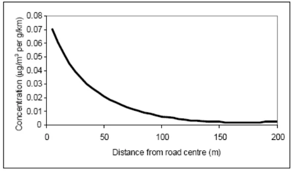
Figure from page 512
Plate 1. Generalised model of traffic contribution to concentrations of pollutants at different distances from a road
4.11 As the NCN Plan proposes 4km wide corridors, it is not yet possible to determine which European sites would lie within 200m of the final route or where construction works may be required. These will both be determined during the later planning and design stages when further assessment and consideration will be required. At this stage all European sites within the proposed 4km corridor are included within the analysis of this pathway.
4.12 All terrestrial European sites shown within Table 6 Appendix A lie within one or more of the proposed NCN corridors and therefore could (pending detailed route planning and design) lie within 200m of at least one NCN cycle route, all of which are sensitive to atmospheric nitrogen deposition to varying degrees. Although there are no details regarding specific measures planned or required for each cycle route, work could include improvements to the standard of existing roads, widening existing roads to include a cycle lane and/ or construction of a new cycleway. There is thus the potential for impacts during the construction stage from construction vehicles within the proposed cycle network sites, or along roads leading up to the sites, as well
Prepared for: Transport Infrastructure Ireland
as any generators that may be needed for the works. Operationally cycle networks would not impact European sites with regards to air quality once any construction has been completed.
4.13 Depending on the nature of the construction works and the substrates and materials involved there is also some potential for limited localised dust generation that may require inclusion of standard dust dispersion control methods, although this is likely to affect a much smaller zone even than exhaust pollutants. For the purposes of assessment, according to guidance from the Institute of Air Quality Management3, with respect to possible effects due to dust, “an assessment will normally be required where there is…an ‘ecological receptor’ within: 50m of the boundary of the site; or 50m of the route(s) used by construction vehicles on the public highway, up to 500m from the site entrance(s)”.
4.14 As identified in Appendix C, 65 of the 85 proposed NCN corridors overlap with at least one European site. Since the actual potential for any effects depends on the final route alignment within the proposed corridor and details of the individual works and interventions required for each cycle route as it progresses through planning and design stages, no traffic or air quality modelling can be undertaken at this stage to quantify the impact of the construction of potential cycle routes on European sites. However, it also means that within the proposed NCN corridors there is considerable flexibility for individual routes to be selected and designed to minimise any impact to an insignificant level, either through ensuring any construction work involving emissions is located at least 200m (50 m for dust emissions), from the nearest SAC or SPA, and/or by ensuring that standard well-established mitigation (such as that used to control dust generation and dispersal4) is utilised to remove emissions or reduce them to an insignificant level.
4.15 Even for the seventeen corridors that lie entirely within a European site it may be possible to avoid new construction (such as by using existing bridge crossings of rivers) and even if new construction cannot be avoided, only some areas of the SACs involved are sensitive to atmospheric nitrogen deposition. For example, most of the SACs involved are riverine sites and ‘in river’ features are more typically phosphatelimited rather than nitrogen-limited. In other words, phosphorus is the principal nutrient controlling eutrophication and this does not stem from atmosphere. While most of these riverine habitats also include wetland terrestrial habitats as interest features (such as wet heathland or alluvial woodland) these are not distributed the entire length of the river, and some (such as alluvial woodland) are not identified on the Air Pollution Information System as being vulnerable to atmospheric nitrogen deposition. Moreover, research has indicated that long-term exposure to nitrogen sources (which will not arise from the NCN Plan or any of its cycleways) is more important to short-term exposure from activities such as construction. For example, ‘critical loads relate to the potential effects over periods of decades… critical loads provide the long-term deposition [emphasis added] below which we are sure that adverse ecosystem effects will not occur’5.
4.16 In Appendix C it is identified for all corridors that overlap with a European site that ‘The final route alignment should aim to avoid any new construction within 200m of any European sites and if any new construction within 200m is needed to create the cycle route an air quality assessment (and potentially air quality mitigation) will be required to ensure there is no air pollution impacts on sensitive habitats’. A paragraph is included within the NCN Plan to reflect the above quoted text from Appendix C. It states that initiatives brought forward under each of the proposed routes will need scrutiny to determine whether potential for significant effects on European sites exist, and if so should undertake a project level Appropriate Assessment to determine whether the initiative/route would have a significant effect, or adverse effect on the integrity of European sites either alone or in combination with other plans and projects.
4.17 Based on the inclusion of this paragraph within the final NCN Plan, it is considered that a sufficient framework exists to ensure that the proposed routes within the NCN Plan could be designed and delivered in such a way as to avoid an adverse effect on European sites with regards to air pollution.
Disturbance of Qualifying Interests
4.18 With regards to the NCN, noise and visual disturbance would only be considered an issue if they are affecting sites designated for vulnerable animal interest (particularly birds and bats) rather than their habitats and would represent a net change in the current exposure. This potentially applies to any European site
3 IAQM. (2016) Guidance on the assessment of dust from demolition and construction. The Institute of Air Quality Management. Version 1.1. 4 Such as those listed in Institute of Air Quality Management Guidance: http://iaqm.co.uk/text/guidance/construction-dust- 2014.pdf 5 source: page 220, World Health Organization. 2000. Air Quality Guidelines for Europe. WHO Regional Publications, European Series, No. 91. Second Edition
Prepared for: Transport Infrastructure Ireland
within 200m of a cycle route on the basis that unlikely significant noise or lighting disturbance would arise at greater distances. The rationale for the use of a 200m distance is cited below. All European sites within the proposed 4km corridors are therefore included within the analysis of this pathway on the basis that subsequent to final routing decisions (to be determined during the planning and design stages) they could ultimately lie within 200m of part of an NCN corridor.
Noise Disturbance during Construction and Operation
4.19 The factors that influence a species response to a noise disturbance are numerous, but key factors are species sensitivity, the scale of the impact (e.g., the noise loudness), proximity of disturbance sources and timing/duration of the potentially disturbing activity. Regarding construction noise impacts on waterfowl and waders, AECOM’s professional experience is that in broad terms (to be confirmed by noise modelling for individual schemes) noise impacts from conventional construction techniques are unlikely to arise from noise-generating activities located more than c. 200m from the qualifying bird species. Studies indicate that noise levels in excess of 84dB(A) typically elicit a flight response in birds(Cutts & Allan, 1999) while those below 55dB elicit no response. The same research recommends that construction noise levels should generally be kept below 70dB at the boundary of the European sites/functionally linked land to avoid excessive disturbance of birds(Cutts, et al., 2009).
4.20 The noisiest construction activity is generally impact piling, where a hammer is dropped on the pile. This has a typical maximum noise level of 100-110dB at 1m from source. Noise attenuates by 6dB for every doubling of distance, such that impact piling typically results in noise levels below 70dB at distances of more than 100m from source. Therefore, a 200m separation between construction activity and a European site should generally ensure no disturbance arises through this pathway. This does not obviate the need for project-level Appropriate Assessment for individual applications (not least because the difference between the baseline and future noise levels may also be relevant) but aids in determining whether the proposed corridors pose a risk of conflict with SPAs through the pathway of construction-related noise. If, during detailed routing decisions, it is not possible or desirable to route an area of cycleway requiring construction work 200m or more away from a sensitive European site, then it will be necessary to undertake noise modelling for any significant construction works and, if the modelling indicates it is required, either implement seasonal avoidance where appropriate (for example, ensuring works are timed to take place outside the sensitive season, such as the September to March period for sites designated for wintering birds) or implement noise mitigation (such as cowling or shielding or use of a temporary noise fence) to reduce noise emissions to non-disturbing levels.
4.21 Underwater noise can also be a concern where in river works may be needed (such as for construction of a new cycle bridge over a river) and the site in question is designated for noise-sensitive receptors such as salmon. In Table 6 and Appendix C there are sixteen European sites designated for this species that lie within a 4km corridor of the NCN. At this stage of the NCN development where 4km corridors are included, routing and constructions methods have not yet been determined. However, there are several methods of minimising or avoiding underwater noise disturbance or harm to fish species such as through use of ‘silent’ piling techniques or seasonal separation between the works and the sensitive qualifying interests.
4.22 With regards to operational traffic, as the proposed corridors are cycle networks the noise created by the network is likely to be de minimis.
Visual Disturbance during Construction and Operation
4.23 Some species of birds and other wildlife (such as bats) are also sensitive to lighting or other visual disturbances such as human presence. The concern regarding the effects of visual disturbance on birds stems from the birds expending more energy than is necessary and spending an increased amount of time responding to the disturbance rather than feeding (Riddington, et al., 1996). Disturbance therefore risks increasing energetic output while reducing energetic input, which can adversely affect the ‘condition’ and ultimately survival of the birds. In addition, displacement of birds from one feeding site to others can increase the pressure on the resources available within the remaining sites, as they have to sustain a greater number of birds (Gill, et al., 1998). Moreover, the more time a breeding bird spends disturbed from its nest, the more its eggs are likely to cool and the more vulnerable they, or any nestlings, are to predators.
4.24 The distance at which a species takes flight when approached by a disturbing stimulus is known as the ‘tolerance distance’ (also called the ‘escape flight distance’) and differs between species to the same stimulus and within a species to different stimuli. For instance, a DTI study of birds of the northwest coast
Prepared for: Transport Infrastructure Ireland
of England noted that: “Divers and scoters were absent from the mouths of some busier estuaries, notably the Mersey… Both species are known to be susceptible to disturbance from boats, and their relative scarcity in these areas… may in part reflect the volume of boat traffic in these areas” (Department for Trade and Industry, 2006).
4.25 Disturbance from visual intrusion such as lighting is likely to be most relevant if the cycle infrastructure is immediately adjacent to an SPA or certain SACs (e.g., those designated for bat species) as cycle networks can result in an increase in path-side lighting. Lighting is only likely to be an issue if the NCN Plan results in the introduction of street lighting to pathways/roads within close proximity of these European sites which are currently unlit.
4.26 Many of the Europeans sites that overlap with the proposed corridors are very large and the length of the proposed corridor may be within a small section; this may mean that even if noise or light is generated to a level that could cause an impact, the impact would not affect a significant area of the European site (SAC & SPA), or a significant proportion (>1%) of an SPA population. Moreover, construction works could potentially be timed to avoid sensitive periods (such as night, when many waterfowl and waders forage undisturbed, or, for sites designated for non-breeding birds, the winter season).
4.27 Taking into account the potential for noise, lighting and other visual disturbance during construction and operation, Appendix C identifies for all corridors that overlap with a European site that ‘The final route alignment should avoid any new construction within 200m of any European sites and within 200m of any European sites there should be no new lighting introduced in currently unlit areasunless it can be demonstrated that there would be no adverse effect on site integrity. If any new construction within 200m is needed to create the cycle route a noise assessment (and potentially visual mitigation or seasonal restrictions on works) will be required to ensure there is no construction-related disturbance that could significantly affect SPA birds’.
4.28 Even for the seventeen corridors that lie entirely within a European site it may be possible to avoid new construction (such as by using existing bridge crossings of rivers). If new construction cannot be avoided, Appendix C identifies that a noise impact assessment of bridge construction will be required, and potentially mitigation (such as seasonal restrictions on working, alternative construction methods or noise control techniques) to ensure no significant effect on the population of qualifying species. Appendix C also identifies that lighting should be avoided in areas that are currently unlit unless it can be demonstrated that there would be no adverse effect on site integrity.
4.29 Based on the inclusion of this approach to route finalisation and associated pre-consent impact assessment within the final NCN Plan, it is considered that a sufficient framework exists to ensure that future routes within the NCN Plan could be designed and delivered in such a way as to avoid an adverse effect on European sites with regards to disturbance.
Recreational Pressure
4.30 Recreational use of a European site has the potential to:
Cause disturbance to sensitive species, particularly ground-nesting birds and (where relevant) wintering wildfowl;
Cause damage through erosion and fragmentation;
Cause eutrophication as a result of dog fouling; and
Prevent appropriate management or exacerbate existing management difficulties.
4.31 Different types of European sites are subject to different types of recreational pressures and have different vulnerabilities. Studies across a range of species have shown that the effects from recreation can be complex.
4.32 Human activity can affect birds either directly (e.g., through causing them to flee) or indirectly (e.g., through damaging their habitat). The most obvious direct effect is that of immediate mortality such as death by shooting, but human activity can also lead to behavioural changes (e.g., alterations in feeding behaviour, avoidance of certain areas) and physiological changes (e.g., an increase in heart rate) that, although less noticeable, may ultimately result in major population-level effects by altering the balance between immigration/birth and emigration/death (Riley, 2003). The impact of disturbance on birds changes during
Prepared for: Transport Infrastructure Ireland
the seasons in relation to a number of very specific factors, for example the winter below freezing temperature, the birds fat resource levels and the need to remain watchful for predators rather than feeding. These considerations lead to birds apparently showing different behavioural responses at different times of the year.
The factors that influence a species response to human presence are numerous, but the three key factors are species sensitivity, proximity of disturbance sources and timing/duration of the potentially disturbing activity. The distance at which a species takes flight when approached by a disturbing stimulus is known as the ‘tolerance distance’ (also called the ‘escape flight distance’) and differs between species to the same stimulus and within a species to different stimuli.
The potential for apparent disturbance may be less in winter than in summer, in that there are often a smaller number of recreational users. In addition, the consequences of disturbance at a population level may be reduced because birds are not breeding. However, activity outside of the summer months can still cause important disturbance, especially as birds are particularly vulnerable at this time of year due to food shortages. Disturbance which results in abandonment of suitable feeding areas can have severe consequences for those birds involved and their ability to find alternative feeding areas. Several empirical studies have, through correlative analysis, demonstrated that out-of-season (October-March) recreational activity can result in quantifiable disturbance:
Tuite et al. (Tuite, et al., 1983) found that during periods of high recreational activity, bird numbers at Llangorse Lake decreased by 30% as the morning progressed, matching the increase in recreational activity towards midday. During periods of low recreational activity, however, no change in numbers was observed as the morning progressed. In addition, all species were found to spend less time in their ‘preferred zones’ (the areas of the lake used most in the absence of recreational activity) as recreational intensity increased;
Underhill et al. (Underhill et al., 1993)counted waterfowl and all disturbance events on 54 water bodies within the South West London Water Bodies Special Protection Area and clearly correlated disturbance with a decrease in bird numbers at weekends in smaller sites and with the movement of birds within larger sites from disturbed to less disturbed areas.
Most types of aquatic or terrestrial European site can be affected by trampling, which in turn causes soil compaction and erosion:
(Wilson & Seney, 1994) examined the degree of track erosion caused by hikers, motorcycles, horses and cyclists from 108 plots along tracks in the Gallatin National Forest, Montana. Although the results proved difficult to interpret, it was concluded that horses and hikers disturbed more sediment on wet tracks, and therefore caused more erosion, than motorcycles and bicycles.
(Cole, 1995) conducted experimental off-track trampling in 18 closed forest, dwarf scrub and meadow & grassland communities (each tramped between 0-500 times) over five mountain regions in the US. Vegetation cover was assessed two weeks and one year after trampling, and an inverse relationship with trampling intensity was discovered, although this relationship was weaker after one year than two weeks indicating some recovery of the vegetation. Differences in plant morphological characteristics were found to explain more variation in response between different vegetation types than soil and topographic factors. Low-growing, mat-forming grasses regained their cover best after two weeks and were considered most resistant to trampling, while tall forbs (non-woody vascular plants other than grasses, sedges, rushes and ferns) were considered least resistant. Cover of hemicryptophytes and geophytes (plants with buds below the soil surface) was heavily reduced after two weeks but had recovered well after one year and as such these were considered most resilient to trampling. Chamaephytes (plants with buds above the soil surface) were least resilient to trampling. It was concluded that these would be the least tolerant of a regular cycle of disturbance.
(Cole, 1995) conducted a follow-up study (in 4 vegetation types) in which shoe type (trainers or walking boots) and trampler weight were varied. Although immediate damage was greater with walking boots, there was no significant difference after one year. Heavier tramplers caused a greater reduction in vegetation height than lighter tramplers, but there was no difference in effect on cover.
(Cole & Spildie, 1998) experimentally compared the effects of off-track trampling by hiker and horse (at two intensities – 25 and 150 passes) in two woodland vegetation types (one with an erect forb
Prepared for: Transport Infrastructure Ireland
understorey and one with a low shrub understorey). Horse traffic was found to cause the largest reduction in vegetation cover. The forb-dominated vegetation suffered greatest disturbance but recovered rapidly. Higher trampling intensities caused more disturbance.
The most recent National Parks and Wildlife Report on European protected habitats and species in Ireland6 4.36 identified recreational infrastructure and leisure activities as a substantial threat and pressure to a large number of European sites. The report identifies the following habitats as having inadequate or bad overall status due to recreation, among other activities: drift lines, vegetated shingle, marram dunes (white dunes), embryonic shifting dunes, decalcified Empetrum dunes, fixed dunes (grey dunes), decalcified dune heath and calaminariam grassland. ‘Development, construction and use of residential, commercial, industrial and recreational infrastructure and areas’ is identified as a pressure in 41% of habitats. The report identifies that the main pressures on habitats are ecologically unsuitable grazing levels – which can be undergrazing (or even abandonment) as well as overgrazing; pollution of freshwaters and coastal marine waters; drainage and/or cutting of peatlands; invasive species; and recreational pressures.
4.37 Forty-nine European sites listed in Table 6 overlap with at least one proposed 4km wide NCN corridor and are designated for at least one of the habitats listed above. Those corridors where the entire 4km width traverses a European site and where it has the potential to introduce new access into an SAC or SPA pose the greatest potential for recreational impacts and are the subject of detailed discussion below.
4.38 Using existing infrastructure through European sites (e.g. existing routes or greenways) for sections of the NCN may not materially alter the exposure of those European sites to disturbance above the existing baseline level. Even new infrastructure may not increase recreational disturbance risk if, for example, public access to the site is already well managed, the features are not particularly disturbance sensitive, and/or the new infrastructure is located such that it would not materially increase exposure of the qualifying interests of the site to disturbance. However, improving and creating new cycle routes past European sites could create easier access to the site and its sensitive features, and therefore cause greater pressure, with regards to both trampling by foot, erosion by bike and disturbance to sensitive species, on European sites in close proximity to the proposed cycle routes.
4.39 Appendix C identifies the 4km wide NCN corridors that overlap with a European site and the European sites involved. In the vast majority of cases the nature of the 4km wide corridor is such that the final design of the cycle way could enable sensitive European sites to be avoided if required; site sensitivity would need to be considered during detailed design. As a general principle any new construction for a cycleway should remain at least 200m from European sites and this will generally work to restrict any potential increase in recreational access. If existing infrastructure through a European site (such as an existing road) is to be used to carry the cycle way then there should be an assessment of the implications for recreational pressure of providing the cycle way. If the implications are deemed unacceptable then the corridor is sufficiently wide the cycleway can be rerouted for that section. In developing the NCN three corridors were identified which entirely overlapped with European sites meaning that the final cycle route would have to traverse the European site(s) in some form:
In the initial version of Corridor 2 (Derry to Letterkenny) - North of Colehill the entire corridor overlapped with the Lough Swilly SPA for a distance of c. 600m.
In the initial version of Corridor 15 (Athlone to Longford) - Lough Ree SAC/SPA occupied the entire 4km corridor between Clooncah and Gallagh, a distance of c. 5km.
In the initial version of Corridor 18 (Athlone to Tullamore) - At Templedew and again at Clonony Beg the entire 4km corridor crossed the River Shannon Callows SAC and Middle Shannon Callows SPA.
4.40 For these three corridors it was identified that relatively limited amendments to the corridors would mean that the corridor would avoid entirely occupying European sites thus allowing for the possibility for the final cycle way to be located entirely outside European sites if required to avoid adverse effects on integrity. The version of all three corridors in the final NCN Plan thus incorporates this change.
4.41 Notwithstanding these amendments, there remain seventeen instances of the entire width of the 4km wide corridor overlapping with a European site meaning that in these locations it would not be possible to determine a final routing within the corridor that entirely avoided the European site. In all instances this is due to the need for bridge crossings of rivers, either using existing infrastructure or new infrastructure, and
6 The Status of EU Protected Habitats and Species in Ireland, 2019. https://www.npws.ie/publications/article-17-reports
Prepared for: Transport Infrastructure Ireland
avoidance of the European site would entail significant rerouting of the corridor; in some cases even rerouting would be difficult because some of the destination settlements cannot be reached from the origin settlement without traversing an SAC or SPA:
Corridor 4 (Letterkenny to Strabane) - there is a single location, between Lifford and Strabane, where the entire 4km corridor crosses the River Finn SAC for c. 100m.
Corridor 5 (Letterkenny to Sligo) - At Sligo, the corridor traverses either the Cummeen Strand SPA and Cummeen Strand/Drumcliff Bay (Sligo Bay) SAC, or Lough Gill SAC depending on where the crossing point is located. The corridor (excluding the western half which is over open sea) also crosses Lough Melvin SAC at Magheracar.
Corridor 6 (Sligo to Enniskillin), Corridor 8 (Longford to Sligo) and Corridor 9 (Sligo to Ballina) - At Ballisodare and again at Collooney the entire 4km corridor for all three routes traverses the Unshin River SAC.
Corridor 10 (Ballina to Castlebar) - West of Foxford the entire 4km corridor traverses the River Moy SAC/ Lough Conn and Lough Cullin SPA.
Corridor 12 (Galway to Castlebar) and Corridor 13 (Castlebar to Longford) - In the vicinity of Lakeland Lower the entire 4km corridor for both routes traverses the River Moy SAC.
Corridor 19 (Limerick to Portlaoise) - At Lacka the 4km buffer crosses the River Barrow And River Nore SAC.
Corridor 20 (Limerick to Athlone) - At Templedew the entire 4km corridor crosses the River Shannon Callows SAC and Middle Shannon Callows SPA.
Corridor 21 (Galway to Athlone) - At Ballinasloe the entire 4km corridor traverses the River Suck Callows SPA.
Corridor 25 (Tralee to Limerick) - At Ballynageragh, Ballyhorgan East and Shanbally the entire 4km corridor traverses the Lower River Shannon SAC.
Corridor 36 (Cork to Waterford) - Between Muckridge and Tinnabinna the entire 4km corridor traverses the Blackwater Estuary SPA and Blackwater River (Cork/Waterford) SAC and at Killongford it traverses Dungarvan Harbour SPA.
Corridor 37 (Cork to Fermoy) - At Ballinterry the entire 4km route corridor traverses the Blackwater River (Cork/Waterford) SAC.
Corridor 38 (Cork to Limerick) - The entire 4km corridor traverses the Blackwater River (Cork/Waterford) SAC at Mallow.
Corridor 40 (Limerick to Kilkenny) - Between Newport and Kilcommon the corridor traverses Lower River Shannon SAC, while at Birchhill the entire 4km corridor traverses the Lower River Suir SAC.
Corridor 49 (Enniscorthy to Wicklow) - At Enniscorthy, Clovass and Clonhenret the entire 4km corridor traverses the Slaney River Valley SAC.
In all these cases the approach taken to designing the final route will be:
i. Utilise existing infrastructure and bridge crossings where possible – in all cases there are existing road bridges crossing the relevant watercourses;
ii. If detailed corridor design indicates that an existing crossing cannot be used and a new crossing is required, the detailed design of the bridge structure will consider the potential to increase access to sensitive European sites. For example, the qualifying interests of many riverine SACs are not particularly sensitive to land-based recreational activity like cycling. While most riverine SACs traversed by the route corridors are also designated for habitats these are wetland habitats whose wet nature may itself discourage recreational access;
iii. If potential for a recreational pressure effect is confirmed to exist at the location identified for any new infrastructure, any bridge will be designed such that access from the crossing into the European site is difficult.
In addition to crossings of watercourses, three of the proposed corridors also traverse European sites designated for hen harrier:
Prepared for: Transport Infrastructure Ireland
Corridor 40 (Limerick to Kilkenny) - Between Newport and Kilcommon the entire 4km corridor encompasses the Slievefelim to Silvermines Mountains SPA.
Corridor 19 (Limerick to Portlaoise) - Between Ballyduff and Carrowreagh the entire 4km corridor lies within Slieve Bloom Mountains SPA for at least 5km; and
Corridor 25 (Tralee to Limerick) - Between Doonakenna and Glendarragh much of the 4km corridor lies across Stack’s to Mullaghareirk Mountains, West Limerick Hills and Mount Eagle SPA.
4.44 In all three cases there is an existing road through the SPA so access already exists. If any works to the existing route, or any new route construction, were required, a study would need to be undertaken in detailed route design to confirm that there would be no material change in accessibility to affect nesting hen harrier.
4.45 With this approach to design of the final routes it is considered that a framework exists at this NCN Plan level to avoid or adequately mitigate adverse effects on the integrity of European sites through recreational pressure.
Waterborne Pollution
4.46 The quality of the water that feeds European sites is an important determinant of the nature of their habitats and the species they support. Poor water quality can have a range of environmental impacts: At high levels, toxic chemicals and metals can result in immediate death of aquatic life, and can have detrimental effects even at lower levels, including increased vulnerability to disease and changes in wildlife behaviour.
4.47 Cycle routes in general operation would not increase pollution risk due to their nature e.g., non-motorised travel. However, any maintenance of these cycle routes once in operation would require further assessment when details on operational maintenance activities are developed. During construction, there is a risk of accidental pollution (such as runoff of sediment, chemicals, hydrocarbons and salt spray from de-icing) of aquatic, marine and riverine European sites during construction or the creation of new hard surfaces increasing surface water runoff, if they occur within close proximity of a sensitive European site.
4.48 Depending on the nature and location of the works, impacts could occur at varying distances from the proposed cycle routes. As the NCN Plan includes 4km wide corridors within which a final route could be developed, all European sites within the proposed corridors are included within the analysis of this pathway.
4.49 The proposed cycle corridors are likely to involve some construction such as improving the standards of the roads or widening to include a cycle lane which could cause a waterborne pollution event to occur. However, it is an offence to pollute the water environment in Ireland. This is legislated through the Local Government (Water Pollution) Act, 1977 (Office of the Attorney General, 1977) and the 1990 Amendment Act (Office of the Attorney General, 1990) where it states: “a person shall not cause or permit any polluting matter to enter waters (3(1))”. Waters within this definition includes: “(a) any (or any part of any) river, stream, lake, canal, reservoir, aquifer, pond, watercourse or other inland waters whether natural or artificial; (b) any tidal waters and, (c) where the context permits, any beach, riverbank, salt marsh or other area which is contiguous to [anything previously mentioned]”.
4.50 Therefore, every project must have a duty of care to the water environment and produce and implement plans and procedures to prevent discharge from works entering surface, groundwater, wetlands or coastal waters. This is usually undertaken in the form of a Construction Environment Management Plan (CEMP) which includes measures for the protection of ground and surface waters, pollution prevention measures and emergency response plan for pollution events.
4.51 As such it is regarded that the proposed cycle routes can be designed in a way to prevent pollution to the water environment to ensure no adverse effects from water pollution on any European site.The NCN Plan states that each project bought forward through the Plan is required to produce a CEMP to ensure compliance with the Water Pollution Act.
Direct Loss of Habitat
4.52 Direct loss of habitat may occur where existing infrastructure is widened or where new cycle routes are constructed away from previous infrastructure through a European site. Removing land from European sites may affect the structure and function of a European site in several ways including reducing qualifying habitats or habitats upon which qualifying species rely, removal of food sources and nesting/roosting
Prepared for: Transport Infrastructure Ireland
opportunities or shelter. A reduction in the land available within the European site, depending on the amount of land removed, may affect the structure and function significantly enough to affect the integrity of the site and therefore the qualifying interests of the site may no longer be able to maintain or achieve favourable conservation status.
4.53 For most of the proposed corridors, direct land take can be avoided simply by ensuring the final route avoids entering any European sites; because each corridor is 4km wide this is entirely possible. However, there are seventeen corridors where the entire width of the corridor in at least one location lies within a European site and where direct land take is therefore a possibility. This affects 20 European sites:
Stack’s to Mullaghareirk Mountains, West Limerick Hills and Mount Eagle SPA
Lower River Shannon SAC
River Shannon Callows SAC
Middle Shannon Callows SPA
River Suck Callows SPA
Slievefelim to Slivermines Mountains SPA
Lough Corrib SAC
Lough Conn and Lough Cullin SPA
Lough Ree SAC
River Moy SAC
Lough Gill SAC
Lough Melvin SAC
Slieve Bloom Mountains SPA
River Barrow and River Nore SAC
Slaney River Valley SAC
Lower River Suir SAC
Blackwater Estuary SPA
Blackwater River (Cork/Waterford) SAC
Dungarvan Harbour SPA
Unshin River SAC
4.54 Clearly any direct loss of habitat which itself is a special conservation interest of a European site, or which supports qualifying interests of a European site, would constitute an adverse effect on the integrity of that European site. However, European site boundaries are also sometimes defined to include areas that are essentially ‘site fabric’ and not fundamental to the ability of the European site to achieve its conservation objectives.
4.55 The appropriate assessment, and approach to be taken in terms of detailed route design and mitigation, regarding the seventeen corridors that lie entirely within a European site boundary for at least a short distance is provided below. With the identified approach to final route design and mitigation/avoidance of adverse effects on the integrity of European sites set out in the table overleaf, it is considered that a framework exists at this NCN Plan level to avoid or adequately mitigate adverse effects on the integrity of European sites through direct land take.
Prepared for: Transport Infrastructure Ireland
Table 4. Assessment of each corridor where direct land take could arise
| Route | Assessment | Mitigation or avoidance measure to be included in NCN Plan |
|---|---|---|
| Corridor 4 (Letterkenny to Strabane) | There is a single location, between Lifford and Strabane, where the entire 4km corridor crosses the River Finn SAC for c. 100m. The River Finn SAC is designated for oligotrophic waters, wet heaths with Erica tetralix, blanket bogs, transition mires and quaking bogs and its populations of salmon and otter. Unless it stops at Lifford, there is no way the connection to Strabane can be accomplished without crossing the River Finn SAC due to the length of the SAC, other than by making a c. 15km detour north to cross the river downstream of the SAC at Whitehouse. | The approach to delivering this corridor should be as follows: 1. Where feasible the crossing will be made using the existing road bridge between Lifford and Strabane; 2. Where engineering works to the road bridge would be required to render it suitable, any permanent works must remain out of the water column, unless it can be demonstrated this would not affect site integrity, and must not hinder potential for otter passage along the riverbanks. If any temporary ‘in river’ works were to be necessary, studies (including but not limited to underwater noise and hydrodynamic studies), and potentially mitigation, would be required to ensure the works could be delivered without an adverse effect on the SAC habitats or salmon population; 3. If a new bridge crossing the River Finn SAC is required, the following general requirements should be followed in designing and assessing the structure: a. Any abutments must be located outside the SAC boundary and/or must involve no loss of qualifying SAC habitat; b. Any abutments must be located outside the river channel and must be set sufficiently far back from the bank top to ensure passage of otter along the banks is not prevented; c. The soffit of the bridge should be sufficiently high that significant shading impacts on the water column and in river vegetation will not arise. Research suggests this would require a soffit height: deck width ratio of 0.7 or above. d. A noise impact assessment of bridge construction regarding salmon and otter will be required, and potentially mitigation (such as seasonal restrictions on working, alternative construction methods or noise control techniques) to ensure no significant effect on the population of either species. e. Water quality protection measures will be required. f. Lighting should be avoided in areas that are currently unlit unless it can be demonstrated that there would be no adverse effect on site integrity. If detailed design work indicates that a new crossing of the River Finn is required but it is not possible to deliver such a crossing over the SAC without an adverse effect on site integrity, the alternative solution of crossing downstream of the SAC should be taken forward, or the Corridor otherwise revised (such as to cease at Lifford) to demonstrate no adverse effect on site integrity. |
| Route | Assessment | Mitigation or avoidance measure to be included in NCN Plan |
|---|---|---|
| Corridor 5 (Letterkenny to Sligo) | At Sligo, the entire 4km corridor traverses either the Cummeen Strand SPA and Cummeen Strand/Drumcliff Bay (Sligo Bay) SAC, or Lough Gill SAC. Cummeen Strand SAC is designated for its estuaries, mudflats and sandflats not covered by seawater at low tide, embryonic shifting dunes, shifting dunes along the shoreline with Ammophila arenaria (white dunes), fixed coastal dunes with herbaceous vegetation (grey dunes), Juniperus communis formations on heaths or calcareous grasslands and calcareous grassland. Lough Gill SAC is designated for its natural eutrophic lakes with Magnopotamion or Hydrocharition - type vegetation, calcareous grassland, oak woodland, alluvial forest, and populations of white-clawed crayfish, sea lamprey, brook lamprey, river lamprey, salmon and otter. The SPA is designated for its light-bellied brent goose, oystercatcher, redshank and wetland and waterbirds. The entire corridor (excluding the western half which is over open sea) also crosses Lough Melvin SAC at Magheracar. Lough Melvin is designated for its oligotrophic to mesotrophic standing waters with vegetation of the Littorelletea uniflorae and/or Isoeto- Nanojuncetea, Molinia meadows on calcareous, peaty or clayey-silt-laden soils and populations of salmon and otter. There is no way the connection to Sligo can be accomplished without crossing either Cummeen Strand SPA/Cummeen Strand/Drumcliff Bay (Sligo Bay) SAC, or Lough Gill SAC, as these form an east west barrier north of Sligo. It would be possible to avoid traversing Lough Melvin but only with a substantial 12km detour to the east and back. | The approach to delivering this corridor should be as follows: 1. Where feasible the crossing will be made using one of the three existing road bridges north from Sligo and one of the existing bridges crossing Lough Melvin; 2. Where engineering works to a road bridge would be required to render it suitable, any permanent works must remain out of the water column, unless it can be demonstrated this would not affect site integrity, and must not hinder potential for otter passage along the riverbanks. If any temporary ‘in river’ works were to be necessary, studies (including but not limited to underwater noise and hydrodynamic studies), and potentially mitigation, would be required to ensure the works could be delivered without an adverse effect on the SAC habitats or white-clawed crayfish, salmon or lamprey populations; 3. If a new bridge is required, the following general requirements should be followed in designing and assessing the structure: a. Any abutments must be located outside the SAC/SPA boundaries and/or must involve no loss of qualifying SAC habitat or supporting habitat for SPA birds; b. Any abutments must be located outside the river channel and must be set sufficiently far back from the bank top to ensure passage of otter along the banks is not prevented; c. The soffit of the bridge should be sufficiently high that significant shading impacts on the water column and in river vegetation will not arise. Research suggests this would require a soffit height: deck width ratio of 0.7 or above. d. A noise impact assessment of bridge construction regarding SPA birds, salmon, lamprey and otter will be required, and potentially mitigation (such as seasonal restrictions on working, alternative construction methods or noise control techniques) to ensure no significant effect on the population of either species. e. Water quality protection measures will be required as well as a hydrological study to confirm any new construction would not affect special interest features that are hydrologically sensitive (e.g. alluvial woodland). f. Lighting should be avoided in areas that are currently unlit unless it can be demonstrated that there would be no adverse effect on site integrity. If detailed design work indicates that a new crossing of either Cummeen Strand SPA/Cummeen Strand/Drumcliff Bay (Sligo Bay) SAC, Lough Gill SAC, or Lough Melvin SAC would not be possible without an adverse effect on site integrity, the Corridor should be revised, such as to cease north of Sligo or make the 12km eastwards detour to avoid Lough Melvin to demonstrate no adverse effect on site integrity. |
| Route | Assessment | Mitigation or avoidance measure to be included in NCN Plan |
|---|---|---|
| Corridor 6 (Sligo to Enniskillin) Corridor 8 (Longford to Sligo) Corridor 9 (Sligo to Ballina) | At Ballisodare and again at Collooney the entire 4km corridor for all three routes traverses the Unshin River SAC. The SAC is designated for its water courses of plain to montane levels with the Ranunculion fluitantis and Callitricho-Batrachion vegetation, its semi-natural dry grasslands and scrubland facies on calcareous substrates (* important orchid sites), its Molinia meadows on calcareous, peaty or clayey-silt-laden soils, its alluvial forests with Alnus glutinosa and Fraxinus excelsior and its populations of salmon and otter. In all three cases it would not be possible to make the connection to Sligo from the south without crossing the Unshin River SAC due to the length of the river. | The approach to delivering this corridor should be as follows: 1. Where feasible the crossing will be made using existing road bridges; 2. Where engineering works to a road bridge would be required to render it suitable, any permanent works must remain out of the water column, unless it can be demonstrated this would not affect site integrity, and must not hinder potential for otter passage along the riverbanks. If any temporary ‘in river’ works were to be necessary, studies (including but not limited to underwater noise and hydrodynamic studies), and potentially mitigation, would be required to ensure the works could be delivered without an adverse effect on the SAC habitats or salmon population; 3. If a new bridge crossing the Unshin River SAC is required, the following general requirements should be followed in designing and assessing the structure: a. Any abutments must be located outside the SAC boundary and/or must involve no loss of qualifying SAC habitat; b. Any abutments must be located outside the river channel and must be set sufficiently far back from the bank top to ensure passage of otter along the banks is not prevented; c. The soffit of the bridge should be sufficiently high that significant shading impacts on the water column and in river vegetation will not arise. Research suggests this would require a soffit height: deck width ratio of 0.7 or above. d. A noise impact assessment of bridge construction regarding salmon and otter will be required, and potentially mitigation (such as seasonal restrictions on working, alternative construction methods or noise control techniques) to ensure no significant effect on the population of either species. e. Water quality protection measures will be required as well as a hydrological study to confirm any new construction would not affect special interest features that are hydrologically sensitive (e.g. alluvial woodland). f. Lighting should be avoided in areas that are currently unlit unless it can be demonstrated that there would be no adverse effect on site integrity. If detailed design work indicates that a new crossing of the Unshin River is required but it is not possible to deliver such a crossing over the SAC without an adverse effect on site integrity, the Corridor should be revised (such as to not to connect to Sligo) to demonstrate no adverse effect on site integrity. |
| Route | Assessment | Mitigation or avoidance measure to be included in NCN Plan |
|---|---|---|
| Corridor 10 (Ballina to Castlebar) | West of Foxford the entire 4km corridor traverses the River Moy SAC/ Lough Conn and Lough Cullin SPA. The SAC is designated for its lowland hay meadows, active raised bogs, degraded raised bogs still capable of natural regeneration, depressions on peat substrates of the Rhynchosporion, alkaline fens, old sessile oak woods with Ilex and Blechnum in the British Isles, alluvial forests with Alnus glutinosa and Fraxinus excelsior and its populations of white clawed crayfish, sea lamprey, brook lamprey, salmon and otter. It would be possible to divert around the SPA but due to the length and large area covered by the River Moy it would not be possible to deliver this corridor without a crossing of the River Moy SAC without a c. 20km detour and back. | The approach to delivering this corridor should be as follows: 1. Where feasible the crossing will be made using one of existing road bridges across the River Moy; 2. Where engineering works to a road bridge would be required to render it suitable, any permanent works must remain out of the water column, unless it can be demonstrated this would not affect site integrity, and must not hinder potential for otter passage along the riverbanks. If any temporary ‘in river’ works were to be necessary, studies (including but not limited to underwater noise and hydrodynamic studies), and potentially mitigation, would be required to ensure the works could be delivered without an adverse effect on the SAC habitats or white-clawed crayfish, salmon or lamprey populations; 3. If a new bridge is required, the following general requirements should be followed in designing and assessing the structure: a. Any abutments must be located outside the SAC/SPA boundaries and/or must involve no loss of qualifying SAC habitat or supporting habitat for SPA birds; b. Any abutments must be located outside the river channel and must be set sufficiently far back from the bank top to ensure passage of otter along the banks is not prevented; c. The soffit of the bridge should be sufficiently high that significant shading impacts on the water column and in river vegetation will not arise. Research suggests this would require a soffit height: deck width ratio of 0.7 or above. d. A noise impact assessment of bridge construction regarding SPA birds, salmon, lamprey and otter will be required, and potentially mitigation (such as seasonal restrictions on working, alternative construction methods or noise control techniques) to ensure no significant effect on the population of either species. e. Water quality protection measures will be required as well as a hydrological study to confirm any new construction would not affect special interest features that are hydrologically sensitive (e.g. alluvial woodland). f. Lighting should be avoided in areas that are currently unlit unless it can be demonstrated that there would be no adverse effect on site integrity. If detailed design work indicates that a new crossing of the River Moy SAC or Lough Conn and Lough Cullin SPA would not be possible without an adverse effect on site integrity, the Corridor should be revised, such as to make the 20km eastwards detour to avoid the River Moy to demonstrate no adverse effect on site integrity. |
| Route | Assessment | Mitigation or avoidance measure to be included in NCN Plan |
|---|---|---|
| Corridor 12 (Galway to Castlebar) Corridor 13 (Castlebar to Longford) | In the vicinity of Lakeland Lower the entire 4km corridor for both routes traverses the River Moy SAC. Due to the length and large area covered by the River Moy it would not be possible to deliver this corridor without a crossing of the River Moy SAC without a c. 20km detour and back. | The approach to delivering this corridor should be as follows: 1. Where feasible the crossing will be made using one of existing road bridges across the River Moy; 2. Where engineering works to a road bridge would be required to render it suitable, any permanent works must remain out of the water column, unless it can be demonstrated this would not affect site integrity, and must not hinder potential for otter passage along the riverbanks. If any temporary ‘in river’ works were to be necessary, studies (including but not limited to underwater noise and hydrodynamic studies), and potentially mitigation, would be required to ensure the works could be delivered without an adverse effect on the SAC habitats or white-clawed crayfish, salmon or lamprey populations; 3. If a new bridge is required, the following general requirements should be followed in designing and assessing the structure: a. Any abutments must be located outside the SAC boundary and/or must involve no loss of qualifying SAC habitat; b. Any abutments must be located outside the river channel and must be set sufficiently far back from the bank top to ensure passage of otter along the banks is not prevented; c. The soffit of the bridge should be sufficiently high that significant shading impacts on the water column and in river vegetation will not arise. Research suggests this would require a soffit height: deck width ratio of 0.7 or above. d. A noise impact assessment of bridge construction regarding salmon, lamprey and otter will be required, and potentially mitigation (such as seasonal restrictions on working, alternative construction methods or noise control techniques) to ensure no significant effect on the population of either species. e. Water quality protection measures will be required as well as a hydrological study to confirm any new construction would not affect special interest features that are hydrologically sensitive (e.g. alluvial woodland). f. Lighting should be avoided in areas that are currently unlit unless it can be demonstrated that there would be no adverse effect on site integrity. If detailed design work indicates that a new crossing of the River Moy SAC would not be possible without an adverse effect on site integrity, the Corridor should be revised, such as to make the 20km eastwards detour to avoid the River Moy to demonstrate no adverse effect on site integrity. |
| Route | Assessment | Mitigation or avoidance measure to be included in NCN Plan |
|---|---|---|
| Corridor 19 (Limerick to Portlaoise) | Between Ballyduff and Carrowreagh the entire 4km corridor lies within Slieve Bloom Mountains SPA for at least 5km and it also passes through the SAC at Lacka. At Lacka the 4km buffer also crosses the River Barrow And River Nore SAC. The Slieve Bloom Mountains SAC is designated for its wet heaths with Erica tetralix, blanket bogs and alluvial forests with Alnus glutinosa and Fraxinus excelsior. The SPA is designated for its hen harrier population. The River Barrow and Nore SAC is designated for its estuaries, mudflats and sandflats not covered by seawater at low tide, reefs, Salicornia and other annuals colonising mud and sand, Atlantic salt meadows, Mediterranean salt meadows, Water courses of plain to montane levels with the Ranunculion fluitantis and Callitricho-Batrachion vegetation, European dry heaths, Hydrophilous tall herb fringe communities of plains and of the montane to alpine levels, Petrifying springs with tufa formation, Old sessile oak woods with Ilex and Blechnum in the British Isles, Alluvial forests with Alnus glutinosa and Fraxinus excelsior, Desmoulin’s Whorl Snail, Freshwater Pearl Mussel, White-clawed Crayfish, Sea Lamprey, Brook Lamprey, River Lamprey, Twaite Shad, Salmon, Otter, Killarney Fern and Nore Pearl Mussel. There is no way to make the connection to Portlaoise without traversing the River Barrow & River Nore SAC and/or the River Nore SPA. | The approach to delivering this corridor should be as follows: 1. Where feasible the corridor will follow the existing road through the SAC/SPA; 2. Where engineering works to the road would be required to render it suitable, there must be no loss of SAC habitat and an assessment would be required to ensure there was no loss of functionally-linked habitat that might affect the ability of the SPA to support its hen harrier population. Construction must be timed to avoid the sensitive season for hen harrier. 3. Where engineering works to a road bridge across the River Barrow & River Nore SAC would be required to render it suitable, any permanent works must remain out of the water column, unless it can be demonstrated this would not affect site integrity, and must not hinder potential for otter passage along the riverbanks. They must be situated so that no loss of SAC plant species would arise. If any temporary ‘in river’ works were to be necessary, studies (including but not limited to underwater noise and hydrodynamic studies), and potentially mitigation, would be required to ensure the works could be delivered without an adverse effect on the SAC habitats or Desmoulin’s Whorl Snail, Freshwater Pearl Mussel, White-clawed Crayfish, Sea Lamprey, Brook Lamprey, River Lamprey, Twaite Shad, Salmon, Otter, Killarney Fern and Nore Pearl Mussel populations; 4. If a new bridge is required, the following general requirements should be followed in designing and assessing the structure: a. Any abutments must be located outside the SAC/SPA boundaries and/or must involve no loss of qualifying SAC habitat or supporting habitat for SPA birds; b. Any abutments must be located outside the river channel and must be set sufficiently far back from the bank top to ensure passage of otter along the banks is not prevented; c. The soffit of the bridge should be sufficiently high that significant shading impacts on the water column and in river vegetation will not arise. Research suggests this would require a soffit height: deck width ratio of 0.7 or above. d. A noise impact assessment of bridge construction regarding hen harrier, otter and qualifying fish species will be required, and potentially mitigation (such as seasonal restrictions on working, alternative construction methods or noise control techniques) to ensure no significant effect on the population of any species. e. Water quality protection measures will be required as well as a hydrological study to confirm any new construction would not affect special interest features that are hydrologically sensitive (e.g. alluvial woodland). |
| Route | Assessment | Mitigation or avoidance measure to be included in NCN Plan |
|---|---|---|
| f. Lighting should be avoided in areas that are currently unlit unless it can be demonstrated that there would be no adverse effect on site integrity. If detailed design work indicates that any improvements to the existing road through the Slieve Bloom Mountains SAC/SPA or a new crossing of the River Nore would not be possible without an adverse effect on site integrity, the Corridor should be revised, such as to end before Portlaoise to demonstrate no adverse effect on site integrity. | ||
| Corridor 20 (Limerick to Athlone) | At Templedew the entire 4km corridor crosses the River Shannon Callows SAC and Middle Shannon Callows SPA. The SAC is designated for Molinia meadows on calcareous, peaty or clayey-silt-laden soils, lowland hay meadows, alkaline fens, limestone pavements, alluvial forests with Alnus glutinosa and Fraxinus excelsior and its population of otter. The SPA is designated for whooper swan, wigeon, corncrake, golden plover, lapwing, back-tailed godwit, black-headed gull and its wetland and waterbird assemblage. There is no way to make the connection to Athlone without crossing the River Shannon and thus traversing the SAC and/or SPA or crossing the River Suck Callows SPA. | The approach to delivering this corridor should be as follows: 1. Where feasible the crossing will be made one of the existing road bridges across the River Shannon; 2. Where engineering works to a road bridge would be required to render it suitable, any permanent works must remain out of the water column, unless it can be demonstrated this would not affect site integrity, and must not hinder potential for otter passage along the riverbanks; 3. If a new bridge is required, the following general requirements should be followed in designing and assessing the structure: a. Any abutments must be located outside the SAC/SPA boundaries and/or must involve no loss of qualifying SAC habitat or supporting habitat for SPA birds; b. Any abutments must be located outside the river channel and must be set sufficiently far back from the bank top to ensure passage of otter along the banks is not prevented; c. The soffit of the bridge should be sufficiently high that significant shading impacts on the water column and in river vegetation will not arise. Research suggests this would require a soffit height: deck width ratio of 0.7 or above. d. A noise impact assessment of bridge construction regarding SPA birds and otter will be required, and potentially mitigation (such as seasonal restrictions on working, alternative construction methods or noise control techniques) to ensure no significant effect on the population of either species. e. Water quality protection measures will be required as well as a hydrological study to confirm any new construction would not affect special interest features that are hydrologically sensitive (e.g. alluvial woodland). f. Lighting should be avoided in areas that are currently unlit unless it can be demonstrated that there would be no adverse effect on site integrity. |
| Route | Assessment | Mitigation or avoidance measure to be included in NCN Plan |
|---|---|---|
| If detailed design work indicates that a new crossing of the River Shannon would not be possible without an adverse effect on site integrity, the Corridor should be revised, such as to end south of the River Shannon to demonstrate no adverse effect on site integrity. | ||
| Corridor 21 (Galway to Athlone) | At Ballinasloe the entire 4km corridor traverses the River Suck Callows SPA. The SPA is designated for its population of whooper swan, wigeon, golden plover, lapwing, Greenland white fronted goose and its wetland and waterbird assemblage. There is no way to make the connection to Athlone without crossing the River Suck Callows SPA or crossing the River Shannon (and its European sites). | The approach to delivering this corridor should be as follows: 1. Where feasible the crossing will be made one of the existing road bridges across the River Suck; 2. Where engineering works to a road bridge would be required to render it suitable, any permanent works must remain out of the water column, unless it can be demonstrated this would not affect site integrity; 3. If a new bridge is required, the following general requirements should be followed in designing and assessing the structure: a. Any abutments must be located outside the SPA boundaries and/or must involve no loss of supporting habitat for SPA birds; b. Any abutments must be located outside the river channel and must be set sufficiently far back from the bank top to ensure that no damage to banks occurs; c. A noise impact assessment of bridge construction regarding SPA birds will be required, and potentially mitigation (such as seasonal restrictions on working, alternative construction methods or noise control techniques) to ensure no significant effect on the population. d. Water quality protection measures will be required. e. Lighting should be avoided in areas that are currently unlit unless it can be demonstrated that there would be no adverse effect on site integrity. If detailed design work indicates that a new crossing of the River Suck would not be possible without an adverse effect on site integrity, the Corridor should be revised, such as to end south of the River Suck to demonstrate no adverse effect on site integrity. |
| Corridor 25 (Tralee to Limerick) | At Ballynageragh, Ballyhorgan East and Shanbally the entire 4km corridor traverses the Lower River Shannon SAC. The SAC is designated for sandbanks which are slightly covered by sea water all the time, estuaries, mudflats and sandflats not covered by seawater at low tide, coastal lagoons, large shallow inlets and bays, reefs, perennial vegetation of stony banks, vegetated sea cliffs of the Atlantic and Baltic coasts, Salicornia and other annuals colonising mud and sand, Atlantic salt meadows, Mediterranean salt meadows, water courses of plain to montane levels with the Ranunculion fluitantis and Callitricho-Batrachion vegetation, Molinia meadows on calcareous, peaty or clayey-silt-laden soils, alluvial forests with Alnus glutinosa and | The approach to delivering this corridor should be as follows: 1. Where feasible the corridor will follow existing roads through the SPA and across the SAC river; 2. Where engineering works to the road would be required to render it suitable, an assessment would be required to ensure there was no loss of functionally-linked habitat that might affect the ability of the SPA to support its hen harrier population. Construction must be timed to avoid the sensitive season for hen harrier. 3. Where engineering works to a road bridge across the Lower River Shannon SAC would be required to render it suitable, any permanent works must remain out of the water column, |
| Route | Assessment | Mitigation or avoidance measure to be included in NCN Plan |
|---|---|---|
| Fraxinus excelsior and its populations of freshwater pearl mussel, sea lamprey, brook lamprey, river lamprey, salmon, otter and bottlenose dolphin. Between Doonakenna and Glendarragh much of the 4km corridor lies across Stack’s to Mullaghareirk Mountains, West Limerick Hills and Mount Eagle SPA. The SPA is designated for its population of hen harrier. It would be possible to make the connection to Limerick without traversing the SPA by moving the corridor south of the SPA but it is not possible to make the connection to Limerick without traversing either the Lower River Shannon SAC or the Blackwater River SAC. | unless it can be demonstrated this would not affect site integrity, and must not hinder potential for otter passage along the riverbanks. They must be situated so that no loss of SAC plant species would arise. If any temporary ‘in river’ works were to be necessary, studies (including but not limited to underwater noise and hydrodynamic studies), and potentially mitigation, would be required to ensure the works could be delivered without an adverse effect on the SAC habitats or qualifying fish and dolphin populations; 4. If a new bridge is required, the following general requirements should be followed in designing and assessing the structure: a. Any abutments must be located outside the SAC/SPA boundaries and/or must involve no loss of qualifying SAC habitat or supporting habitat for SPA birds; b. Any abutments must be located outside the river channel and must be set sufficiently far back from the bank top to ensure passage of otter along the banks is not prevented; c. The soffit of the bridge should be sufficiently high that significant shading impacts on the water column and in river vegetation will not arise. Research suggests this would require a soffit height: deck width ratio of 0.7 or above. d. A noise impact assessment of bridge construction regarding hen harrier, otter and qualifying fish and dolphin species will be required, and potentially mitigation (such as seasonal restrictions on working, alternative construction methods or noise control techniques) to ensure no significant effect on the population of any species. e. Water quality protection measures will be required as well as a hydrological study to confirm any new construction would not affect special interest features that are hydrologically sensitive (e.g. alluvial woodland). f. Lighting should be avoided in areas that are currently unlit unless it can be demonstrated that there would be no adverse effect on site integrity. If detailed design work indicates that any improvements to existing roads through the Stack’s to Mullaghareirk Mountains, West Limerick Hills and Mount Eagle SPA, or a new crossing of the River Shannon, would not be possible without an adverse effect on site integrity, the Corridor should be revised, such as to end before Limerick to demonstrate no adverse effect on site integrity. | |
| Corridor 36 (Cork to Waterford) | Between Muckridge and Tinnabinna the entire 4km corridor traverses the Blackwater Estuary SPA and Blackwater River (Cork/Waterford) SAC and at Killongford it traverses Dungarvan Harbour SPA. | The approach to delivering this corridor should be as follows: 1. Where feasible the corridor will follow existing roads through the SPA and across the SAC; 2. Where engineering works to the bridge and roads through the SAC/SPAs would be required to render it suitable, an assessment would be required to ensure there was no |
| Route | Assessment | Mitigation or avoidance measure to be included in NCN Plan |
|---|---|---|
| Blackwater River SAC is designated for its estuaries, mudflats and sandflats not covered by seawater at low tide, perennial vegetation of stony banks, Salicornia and other annuals colonising mud and sand, Atlantic salt meadows, Mediterranean salt meadows, water courses of plain to montane levels with the Ranunculion fluitantis and Callitricho-Batrachion vegetation, old sessile oak woods with Ilex and Blechnum in the British Isles, alluvial forests with Alnus glutinosa and Fraxinus excelsior, freshwater pearl mussel, white-clawed crayfish, sea lamprey, brook lamprey, river lamprey, twaite shad, salmon, otter and Killarney fern. Dungarvan Harbour SPA is designated for its great crested grebe, light-bellied brent goose, shelduck, red-breasted merganser, oystercatcher, golden plover, grey plover, lapwing, knot, dunlin, black-tailed godwit, bar-tailed godwit, curlew, redshank, turnstone and its population of wetland and waterbirds. It would not be possible to make the connection to Waterford without traversing the River Blackwater SAC. | loss of SAC habitat or of functionally-linked habitat that might affect the ability of the SPA to support its bird population. Construction must be timed to avoid the winter period. 3. Where engineering works to a road bridge across the Blackwater River SAC would be required to render it suitable, any permanent works must remain out of the water column, unless it can be demonstrated this would not affect site integrity, and must not hinder potential for otter passage along the riverbanks. They must be situated so that no loss of SAC plant species would arise. If any temporary ‘in river’ works were to be necessary, studies (including but not limited to underwater noise and hydrodynamic studies), and potentially mitigation, would be required to ensure the works could be delivered without an adverse effect on the SAC habitats or qualifying fish populations; 4. If a new bridge is required, the following general requirements should be followed in designing and assessing the structure: a. Any abutments must be located outside the SAC/SPA boundaries and/or must involve no loss of qualifying SAC habitat or supporting habitat for SPA birds; b. Any abutments must be located outside the river channel and must be set sufficiently far back from the bank top to ensure passage of otter along the banks is not prevented; c. The soffit of the bridge should be sufficiently high that significant shading impacts on the water column and in river vegetation will not arise. Research suggests this would require a soffit height: deck width ratio of 0.7 or above. d. A noise impact assessment of bridge construction regarding hen harrier, otter and qualifying fish species will be required, and potentially mitigation (such as seasonal restrictions on working, alternative construction methods or noise control techniques) to ensure no significant effect on the population of any species. e. Water quality protection measures will be required as well as a hydrological study to confirm any new construction would not affect special interest features that are hydrologically sensitive (e.g. alluvial woodland). f. Lighting should be avoided in areas that are currently unlit unless it can be demonstrated that there would be no adverse effect on site integrity. If detailed design work indicates that any improvements to existing roads through the SPA, or a new crossing of the Blackwater River, would not be possible without an adverse effect on site integrity, the Corridor should be revised, such as to divert to cross where the River Blackwater is narrower and/or to divert around the Dungarvan Harbour SPA between Killongford and Dungarvan to demonstrate no adverse effect on site integrity. |
| Route | Assessment | Mitigation or avoidance measure to be included in NCN Plan |
|---|---|---|
| Corridor 37 (Cork to Fermoy) | At Ballinterry the entire 4km route corridor traverses the Blackwater River (Cork/Waterford) SAC. It would be possible to route around the SAC with a c. 12km diversion to the west. | The approach to delivering this corridor should be as follows: 1. Where feasible the corridor will follow existing road bridges across the SAC; 2. Where engineering works to any bridge across the SAC would be required to render it suitable, an assessment would be required to ensure there was no loss of SAC habitat. 3. Where engineering works to a road bridge across the Blackwater River SAC would be required to render it suitable, any permanent works must remain out of the water column, unless it can be demonstrated this would not affect site integrity, and must not hinder potential for otter passage along the riverbanks. They must be situated so that no loss of SAC plant species would arise. If any temporary ‘in river’ works were to be necessary, studies (including but not limited to underwater noise and hydrodynamic studies), and potentially mitigation, would be required to ensure the works could be delivered without an adverse effect on the SAC habitats or qualifying fish populations; 4. If a new bridge is required, the following general requirements should be followed in designing and assessing the structure: a. Any abutments must be located outside the SAC boundary and/or must involve no loss of qualifying SAC habitat; b. Any abutments must be located outside the river channel and must be set sufficiently far back from the bank top to ensure passage of otter along the banks is not prevented; c. The soffit of the bridge should be sufficiently high that significant shading impacts on the water column and in river vegetation will not arise. Research suggests this would require a soffit height: deck width ratio of 0.7 or above. d. A noise impact assessment of bridge construction regarding hen harrier, otter and qualifying fish species will be required, and potentially mitigation (such as seasonal restrictions on working, alternative construction methods or noise control techniques) to ensure no significant effect on the population of any species. e. Water quality protection measures will be required as well as a hydrological study to confirm any new construction would not affect special interest features that are hydrologically sensitive (e.g. alluvial woodland). f. Lighting should be avoided in areas that are currently unlit unless it can be demonstrated that there would be no adverse effect on site integrity. If detailed design work indicates that a new crossing of the Blackwater River, would not be possible without an adverse effect on site integrity, the Corridor should be revised, such as to divert to west around the SAC to demonstrate no adverse effect on site integrity. |
| Route | Assessment | Mitigation or avoidance measure to be included in NCN Plan |
|---|---|---|
| Corridor 38 (Cork to Limerick) | The entire 4km corridor traverses the Blackwater River (Cork/Waterford) SAC at Mallow. It would be possible to route around the SAC with a c. 12km diversion to the west. | The approach to delivering this corridor should be as follows: 1. Where feasible the corridor will follow existing road bridges across the SAC; 2. Where engineering works to any bridge across the SAC would be required to render it suitable, an assessment would be required to ensure there was no loss of SAC habitat. 3. Where engineering works to a road bridge across the Blackwater River SAC would be required to render it suitable, any permanent works must remain out of the water column, unless it can be demonstrated this would not affect site integrity, and must not hinder potential for otter passage along the riverbanks. They must be situated so that no loss of SAC plant species would arise. If any temporary ‘in river’ works were to be necessary, studies (including but not limited to underwater noise and hydrodynamic studies), and potentially mitigation, would be required to ensure the works could be delivered without an adverse effect on the SAC habitats or qualifying fish populations; 4. If a new bridge is required, the following general requirements should be followed in designing and assessing the structure: a. Any abutments must be located outside the SAC boundary and/or must involve no loss of qualifying SAC habitat; b. Any abutments must be located outside the river channel and must be set sufficiently far back from the bank top to ensure passage of otter along the banks is not prevented; c. The soffit of the bridge should be sufficiently high that significant shading impacts on the water column and in river vegetation will not arise. Research suggests this would require a soffit height: deck width ratio of 0.7 or above. d. A noise impact assessment of bridge construction regarding otter and qualifying fish species will be required, and potentially mitigation (such as seasonal restrictions on working, alternative construction methods or noise control techniques) to ensure no significant effect on the population of any species. e. Water quality protection measures will be required as well as a hydrological study to confirm any new construction would not affect special interest features that are hydrologically sensitive (e.g. alluvial woodland). f. Lighting should be avoided in areas that are currently unlit unless it can be demonstrated that there would be no adverse effect on site integrity. If detailed design work indicates that a new crossing of the Blackwater River, would not be possible without an adverse effect on site integrity, the Corridor should be revised, such as to divert to west around the SAC to demonstrate no adverse effect on site integrity. |
| Route | Assessment | Mitigation or avoidance measure to be included in NCN Plan |
|---|---|---|
| Corridor 40 (Limerick to Kilkenny) | Between Newport and Kilcommon the entire 4km corridor encompasses the Slievefelim to Silvermines Mountains SPA and Lower River Shannon SAC. The SPA is designated for its hen harrier population. The reasons for SAC designation have already been given. At Birchhill the entire 4km corridor traverses the Lower River Suir SAC. The SAC is designated for Atlantic salt meadows, Mediterranean salt meadows, water courses of plain to montane levels with the Ranunculion fluitantis and Callitricho-Batrachion vegetation, Hydrophilous tall herb fringe communities of plains and of the montane to alpine levels, old sessile oak woods with Ilex and Blechnum in the British Isles, alluvial forests with Alnus glutinosa and Fraxinus excelsior, Taxus baccata woods of the British Isles and its populations of freshwater pearl mussel, white clawed crayfish, sea lamprey, brook lamprey, river lamprey, twaite shad, salmon and otter. It would be possible to route the corridor south of the SPA and north of the Lower River Suir SAC. However, it would not be possible to make the connection with Kilkenny without traversing the Lower River Shannon. | The approach to delivering this corridor should be as follows: 1. Where feasible the corridor will follow existing roads through the SPA and across the SAC river; 2. Where engineering works to the road would be required to render it suitable, an assessment would be required to ensure there was no loss of functionally-linked habitat that might affect the ability of the SPA to support its hen harrier population. Construction must be timed to avoid the sensitive season for hen harrier. 3. Where engineering works to a road bridge across the Lower River Shannon SAC or Lower River Suir SAC would be required to render it suitable, any permanent works must remain out of the water column, unless it can be demonstrated this would not affect site integrity, and must not hinder potential for otter passage along the riverbanks. They must be situated so that no loss of SAC plant species would arise. If any temporary ‘in river’ works were to be necessary, studies (including but not limited to underwater noise and hydrodynamic studies), and potentially mitigation, would be required to ensure the works could be delivered without an adverse effect on the SAC habitats or qualifying fish and dolphin populations; 4. If a new bridge is required, the following general requirements should be followed in designing and assessing the structure: a. Any abutments must be located outside the SAC/SPA boundaries and/or must involve no loss of qualifying SAC habitat or supporting habitat for SPA birds; b. Any abutments must be located outside the river channel and must be set sufficiently far back from the bank top to ensure passage of otter along the banks is not prevented; c. The soffit of the bridge should be sufficiently high that significant shading impacts on the water column and in river vegetation will not arise. Research suggests this would require a soffit height: deck width ratio of 0.7 or above. d. A noise impact assessment of bridge construction regarding hen harrier, otter and qualifying fish and dolphin species will be required, and potentially mitigation (such as seasonal restrictions on working, alternative construction methods or noise control techniques) to ensure no significant effect on the population of any species. e. Water quality protection measures will be required as well as a hydrological study to confirm any new construction would not affect special interest features that are hydrologically sensitive (e.g. alluvial woodland). f. Lighting should be avoided in areas that are currently unlit unless it can be demonstrated that there would be no adverse effect on site integrity. |
| Route | Assessment | Mitigation or avoidance measure to be included in NCN Plan |
|---|---|---|
| If detailed design work indicates that any improvements to existing roads through the Slievefelim to Silvermines Mountains SPA, or a new crossing of the River Shannon or Suir, would not be possible without an adverse effect on site integrity, the Corridor should be revised, such as to divert south of the SPA and north of the River Suir to demonstrate no adverse effect on site integrity. | ||
| Corridor 49 (Enniscorthy to Wicklow) | At Enniscorthy, Clovass and Clonhenret the entire 4km corridor traverses the Slaney River Valley SAC. The SAC is designated for estuaries, mudflats and sandflats not covered by seawater at low tide, Atlantic salt meadows, Mediterranean salt meadows, water courses of plain to montane levels with the Ranunculion fluitantis and Callitricho- Batrachion vegetation, old sessile oak woods with Ilex and Blechnum in the British Isles, alluvial forests with Alnus glutinosa and Fraxinus excelsior and its populations of freshwater pearl mussel, sea lamprey, brook lamprey, river lamprey, twaite shad, salmon, otter and harbour seal. It would be possible to avoid any crossings of the SAC by moving the corridor approximately 4km to the east. | The approach to delivering this corridor should be as follows: 1. Where feasible the corridor will follow existing road bridges across the SAC; 2. Where engineering works to any bridge across the SAC would be required to render it suitable, an assessment would be required to ensure there was no loss of SAC habitat. 3. Where engineering works to a road bridge across the Slaney River would be required to render it suitable, any permanent works must remain out of the water column, unless it can be demonstrated this would not affect site integrity, and must not hinder potential for otter passage along the riverbanks. If any temporary ‘in river’ works were to be necessary, studies (including but not limited to underwater noise and hydrodynamic studies), and potentially mitigation, would be required to ensure the works could be delivered without an adverse effect on the SAC habitats or qualifying fish or seal populations; 4. If any new bridges are required, the following general requirements should be followed in designing and assessing the structure: a. Any abutments must be located outside the SAC boundary and/or must involve no loss of qualifying SAC habitat; b. Any abutments must be located outside the river channel and must be set sufficiently far back from the bank top to ensure passage of otter along the banks is not prevented; c. The soffit of the bridge should be sufficiently high that significant shading impacts on the water column and in river vegetation will not arise. Research suggests this would require a soffit height: deck width ratio of 0.7 or above. d. A noise impact assessment of bridge construction regarding otter and qualifying fish and seal species will be required, and potentially mitigation (such as seasonal restrictions on working, alternative construction methods or noise control techniques) to ensure no significant effect on the population of any species. e. Water quality protection measures will be required as well as a hydrological study to confirm any new construction would not affect special interest features that are hydrologically sensitive (e.g. alluvial woodland). |
| Route | Assessment | Mitigation or avoidance measure to be included in NCN Plan |
|---|---|---|
| f. Lighting should be avoided in areas that are currently unlit unless it can be demonstrated that there would be no adverse effect on site integrity. If detailed design work indicates that a new crossing of the Blackwater River, would not be possible without an adverse effect on site integrity, the Corridor should be revised, such as to divert east around the SAC to demonstrate no adverse effect on site integrity. |
Loss of Functionally Linked Habitat
4.56 This is defined as the loss of habitat which is outside of the boundary of a European site, but which is critical to its functioning. For example, the loss of habitat outside of an SPA which is used for foraging purposes by qualifying bird species for which the SPA is designated, is regarded as loss of functionally-linked habitat. The distance related to loss of functionally-linked habitat is dependent on the species in question and can vary greatly. A variety of species specific buffers are listed within Table 5 below to give an overview of distances that may need to be considered. This is not intended to be a comprehensive list of all mobile species for which European sites in Ireland are designated.
Table 5. Species-specific functionally-linked habitat buffer distances
SPECIES BUFFER DISTANCE
Invertebrates
Freshwater pearl mussel Margaritifera margaritifera Use of a screening buffer not appropriate for this species. The possibility of an impact pathway for freshwater pearl mussel relies on there being hydrological connectivity to a development, rather than being located within a certain distance.
Fish
Sea lamprey Petromyzon marinus
Use of a screening buffer not appropriate for fish species. Pathway for impacts depends largely on there being a hydrological connection between development and the qualifying fish species of a given SAC. The source-pathway-receptor approach must therefore be adopted, and distances over which effects could occur will vary accordingly.
Brook lamprey Lampetra planeri
River lamprey Lampetra fluviatilis
Atlantic salmon Salmo salar
Mammals
Otter Lutra lutra 150m(National Roads Authority, 2008)
Lesser horseshoe bat Rhinolophus hipposideros 2km 7
Birds
Barnacle goose Branta leucopsis 20km (Scottish Natural Heritage, 2016; Natural England, 2019)
Greenland white-fronted goose Anser albifrons flavirostris
10 km (Natural England, 2019)
Corncrake Crex crex 1.5km (Bright, et al., 2008)
Whooper swan Cygnus cygnus 5km (Scottish Natural Heritage, 2016)
Greylag goose Anser anser 2km (Scottish Natural Heritage, 2016)
Golden plover Pluvialis apricaria and lapwing Vanellus vanellus
20km (Natural England, 2019)
Merlin Falco columbarius 5km (Scottish Natural Heritage, 2016)
Hen harrier Circus cyaneaus 2km (Scottish Natural Heritage, 2016)
Peregrine falcon Falco peregrinus 2km (Scottish Natural Heritage, 2016)
7https://www.bats.org.uk/our-work/landscapes-for-bats/core-sustenance-zones
Prepared for: Transport Infrastructure Ireland
SPECIES BUFFER DISTANCE
Pink-footed goose Anser brachyrhncus 20km (Scottish Natural Heritage, 2016)
Wintering waders (except golden plover and lapwing), Brent goose Branta bernicla and wigeon Anas penelope
2km (Natural England, 2019)
4.57 As explained in the methodology, a 2km zone has been used around each European site to identify greatest risk to functionally-linked land. Even for birds and other wildlife that can travel further than 2km from their European sites to forage or roost, not all habitat within the wider zone is of equal value with the habitat of greatest importance in sustaining the SPA or SAC population often being located closest to the SAC/SPA. Published guidance regarding distances from SPA boundaries at which habitat for various species is likely to be significant in sustaining populations cites an impact risk zone of 2km from the designated site. Moreover, given the nature of a cycle way even new construction would be likely to result in insignificant levels of habitat loss from supporting habitat, if any. Therefore it is reasonable taking into account the likely greater value of functionally linked habitat closer to the European site and the relatively low risk of significant functionally-linked habitat loss posed by creation of a new cycleway a 2km zone of influence is appropriate for identifying European sites at greatest risk from the NCN Plan.
4.58 As identified in Table 6 and Appendix C at the rear of this report, 87 European sites designated for mobile species overlap with at least one 4km wide NCN corridor. Establishment of the cycle routes could therefore affect any of these sites’ mobile Qualifying Interests depending on the precise location of the route, the use of any functionally-linked land/water within those corridors by the mobile species for which the European sites are designated, and the exact nature of the works proposed at each location. Appendix C identifies that all but three corridors (Corridors 26, 57 and 68) have at least one SPA (or SAC designated for mobile species) within the proposed 4km wide corridor.
4.59 The sites are: Ballyallia Lough SPA, Ballykenny-Fisherstown Bog SPA, Ballymacoda Bay SPA, Ballynafagh Lake SAC, Ballysadare Bay SPA, Blackwater Callows SPA, Blackwater Estuary SPA, Blackwater River SAC, Boyne Estuary SPA, Bunduff Lough And Machair/Trawalua/Mullaghmore SAC, Caherglassaun Turlough SAC, Carlingford Lough SPA, Castlemaine Harbour SAC, Clew Bay Complex SAC, Coole- Garryland SPA, Cork Harbour SPA, Cregganna Marsh SPA, Cummeen Strand SPA, Cummeen Strand/Drumcliff Bay (Sligo Bay) SAC, Donegal Bay SPA, Dromore Woods And Loughs SAC, Drumcliff Bay SPA, Dundalk Bay SPA, Dungarvan Harbour SPA, East Burren Complex SAC, Galway Bay Complex SAC, Inner Galway Bay SPA, Killala Bay/Moy Estuary SAC, Killarney National Park SPA, Killarney National Park, Macgillycuddy’s Reeks and Caragh River Catchment SAC, Lough Arrow SPA, Lough Conn and Lough Cullin SPA, Lough Corrib SAC, Lough Derg (Shannon) SPA, Lough Ennell SPA, Lough Eske and Ardnamona Wood SAC, Lough Fingall Complex SAC, Lough Gill SAC, Lough Melvin SAC, Lough Oughter And Associated Loughs SAC, Lough Oughter SPA, Lough Rea SPA, Lough Ree SAC, Lough Ree SPA, Lough Swilly SAC, Lough Swilly SPA, Lower River Shannon SAC, Lower River Suir SAC, Malahide Estuary SPA, Middle Shannon Callows SPA, Mongan Bog SPA, Moyree River System SAC, Mullaghanish to Musheramore Mountains SPA, Newhall and Edenvale Complex SAC, Old Farm Buildings, Ballymacrogan SAC, Poulaphouca Reservoir SPA, Rahasane Turlough SPA, River Barrow and River Nore SAC, River Boyne and River Blackwater SAC, River Boyne and River Blackwater SPA, River Finn SAC, River Little Brosna Callows SPA, River Moy SAC, River Nanny Estuary and Shore SPA, River Nore SPA, River Shannon and River Fergus Estuaries SPA, River Shannon Callows SAC, River Suck Callows SPA, Rogerstown Estuary SPA, Slaney River Valley SAC, Slaney River Valley SAC, Slieve Bloom Mountains SPA, Slievefelim to Silvermines Mountains SPA, Sligo/Leitrim Uplands SPA, South Dublin Bay and River Tolka Estuary SPA, Stack’s to Mullaghareirk Mountains, West Limerick Hills and Mount Eagle SPA, The Gearagh SAC, The Gearagh SPA, The Murrough SPA, Tralee Bay and Magharees Peninsula, West to Cloghane SAC, Tralee Bay Complex SPA, Tramore Back Strand SPA, Unshin River SAC and Wexford Harbour and Slobs SPA.
4.60 Note that sites designated for marine mammals and seabirds are excluded on the basis that cycle routes will not affect functionally linked habitat for those species. As can be seen from Table 5 above, some species (particularly geese, lapwing and golden plover) can have core functionally-linked land areas such as high tide roosts and core foraging locations that lie considerably further from their SPAs than 2km. However, since the precise location of each future route of the NCN and how each section of the NCN might be created is a matter for detailed corridor design and finalisation (for example some stretches could consist
Prepared for: Transport Infrastructure Ireland
simply of adopting and designating existing cycleways), it would be speculative to discuss specific European sites any further afield.
4.61 The considerable width of the 4km wide NCN corridors compared to the narrow nature of the final cycle route that will be identified within each corridor, and that parts of any route could utilise existing infrastructure and will do so where feasible, mean that it will be possible to design final routes in a way that the individual initiatives could avoid functionally-linked habitat or avoid having a likely significant effect on such habitat. As sucha paragraph in the NCN Plan states that each proposed cycle route should undertake a project level Appropriate Assessment, to determine whether any interventions would have an adverse effect with regards to loss of functionally linked habitat for mobile SAC or SPA features. More detailed advice is provided for each of the NCN Corridors in Appendix C where possible.
4.62 For example, in Appendix C a version of the following recommendation is made for each relevant corridor: ‘Since a large part of the corridor either overlaps with, or lies within 2km of, Lough Swilly SPA, there will need to be consideration of any potential for loss of functionally-linked habitat for SPA birds once the actual cycle route is determined. This will only be required if new construction is required within natural habitats. In such a situation wintering bird surveys to determine use of the habitats by SPA birds may be required and, if necessary, appropriate mitigation provided to ensure no adverse effect on the integrity of the European site before the works are consented’.
4.63 With the inclusion of this text in the NCN Plan, it is considered that a sufficient framework exists to ensure that the recommendations could be designed and delivered in such a way as to avoid an adverse effect on the integrity of European sites and the NCN Plan could be concluded not to have an adverse effects on the integrity of any European sites.
Prepared for: Transport Infrastructure Ireland
5. In Combination Assessment
5.1 The Plans which have been considered within the in-combination assessment are listed within Chapter 2 (Methodology).
National and Regional Plans
5.2 The Climate Action Plan follows the Climate Act 2021, which commits Ireland to a legally binding target of net-zero greenhouse gas emissions no later than 2050, and a reduction of 51% by 2030. These targets are a key pillar of the Programme for Government. The plan sets out indicative ranges of emissions reductions for each sector of the economy. It also sets out the actions needed to deliver on these climate targets. The plan calls for a significant reduction in transport emissions by 2030. (Following on from this, a target of a 50% reduction has been set). Measures will be aimed at enabling 500,000 extra walking, cycling and public transport journeys per day by 2030. An Annex to the plan outlines 493 actions to be taken to meet the targets outlined in the plan. Several actions are related to delivering cycling and walking infrastructure and encouraging an increased level of modal shift towards active travel and away from private car use, while Action 232 specifically calls for the development of a coherent and connected National Cycle Network Plan. The NCN Plan will therefore be key to delivering objectives of the Climate Action Plan but the Action Plan is an intentionally high level document and does not set out or commit to detailed specific schemes. As such it will not have in combination effects with the NCN Plan.
5.3 Cycling and walking has been given a high level of prominence and ongoing importance in the October 2020 Programme for Government (PfG) Statement. Significant funding is earmarked to improve the facilities and functions to enable people to travel by bicycle (and foot), ultimately improving people’s quality of life, air quality, as well as Ireland’s commitments to sustainability and decarbonisation. The PfG mandates that every local authority, with assistance from the National Transport Authority (NTA), adopts a high-quality cycling policy, carries out an assessment of their roads network and develops cycle network plans, which will be implemented with the help of a suitably qualified Cycling Officer with clear powers and roles. Development of the NCN will take cognisance of the county-level cycle network plans and the need for appropriate interface between networks. As well as the mandated development of cycle network planning, delivery and positioning of qualified personnel, the PfG seeks more cycling to schools, widening of cycling incentives for employment (Bike to Work) and ongoing enhancement of safety through policy and legislation review. Development of the NCN is consistent with the ambitions outlined in the Programme for Government. The Programme for Government does not itself set out any specific schemes but rather provides direction to lower-tier authorities when they are developing their plans and schemes. As such the Programme for Government will not have in combination effects with the NCN Plan.
5.4 The National Planning Framework (NPF) 2040 document was published in February 2018 and sets out Ireland’s planning policy direction for the period up to 2040. The NPF forecasts a substantial increase in population across all regions of the country which, along with associated employment and educational use, will lead to a subsequent increase in demand for travel. Within this context, several of the NPF’s National Strategic Outcomes are particularly relevant to the development of the NCN, including:
NSO 2: Enhanced Regional Accessibility.
NSO 3: Strengthened Rural Economies and Communities.
NSO 4: Sustainable Mobility.
NSO 8: Transition to a Low Carbon and Climate Resilient Economy.
5.5 The Framework outlines a policy objective to improve accessibility between centres of scale separate from Dublin, with a focus on key routes to a number of larger and regionally distributed centres. The development of the NCN will contribute to this. As with the Programme for Government, the NPF does not itself set out any specific schemes but rather provides direction to lower-tier authorities when they are developing their plans and schemes, and the NCN is intended to partly deliver the objectives of the NPF. As such the NPF will not have in combination effects with the NCN Plan.
5.6 The National Development Plan (NDP) is the most recent infrastructure investment plan adopted by the government. The Plan sets out the investment priorities of the state from 2021 to 2030 and supports the delivery of Project Ireland 2040 through public capital investment over the next nine years and guides
Prepared for: Transport Infrastructure Ireland
national, regional and local planning and investment decisions in Ireland over the next two decades. The NDP has been developed with a strong focus on climate action and the environment, with a key aim to catalyse a shift towards accessibility-based mobility systems by encouraging people to adopt more sustainable mobility options, particularly cycling and walking. The NCN Plan is specifically referenced in the NDP and is the mechanism by which part of the NDP will be delivered. The NDP is a funding and investment framework and therefore does not detail specific schemes or imply consent for particular plans or schemes. Therefore, as with the NPF, it will not have in combination effects with the NCN Plan.
5.7 The National Investment Framework for Transport in Ireland (NIFTI) is intended to enable the delivery of Project Ireland 2040 by guiding the appropriate investment in Ireland’s roads, active travel and public transport infrastructure. NIFTI establishes four investment priorities, of which new projects must align with at least one: decarbonisation, protection and renewal, mobility of people and goods in urban areas and enhanced regional and rural connectivity. The NCN Plan will deliver the objectives of NIFTI but since the NIFTI is primarily a funding strategy it does not detail specific schemes or imply consent for particular plans or schemes. Therefore, as with the NPF, it will not have in combination effects with the NCN Plan.
5.8 The Outdoor Recreational Plan (ORP) sets out a strategy to revolutionise the provision of outdoor recreational facilities and services on public owned land. The plan sets out to deliver world-class outdoor infrastructure and services in Ireland by taking advantage of the potential of resources the state already owns. Chapter 2.5 of the Plan, “Healthy Ireland”, outlines a framework for improved health and well-being and notes that goals outlined in this framework could be met by increasing the amount of public recreational space available. These goals include: increasing the proportion of people who are healthy at all stages of life, reducing health inequalities and providing opportunities for healthy outdoor recreation, close to people and in all parts of the country. Development of the NCN will contribute to achieving these goals by providing increased facilities for active modes. As with the other strategies and national plans discussed up to this point, the ORP is a very high-level declaration of policy and does not detail specific schemes or imply consent for particular plans or schemes. Therefore, it will not have in combination effects with the NCN Plan.
5.9 The 2021 GDA Cycle Network Plan aims to strengthen access and local permeability within Dublin and GDA towns and cycling connectivity between them. The 2021 GDA Cycle Network Plan covers the entire Greater Dublin Area and therefore includes proposals for improvements within district centres and county towns throughout Dublin, Meath, Kildare and Wicklow. The updated plan also outlines a new classification system for cycle routes, which represents a step change towards more tailored cycling environments. The revised classification differentiates between ‘utility’ movements and ‘leisure’ movements, acknowledging that different types of cycling facilities are appropriate for different intended uses, although it may sometimes be the case that a single route corridor would be appropriate for both uses. These proposals and the potential for overlap / interface with the NCN were considered during the NCN Plan development. There is clearly potential for specific cycle routes in the Cycle Network Plan to be developed at approximately the same time as those in the Dublin area for the NCN Plan (51 Bray to Dublin, 67 Dublin to Leixlip, 68 Naas to Dublin, 69 Swords to Dublin Airport, 70 Celbridge to Dublin, 71 Grand Canal Greenway, 72 Dublin Port to Heuston Station via Connolly Station and 73 Swords to Dublin) and for in combination effects to result either during construction (e.g. noise and air quality impacts) or operation (increased recreational accessibility to sensitive European sites). However, the mitigation hierarchy and strategy set out within the NCN Plan and this NIS will ensure that any contribution of the NCN Plan to in combination effects will be avoided or adequately mitigated. As with the NCN Plan the GDA Cycle Network Plan will require its own AA Screening and NIS (where necessary) and to detail required mitigation.
County Development Plans
5.10 Development Plans are the most likely plans to affect the NCN in combination as the main source of additional recreational pressure is associated with increased housing and an increased residential population. Recreation is likely to be the main impact that could arise in-combination with the proposed NCN Corridors if the final routes do not take account of potential to increase recreational access to European sites where that does not already exist. The County Development Plans reviewed set out the housing needed for the plan period. In total the County Development Plans allocate over 247,131 net new dwellings over the plan periods. This may work in combination with the NCN if the proposed cycle corridors created access to recreationally sensitive areas of European sites to more visitors.
5.11 However, many County Development Plans have policies within them to ensure that the plan itself does not cause adverse impacts alone or in-combination, such as the adopted Wicklow County Development Plan 2016-2022 (Wicklow County Council, 2016) which states “NH2 – No projects giving rise to significant
Prepared for: Transport Infrastructure Ireland
cumulative, direct, indirect, or secondary impacts on Natura 2000 sites arising from their size or scale, land take, proximity, resource requirements, emissions (disposal to land, water or air), transportation requirements, duration of construction, operation, decommissioning or from any other effects shall be permitted on the basis of this plan (either individually or in combination with other plans or projects8)”.
5.12 Additionally, each of the Development Plans are required to have an Appropriate Assessment to assess their own contribution to impacts such as recreational pressure, as well as recreational pressure in combination, and would only be adopted where there was no adverse impact on European sites. For example: the conclusion of the adopted (2016-2022) Wicklow County Development Plan Appropriate Assessment (Wicklow County Council & CAAS Ltd, 2016) states: “Stage 1 screening and Stage 2 appropriate assessment of the Wicklow County Development Plan 2016 - 2022 have been carried out. Implementation of the Plan has the potential to result in impacts to the integrity of the Natura 2000 network, if unmitigated.
The risks to the safeguarding and integrity of the qualifying interests and conservation objectives of the Natura 2000 network have been addressed by the inclusion of mitigation measures that will prioritise the avoidance of impacts in the first place and mitigate impacts where these cannot be avoided. In addition, all lower level plans and projects arising through the implementation of the Plan will themselves be subject to AA when further details of design and location are known.
Having incorporated mitigation measures, it is considered that the Plan will not have a significant adverse effect on the integrity of the Natura 2000 network.”
5.13 At this strategic stage of the NCN the assessment has focussed on the 4km wide NCN corridors which are discussed collectively in sections 4 and 5 of this report and are detailed corridor by corridor in Appendix C. The work required to create future routes of the NCN in each corridor is also undetermined at this stage which means it is unknown where specific activities will be carried out and what they may be. However, this allows the cycle routes to be designed in a way to avoid adverse impact upon European sites. To ensure no adverse effect on European sites a paragraph similar to the above NH2 Policy from the Wicklow County Development Plan 2016-2022 will be incorporated into the NCN Plan with the addition of a sentence which provides for down the line assessment of each project for example: “each project bought forward under the NCN Plan should be subject to a project level appropriate assessment screening2”. Moreover, a series of specific recommendations have been provided in this report which will guide delivery of the final NCN Corridors. This includes a specific recommendation regarding careful routing to avoid recreational pressure effects: ‘Where the cycle route will traverse a European site there will also need to be consideration at the project level of any detailed design requirements (such as prevention of access) that will assess the potential impact of any possible net increase in recreational access to, or pressure within, the European site and determine if it is considered acceptable’. This will be a general requirement within the NCN Plan. It also provides other specific restrictions including ensuring any new construction is kept at least 200m from any European sites where possible, using existing infrastructure where possible and appropriate, particularly regarding any roads and bridges to carry the cycle route over riverine European sites, and ensuring no new lighting is introduced in currently unlit areas unless it can be demonstrated that there would be no adverse effect on site integrity.
5.14 These measures will give a robust framework to the NCN Plan for projects brought forward under the plan in order to ensure they can be delivered in such a way as to have no adverse effect on European sites during construction or operation. If the delivery of each corridor can avoid adverse effects on European sites entirely then it will also address its contribution to any ‘in combination’ effect. With the approach and measures included in the NCN Plan, it can be concluded that the NCN Plan will not adversely affect any European site either alone or in combination with other plans and projects.
8 Except as provided for in Section 6(4) of the Habitats Directive, viz. There must be: a) no alternative solution available, b) imperative reasons of overriding public interest for the project to proceed; and c) adequate compensatory measures in place.
Prepared for: Transport Infrastructure Ireland
6. Conclusions
An Appropriate Assessment Screening, and an Appropriate Assessment have been undertaken for the 4km wide cycle corridors identified in the NCN Plan. A total of 173 European sites were located within the network. These are shown in Table 6 of Appendix A.
Taking into consideration each European site’s qualifying features and their vulnerabilities as well as potential impacts the following impact pathways were identified as having potential to create a significant effect upon European sites:
Airborne pollution
Disturbance of qualifying features
Noise/light/visual during construction and operation.
Recreational pressure
Waterborne pollution
Direct loss of habitat
Loss of functionally-linked habitat
Each of these pathways has been discussed within the Appropriate Assessment (Chapter 4). At this stage the 4km wide corridors provide the ability for all final cycle routes to be designed in such a way as to minimise and potentially avoid impacts rendering them non-significant. However, to ensure a robust framework to capture any significant effects the following measures are included in the NCN Plan:
i. The following text is included in the NCN Plan to provide a framework of protection for European sites: “No projects giving rise to significant cumulative, direct, indirect, or secondary impacts on Natura 2000 sites arising from their size or scale, land take, proximity, resource requirements, emissions (disposal to land, water or air), transportation requirements, duration of construction, operation, decommissioning or from any other effects shall be permitted on the basis of this plan (either individually or in combination with other plans or projects9) and each project brought forward under the NCN Plan should be subject to a project level appropriate assessment screening”.;
ii. The NCN Plan includes a commitment that no project that has an adverse effect on the integrity of a European site will be progressed;
iii. The NCN Plan states that each project bought forward through the Plan will be required to produce a CEMP to ensure compliance with all relevant legislation;
iv. The following text is included in the NCN Plan which will apply to all routes except the seventeen corridors where the entire corridor overlaps with at least one European site: ‘In determining the final route alignment, there will be a general principle of avoiding any new construction within 200m of any European sites as a first preference. Where European sites are to be traversed existing roads and bridges should be used to carry the cycle route, where feasible, and there should be no new lighting introduced in currently unlit areas unless it can be demonstrated that there would be no adverse effect on site integrity. Where the cycle route will traverse a European site there will also be a need for consideration at the project level of any detailed design requirements (such as prevention of access) that will assess the potential impact of any possible net increase in recreational access to, or pressure within, the European site and determine if it is considered acceptable. If any new construction within 200m is required to develop the cycle route a noise and air quality assessment (and potentially noise and air quality mitigation) will be required to ensure there is no construction-related disturbance that could significantly affect SPA birds or significant air pollution impacts on sensitive habitats. There will need to be consideration of any potential for loss of functionally-linked habitat for SPA birds once the actual cycle route is determined. This will only be required if new construction is required within natural habitats and loss of habitat is greater than trivial; this is relevant because very little land is required for a cycle route. In such a situation wintering bird surveys to determine use of the habitats by SPA birds may be required, followed by
9 Except as provided for in Section 6(4) of the Habitats Directive, viz. There must be: a) no alternative solution available, b) imperative reasons of overriding public interest for the project to proceed; and c) adequate compensatory measures in place.
Prepared for: Transport Infrastructure Ireland
micro-design adjustments to ensure the route results in no material loss, or, if necessary, appropriate mitigation provided to ensure no adverse effect on the integrity of the European site before the works are consented’.
For each of the seventeen corridors whose entire width overlaps with at least one European site, Appendix C sets out the detailed approach to final route design and mitigation. The overlap is generally due to the need to traverse a riverine European site in order to complete the route. The approach is slightly different depending on the interest features of the European sites involved but in broad terms the approach is:
i. Where feasible the crossing will be made using the existing road bridges;
ii. Where engineering works to the road bridge would be required to render it suitable, any permanent works must remain out of the water column, unless it can be demonstrated this would not affect site integrity, and must not hinder potential for otter passage along the riverbanks. If any temporary ‘in river’ works were to be necessary, studies (including but not limited to underwater noise and hydrodynamic studies), and potentially mitigation, would be required to ensure the works could be delivered without an adverse effect on the SAC habitats or fish populations;
iii. If a new bridge crossing is required, the following general requirements should be followed in designing and assessing the structure:
-
Any abutments must be located outside the SAC boundary and/or must involve no loss of qualifying SAC habitat;
-
Any abutments must be located outside the river channel and must be set sufficiently far back from the bank top to ensure passage of otter along the banks is not prevented;
-
The soffit of the bridge should be sufficiently high that significant shading impacts on the water column and in river vegetation will not arise. Research suggests this would require a soffit height: deck width ratio of 0.7 or above10.
-
A noise impact assessment of bridge construction regarding salmon and otter will be required, and potentially mitigation (such as seasonal restrictions on working, alternative construction methods or noise control techniques) to ensure no significant effect on the population of relevant species.
-
Water quality protection measures will be required.
-
Lighting should be avoided in areas that are currently unlit unless it can be demonstrated that there would be no adverse effect on site integrity.
iv. If detailed design work indicates that a new crossing is required but it is not possible to deliver such a crossing without an adverse effect on site integrity, the identified potential alternative solutions should be taken forward, or the corridor otherwise revised to demonstrate no adverse effect on site integrity.
Finally, a text is included in the NCN Plan stating that initiatives bought forward under each of the proposed routes will require scrutiny, so should undertake a project level Appropriate Assessment to determine whether the initiative/route would have an adverse effect on the integrity of European sites either alone or in combination with other plans and projects.
Given the flexibility of design of the proposed cycle corridors and the measures outlined above to guide and influence final route selection and outlining the detailed work that would be needed to inform the AA for each final route it can be concluded that the NCN would not have an adverse effect European sites alone.
An in combination assessment was also undertaken of relevant plans and projects, which are listed in the Methodology (Chapter 2), which includes the County Development Plans of the Republic of Ireland. Given that each of the land use plans provide a policy for European site protection and each will have undergone their own appropriate assessment alone and in combination and would have concluded no adverse effects before the plans could become adopted, as well as the flexibility in design of the proposed NCN corridors and finally the measures outlined above, it can be concluded that the NCN Plan and the proposed cycle
10 Broome, S.W., Craft, C.B., Struck, S.D. and M. San Clements. 2005. Effects of Shading from Bridges on Estuarine Wetlands. [pdf] Available at: https://connect.ncdot.gov/projects/planning/RNAProjDocs/2001-12FinalReport.pdf. A study undertaken by AECOM for a new bypass in the UK also investigated this issue, considering various different bridge types and dimensions across the country and the effect it had on riverine vegetation. This supported a preferred height:width ratio of 0.7 or above.
Prepared for: Transport Infrastructure Ireland
corridors would not have an adverse effect on the integrity of European sites, either alone or in combination with other plans and projects.
Prepared for: Transport Infrastructure Ireland
7. References
Bright, J. et al., 2008. Map of bird sensitivities to wind farms in Scotland: A tool to aid planning and conservation. Biological Conservation, 141( ), pp. 2342-2356..
Council, 2015. Carlow County Development https://www.carlow.ie/wp-content/uploads/2015/08/carlow-county-dev-plan-2015-2021.pdf [Accessed 26 May 2022].
Council, 2022. Carlow Country Development https://consult.carlow.ie/system/files/materials/5/Carlow%20County%20Development%20Plan%202022%20%E2 %80%93%202028%20Issues%20Paper.pdf [Accessed 26 May 2022].
Council, 2021. Cavan County Development at: https://www.cavancoco.ie/file-library/planning/draft_writtenstatement_web.pdf [Accessed 26 May 2022].
CJEU, 2004. Judgment of the Court (Grand Chamber) of 7 September 2004. Landelijke Vereniging tot Behoud van de Waddenzee and Nederlandse Vereniging tot Bescherming van Vogels v Staatssecretaris van Landbouw, en at: https://eur-lex.europa.eu/legal-content/EN/TXT/?uri=CELEX:62002CJ0127 [Accessed 14 December 2021].
CJEU, 2005. Judgment of the Court (Second Chamber) of 20 October 2005. Commission of the European United Kingdom of Great Britain at: https://eur-lex.europa.eu/legal-content/EN/TXT/?uri=CELEX%3A62004CJ0006 [Accessed 14 December 2021].
CJEU, 2014. Judgment of the Court (Second Chamber) of 15 May 2014. T.C. Briels and Others v Minister van en at: https://eur-lex.europa.eu/legal-content/EN/TXT/?uri=CELEX:62012CA0521 [Accessed 14 December 2021].
CJEU, 2018. Judgment of the Court (Second Chamber) of 7 November 2018. Brian Holohan and Others v An Bord at: https://eur-lex.europa.eu/legal-content/GA/TXT/?uri=CELEX:62017CJ0461 [Accessed 14 December 2021].
CJEU, 2018. Judgment of the Court (Seventh Chamber) of 12 April 2018. People Over Wind and Peter Sweetman Coillte at: https://eur-lex.europa.eu/legal-content/EN/TXT/?uri=CELEX%3A62017CJ0323 [Accessed 14 December 2021].
Council, 2021. Clare County Development Available at: https://clarecdp2023-2029.clarecoco.ie/stage2-draft/display/volume-1-written-statement-45158.pdf [Accessed 26 May 2022].
Cole, D. N., 1995. Experimental trampling of vegetation. I. Relationship between trampling intensity and vegetation response. Journal of Applied Ecology, 32(1), pp. 203-214.
Cole, D. N., 1995. Experimental Trampling of Vegetation. II. Predictors of Resistance and Resilience. Journal of Applied Ecology, 32(1), pp. 215-224.
Cole, D. N. & Spildie, D. R., 1998. Hiker, horse and llama trampling effects on native vegetation in Montana, USA. Journal of Environmental Management, 53(1), pp. 61-71.
Prepared for: Transport Infrastructure Ireland
County Council, 2022. Cork County Development Available at: 01/Part%201a%20Combined%20Amendments%20Vol%201%20Ch%201- 10%20for%2018th%20Jan_V2%20margins%20with%20covers.%20amended.pdf [Accessed 26 May 2022].
Cutts, N. & Allan, J., 1999. Avifaunal Disturbance Assessment. Flood Defence Works: Salt End., s.l.: Environment Agency.
Cutts, N., Phelps, A. & Burdon D, 2009. Construction and waterfowl: defining sensitivity, response, impacts and guidance, s.l.: Humber INCA, Institute of Estuarine and Coastal Studies, University of Hull.
Department for Trade and Industry, 2006. Aerial surveys of waterbirds in strategic wind farm areas: 2004/05, London: HMSO.
DoEHLG, 2010. Appropriate Assessment of Plans and Projects in Ireland; Guidance for Planning Authorities, s.l.: Department of Environment, Heritage and Local Government.
Donegal County Council, 2018. Donegal County Development Available https://www.donegalcoco.ie/media/donegalcountyc/planning/pdfs/viewdevelopmentplans/countydonegaldevelopm entplan2018- 2024/partaandb/Part%20A%20The%20Strategic%20Plan%20and%20Part%20B%20Objectives%20and%20Poli cies.pdf [Accessed 26 May 2022].
City Council, 2022. Dublin City Development Available at: https://www.dublincity.ie/sites/default/files/2021-12/volume-1-draft-dublin-city-development-plan- 2022-2028-low-res.pdf [Accessed 26 May 2022].
Dún Laoghaire–Rathdown County Council, 2022. Dún Laoghaire–Rathdown County Development Plan 2022 - Available at: https://www.dlrcoco.ie/sites/default/files/atoms/files/chapter_02_-_core_strategy.pdf [Accessed 26 May 2022].
European Commission, 2019. Managing Natura 2000 site: The provisions of Article 6 of the Habitats Directive 92/43/EEC (2019/C 33/01), s.l.: European Comission.
European Commission, 2021. Commission notice Assessment of plans and projects in relation to Natura 2000 sites – Methodological guidance on the provisions of Article 6(3) and (4) of the Habitats Directive 92/43/EEC 2021/C 437/01. Luxembourg: Office of Official Publications of the European Communities.
Fingal County Council , 2022. Draft Fingal County Development Plan 2023 - 2029. [Online] Available at: https://www.fingal.ie/sites/default/files/2022-03/fingal-development-plan-14.03.22-web.pdf [Accessed 26 May 2022].
Galway County Council, 2022. Galway County Development Available at: https://consult.galway.ie/en/consultation/draft-galway-county-development-plan-2022- 2028/chapter/chapter-2-core-strategy-settlement-strategy-and-housing-strategy [Accessed 26 May 2022].
Gill, J. A., Sutherland , W. J. & Norris, K., 1998. The consequences of human disturbance for estuarine birds. RSPB Conservation Review, Volume 12, pp. 67-72.
High Court, Ireland, 2019. High Court Judicial Review; Eoin Kelly V An Bord Pleanala & Aldi Stores (Ireland) Limited (2017 No. 883 J.R.). s.l.:s.n.
Holman, C. et al., 2020. A guide to the assessment of air quality impacts on designated nature conservation sites, London: Institute of Air Quality Management.
Prepared for: Transport Infrastructure Ireland
Council, 2022. Kerry County Development https://consult.kerrycoco.ie/en/consultation/draft-kerry-county-development-plan-2022- 2028/chapter/chapter-3-core-settlement-strategy#3.10
Council, 2022. Kildare County Development at:
Kilkenny County Council, 2021. Kilkenny City and County Development Plan 2021 - 2027. [Online] Available at: https://www.kilkennycoco.ie/eng/services/planning/development-plans/city-and-county-developmentplan/vol1-master-ccdp-2-11-2021.pdf
Council, 2022. Laois County Development Available at: https://laois.ie/wp-content/uploads/Volume-1-Written-Statement-of-Adopted-LCDP-2021-2027.pdf
Council, 2022. Leitrim County Development https://leitrimcoco.ie/eng/Services_A-Z/Planning-and-Development/Development-Plans/Leitrim- County-Development-Plan-2023-%E2%80%93-2029/Volume-I-Written-Statement.pdf
Limerick City and County Council, 2022. Draft Limerick County Development Plan 2022 - 2028. [Online] Available at: https://www.limerick.ie/council/services/planning-and-property/limerick-development-plan/draft-plan
Council, 2021. Longford County https://www.longfordcoco.ie/services/planning/longford-county-development-plan-2021- 2027/volume-1-written-statement-compressed.pdf
Council, 2021. Louth County Development Available at: https://www.louthcoco.ie/en/publications/development-plans/louth-county-development-plan-2021-
Council, 2022. Mayo County Development Available at: https://www.mayo.ie/getmedia/aae4ebe0-808a-40ac-a306-01d849cd1fa0/Vol-1-Draft-Mayo-County- Development-Plan-2021-2027-FINAL.pdf
Council, 2019. Meath County Development Available at: https://monaghan.ie/planning/wp-content/uploads/sites/4/2019/04/Monaghan-County-Development- Plan-2019-2025-%E2%80%93-Written-Statement.pdf
Council, 2021. Meath County Development Available at: https://consult.meath.ie/en/consultation/meath-adopted-county-development-plan/chapter/02-core-
National Roads Authority, 2008. Guidelines for the treatment of otters prior to the construction of national road https://www.tii.ie/tii-library/environment/construction-guidelines/guidelines-for-the-treatmentof=otters-prior-to-the-construction-of-national-road-schemes.pdf [Accessed 19 January 2022].
Natural England, 2019. Impact Risk Zones Guidance Summary - Sites of Special Scientific Interest Notified for Birds. Natural England Guidance Note., s.l.: Natural England.
Prepared for: Transport Infrastructure Ireland
NPWS, 2010. Appropriate Assessment under Article 6 of the Habitats Directive; guidance for Planning Authorities. Circular NPW 1/10 & PSSP 2/10, s.l.: National Parks and Wildlife Services; Department of Environment, Heritage
Askeaton Fen Available at: https://www.npws.ie/protected-sites/sac/002279
Balla Turlough Available at: https://www.npws.ie/protected-sites/sac/000463
Ballintra Available at: https://www.npws.ie/protected-sites/sac/000115
Ballyallia Lake Available at: https://www.npws.ie/protected-sites/sac/000014
Ballymacoda (Clonpriest and Available at: https://www.npws.ie/protected-sites/sac/000077
Ballyman Available at: https://www.npws.ie/protected-sites/sac/000713
Ballynafagh Available at: https://www.npws.ie/protected-sites/sac/000391
Ballynafagh Available at: https://www.npws.ie/protected-sites/sac/001387
Ballyogan Lough Available at: https://www.npws.ie/protected-sites/sac/000019
Ballysadare Available at: https://www.npws.ie/protected-sites/sac/000622
Ballyseedy Available at: https://www.npws.ie/protected-sites/sac/002112
Bulben, Gleniff and Available at: https://www.npws.ie/protected-sites/sac/000623
Blackstairs Mountains Available at: https://www.npws.ie/protected-sites/sac/000770
Blackwater Callows Available at: https://www.npws.ie/protected-sites/spa/004094
Blackwater Estuary Available at: https://www.npws.ie/protected-sites/spa/004028
Blackwater River (Cork/Waterford) Available at: https://www.npws.ie/protected-sites/sac/002170
Boleybrack Mountain Available at: https://www.npws.ie/protected-sites/sac/002032
Boyne Coast and Available at: https://npws.fusio.dev/protected-sites/sac/001957
Boyne Estuary Available at: https://www.npws.ie/protected-sites/spa/004080
Prepared for: Transport Infrastructure Ireland
Bray Head Available at: https://www.npws.ie/protected-sites/sac/000714
Bricklieve Mountains and Available at: https://www.npws.ie/protected-sites/sac/001656
Brown Bog Available at: https://www.npws.ie/protected-sites/sac/002346
Buckroney-Brittas Dunes Available at: https://www.npws.ie/protected-sites/sac/000729
Lough and Machair/Trawalua/Mullaghmore Available at: https://www.npws.ie/protected-sites/sac/000625
Caherglassaun Available at: https://www.npws.ie/protected-sites/sac/000238
Carlingford Available at: https://www.npws.ie/protected-sites/spa/004078
Carlingford Mountain Available at: https://www.npws.ie/protected-sites/sac/000453
Carlingford Available at: https://www.npws.ie/protected-sites/sac/002306
Carn Park Available at: https://www.npws.ie/protected-sites/sac/002336
Carnsore Point Available at: https://www.npws.ie/protected-sites/sac/002269
Castlemaine Harbour Available at: https://www.npws.ie/protected-sites/sac/000343
Charleville Wood Available at: https://www.npws.ie/protected-sites/sac/000571
Clare Glen Available at: https://www.npws.ie/protected-sites/sac/000930
Clew Bay Available at: https://www.npws.ie/protected-sites/sac/001482
Clogher Head Available at: https://www.npws.ie/protected-sites/sac/001459
Cloonchambers Available at: https://www.npws.ie/protected-sites/sac/000600
Clooneen Available at: https://www.npws.ie/protected-sites/sac/002348
Coole-Garryland Available at: https://www.npws.ie/protected-sites/sac/000252
Coole-Garryland Available at: https://www.npws.ie/protected-sites/spa/004107
Prepared for: Transport Infrastructure Ireland
Cork Harbour Available at: https://www.npws.ie/protected-sites/spa/004030
Corliskea/Trien/Cloonfelliv Available at: https://www.npws.ie/protected-sites/sac/002110
Corratirrim Available at: https://www.npws.ie/protected-sites/sac/000979
Cregganna Available at: https://www.npws.ie/protected-sites/spa/004142
Croaghonagh Available at: https://www.npws.ie/protected-sites/sac/000129
Crosswood Available at: https://www.npws.ie/protected-sites/sac/002337
Cummeen Strand Available at: https://www.npws.ie/protected-sites/spa/004035
Strand/Drumcliff Bay Available at: https://www.npws.ie/protected-sites/sac/000627
Dalkey Islands Available at: https://www.npws.ie/protected-sites/spa/004172
Donegal Bay Available at: https://www.npws.ie/protected-sites/sac/000133
Donegal Available at: https://www.npws.ie/protected-sites/spa/004151
Dromore Woods and Available at: https://www.npws.ie/protected-sites/sac/000032
Drumcliff Available at: https://www.npws.ie/protected-sites/spa/004013
Dundalk Available at: https://www.npws.ie/protected-sites/sac/000455
Dundalk Available at: https://www.npws.ie/protected-sites/spa/004026
Dungarvan Harbour Available at: https://www.npws.ie/protected-sites/spa/004032
Dunmuckrum Turloughs Available at: https://www.npws.ie/protected-sites/sac/002303
Durnesh Lough Available at: https://www.npws.ie/protected-sites/sac/000138
East Burren Available at: https://www.npws.ie/protected-sites/sac/001926
Fin Lough Available at: https://www.npws.ie/protected-sites/sac/000576
Galway Bay Available at: https://www.npws.ie/protected-sites/sac/000268
Glendine Wood Available at: https://www.npws.ie/protected-sites/sac/002324
Glenloughaun Available at: https://www.npws.ie/protected-sites/sac/002213
Great Island Available at: https://www.npws.ie/protected-sites/sac/001058
Inner Galway Available at: https://www.npws.ie/protected-sites/spa/004031
Kilcarren-Firville Available at: https://www.npws.ie/protected-sites/sac/000647
Killala Bay/Moy Available at: https://www.npws.ie/protected-sites/sac/000458
Killarney National Available at: https://www.npws.ie/protected-sites/spa/004038
NPWS, 2022. Killarney National Park, Macgillycuddy’s Reeks and Caragh River Catchment SAC. [Online] Available at: https://www.npws.ie/protected-sites/sac/000365
Killyconny Bog Available at: https://www.npws.ie/protected-sites/sac/000006
Kilroosky Lough Available at: https://www.npws.ie/protected-sites/sac/001786
Lisbigney Available at: https://www.npws.ie/protected-sites/sac/000869
Lough Arrow Available at: https://www.npws.ie/protected-sites/sac/001673
Lough Arrow Available at: https://www.npws.ie/protected-sites/spa/004050
Conn and Lough Available at: https://www.npws.ie/protected-sites/spa/004228
Lough Corrib Available at: https://www.npws.ie/protected-sites/sac/000297
Lough Derg Available at: https://www.npws.ie/protected-sites/spa/004058
Derg, North-east Available at: https://www.npws.ie/protected-sites/sac/002241
Lough Ennell Available at: https://www.npws.ie/protected-sites/sac/000685
Lough Ennell Available at: https://www.npws.ie/protected-sites/spa/004044
Eske and Ardnamona Available at: https://www.npws.ie/protected-sites/sac/000163
Lough Fingall Available at: https://www.npws.ie/protected-sites/sac/000606
Lough Forbes Available at: https://www.npws.ie/protected-sites/sac/001818
Lough Gash Available at: https://www.npws.ie/protected-sites/sac/000051
Lough Gill Available at: https://www.npws.ie/protected-sites/sac/001976
Lough Hoe Available at: https://www.npws.ie/protected-sites/sac/000633
Lough Melvin Available at: https://www.npws.ie/protected-sites/sac/000428
Lough Nabrickkeagh Available at: https://www.npws.ie/protected-sites/sac/000634
Oughter and Associated Available at: https://www.npws.ie/protected-sites/sac/000007
Lough Oughter Available at: https://www.npws.ie/protected-sites/spa/004049
Lough Rea Available at: https://www.npws.ie/protected-sites/sac/000304
Lough Rea Available at: https://www.npws.ie/protected-sites/spa/004134
Lough Ree Available at: https://www.npws.ie/protected-sites/sac/000440
Lough Ree Available at: https://www.npws.ie/protected-sites/spa/004064
Lough Swilly Available at: https://www.npws.ie/protected-sites/sac/002287
Lough Swilly Available at: https://www.npws.ie/protected-sites/spa/004075
Lower River Available at: https://www.npws.ie/protected-sites/sac/002165
Lower River Available at: https://www.npws.ie/protected-sites/sac/002137
Malahide Estuary Available at: https://www.npws.ie/protected-sites/sac/000205
Malahide Estuary Available at: https://www.npws.ie/protected-sites/spa/004025
Middle Shannon Available at: https://www.npws.ie/protected-sites/spa/004096
Mid-Waterford Available at: https://www.npws.ie/protected-sites/spa/004193
Moanveanlagh Available at: https://www.npws.ie/protected-sites/sac/002351
Mongan Available at: https://www.npws.ie/protected-sites/sac/000580
Mongan Available at: https://www.npws.ie/protected-sites/spa/004017
Mount Hevey Available at: https://www.npws.ie/protected-sites/sac/002342
Mount Jessop Available at: https://www.npws.ie/protected-sites/sac/002202
Moyclare Available at: https://www.npws.ie/protected-sites/sac/000581
Moyree River Available at: https://www.npws.ie/protected-sites/sac/000057
Mullaghanish to Musheramore Available at: https://www.npws.ie/protected-sites/spa/004162
Newhall and Edenvale Available at: https://www.npws.ie/protected-sites/sac/002091
Farm Buildings, Available at: https://www.npws.ie/protected-sites/sac/002245
Ox Mountains Available at: https://www.npws.ie/protected-sites/sac/002006
Pilgrim’s Road Available at: https://www.npws.ie/protected-sites/sac/001776
Pollardstown Available at: https://www.npws.ie/protected-sites/sac/000396
Poulaphouca Reservoir Available at: https://www.npws.ie/protected-sites/spa/004063
Rahasane Turlough Available at: https://www.npws.ie/protected-sites/sac/000322
Rahasane Turlough Available at: https://www.npws.ie/protected-sites/spa/004089
Red Bog, Available at: https://www.npws.ie/protected-sites/sac/000397
Redwood Available at: https://www.npws.ie/protected-sites/sac/002353
Prepared for: Transport Infrastructure Ireland
Barrow and Available at: https://www.npws.ie/protected-sites/sac/002162
Boyne and River Available at: https://www.npws.ie/protected-sites/sac/002299
Boyne and River Available at: https://www.npws.ie/protected-sites/spa/004232
River Finn Available at: https://www.npws.ie/protected-sites/sac/002301
Little Brosna Available at: https://www.npws.ie/protected-sites/spa/004086
River Moy Available at: https://www.npws.ie/protected-sites/sac/002298
Nanny Estuary Available at: https://www.npws.ie/protected-sites/spa/004158
River Nore Available at: https://www.npws.ie/protected-sites/spa/004233
Shannon and River Available at: https://www.npws.ie/protected-sites/spa/004077
River Shannon Available at: https://www.npws.ie/protected-sites/sac/000216
River Suck Available at: https://www.npws.ie/protected-sites/spa/004097
Rockabill Available at: https://www.npws.ie/protected-sites/spa/004014
Rockabill to Dalkey Available at: https://www.npws.ie/protected-sites/sac/003000
Rogerstown Estuary Available at: https://www.npws.ie/protected-sites/sac/000208
Rogerstown Estuary Available at: https://www.npws.ie/protected-sites/spa/004015
Water Valley/Carton Available at: https://www.npws.ie/protected-sites/sac/001398
Sheheree (Ardagh) Available at: https://www.npws.ie/protected-sites/sac/000382
Skerries Islands Available at: https://www.npws.ie/protected-sites/spa/004122
Slaney River Available at: https://www.npws.ie/protected-sites/sac/000781
Slaney River Available at: https://www.npws.ie/protected-sites/sac/000781
Slieve Bloom Available at: https://www.npws.ie/protected-sites/sac/000412
Slieve Bloom Available at: https://www.npws.ie/protected-sites/spa/004160
Slieve Mish Available at: https://www.npws.ie/protected-sites/sac/002185
Slievefelim to Silvermines Available at: https://www.npws.ie/protected-sites/spa/004165
Sligo/Leitrim Uplands Available at: https://www.npws.ie/protected-sites/spa/004187
Dublin Bay and River Available at: https://www.npws.ie/protected-sites/spa/004024
South Dublin Available at: https://www.npws.ie/protected-sites/sac/000210
Spahill and Clomantagh Available at: https://www.npws.ie/protected-sites/sac/000849
Hills and Long Available at: https://www.npws.ie/protected-sites/sac/001831
St. Gobnet’s Available at: https://www.npws.ie/protected-sites/sac/000106
NPWS, 2022. Stack’s to Mullaghareirk Mountains, West Limerick Hills and Mount Eagle SPA. [Online] Available at: https://www.npws.ie/protected-sites/spa/004161
Streedagh Point Available at: https://www.npws.ie/protected-sites/sac/001680
Termon Lough Available at: https://www.npws.ie/protected-sites/sac/001321
The Gearagh Available at: https://www.npws.ie/protected-sites/sac/000108
The Gearagh Available at: https://www.npws.ie/protected-sites/spa/004109
Long Derries, Available at: https://www.npws.ie/protected-sites/sac/000925
The Loughans Available at: https://www.npws.ie/protected-sites/sac/000407
The Murrough Available at: https://www.npws.ie/protected-sites/spa/004186
The Murrough Available at: https://www.npws.ie/protected-sites/sac/002249
Tory Hill Available at: https://www.npws.ie/protected-sites/sac/000439
and Magharees Peninsula, Available at: https://www.npws.ie/protected-sites/sac/002070
Tralee Bay Available at: https://www.npws.ie/protected-sites/spa/004188
Tramore Back Available at: https://www.npws.ie/protected-sites/spa/004027
Tramore Dunes and Available at: https://www.npws.ie/protected-sites/sac/000671
Union Wood Available at: https://www.npws.ie/protected-sites/sac/000638
Unshin River Available at: https://www.npws.ie/protected-sites/sac/001898
Wexford Harbour and Available at: https://www.npws.ie/protected-sites/spa/004076
Wicklow Head Available at: https://www.npws.ie/protected-sites/spa/004127
Wooddown Available at: https://www.npws.ie/protected-sites/sac/002205
- Offaly County Development https://www.offaly.ie/eng/Services/Planning/County-Development-Plan-2021-2027/Stage-4-Final-
General, 1977. Local Government https://www.irishstatutebook.ie/eli/1977/act/1/enacted/en/print.html
Office of the Attorney General, 1990. Local Government (Water Pollution) (Ammendment) Act. [Online] https://www.irishstatutebook.ie/eli/1990/act/21/enacted/en/print
Office of the Attorney General, 2010. S.I. No. 212/2010 - European Communities (Conservation of Wild Birds (South Dublin Bay and River Tolka Estuary Special Protection Area 004024)) Regulations 2010.. [Online] Available at: https://www.irishstatutebook.ie/eli/2010/si/212/made/en/print
Office of the Attorney General, 2010. S.I. No. 236/2010 - European Communities (Conservation of Wild Birds Protection Area 004107)) Available at: https://www.irishstatutebook.ie/eli/2010/si/236/made/en/print
Office of the Attorney General, 2010. S.I. No. 238/2010 - European Communities (Conservation of Wild Birds Protection Area 004172)) Available at: https://www.irishstatutebook.ie/eli/2010/si/238/made/en/print
Office of the Attorney General, 2010. S.I. No. 245/2010 - European Communities (Conservation of Wild Birds Special Protection Area 004122)) Available at: https://www.irishstatutebook.ie/eli/2010/si/245/made/en/print
Office of the Attorney General, 2010. S.I. No. 271/2010 - European Communities (Conservation of Wild Birds Special Protection Area 004015)) Available at: https://www.irishstatutebook.ie/eli/2010/si/271/made/en/print
Prepared for: Transport Infrastructure Ireland
Office of the Attorney General, 2010. S.I. No. 72/2010 - European Communities (Conservation of Wild Birds (Lough Protection Area 004134)) Regulations Available at: https://www.irishstatutebook.ie/eli/2010/si/72/made/en/print
Office of the Attorney General, 2010. S.I. No. 73/2010 - European Communities (Conservation of Wild Birds Special Protection Area 004063)) Available at: https://www.irishstatutebook.ie/eli/2010/si/73/made/en/print
Office of the Attorney General, 2010. S.I. No. 75/2010 - European Communities (Conservation of Wild Birds Special Protection Area 004187)) Available at: https://www.irishstatutebook.ie/eli/2010/si/75/made/en/print
Office of the Attorney General, 2011. S.I. No. 285/2011 - European Communities (Conservation of Wild Birds Special Protection Area 004025)) Regulations Available at: https://www.irishstatutebook.ie/eli/2011/si/285/made/en/print
Office of the Attorney General, 2011. S.I. No. 286/2011 - European Communities (Conservation of Wild Birds Special Protection Area 004027)) Available at: https://www.irishstatutebook.ie/eli/2011/si/286/made/en/print
Office of the Attorney General, 2011. S.I. No. 289/2011 - European Communities (Conservation of Wild Birds (Lough Protection Area 004050)) Regulations Available at: https://www.irishstatutebook.ie/eli/2011/si/289/made/en/print
Office of the Attorney General, 2011. S.I. No. 295/2011 - European Communities (Conservation of Wild Birds Special Protection Area 004151)) Regulations Available at: https://www.irishstatutebook.ie/eli/2011/si/295/made/en/print
Office of the Attorney general, 2011. S.I. No. 298/2011 - European Communities (Conservation of Wild Birds (The Protection Area 004186)) Regulations Available at: https://www.irishstatutebook.ie/eli/2011/si/298/made/en/print
Office of the Attorney General, 2011. S.I. No. 376/2011 - European Communities (Conservation of Wild Birds Special Protection Area 004035)) Regulations Available at: https://www.irishstatutebook.ie/eli/2011/si/376/made/en/print
Office of the Attorney General, 2011. S.I. No. 558/2011 - European Communities (Conservation of Wild Birds (Mid- Special Protection Area 004193)) Regulations Available at: https://www.irishstatutebook.ie/eli/2011/si/558/made/en/print
Office of the Attorney General, 2011. S.I. No. 587/2011 - European Communities (Conservation of Wild Birds (Slievefelim to Silvermines Mountains Special Protection Area 004165)) Regulations 2011.. [Online] Available at: https://www.irishstatutebook.ie/eli/2011/si/587/made/en/print
Office of the Attorney General, 2011. S.I. No. 590/2011 - European Communities (Conservation of Wild Birds Lough Cullin Special Protection Area 004228)) Available at: https://www.irishstatutebook.ie/eli/2011/si/590/made/en/print
Office of the Attorney General, 2011. S.I. No. 618/2011 - European Communities (Conservation of Wild Birds (Lough Protection Area 004044)) Regulations Available at: https://www.irishstatutebook.ie/eli/2011/si/618/made/en/print
Office of the Attorney General, 2011. S.I. No. 626/2011 - European Communities (Conservation of Wild Birds Special Protection Area 004080)) Regulations Available at: https://www.irishstatutebook.ie/eli/2011/si/626/made/en/print
Office of the Attorney General, 2011. S.I. No. 627/2011 - European Communities (Conservation of Wild Birds (Mullaghanish to Musheramore Mountains Special Protection Area 004162)) Regulations 2011.. [Online] Available at: https://www.irishstatutebook.ie/eli/2011/si/627/made/en/print
Prepared for: Transport Infrastructure Ireland
Office of the Attorney General, 2011. S.I. No. 652/2011 - European Communities (Conservation of Wild Birds (River Special Protection Area 004086)) Available at: https://www.irishstatutebook.ie/eli/2011/si/652/made/en/print
Office of the Attorney General, 2012. S.I. No. 140/2012 - European Communities (Conservation of Wild Birds (River Shore SPA 004158)) Regulations Available at: https://www.irishstatutebook.ie/eli/2012/si/140/made/en/print
Office of the Attorney General, 2012. S.I. No. 184/2012 - European Communities (Conservation of Wild Birds Special Protection Area 004160)) Available at: https://www.irishstatutebook.ie/eli/2012/si/184/made/en/print
Office of the Attorney General, 2012. S.I. No. 191/2012 - European Communities (Conservation of Wild Birds Special Protection Area 004094)) Available at: https://www.irishstatutebook.ie/eli/2012/si/191/made/en/print
Office of the Attorney General, 2012. S.I. No. 193/2012 - European Communities (Conservation of Wild Birds (River Protection Area 004233)) Regulations Available at: https://www.irishstatutebook.ie/eli/2012/si/193/made/en/print
Office of the Attorney General, 2012. S.I. No. 194/2012 - European Communities (Conservation of Wild Birds Slobs Special Protection Area 004076)) Available at: https://www.irishstatutebook.ie/eli/2012/si/194/made/en/print
Office of the Attorney General, 2012. S.I. No. 310/2012 - European Communities (Conservation of Wild Birds Protection Area 004026)) Regulations Available at: https://www.irishstatutebook.ie/eli/2012/si/310/made/en/print
Office of the Attorney General, 2012. S.I. No. 311/2012 - European Communities (Conservation of Wild Birds Special Protection Area 004089)) Available at: https://www.irishstatutebook.ie/eli/2012/si/311/made/en/print
Office of the Attorney General, 2012. S.I. No. 397/2012 - European Communities (Conservation of Wild Birds (River Protection Area 004097)) Regulations Available at: https://www.irishstatutebook.ie/eli/2012/si/397/made/en/print
Office of the Attorney General, 2012. S.I. No. 40/2012 - European Communities (Conservation of Wild Birds Protection Area 004013)) Regulations Available at: https://www.irishstatutebook.ie/eli/2012/si/40/made/en/print
Office of the Attorney General, 2012. S.I. No. 41/2012 - European Communities (Conservation of Wild Birds (Middle Special Protection Area 004096)) Available at: https://www.irishstatutebook.ie/eli/2012/si/41/made/en/print
Office of the Attorney General, 2012. S.I. No. 456/2012 - European Communities (Conservation of Wild Birds Protection Area 004064)) Regulations Available at: https://www.irishstatutebook.ie/eli/2012/si/456/made/en
Office of the Attorney General, 2012. S.I. No. 462/2012 - European Communities (Conservation of Wild Birds (River Blackwater Special Protection Area 004232)) Available at: https://www.irishstatutebook.ie/eli/2012/si/462/made/en/print
Office of the Attorney General, 2012. S.I. No. 464/2012 - European Communities (Conservation of Wild Birds Special Protection Area 004078)) Available at: https://www.irishstatutebook.ie/eli/2012/si/464/made/en/print
Office of the Attorney General, 2012. S.I. No. 585/2012 - European Communities (Conservation of Wild Birds Special Protection Area 004049)) Available at: https://www.irishstatutebook.ie/eli/2012/si/585/made/en/print
Prepared for: Transport Infrastructure Ireland
Office of the Attorney General, 2012. S.I. No. 590/2012 - European Communities (Conservation of Wild Birds Special Protection Area 004028)) Available at: https://www.irishstatutebook.ie/eli/2012/si/590/made/en/print
Office of the Attorney General, 2012. S.I. No. 591/2012 - European Communities (Conservation of Wild Birds (Stack’s to Mullaghareirk Mountains, West Limerick Hills and Mount Eagle Special Protection Area 004161)) 2012.. Available at: https://www.irishstatutebook.ie/eli/2012/si/591/made/en/print
Office of the Attorney General, 2012. S.I. No. 592/2012 - European Communities (Conservation of Wild Birds Special Protection Area 004075)) Available at: https://www.irishstatutebook.ie/eli/2012/si/592/made/en/print
Office of the Attorney General, 2012. S.I. No. 94/2012 - European Communities (Conservation of Wild Birds Protection Area 004014)) Available at: https://www.irishstatutebook.ie/eli/2012/si/94/made/en
Office of the Attorney General, 2016. S.I. No. 178/2016 - European Union Habitats (Lisbigney Bog Special Area of 000869) Regulations Available at: https://www.irishstatutebook.ie/eli/2016/si/178/made/en
Office of the Attorney General, 2016. S.I. No. 191/2016 - European Union Habitats (The Loughans Special Area of 000407) Regulations Available at: https://www.irishstatutebook.ie/eli/2016/si/191/made/en
Office of the Attorney General, 2016. S.I. No. 197/2016 - European Union Habitats (Ballyseedy Wood Special Area Conservation 002112) Regulations Available at: https://www.irishstatutebook.ie/eli/2016/si/197/made/en
Office of the Attorney General, 2016. S.I. No. 200/2016 - European Union Habitats (Glendine Wood Special Area Conservation 002324) Regulations Available at: https://www.irishstatutebook.ie/eli/2016/si/200/made/en
Office of the Attorney General, 2016. S.I. No. 249/2016 - European Union Habitats (Glenloughaun Esker Special Conservation 002213) Regulations Available at: https://www.irishstatutebook.ie/eli/2016/si/249/made/en
Office of the Attorney General, 2016. S.I. No. 256/2016 - European Union Habitats (Ballintra Special Area of 000115) Regulations Available at: https://www.irishstatutebook.ie/eli/2016/si/256/made/en
Office of the Attorney General, 2016. S.I. No. 265/2016 - European Union Habitats (Kilroosky Lough Cluster Special Conservation 001786) Regulations Available at: https://www.irishstatutebook.ie/eli/2016/si/265/made/en
Office of the Attorney General, 2016. S.I. No. 294/2016 - European Union Habitats (St. Gobnets Wood Special Conservation 000106) Regulations Available at: https://www.irishstatutebook.ie/eli/2016/si/294/made/en
Office of the Attorney General, 2016. S.I. No. 297/2016 - European Union Habitats (Tory Hill Special Area of 000439) Regulations Available at: https://www.irishstatutebook.ie/eli/2016/si/297/made/en
Office of the Attorney General, 2016. S.I. No. 298/2016 - European Union Habitats (Clare Glen Special Area of 000930) Regulations Available at: https://www.irishstatutebook.ie/eli/2016/si/298/made/en
Office of the Attorney General, 2016. S.I. No. 528/2016 - European Union Habitats (The Long Derries, Edenderry of Conservation 000925) Regulations Available at: https://www.irishstatutebook.ie/eli/2016/si/528/made/en
Prepared for: Transport Infrastructure Ireland
Office of the Attorney General, 2016. S.I. No. 530/2016 - European Union Habitats (Carnsore Point Special Area Conservation 002269) Regulations Available at: https://www.irishstatutebook.ie/eli/2016/si/530/made/en
Office of the Attorney General, 2016. S.I. No. 648/2016 - European Union Habitats (Carn Park Bog Special Area of 002336) Regulations Available at: https://www.irishstatutebook.ie/eli/2016/si/648/made/en
Office of the Attorney General, 2016. S.I. No. 92/2016 - European Union Habitats (Old Farm Buildings, Special Area of Conservation 002245) Available at: https://www.irishstatutebook.ie/eli/2016/si/92/made/en
Office of the Attorney General, 2017. S.I. No. 141/2017 - European Union Habitats (Ballynafagh Bog Special Area Conservation 000391) Regulations Available at: https://www.irishstatutebook.ie/eli/2017/si/141/made/en
Office of the Attorney General, 2017. S.I. No. 223/2017 - European Union Habitats (Fin Lough (Offaly) Special Area Conservation 000576) Regulations Available at: https://www.irishstatutebook.ie/eli/2017/si/223/made/en
Office of the Attorney General, 2017. S.I. No. 224/2017 - European Union Habitats (Moyclare Bog Special Area of 000581) Regulations Available at: https://www.irishstatutebook.ie/eli/2017/si/224/made/en
Office of the Attorney General, 2017. S.I. No. 227/2017 - European Union Habitats (Union Wood Special Area of 000638) Regulations Available at: https://www.irishstatutebook.ie/eli/2017/si/227/made/en
Office of the Attorney General, 2017. S.I. No. 284/2017 - European Union Habitats (Newhall and Edenvale Complex of Conservation 002091) Regulations Available at: https://www.irishstatutebook.ie/eli/2017/si/284/made/en
Office of the Attorney General, 2017. S.I. No. 447/2017 - European Union Habitats (Lough Rea Special Area of 000304) Regulations Available at: https://www.irishstatutebook.ie/eli/2017/si/447/made/en
Office of the Attorney General, 2017. S.I. No. 448/2017 - European Union Habitats (Mongan Bog Special Area of 000580) Regulations Available at: https://www.irishstatutebook.ie/eli/2017/si/448/made/en
Office of the Attorney General, 2017. S.I. No. 452/2017 - European Union Habitats (Lough Forbes Complex Special Conservation 001818) Regulations Available at: https://www.irishstatutebook.ie/eli/2017/si/452/made/en
Office of the Attorney General, 2017. S.I. No. 503/2017 - European Union Habitats (Rahasane Turlough Special Conservation 000322) Regulations Available at: https://www.irishstatutebook.ie/eli/2017/si/503/made/en
Office of the Attorney General, 2017. S.I. No. 612/2017 - European Union Habitats (Ballymacoda (Clonpriest and Area of Conservation 000077) Available at: https://www.irishstatutebook.ie/eli/2017/si/612/made/en
Office of the Attorney General, 2017. S.I. No. 617/2017 - European Union Habitats (Askeaton Fen Complex Special Conservation 002279) Regulations Available at: https://www.irishstatutebook.ie/eli/2017/si/617/made/en
Office of the Attorney General, 2017. S.I. No. 620/2017 - European Union Habitats (Bray Head Special Area of 000714) Regulations Available at: https://www.irishstatutebook.ie/eli/2017/si/620/made/en
Prepared for: Transport Infrastructure Ireland
Office of the Attorney General, 2017. S.I. No. 621/2017 - European Union Habitats (Mount Hevey Bog Special Area Conservation 002342) Regulations Available at: https://www.irishstatutebook.ie/eli/2017/si/621/made/en
Office of the Attorney General, 2017. S.I. No. 622/2017 - European Union Habitats (The Murrough Wetlands Special Conservation 002249) Regulations Available at: https://www.irishstatutebook.ie/eli/2017/si/622/made/en
Office of the Attorney General, 2018. S.I. No. 284/2018 - European Union Habitats (Killyconny Bog (Cloghbally) of Conservation 000006) Regulations Available at: https://www.irishstatutebook.ie/eli/2018/si/284/made/en
Office of the Attorney General, 2018. S.I. No. 286/2018 - European Union Habitats (Rogerstown Estuary Special Conservation 000208) Regulations Available at: https://www.irishstatutebook.ie/eli/2018/si/286/made/en
Office of the Attorney General, 2018. S.I. No. 288/2018 - European Union Habitats (Brown Bog Special Area of 002346) Regulations Available at: https://www.irishstatutebook.ie/eli/2018/si/288/made/en
Office of the Attorney General, 2018. S.I. No. 289/2018 - European Union Habitats (Carlingford Shore Special Area Conservation 002306) Regulations Available at: https://www.irishstatutebook.ie/eli/2018/si/289/made/en
Office of the Attorney General, 2018. S.I. No. 415/2018 - European Union Habitats (Durnesh Lough Special Area Conservation 000138) Regulations Available at: https://www.irishstatutebook.ie/eli/2018/si/415/made/en
Office of the Attorney General, 2018. S.I. No. 418/2018 - European Union Habitats (Lough Swilly Special Area of 002287) Regulations Available at: https://www.irishstatutebook.ie/eli/2018/si/418/made/en
Office of the Attorney General, 2018. S.I. No. 493/2018 - European Union Habitats (Ballynafagh Lake Special Area Conservation 001387) Regulations Available at: https://www.irishstatutebook.ie/eli/2018/si/493/made/en
Office of the Attorney General, 2018. S.I. No. 494/2018 - European Union Habitats (Rye Water Valley/Carton of Conservation 001398) Regulations Available at: https://www.irishstatutebook.ie/eli/2018/si/494/made/en
Office of the Attorney General, 2018. S.I. No. 496/2018 - European Union Habitats (Balla Turlough Special Area of 000463) Regulations Available at: https://www.irishstatutebook.ie/eli/2018/si/496/made/en
Office of the Attorney General, 2018. S.I. No. 541/2018 - European Union Habitats (Lough Eske and Ardnamona Area of Conservation 000163) Available at: https://www.irishstatutebook.ie/eli/2018/si/541/made/en
Office of the Attorney General, 2018. S.I. No. 542/2018 - European Union Habitats (Pollardstown Fen Special Area Conservation 000396) Regulations Available at: https://www.irishstatutebook.ie/eli/2018/si/542/made/en
Office of the Attorney General, 2018. S.I. No. 545/2018 - European Union Habitats (Lough Arrow Special Area of 001673) Regulations Available at: https://www.irishstatutebook.ie/eli/2018/si/545/made/en
Office of the Attorney General, 2018. S.I. No. 546/2018 - European Union Habitats (Tramore Dunes and Backstrand of Conservation 000671) Regulations Available at: https://www.irishstatutebook.ie/eli/2018/si/546/made/en
Prepared for: Transport Infrastructure Ireland
Office of the Attorney General, 2018. S.I. No. 71/2018 - European Union Habitats (Ballyallia Lake Special Area of 000014) Regulations Available at: https://www.irishstatutebook.ie/eli/2018/si/71/made/en
Office of the Attorney General, 2018. S.I. No. 72/2018 - European Union Habitats (Lough Gash Turlough Special Conservation 000051) Regulations Available at: https://www.irishstatutebook.ie/eli/2018/si/72/made/en
Office of the Attorney General, 2018. S.I. No. 74/2018 - European Union Habitats (Lough Derg, Northeast Shore of Conservation 002241) Regulations Available at: https://www.irishstatutebook.ie/eli/2018/si/74/made/en
Office of the Attorney General, 2018. S.I. No. 76/2018 - European Union Habitats (Red Bog, Kildare Special Area Conservation 000397) Regulations Available at: https://www.irishstatutebook.ie/eli/2018/si/76/made/en
Office of the Attorney General, 2018. S.I. No. 78/2018 - European Union Habitats (Bricklieve Mountains and Special Area of Conservation 001656) Available at: https://www.irishstatutebook.ie/eli/2018/si/78/made/en
Office of the Attorney General, 2018. S.I. No. 79/2018 - European Union Habitats (Streedagh Point Dunes Special Conservation 001680) Regulations Available at: https://www.irishstatutebook.ie/eli/2018/si/79/made/en
Office of the Attorney General, 2019. S.I. No. 175/2019 - European Union Conservation of Wild Birds (Tralee Bay Protection Area 004188) Available at: https://www.irishstatutebook.ie/eli/2019/si/175/made/en
Office of the Attorney General, 2019. S.I. No. 206/2019 - European Union Habitats (Great Island Channel Special Conservation 001058) Regulations Available at: https://www.irishstatutebook.ie/eli/2019/si/206/made/en
Office of the Attorney General, 2019. S.I. No. 293/2019 - European Union Habitats (Donegal Bay (Murvagh) Special Conservation 000133) Regulations Available at: https://www.irishstatutebook.ie/eli/2019/si/293/made/en
Office of the Attorney General, 2019. S.I. No. 329/2019 - European Union Conservation Of Wild Birds (River Shannon And River Fergus Estuaries Special Protection Area 004077) Regulations 2019. [Online] Available at: https://www.irishstatutebook.ie/eli/2019/si/329/made/en
Office of the Attorney General, 2019. S.I. No. 330/2019 - European Union Conservation Of Wild Birds (Dungarvan Protection Area 004032) Available at: https://www.irishstatutebook.ie/eli/2019/si/330/made/en
Office of the Attorney General, 2019. S.I. No. 331/2019 - European Union Conservation Of Wild Birds (Lough Derg Special Protection Area 004058) Available at: https://www.irishstatutebook.ie/eli/2019/si/331/made/en
Office of the Attorney General, 2019. S.I. No. 514/2019 - European Union Conservation of Wild Birds (Cregganna Protection Area 004142) Regulations Available at: https://www.irishstatutebook.ie/eli/2019/si/514/made/en
Office of the Attorney General, 2019. S.I. No. 515/2019 - European Union Conservation of Wild Birds (Inner Galway Protection Area 004031) Regulations Available at: https://www.irishstatutebook.ie/eli/2019/si/515/made/en
Office of the Attorney General, 2019. S.I. No. 523/2019 - European Union Habitats (The GearaghSpecial Area of 000108) Regulations Available at: https://www.irishstatutebook.ie/eli/2019/si/523/made/en
Prepared for: Transport Infrastructure Ireland
Office of the Attorney General, 2019. S.I. No. 525/2019 - European Union Habitats (South Dublin Bay Special Area Conservation 000210) Regulations Available at: https://www.irishstatutebook.ie/eli/2019/si/525/made/en
Office of the Attorney General, 2019. S.I. No. 609/2019 - European Union Habitats (Dundalk Bay Special Area of 000455) Regulations Available at: https://www.irishstatutebook.ie/eli/2019/si/609/made/en
Office of the Attorney General, 2019. S.I. No. 610/2019 - European Union Habitats (Clogher Head Special Area of 001459) Regulations Available at: https://www.irishstatutebook.ie/eli/2019/si/610/made/en
Office of the Attorney General, 2019. S.I. No. 651/2019 - European Union Habitats (Moyree River System Special Conservation 000057) Regulations Available at: https://www.irishstatutebook.ie/eli/2019/si/651/made/en
Office of the Attorney General, 2019. S.I. No. 654/2019 - European Union Habitats (Croaghonagh Bog Special Conservation 000129) Regulations Available at: https://www.irishstatutebook.ie/eli/2019/si/654/made/en
Office of the Attorney General, 2019. S.I. No. 658/2019 - European Union Habitats (Charleville Wood Special Area Conservation 000571) Regulations Available at: https://www.irishstatutebook.ie/eli/2019/si/658/made/en
Office of the Attorney General, 2019. S.I. No. 659/2019 - European Union Habitats (Lough Nabrickkeagh Bog of Conservation 000634) Regulations Available at: https://www.irishstatutebook.ie/eli/2019/si/659/made/en
Office of the Attorney General, 2019. S.I. No. 660/2019 - European Union Habitats (Split Hills and Long Hill Esker of Conservation 001831) Regulations Available at: https://www.irishstatutebook.ie/eli/2019/si/660/made/en
Office of the Attorney General, 2019. S.I. No. 90/2019 - European Union Habitats (Blackstairs Mountains Special Conservation 000770) Regulations Available at: https://www.irishstatutebook.ie/eli/2019/si/90/made/en
Office of the Attorney General, 2019. S.I. No. 91/2019 - European Union Habitats (Malahide Estuary Special Area Conservation 000205) Regulations Available at: https://www.irishstatutebook.ie/eli/2019/si/91/made/en
Office of the Attorney General, 2019. S.I. No. 92/2019 - European Union Habitats (Ballyman Glen Special Area Of 000713) Regulations Available at: https://www.irishstatutebook.ie/eli/2019/si/92/made/en
Office of the Attorney General, 2019. S.I. No. 94/2019 - European Union Habitats (Rockabill To Dalkey Island Of Conservation 003000) Regulations Available at: https://www.irishstatutebook.ie/eli/2019/si/94/made/en
Office of the Attorney General, 2019. S.I. No. 99/2019 - European Union Habitats (Unshin River Special Area Of 001898) Regulations Available at: https://www.irishstatutebook.ie/eli/2019/si/99/made/en
Office of the Attorney General, 2020. S.I. No. 114/2020 - European Union Habitats (Dromore Woods and Loughs of Conservation 000032) Regulations Available at: https://www.irishstatutebook.ie/eli/2020/si/114/made/en
Office of the Attorney General, 2020. S.I. No. 117/2020 - European Union Habitats (Killala Bay/Moy Estuary Special Conservation 000458) Regulations Available at: https://www.irishstatutebook.ie/eli/2020/si/117/made/en
Prepared for: Transport Infrastructure Ireland
OPR, 2021. Approprite Assessment Screening for Development; OPR Practice Note PN01, s.l.: Office of the Planning Regulator.
Reijnen, R., Foppen, R., Braak, C. T. & Thissen, J., 1995. The effects of car traffic on breeding bird populations in woodland. III. Reduction of density in relation to the proximity of main roads.. Applied Ecology, Volume 23, pp. 187- 202.
Riddington, R. et al., 1996. The impact of disturbance on the behaviour and energy budgets of brent geese.. Bird Study, Volume 43, pp. 269-279.
Riley, J., 2003. Review of Recreational Disturance Research on Selected Wildlife in Scotland, s.l.: Scotish Natural Heritage.
Roscommon County Council, 2022. Roscommon County Development Plan 2022 - 2028. [Online] Available at: https://www.rosdevplan.ie/stage-3-amendments/stage-3-adoption-of-plan/ [Accessed 27 May 2022].
Scottish Natural Heritage, 2016. Assessing connectivity with Special Protection Areas (SPA). Guidance Note Version 3. Available at: https://www.nature.scot/doc/assessing-connectivity-special-protection-areas [Accessed 07 July 2022].
Sligo County Council, 2017. Sligo County Development Plan Available at: https://www.sligococo.ie/cdp/Volume1_MainWrittenStatement.pdf [Accessed 27 May 2022].
South Dublin County Council, 2022. South Dublin County Development Plan 2022 - 2028. [Online] Available at: https://www.sdcc.ie/en/devplan2022/stage-2-draft-plan/chapter-2-core-strategy-and-settlementstrategy/ [Accessed 26 May 2022].
The Stationery Office, 2021. European Union Conservation Of Wild Birds (Cork Harbour Special Protection Area 004030) Regulations 2021. Available at: https://www.irishstatutebook.ie/eli/2021/si/391/made/en/pdf
The Stationery Office, 2021. European Union Habitats (Ballyogan Lough Special Area of Conservation 000019) Regulations 2021. Available at: https://www.irishstatutebook.ie/eli/2021/si/547/made/en/pdf
The Stationery Office, 2021. European Union Habitats (Corliskea/Trien/Cloonfelliv Bog Special Area of Conservation 002110) Regulations Available at: https://www.irishstatutebook.ie/eli/2021/si/654/made/en/pdf
The Stationery Office, 2021. European Union Habitats (Corratirrim Special Area of Conservation 000979) Regulations 2021. Available at: https://www.irishstatutebook.ie/eli/2021/si/469/made/en/pdf
The Stationery Office, 2021. European Union Habitats (Crosswood Bog Special Area of Conservation 002337) Regulations 2021. Available at: https://www.irishstatutebook.ie/eli/2021/si/767/made/en/pdf
The Stationery Office, 2021. European Union Habitats (Galway Bay Complex Special Area of Conservation 000268) Regulations 2021. Available at: https://www.irishstatutebook.ie/eli/2021/si/548/made/en/pdf
The Stationery Office, 2021. European Union Habitats (Kilcarren-Firville Bog Special Area of Conservation 000647) Regulations 2021. Available at: https://www.irishstatutebook.ie/eli/2021/si/556/made/en/pdf
Prepared for: Transport Infrastructure Ireland
The Stationery Office, 2021. European Union Habitats (Lough Hoe Bog Special Area of Conservation 000633) Regulations 2021. Available at: https://www.irishstatutebook.ie/eli/2021/si/761/made/en/pdf
The Stationery Office, 2021. European Union Habitats (Lough Melvin Special Area of Conservation 000428) Regulations 2021. Available at: https://www.irishstatutebook.ie/eli/2021/si/520/made/en/pdf
The Stationery Office, 2021. European Union Habitats (Ox Mountains Bogs Special Area of Conservation 002006) Regulations 2021. Available at: https://www.irishstatutebook.ie/eli/2021/si/552/made/en/pdf
The Stationery Office, 2021. European Union Habitats (Redwood Bogs Special Area of Conservation 002353) Regulations 2021. Available at: https://www.irishstatutebook.ie/eli/2021/si/657/made/en/pdf
The Stationery Office, 2021. European Union Habitats (River Shannon Callows Special Area of Conservation 000216) Regulations 2021. Available at: https://www.irishstatutebook.ie/eli/2021/si/473/made/en/pdf
The Stationery Office, 2021. European Union Habitats (Slieve Mish Mountains Special Area of Conservation 002185) Regulations 2021. Available at: https://www.irishstatutebook.ie/eli/2021/si/352/made/en/pdf
The Stationery Office, 2021. European Union Habitats (Spahill and Clomantagh Hill Special Area of Conservation 000849) Regulations 2021. Available at: https://www.irishstatutebook.ie/eli/2021/si/346/made/en/pdf
The Stationery Office, 2021. European Union Habitats (Tralee Bay and Magharees Peninsula, West to Cloghane Special Area of Conservation 002070) Regulations Available at: https://www.irishstatutebook.ie/eli/2021/si/550/made/en/pdf
Tipperary County Council , 2022. Tipperary Council Development Plan 2022 - 2028. [Online] Available at: https://consultations.tipperarycoco.ie/sites/default/files/2021-07/Volume%201- Written%20Statement_0.pdf [Accessed 27 May 2022].
Tuite, C. H., Owen, M. & Paynter, D., 1983. Interaction between wildfowl and recreation at Llangorse Lake and Talybont Reservoir, South Wales. Wildfowl, Volume 34, pp. 48-63.
Underhill et al., 1993. Use of waterbodies in South West London by Waterfowl. An Investigation of the Factors Affecting Distribution, Abundance and Community Structure., Wetland Advisory Service, Slimbridge: Report to Thames Water Utilities Ltd. and Natural England.
Waterford City and County Council, 2022. Draft Waterford City and County Development Plan 2022 - 2028. [Online] Available at: https://consult.waterfordcouncil.ie/en/system/files/materials/805/Chapter%207.pdf [Accessed 27 May 2022].
Westmeath County Council, 2021. Westmeath County Development Plan 2021 - 2028. [Online] Available at: https://consult.westmeathcoco.ie/en/consultation/draft-westmeath-county-development-plan-2021- 2027/chapter/03-housing [Accessed 27 May 2022].
Wexford County Council, 2021. Wexford County Development Available at: https://consult.wexfordcoco.ie/en/consultation/draft-wexford-county-development-plan-2021- 2027/chapter/chapter-4-sustainable-housing [Accessed 27 May 2022].
Wicklow County Council & CAAS Ltd, 2016. Natura Impact Report In Support of the Appropriate Assessment of Wicklow County Development Plan
Prepared for: Transport Infrastructure Ireland
Available at: https://www.wicklow.ie/Portals/0/Documents/Planning/Development-Plans- Strategies/Nat%20Reg%20County%20Plans/Wicklow%20County%20Dev%20Plan/CDP%202016%202022/v3/V olume_3_-Appendix_10-_Appropriate_Assessment_Natura_Impact_Report_and_Determination.pdf [Accessed 31 May 2022].
Wicklow County Council, 2016. Wicklow 2016 - 2022. Available at: https://www.wicklow.ie/Portals/0/Documents/Planning/Development-Plans- Strategies/Nat%20Reg%20County%20Plans/Wicklow%20County%20Dev%20Plan/Wicklow%20County%20Dev %20Plan%202016%202022/v1/Chapter_10_-__Heritage.pdf [Accessed 31 May 2022].
Wicklow County Council, 2021. Wicklow 2021 - 2027. Available at: https://consult.wicklow.ie/en/system/files/materials/6/Chapter%203%20Core%20Strategy.pdf [Accessed 27 May 2022].
Wilson, J. P. & Seney, J. P., 1994. Erosional impact of hikers, horses, motorcycles and off-road bicycles on mountain trails in Montana. Mountain Research and Development, Volume 14, pp. 77-88.
Prepared for: Transport Infrastructure Ireland
Appendix A Background to European sites
Prepared for: Transport Infrastructure Ireland
Table 6. Republic of Ireland European sites relevant to the NCN Plan and proposed 4km wide corridors
European Site Link to Conservation Objectives
Qualifying Interests Vulnerabilities to Structure and Function of Site
NCN Corridor Name County Reference
Askeaton Fen Complex SAC (002279)
Askeaton Fen Complex SAC Conservation Objectives
Tralee to Limerick County
(NPWS, 2022) (Office of the Attorney General, 2017)
Calcareous fens with Cladium mariscus and species of the Caricion davallianae Alkaline fens
Reclamation, including infilling. Blasting, drilling, dredging or otherwise removing or disturbing fossils, rock, minerals, mud, sand, gravel, or other sediment. Cutting, uprooting, or otherwise removing plants. [Consent is not required for harvesting of cultivated crops, or for grazing or mowing.] Introduction, or reintroduction, of plants or animals not found in the area. [Consent is not required for the planting of crops on established reseeded grassland or cultivated land.] Construction or alteration of tracks, paths, roads, bridges, culverts or access routes. Construction, removal or alteration of fences, stone walls, hedgerows, banks or any field boundary other than temporary electric fencing. [Consent is not required for normal maintenance.] Digging, ploughing, harrowing or otherwise disturbing soil or substrate. [Consent is not required for these activities on established reseeded grassland or cultivated land provided it is greater than 50m from a river, stream,
Limerick
floodplain, wetland, lake, turlough or pond.] Applying inorganic or organic fertiliser, including slurry and farmyard manure. [Consent is not required for these activities on established reseeded grassland or cultivated land provided it is greater than 20m from a river, stream or floodplain; or greater than 50m from a wetland, lake, turlough or pond.] Storage, burial, disposal or recovery of any materials. [Consent is not required for these activities on established reseeded grassland or cultivated land provided it is greater than 20m from a river, stream or floodplain; or greater than 50m from a wetland, lake, turlough or pond.] Burning, topping, clearing scrub or rough vegetation or reseeding. [Consent is not required for these activities on established reseeded grassland or cultivated land provided it is greater than 20m from a river, stream or floodplain; or greater than 50m from a wetland, lake, turlough or pond.] Application of pesticides, including herbicides. [Consent is not required for these activities on established reseeded grassland or cultivated land provided it is greater than 20m from a river,
stream or floodplain; or greater than 50m from a wetland, lake, turlough or pond.] Supplementary feeding of livestock. [Consent is not required for this activity on established reseeded grassland or cultivated land provided it is greater than 20m from a river, stream or floodplain; or greater than 50m from a wetland, lake, turlough or pond.] Significant changes in livestock density (including introduction of grazing), changes in livestock type or grazing season, other than on established reseeded grassland. [Consent is not required for changes of less than 20% in livestock density unless notice has been given that a lower percentage is applicable to a particular site.] Works on, or alterations to, the banks, bed or flow of a drain, watercourse or waterbody. Drainage works including digging, deepening, widening or blocking a drain, watercourse or waterbody. Water abstraction, sinking of boreholes and wells. Planting of trees or multiannual bioenergy crops. Developing or consenting to the development or operation of commercial recreational/visitor facilities or
organised recreational activities.
Balla Turlough SAC Conservation Objectives
County Mayo (NPWS,
Turloughs Reclamation, including infilling. Blasting, drilling, dredging or otherwise removing or disturbing fossils, rock, minerals, mud, sand, gravel or other sediment. Cutting, uprooting or otherwise removing plants. [Consent is not required for harvesting of cultivated crops, or for grazing or mowing.] Introduction, or reintroduction, of plants or animals not found in the area. [Consent is not required for the planting of crops on established reseeded grassland or cultivated land.] Construction or alteration of tracks, paths, roads, bridges, culverts or access routes. Construction, removal or alteration of fences, stone walls, hedgerows, banks or any field boundary other than temporary electric fencing. [Consent is not required for normal maintenance.] Digging, ploughing, harrowing or otherwise disturbing soil or substrate. [Consent is not required for these activities on established reseeded grassland or cultivated land provided it is greater than 50m from a river, stream,
to to
- (Office of the Attorney General, 2018)
floodplain, wetland, lake, turlough or pond.] Applying inorganic or organic fertiliser, including slurry and farmyard manure. [Consent is not required for these activities on established reseeded grassland or cultivated land provided it is greater than 20m from a river, stream or floodplain; or greater than 50m from a wetland, lake, turlough or pond.] Storage, burial, disposal or recovery of any materials. [Consent is not required for these activities on established reseeded grassland or cultivated land provided it is greater than 20m from a river, stream or floodplain; or greater than 50m from a wetland, lake, turlough or pond.] Burning, topping, clearing scrub or rough vegetation or reseeding. [Consent is not required for these activities on established reseeded grassland or cultivated land provided it is greater than 20m from a river, stream or floodplain; or greater than 50m from a wetland, lake, turlough or pond.] Application of pesticides, including herbicides. [Consent is not required for these activities on established reseeded grassland or cultivated land provided it is greater than 20m from a river, stream or floodplain; or greater
than 50m from a wetland, lake, turlough or pond.] Supplementary feeding of livestock. [Consent is not required for this activity on established reseeded grassland or cultivated land provided it is greater than 20m from a river, stream or floodplain; or greater than 50m from a wetland, lake, turlough or pond.] Significant changes in livestock density (including introduction of grazing), changes in livestock type or grazing season, other than on established reseeded grassland. [Consent is not required for changes of less than 20% in livestock density unless notice has been given that a lower percentage is applicable to a particular site.] Changing of agricultural use from hay meadow to any other use. Works on, or alterations to, the banks, bed or flow of a drain, watercourse or waterbody. Drainage works including digging, deepening, widening or blocking a drain, watercourse or waterbody. Water abstraction, sinking of boreholes and wells. Planting of trees or multiannual bioenergy crops. Developing or consenting to the development or operation of commercial
recreational/visitor facilities or organised recreational activities.
Ballintra SAC Conservation Objectives
Letterkenny to Sligo County
(NPWS, 2022) (Office of the Attorney General, 2016)
European dry heaths Limestone pavements
Reclamation, including infilling. Blasting, drilling, dredging or otherwise removing or disturbing fossils, rock, minerals, mud, sand, gravel or other sediment. Cutting, uprooting or otherwise removing plants. [Consent is not required for harvesting of cultivated crops, or for grazing or mowing.] Introduction, or re-introduction, of plants or animals not found in the area. [Consent is not required for the planting of crops on established reseeded grassland or cultivated land.] Construction or alteration of tracks, paths, roads, bridges, culverts or access routes. Construction, removal or alteration of fences, stone walls, hedgerows, banks or any field boundary other than temporary electric fencing. [Consent is not required for normal maintenance.] Digging, ploughing, harrowing or otherwise disturbing soil or substrate. [Consent is not required for these activities on established reseeded grassland or cultivated land provided it is greater than 50m from a river, stream, floodplain, wetland, lake, turlough or pond.]
Applying inorganic or organic fertiliser, including slurry and farmyard manure. [Consent is not required for these activities on established reseeded grassland or cultivated land provided it is greater than 20m from a river, stream or floodplain; or greater than 50m from a wetland, lake, turlough or pond.] Applying lime. [Consent is not required for this activity on established reseeded grassland or cultivated land provided it is greater than 20m from a river, stream or floodplain; or greater than 50m from a wetland, lake, turlough or pond.] Storage, burial, disposal or recovery of any materials. [Consent is not required for these activities on established reseeded grassland or cultivated land provided it is greater than 20m from a river, stream or floodplain; or greater than 50m from a wetland, lake, turlough or pond.] Burning, topping, clearing scrub or rough vegetation or reseeding. [Consent is not required for these activities on established reseeded grassland or cultivated land provided it is greater than 20m from a river, stream or floodplain; or greater than 50m from a wetland, lake, turlough or pond.]
Application of pesticides, including herbicides. [Consent is not required for these activities on established reseeded grassland or cultivated land provided it is greater than 20m from a river, stream or floodplain; or greater than 50m from a wetland, lake, turlough or pond.] Supplementary feeding of livestock. [Consent is not required for this activity on established reseeded grassland or cultivated land provided it is greater than 20m from a river, stream or floodplain; or greater than 50m from a wetland, lake, turlough or pond.] Significant changes in livestock density (including introduction of grazing), changes in livestock type or grazing season, other than on established reseeded grassland. [Consent is not required for changes of less than 20% in livestock density unless notice has been given that a lower percentage is applicable to a particular site.] Grazing of livestock between 1st April and 31st October on traditional winterages. Changing of agricultural use from hay meadow to any other use. Works on, or alterations to, the banks, bed or flow of a drain, watercourse or waterbody.
Drainage works including digging, deepening, widening or blocking a drain, watercourse or waterbody. Planting of trees or multiannual bioenergy crops. Developing or consenting to the development or operation of commercial recreational/visitor facilities or organised recreational activities.
• Reclamation, including infilling. • Stocking or re-stocking with fish. • Blasting, drilling, dredging or otherwise removing or disturbing fossils, rock, minerals, mud, sand, gravel or other sediment. • Cutting, uprooting or otherwise removing plants. [Consent is not required for harvesting of cultivated crops, or for grazing or mowing.] • Introduction, or re-introduction, of plants or animals not found in the area. [Consent is not required for the planting of crops on established reseeded grassland or cultivated land.] • Construction, removal or alteration of fences, stone walls, hedgerows, banks or any field boundary other than temporary electric fencing. [Consent is not required for normal maintenance.] • Digging, ploughing, harrowing or otherwise disturbing soil or substrate. [Consent is not
Ballyallia Lake SAC (000014) Ballyallia Lake Conservation Objectives
County Clare (NPWS,
eutrophic with or Hydrocharition - type
- (Office of the Attorney General, 2018)
required for these activities on established reseeded grassland or cultivated land provided it is greater than 50m from a river, stream, floodplain, wetland, lake, turlough or pond.] • Applying inorganic or organic fertiliser, including slurry and farmyard manure. [Consent is not required for these activities on established reseeded grassland or cultivated land provided it is greater than 20m from a river, stream or floodplain; or greater than 50m from a wetland, lake, turlough or pond.] • Storage, burial, disposal or recovery of any materials. [Consent is not required for these activities on established reseeded grassland or cultivated land provided it is greater than 20m from a river, stream or floodplain; or greater than 50m from a wetland, lake, turlough or pond.] • Burning, topping, clearing scrub or rough vegetation or reseeding. [Consent is not required for these activities on established reseeded grassland or cultivated land provided it is greater than 20m from a river, stream or floodplain; or greater than 50m from a wetland, lake, turlough or pond.] • Application of pesticides, including herbicides. [Consent is not required for these
activities on established reseeded grassland or cultivated land provided it is greater than 20m from a river, stream or floodplain; or greater than 50m from a wetland, lake, turlough or pond.] • Supplementary feeding of livestock. [Consent is not required for this activity on established reseeded grassland or cultivated land provided it is greater than 20m from a river, stream or floodplain; or greater than 50m from a wetland, lake, turlough or pond.] • Significant changes in livestock density (including introduction of grazing), changes in livestock type or grazing season, other than on established reseeded grassland. [Consent is not required for changes of less than 20% in livestock density unless notice has been given that a lower percentage is applicable to a particular site.] • Works on, or alterations to, the banks, bed or flow of a drain, watercourse or waterbody. • Drainage works including digging, deepening, widening or blocking a drain, watercourse or waterbody. • Water abstraction, sinking of boreholes and wells. • Planting of trees or multi-annual bioenergy crops.
• Developing or consenting to the development or operation of commercial recreational/visitor facilities or organised recreational activities.
Ballyallia Lough SPA (004041) Ballyallia Lough Conservation Objectives
County Clare (NPWS,
Wigeon Gadwall Teal Mallard Shoveler Coot Black-tailed godwit Wetland waterbirds
Altering watercourses or wetlands, including changing the height of the water table, blocking or altering the flow of the water or deepening any channel. Developing, operating or allowing leisure or sporting activities liable to cause significant disturbance to those birds listed in Schedule 3 of these Regulations or damage to their habitats. Construction or alteration of tracks, path, roads, embankments, car parks or access routes, or using or permitting the use of lands for car parking. Extracting water for irrigation or other purposes. Planting of trees. Reclamation or infilling. Introduction (or reintroduction) into the wild of plants or animals not currently found in the area. Any activity which destroys habitat, except normal maintenance activities as defined in approved farm plans. Reclaiming land for agriculture purposes, including spraying or burning vegetation, clearing
- (Office of the Attorney General, 2010)
scrub and rough vegetation, draining or moving soil, ploughing, harrowing reseeding.
Ballykenny-Fisherstown SPA (004101)
No supplementary conservation advice available
County Longford
(NPWS, 2022)
white
Longford to Cavan to to to Longford to Sligo
Ballymacoda (Clonpriest Pillmore) SAC (000077)
(NPWS, County Cork Cork to Waterford 2022) (Office of the Attorney General, 2017)
Reclamation, including infilling. Blasting, drilling, dredging or otherwise removing disturbing fossils, rock, minerals, mud, sand, gravel or other sediment. Cutting, uprooting or otherwise removing plants. [Consent is not required for harvesting of cultivated crops, or for grazing or mowing. Introduction, or re-introduction, of plants or animals not found in the area. [Consent is not required for the planting of crops on established reseeded grassland or cultivated land.] Undertaking scientific research involving the collection and removal of biological material. Construction or alteration of tracks, paths, roads, bridges, culverts or access routes. Construction, removal alteration of fences, stone walls, hedgerows, banks or any field boundary other than
Mudflats and sandflats by other annuals colonising mud salt
temporary electric fencing. [Consent is not required for normal maintenance.] Digging, ploughing, harrowing or otherwise disturbing soil or substrate. [Consent is not required for these activities on established reseeded grassland or cultivated land provided it is greater than 50m from a river, stream, floodplain, wetland, lake, turlough or pond.] Applying inorganic or organic fertiliser, including slurry and farmyard manure. [Consent is not required for these activities on established reseeded grassland or cultivated land provided it is greater than 20m from a river, stream or floodplain; or greater than 50m from a wetland, lake, turlough or pond.] Applying lime. [Consent is not required for this activity on established reseeded grassland or cultivated land provided it is greater than 20m from a river, stream or floodplain; or greater than 50m from a wetland, lake, turlough or pond.] Storage, burial, disposal or recovery of any materials. [Consent is not required for these activities on established reseeded grassland or cultivated land provided it is greater than 20m from a river, stream or floodplain; or greater
than 50m from a wetland, lake, turlough or pond.] Burning, topping, clearing scrub or rough vegetation or reseeding. [Consent is not required for these activities on established reseeded grassland or cultivated land provided it is greater than 20m from a river, stream or floodplain; or greater than 50m from a wetland, lake, turlough or pond.] Application of pesticides, including herbicides. [Consent is not required for these activities on established reseeded grassland or cultivated land provided it is greater than 20m from a river, stream or floodplain; or greater than 50m from a wetland, lake, turlough or pond.] Supplementary feeding of livestock. [Consent is not required for this activity on established reseeded grassland or cultivated land provided it is greater than 20m from a river, stream or floodplain; or greater than 50m from a wetland, lake, turlough or pond.] Significant changes in livestock density (including introduction of grazing), changes in livestock type or grazing season, other than on established reseeded grassland. [Consent is not required for changes of less than 20% in livestock density
unless notice has been given that a lower percentage is applicable to a particular site.] Works on, or alterations to, the banks, bed or flow of a drain, watercourse or waterbody. Drainage works including digging, deepening, widening or blocking a drain, watercourse or waterbody. Planting of trees or multiannual bioenergy crops. Developing or consenting to the development or operation of commercial recreational/visitor facilities or organised recreational activities. Harvesting marine invertebrate species in intertidal areas. Driving mechanically propelled vehicles in intertidal areas, except over prescribed access routes.
County Cork (NPWS, 2022) (Office of the Attorney General, 2013)
Wigeon Teal Ringed plover Golden plover Grey plover Lapwing Sanderling Dunlin Black-tailed godwit Bar-tailed godwit Curlew Redshank Turnstone
Reclamation, including infilling. Blasting, drilling, dredging or otherwise removing or disturbing rock, minerals, mud, sand, gravel or other sediment. Introduction, or reintroduction, of plants or animals not found in the area. [Consent is not required for the planting of crops on established reseeded grassland or cultivated land.]
Construction or alteration of tracks, paths, roads, bridges, culverts or access routes. Burning, topping, clearing scrub or rough vegetation or reseeding. [Consent is not required for these activities on established reseeded grassland or cultivated land provided it is greater than 20m from a river, stream floodplain; or greater than 50m from a wetland, lake, turlough or pond.] Drainage works including digging, deepening, widening or blocking a drain, watercourse or waterbody. Developing or consenting to the development or operation of commercial recreational/visitor facilities or activities. Harvesting marine invertebrate species intertidal areas. Driving mechanically propelled vehicles in intertidal areas, except over prescribed access routes
Ballyman Glen SAC (000713) Ballyman Glen Conservation Objectives
County Bray to Dublin Dublin, County Wickow
(NPWS, 2022) (Office of the Attorney General, 2019)
Reclamation, including infilling. Blasting, drilling, dredging or otherwise removing disturbing fossils, rock, minerals, mud, sand, gravel or other sediment. Cutting, uprooting otherwise removing plants. [Consent is not required for
harvesting of cultivated crops, or for grazing or mowing.] Introduction, or reintroduction, of plants or animals not found in the area. [Consent is not required for the planting of crops on established reseeded grassland or cultivated land.] Construction or alteration of tracks, paths, roads, bridges, culverts or access routes. Construction, removal or alteration of fences, stone walls, hedgerows, banks or any field boundary other than temporary electric fencing. [Consent is not required for normal maintenance.] Digging, ploughing, harrowing or otherwise disturbing soil or substrate. [Consent is not required for these activities on established reseeded grassland or cultivated land provided it is greater than 50m from a river, stream, floodplain, wetland, lake, turlough or pond.] Applying inorganic or organic fertiliser, including slurry and farmyard manure. [Consent is not required for these activities on established reseeded grassland or cultivated land provided it is greater than 20m from a river, stream or floodplain; or greater than 50m from a wetland, lake, turlough or pond.]
Storage, burial, disposal or recovery of any materials. [Consent is not required for these activities on established reseeded grassland or cultivated land provided it is greater than 20m from a river, stream or floodplain; or greater than 50m from a wetland, lake, turlough or pond.] Burning, topping, clearing scrub or rough vegetation or reseeding. [Consent is not required for these activities on established reseeded grassland or cultivated land provided it is greater than 20m from a river, stream or floodplain; or greater than 50m from a wetland, lake, turlough or pond.] Application of pesticides, including herbicides. [Consent is not required for these activities on established reseeded grassland or cultivated land provided it is greater than 20m from a river, stream or floodplain; or greater than 50m from a wetland, lake, turlough or pond.] Supplementary feeding of livestock. [Consent is not required for this activity on established reseeded grassland or cultivated land provided it is greater than 20m from a river, stream or floodplain; or greater than 50m from a wetland, lake, turlough or pond.]
Significant changes in livestock density (including introduction of grazing), changes in livestock type or grazing season, other than on established reseeded grassland. [Consent is not required for changes of less than 20% in livestock density unless notice has been given that a lower percentage is applicable to a particular site.] Works on, or alterations to, the banks, bed or flow of a drain, watercourse or waterbody. Drainage works including digging, deepening, widening or blocking a drain, watercourse or waterbody. Water abstraction, sinking of boreholes and wells. Planting of trees or multiannual bioenergy crops. Developing or consenting to the development or operation of commercial recreational/visitor facilities or organised recreational activities.
Ballynafagh Bog Ballynafagh Bog SAC (000391) Conservation Objectives
(NPWS, 2022) (Office of the Attorney General, 2017)
Reclamation, including infilling. Blasting, drilling, dredging or otherwise removing or disturbing fossils, rock, minerals, mud, sand, gravel or other sediment. All activities relating to turf cutting and/or peat extraction. Cutting, uprooting or otherwise removing plants.
[Consent is not required for harvesting of cultivated crops, or for grazing or mowing.] Introduction, or reintroduction, of plants or animals not found in the area. [Consent is not required for the planting of crops on established reseeded grassland or cultivated land.] Construction or alteration of tracks, paths, roads, bridges, culverts or access routes. Digging, ploughing, harrowing or otherwise disturbing soil or substrate. [Consent is not required for these activities on established reseeded grassland or cultivated land provided it is greater than 50m from a river, stream, floodplain, wetland, lake, turlough or pond.] Applying inorganic or organic fertiliser, including slurry and farmyard manure. [Consent is not required for these activities on established reseeded grassland or cultivated land provided it is greater than 20m from a river, stream or floodplain; or greater than 50m from a wetland, lake, turlough or pond.] Applying lime. [Consent is not required for this activity on established reseeded grassland or cultivated land provided it is greater than 20m from a river, stream or floodplain; or greater than 50m
from a wetland, lake, turlough or pond.] Storage, burial, disposal or recovery of any materials. [Consent is not required for these activities on established reseeded grassland or cultivated land provided it is greater than 20m from a river, stream or floodplain; or greater than 50m from a wetland, lake, turlough or pond.] Burning, topping, clearing scrub or rough vegetation or reseeding. [Consent is not required for these activities on established reseeded grassland or cultivated land provided it is greater than 20m from a river, stream or floodplain; or greater than 50m from a wetland, lake, turlough or pond.] Application of pesticides, including herbicides. [Consent is not required for these activities on established reseeded grassland or cultivated land provided it is greater than 20m from a river, stream or floodplain; or greater than 50m from a wetland, lake, turlough or pond.] Supplementary feeding of livestock. [Consent is not required for this activity on established reseeded grassland or cultivated land provided it is greater than 20m from a river, stream or
floodplain; or greater than 50m from a wetland, lake, turlough or pond.] Significant changes in livestock density (including introduction of grazing), changes in livestock type or grazing season, other than on established reseeded grassland. [Consent is not required for changes of less than 20% in livestock density unless notice has been given that a lower percentage is applicable to a particular site.] Works on, or alterations to, the banks, bed or flow of a drain, watercourse or waterbody. Drainage works including digging, deepening, widening or blocking a drain, watercourse or waterbody. Water abstraction, sinking of boreholes and wells. Felling of trees or removing timber, including dead wood. Planting of trees or multiannual bioenergy crops. Developing or consenting to the development or operation of commercial recreational/visitor facilities or organised recreational activities.
SAC
Edenderry to Naas County
(NPWS, 2022) (Office of the Attorney
Alkaline fens Desmoulin’s Whorl Snail Marsh Fritillary
Reclamation, including infilling. Stocking or re-stocking with fish. Blasting, drilling, dredging or otherwise removing or disturbing fossils, rock,
minerals, mud, sand, gravel or other sediment. Cutting, uprooting or otherwise removing plants. [Consent is not required for harvesting of cultivated crops, or for grazing or mowing.] Introduction, or re-introduction, of plants or animals not found in the area. [Consent is not required for the planting of crops on established reseeded grassland or cultivated land.] Construction or alteration of tracks, paths, roads, bridges, culverts or access routes. Construction, removal or alteration of fences, stone walls, hedgerows, banks or any field boundary other than temporary electric fencing. [Consent is not required for normal maintenance.] Digging, ploughing, harrowing or otherwise disturbing soil or substrate. [Consent is not required for these activities on established reseeded grassland or cultivated land provided it is greater than 50m from a river, stream, floodplain, wetland, lake, turlough or pond.] Applying inorganic or organic fertiliser, including slurry and farmyard manure. [Consent is not required for these activities on established reseeded grassland or cultivated land provided it is greater than 20m from a river, stream or floodplain; or greater than 50m
General, 2018)
from a wetland, lake, turlough or pond.] Storage, burial, disposal or recovery of any materials. [Consent is not required for these activities on established reseeded grassland or cultivated land provided it is greater than 20m from a river, stream or floodplain; or greater than 50m from a wetland, lake, turlough or pond.] Burning, topping, clearing scrub or rough vegetation or reseeding. [Consent is not required for these activities on established reseeded grassland or cultivated land provided it is greater than 20m from a river, stream or floodplain; or greater than 50m from a wetland, lake, turlough or pond.] Application of pesticides, including herbicides. [Consent is not required for these activities on established reseeded grassland or cultivated land provided it is greater than 20m from a river, stream or floodplain; or greater than 50m from a wetland, lake, turlough or pond.] Supplementary feeding of livestock. [Consent is not required for this activity on established reseeded grassland or cultivated land provided it is greater than 20m from a river, stream or floodplain; or greater than 50m from a wetland, lake, turlough or pond.]
Significant changes in livestock density (including introduction of grazing), changes in livestock type or grazing season, other than on established reseeded grassland. [Consent is not required for changes of less than 20% in livestock density unless notice has been given that a lower percentage is applicable to a particular site.] Works on, or alterations to, the banks, bed or flow of a drain, watercourse or waterbody. Drainage works including digging, deepening, widening or blocking a drain, watercourse or waterbody. Water abstraction, sinking of boreholes and wells. Planting of trees or multi-annual bioenergy crops. Developing or consenting to the development or operation of commercial recreational/visitor facilities or organised recreational activities.
with and species of the Caricion
County Clare (NPWS,
Reclamation, including infilling. Blasting, drilling, dredging or otherwise removing or disturbing fossils, rock, minerals, mud, sand, gravel or other sediment. Cutting, uprooting or otherwise removing plants. [Consent is not required for harvesting of cultivated crops, or for grazing or mowing.]
- (The Stationery Office, 2021)
Introduction, or reintroduction, of plants or animals not found in the area. [Consent is not required for the planting of crops on established reseeded grassland or cultivated land.] Construction or alteration of tracks, paths, roads, bridges, culverts or access routes. Construction, removal or alteration of fences, stone walls, hedgerows, banks or any field boundary other than temporary electric fencing. [Consent is not required for normal maintenance.] Digging, ploughing, harrowing or otherwise disturbing soil or substrate. [Consent is not required for these activities on established reseeded grassland or cultivated land provided it is greater than 50m from a river, stream, floodplain, wetland, lake, turlough or pond.] Applying inorganic or organic fertiliser, including slurry and farmyard manure. [Consent is not required for these activities on established reseeded grassland or cultivated land provided it is greater than 20m from a river, stream or floodplain; or greater than 50m from a wetland, lake, turlough or pond.] Applying lime. [Consent is not required for this activity on established reseeded
grassland or cultivated land provided it is greater than 20m from a river, stream or floodplain; or greater than 50m from a wetland, lake, turlough or pond.] Storage, burial, disposal or recovery of any materials. [Consent is not required for these activities on established reseeded grassland or cultivated land provided it is greater than 20m from a river, stream or floodplain; or greater than 50m from a wetland, lake, turlough or pond.] Burning, topping, clearing scrub or rough vegetation or reseeding. [Consent is not required for these activities on established reseeded grassland or cultivated land provided it is greater than 20m from a river, stream or floodplain; or greater than 50m from a wetland, lake, turlough or pond.] Application of pesticides, including herbicides. [Consent is not required for these activities on established reseeded grassland or cultivated land provided it is greater than 20m from a river, stream or floodplain; or greater than 50m from a wetland, lake, turlough or pond.] Supplementary feeding of livestock. [Consent is not required for this activity on
established reseeded grassland or cultivated land provided it is greater than 20m from a river, stream or floodplain; or greater than 50m from a wetland, lake, turlough or pond.] Significant changes in livestock density (including introduction of grazing), changes in livestock type or grazing season, other than on established reseeded grassland. [Consent is not required for changes of less than 20% in livestock density unless notice has been given that a lower percentage is applicable to a particular site.] Grazing of livestock between 1st April and 31st October on traditional winterages. Changing of agricultural use from hay meadow to any other use. Works on, or alterations to, the banks, bed or flow of a drain, watercourse or waterbody. Drainage works including digging, deepening, widening or blocking a drain, watercourse or waterbody. Water abstraction, sinking of boreholes and wells. Planting of trees or multiannual bioenergy crops. Developing or consenting to the development or operation of commercial recreational/visitor facilities or
organised activities
Ballysadare Bay SAC (000622) Ballysadare Bay Conservation Objectives
No supplementary conservation advice available
County Sligo (NPWS, 2022)
to Sligo to Ballina Longford to Sligo
Mudflats and sandflats by seawater at low tide shifting Shifting dunes along with arenaria Fixed coastal dunes herbaceous (grey Humid dune slacks
Ballysadare Bay SPA (004129) Ballysadare Bay Conservation Objectives
County Sligo (NPWS, 2022) (Office of the Attorney General, 2011)
brent and
Reclamation, infilling. Blasting, drilling, dredging or otherwise disturbing rock, mud, sand, gravel or other sediment. Introduction, introduction, animals not found in the area. [Consent is not required for the planting of crops on established grassland or cultivated land.] Construction or alteration of tracks, paths, roads, bridges, culverts or access routes. Burning, topping, scrub or rough vegetation or
Sligo to Enniskillen Sligo to Ballina Longford to Sligo
reseeding. [Consent is not required for these activities on established reseeded grassland or cultivated land provided it is greater than 20m from a river, stream or floodplain; or greater than 50m from a wetland, lake, turlough or pond.] Drainage works including digging, deepening, widening or blocking a drain, watercourse or waterbody. Planting of trees or multiannual bioenergy crops. Any activity intended to disturb birds, including by mechanical, air, gas, wind powered or audible means. Developing or allowing the development or operation of recreational/ visitor facilities or activities, at a commercial scale. Harvesting marine invertebrate species in intertidal areas. Driving mechanically propelled vehicles in intertidal areas, except over prescribed access routes.
County Kerry (NPWS,
Reclamation, including infilling. Blasting, drilling, dredging or otherwise removing or disturbing fossils, rock, minerals, mud, sand, gravel or other sediment. Cutting, uprooting or otherwise removing plants.
- (Office of the Attorney General, 2016)
[Consent is not required for harvesting of cultivated crops, or for grazing or mowing.] Introduction, or reintroduction, of plants or animals not found in the area. [Consent is not required for the planting of crops on established reseeded grassland or cultivated land.] Construction or alteration of tracks, paths, roads, bridges, culverts or access routes. Construction, removal or alteration of fences, stone walls, hedgerows, banks or any field boundary other than temporary electric fencing. [Consent is not required for normal maintenance.] Digging, ploughing, harrowing or otherwise disturbing soil or substrate. [Consent is not required for these activities on established reseeded grassland or cultivated land provided it is greater than 50m from a river, stream, floodplain, wetland, lake, turlough or pond.] Applying inorganic or organic fertiliser, including slurry and farmyard manure. [Consent is not required for these activities on established reseeded grassland or cultivated land provided it is greater than 20m from a river, stream or floodplain; or greater than 50m from a
wetland, lake, turlough or pond.] Applying lime. [Consent is not required for this activity on established reseeded grassland or cultivated land provided it is greater than 20m from a river, stream or floodplain; or greater than 50m from a wetland, lake, turlough or pond.] Storage, burial, disposal or recovery of any materials. [Consent is not required for these activities on established reseeded grassland or cultivated land provided it is greater than 20m from a river, stream or floodplain; or greater than 50m from a wetland, lake, turlough or pond.] Burning, topping, clearing scrub or rough vegetation or reseeding. [Consent is not required for these activities on established reseeded grassland or cultivated land provided it is greater than 20m from a river, stream or floodplain; or greater than 50m from a wetland, lake, turlough or pond.] Application of pesticides, including herbicides. [Consent is not required for these activities on established reseeded grassland or cultivated land provided it is greater than 20m from a river, stream or floodplain; or greater than 50m from a
wetland, lake, turlough or pond.] Supplementary feeding of livestock. [Consent is not required for this activity on established reseeded grassland or cultivated land provided it is greater than 20m from a river, stream or floodplain; or greater than 50m from a wetland, lake, turlough or pond.] Significant changes in livestock density (including introduction of grazing), changes in livestock type or grazing season, other than on established reseeded grassland. [Consent is not required for changes of less than 20% in livestock density unless notice has been given that a lower percentage is applicable to a particular site.] Works on, or alterations to, the banks, bed or flow of a drain, watercourse or waterbody. Drainage works including digging, deepening, widening or blocking a drain, watercourse or waterbody. Felling of trees or removing timber, including dead wood. Planting of trees or multiannual bioenergy crops. Developing or consenting to the development or operation of commercial recreational/visitor facilities or organised recreational activities.
Ben Bulben, Gleniff and Glenade Complex SAC (000623)
Ben Bulben, Gleniff and Glenade Complex SAC Conservation Objectives
No supplementary conservation advice available
County Sligo (NPWS, 2022)
Water courses of plain to montane levels with the Ranunculion fluitantis and Callitricho-Batrachion vegetation Northern Atlantic wet heaths with Erica tetralix European dry heaths Alpine and Boreal heaths Juniperus communis formations on heaths or calcareous grasslands Semi-natural dry grasslands and scrubland facies on calcareous substrates (* important orchid sites) Species-rich Nardus grasslands, on siliceous substrates in mountain areas (and submountain areas, in Continental Europe) Hydrophilous tall herb fringe communities of plains and of the montane to alpine levels Blanket bogs (* if active bog) Transition mires and quaking bogs Petrifying springs with tufa formation Alkaline fens
Letterkenny to Sligo
Siliceous scree of the to snow and calcshist screes of the to alpine rocky with chasmophytic Geyer’s Whorl Snail
• Reclamation, including infilling. • Blasting, drilling, dredging or otherwise disturbing minerals, mud, sand, gravel or other sediment. • Cutting, uprooting or otherwise removing plants. [Consent is not required for harvesting of cultivated crops, or for grazing or mowing.] • Introduction, or re-introduction, of plants or animals not found in the area. [Consent is not required for the planting of crops on established reseeded grassland or cultivated land.] • All activities relating to turf cutting and/or peat extraction. [Consent is not required to continue domestic turf cutting from existing turf banks.] • Construction or alteration of tracks, paths, roads, bridges, culverts or access routes.
County Carlow, County Wexford
(NPWS, 2022) (Office of the Attorney General, 2019)
Northern Atlantic wet with Erica European dry heaths
to
• Construction, removal or alteration of fences, stone walls, hedgerows, banks or any field boundary other than temporary electric fencing. [Consent is not required for normal maintenance.] • Digging, ploughing, harrowing or otherwise disturbing soil or substrate. [Consent is not required for these activities on established reseeded grassland or cultivated land provided it is greater than 50m from a river, stream, floodplain, wetland, lake, turlough or pond.] • Applying inorganic or organic fertiliser, including slurry and farmyard manure. [Consent is not required for these activities on established reseeded grassland or cultivated land provided it is greater than 20m from a river, stream or floodplain; or greater than 50m from a wetland, lake, turlough or pond.] • Applying lime. [Consent is not required for this activity on established reseeded grassland or cultivated land provided it is greater than 20m from a river, stream or floodplain; or greater than 50m from a wetland, lake, turlough or pond.] • Storage, burial, disposal or recovery of any materials. [Consent is not required for these activities on established reseeded grassland or
cultivated land provided it is greater than 20m from a river, stream or floodplain; or greater than 50m from a wetland, lake, turlough or pond.] • Burning, topping, clearing scrub or rough vegetation or reseeding. [Consent is not required for these activities on established reseeded grassland or cultivated land provided it is greater than 20m from a river, stream or floodplain; or greater than 50m from a wetland, lake, turlough or pond.] • Application of pesticides, including herbicides. [Consent is not required for these activities on established reseeded grassland or cultivated land provided it is greater than 20m from a river, stream or floodplain; or greater than 50m from a wetland, lake, turlough or pond.] • Supplementary feeding of livestock. [Consent is not required for this activity on established reseeded grassland or cultivated land provided it is greater than 20m from a river, stream or floodplain; or greater than 50m from a wetland, lake, turlough or pond.] • Significant changes in livestock density (including introduction of grazing), changes in livestock type or grazing season, other than on established reseeded
grassland. [Consent is not required for changes of less than 20% in livestock density unless notice has been given that a lower percentage is applicable to a particular site.] • Works on, or alterations to, the banks, bed or flow of a drain, watercourse or waterbody. • Drainage works including digging, deepening, widening or blocking a drain, watercourse or waterbody. • Water abstraction, sinking of boreholes and wells. • Planting of trees or multi-annual bioenergy crops. • Developing or consenting to the development or operation of commercial recreational/visitor facilities or organised recreational activities. • Recreational use of an off-road vehicle.
• Reclamation, including infilling. • Introduction, or re-introduction, of plants or animals not found in the area. [Consent is not required for the planting of crops on established reseeded grassland or cultivated land.] • Construction or alteration of tracks, paths, roads, bridges, culverts or access routes. • Burning, topping, clearing scrub or rough vegetation or reseeding. [Consent is not required for these activities on established reseeded grassland or cultivated land
Blackwater SPA (004094)
Blackwater Conservation Objectives
County Cork to Fermoy Waterford
(NPWS, 2022) (Office of the Attorney General, 2012)
Whooper swan Wigeon Teal Black-tailed godwit Wetland and waterbirds
provided it is greater than 20m from a river, stream or floodplain; or greater than 50m from a wetland, lake, turlough or pond.] • Drainage works including digging, deepening, widening or blocking a drain, watercourse or waterbody. • Water abstraction, sinking of boreholes and wells. • Planting of trees or multi-annual bioenergy crops. • Any activity intended to disturb birds, including by mechanical, air, gas, wind powered or audible means. • Developing or consenting to the development or operation of commercial recreational/visitor facilities or activities.
• Reclamation, including infilling. • Blasting, drilling, dredging or otherwise removing or disturbing rock, minerals, mud, sand, gravel or other sediment. • Introduction, or re-introduction, of plants or animals not found in the area. [Consent is not required for the planting of crops on established reseeded grassland or cultivated land.] • Construction or alteration of tracks, paths, roads, bridges, culverts or access routes. • Burning, topping, clearing scrub or rough vegetation or reseeding. [Consent is not required for these activities on established reseeded
Blackwater SPA (004028)
Blackwater Conservation Objectives
County Cork to Waterford Waterford
(NPWS, 2022) (Office of the Attorney General, 2012)
Wigeon Golden plover Lapwing Dunlin Black-tailed godwit Bar-tailed godwit Curlew Redshank Wetland and waterbirds
grassland or cultivated land provided it is greater than 20m from a river, floodplain; or greater than 50m from a wetland, lake, turlough or pond.] • Drainage works digging, deepening, widening or blocking watercourse or waterbody. • Developing or consenting to the development or operation of commercial recreational/visitor facilities or activities. • Using or permitting the use of land for car parking. • Harvesting marine invertebrate species in intertidal areas. • Driving mechanically propelled vehicles in intertidal areas, except over prescribed access routes.
Blackwater River (Cork/Waterford) SAC (002170)
Blackwater (Cork/Waterford) Conservation Objectives
No supplementary conservation advice available
County Cork (NPWS, 2022)
Mudflats and sandflats by seawater at low tide vegetation Salicornia and other colonising Atlantic salt meadows salt Water courses of plain to montane levels with Ranunculion and
Callitricho-Batrachion vegetation Old sessile oak woods with Ilex and Blechnum in the British Isles Alluvial forests with Alnus glutinosa and Fraxinus excelsior Freshwater pearl mussel White-clawed crayfish Sea lamprey Brook lamprey River lamprey Twaite shad Salmon Otter Killarney fern
County Leitrim
(NPWS, 2022)
Natural dystrophic lakes and ponds Northern Atlantic wet heaths with Erica tetralix European dry heaths Molinia meadows on calcareous, peaty or clayey-silt-laden soils Blanket bogs (* active bog)
Sligo to Enniskillen
County Louth (NPWS,
Estuaries Mudflats and sandflats not covered seawater at low tide Annual vegetation of drift lines
Dundalk to Drogheda Drogheda to Balbriggan
Salicornia and other colonising Atlantic salt meadows shifting Shifting dunes along with arenaria Fixed coastal dunes herbaceous (grey
• Reclamation, including infilling. • Blasting, drilling, dredging or otherwise disturbing rock, minerals, mud, sand, gravel or other sediment. • Introduction, or re-introduction, of plants or animals not found in the area. [Consent is not required for the planting of crops on established reseeded grassland or cultivated land.] • Construction or alteration of tracks, paths, roads, bridges, culverts or access routes. • Burning, topping, clearing scrub or rough reseeding. [Consent is not required for these activities on established grassland or cultivated land provided it is greater than 20m from a floodplain; or greater than 50m from a wetland, lake, turlough or pond.]
County Louth (NPWS,
to to to
- (Office of the Attorney General, 2011)
and
• Drainage works including digging, deepening, widening or blocking a drain, watercourse or waterbody. • Planting of trees or multi-annual bioenergy crops. • Developing or consenting to the development or operation of commercial recreational/visitor facilities or activities. • Harvesting marine invertebrate species in intertidal areas. • Driving mechanically propelled vehicles in intertidal areas, except over prescribed access routes.
Bray Head SAC Conservation Objectives
County Wicklow
(NPWS, 2022) (Office of the Attorney General, 2017)
Vegetated sea cliffs of the Atlantic and Baltic coasts European dry heaths
Reclamation, including infilling. Blasting, drilling, dredging or otherwise removing or disturbing fossils, rock, minerals, mud, sand, gravel or other sediment. Cutting, uprooting or otherwise removing plants. [Consent is not required for harvesting of cultivated crops, or for grazing or mowing.] Introduction, or reintroduction, of plants or animals not found in the area. [Consent is not required for the planting of crops on established reseeded grassland or cultivated land.] Construction or alteration of tracks, paths, roads, bridges, culverts or access routes. Construction, removal or alteration of fences, stone
Wicklow to Bray
walls, hedgerows, banks or any field boundary other than temporary electric fencing. [Consent is not required for normal maintenance.] Digging, ploughing, harrowing or otherwise disturbing soil or substrate. [Consent is not required for these activities on established reseeded grassland or cultivated land provided it is greater than 50m from a river, stream, floodplain, wetland, lake, turlough or pond.] Applying inorganic or organic fertiliser, including slurry and farmyard manure. [Consent is not required for these activities on established reseeded grassland or cultivated land provided it is greater than 20m from a river, stream or floodplain; or greater than 50m from a wetland, lake, turlough or pond.] Applying lime. [Consent is not required for this activity on established reseeded grassland or cultivated land provided it is greater than 20m from a river, stream or floodplain; or greater than 50m from a wetland, lake, turlough or pond.] Storage, burial, disposal or recovery of any materials. [Consent is not required for these activities on established reseeded grassland or cultivated land provided it is
greater than 20m from a river, stream or floodplain; or greater than 50m from a wetland, lake, turlough or pond.] Burning, topping, clearing scrub or rough vegetation or reseeding. [Consent is not required for these activities on established reseeded grassland or cultivated land provided it is greater than 20m from a river, stream or floodplain; or greater than 50m from a wetland, lake, turlough or pond.] Application of pesticides, including herbicides. [Consent is not required for these activities on established reseeded grassland or cultivated land provided it is greater than 20m from a river, stream or floodplain; or greater than 50m from a wetland, lake, turlough or pond.] Supplementary feeding of livestock. [Consent is not required for this activity on established reseeded grassland or cultivated land provided it is greater than 20m from a river, stream or floodplain; or greater than 50m from a wetland, lake, turlough or pond.] Significant changes in livestock density (including introduction of grazing), changes in livestock type or grazing season, other than on
established reseeded grassland. [Consent is not required for changes of less than 20% in livestock density unless notice has been given that a lower percentage is applicable to a particular site.] Works on, or alterations to, the banks, bed or flow of a drain, watercourse waterbody. Drainage works including digging, deepening, widening or blocking a watercourse or waterbody. Planting of trees or multiannual bioenergy crops. Developing or consenting to the development or operation of commercial recreational/visitor facilities or organised recreational activities.
County Sligo (NPWS, 2022) (Office of the Attorney General, 2018)
Reclamation, including infilling. Stocking or re-stocking with fish. Blasting, drilling, dredging or otherwise removing disturbing fossils, minerals, mud, sand, gravel or other sediment. Cutting, uprooting or otherwise removing plants. [Consent is not required for harvesting of cultivated crops, or for grazing or mowing.] Introduction, or re-introduction, of plants or animals not found in the area. [Consent is not required for the planting of
dry and on calcareous substrates (* and calcshist screes of the montane to alpine levels
crops on established reseeded grassland or cultivated land.] Construction or alteration of tracks, paths, roads, bridges, culverts or access routes. Construction, removal or alteration of fences, stone walls, hedgerows, banks or any field boundary other than temporary electric fencing. [Consent is not required for normal maintenance.] Digging, ploughing, harrowing or otherwise disturbing soil or substrate. [Consent is not required for these activities on established reseeded grassland or cultivated land provided it is greater than 50m from a river, stream, floodplain, wetland, lake, turlough or pond.] Applying inorganic or organic fertiliser, including slurry and farmyard manure. [Consent is not required for these activities on established reseeded grassland or cultivated land provided it is greater than 20m from a river, stream or floodplain; or greater than 50m from a wetland, lake, turlough or pond.] Applying lime. [Consent is not required for this activity on established reseeded grassland or cultivated land provided it is greater than 20m from a river, stream or floodplain; or greater than 50m from a wetland, lake, turlough or pond.]
Storage, burial, disposal or recovery of any materials. [Consent is not required for these activities on established reseeded grassland or cultivated land provided it is greater than 20m from a river, stream or floodplain; or greater than 50m from a wetland, lake, turlough or pond.] Burning, topping, clearing scrub or rough vegetation or reseeding. [Consent is not required for these activities on established reseeded grassland or cultivated land provided it is greater than 20m from a river, stream or floodplain; or greater than 50m from a wetland, lake, turlough or pond.] Application of pesticides, including herbicides. [Consent is not required for these activities on established reseeded grassland or cultivated land provided it is greater than 20m from a river, stream or floodplain; or greater than 50m from a wetland, lake, turlough or pond.] Supplementary feeding of livestock. [Consent is not required for this activity on established reseeded grassland or cultivated land provided it is greater than 20m from a river, stream or floodplain; or greater than 50m from a wetland, lake, turlough or pond.] Significant changes in livestock density (including introduction of grazing), changes in livestock
type or grazing season, other than on established reseeded grassland. [Consent is not required for changes of less than 20% in livestock density unless notice has been given that a lower percentage is applicable to a particular site.] Changing of agricultural use from hay meadow to any other use. Works on, or alterations to, the banks, bed or flow of a drain, watercourse or waterbody. Drainage works including digging, deepening, widening or blocking a drain, watercourse or waterbody. Water abstraction, sinking of boreholes and wells. Planting of trees or multi-annual bioenergy crops. Developing or consenting to the development or operation of commercial recreational/visitor facilities or organised recreational activities.
Brown Bog SAC Conservation Objectives
County Longford
(NPWS, 2022) (Office of the Attorney General, 2018)
Reclamation, including infilling. Blasting, drilling, dredging or otherwise removing or disturbing fossils, rock, minerals, mud, sand, gravel or other sediment. All activities relating to turf cutting and/or peat extraction. Cutting, uprooting or otherwise removing plants. [Consent is not required for
Roscommon to to to
Degraded raised bogs still natural peat the
harvesting of cultivated crops, or for grazing or mowing.] Introduction, or reintroduction, of plants or animals not found in the area. [Consent is not required for the planting of crops on established reseeded grassland or cultivated land.] Construction or alteration of tracks, paths, roads, bridges, culverts or access routes. Digging, ploughing, harrowing or otherwise disturbing soil or substrate. [Consent is not required for these activities on established reseeded grassland or cultivated land provided it is greater than 50m from a river, stream, floodplain, wetland, lake, turlough or pond.] Applying inorganic or organic fertiliser, including slurry and farmyard manure. [Consent is not required for these activities on established reseeded grassland or cultivated land provided it is greater than 20m from a river, stream or floodplain; or greater than 50m from a wetland, lake, turlough or pond.] Applying lime. [Consent is not required for this activity on established reseeded grassland or cultivated land provided it is greater than 20m from a river, stream or floodplain; or greater than
50m from a wetland, lake, turlough or pond.] Storage, burial, disposal or recovery of any materials. [Consent is not required for these activities on established reseeded grassland or cultivated land provided it is greater than 20m from a river, stream or floodplain; or greater than 50m from a wetland, lake, turlough or pond.] Burning, topping, clearing scrub or rough vegetation or reseeding. [Consent is not required for these activities on established reseeded grassland or cultivated land provided it is greater than 20m from a river, stream or floodplain; or greater than 50m from a wetland, lake, turlough or pond.] Application of pesticides, including herbicides. [Consent is not required for these activities on established reseeded grassland or cultivated land provided it is greater than 20m from a river, stream or floodplain; or greater than 50m from a wetland, lake, turlough or pond.] Supplementary feeding of livestock. [Consent is not required for this activity on established reseeded grassland or cultivated land provided it is greater than 20m from a river, stream or
floodplain; or greater than 50m from a wetland, lake, turlough or pond.] Significant changes in livestock density (including introduction of grazing), changes in livestock type or grazing season, other than on established reseeded grassland. [Consent is not required for changes of less than 20% in livestock density unless notice has been given that a lower percentage is applicable to a particular site.] Works on, or alterations to, the banks, bed or flow of a drain, watercourse or waterbody. Drainage works including digging, deepening, widening or blocking a drain, watercourse or waterbody. Water abstraction, sinking of boreholes and wells. Felling of trees or removing timber, including dead wood. Planting of trees or multiannual bioenergy crops. Developing or consenting to the development or operation of commercial recreational/visitor facilities or organised recreational activities.
Buckroney-Brittas Dunes and Fen SAC (000729)
Buckroney-Brittas Dunes and Fen SAC Conservation Objectives
No supplementary conservation advice available
County Wicklow
(NPWS, 2022)
to
Embryonic shifting dunes Shifting dunes along the shoreline with Ammophila arenaria (white dunes) Fixed coastal dunes with herbaceous vegetation (grey dunes) Atlantic decalcified fixed dunes Dunes with Salix repens ssp. argentea Humid dune slacks Alkaline fens
Bunduff Lough And Machair/Trawalua/Mullaghmore SAC (000625)
Bunduff Machair/Trawalua/Mullaghmore SAC Conservation Objectives
County Sligo (NPWS, 2022)
Mudflats and sandflats not covered by seawater at low tide Large shallow inlets and bays Reefs Shifting dunes along the shoreline with Ammophila arenaria (white dunes) Fixed coastal dunes with herbaceous vegetation (grey dunes) Humid dune slacks Machairs (* in Ireland) Juniperus communis formations on heaths or calcareous grasslands Semi-natural dry grasslands and
Letterkenny to Sligo
scrubland facies on calcareous substrates (Festuco-Brometalia) orchid aurinia ralfsii
Caherglassaun Turlough SAC (00238)
Caherglassaun Turlough SAC Conservation Objectives
No supplementary conservation advice available
County Galway to Ennis Galway
(NPWS, 2022)
muddy with Chenopodion rubri p.p. p.p. Lesser Horseshoe Bat
• Reclamation, including infilling. • Blasting, drilling, dredging or otherwise disturbing rock, minerals, mud, sand, gravel or other sediment. • Introduction or re-introduction, of plants or animals not found in the area. [Consent is not required for the planting of crops on established reseeded grassland or cultivated land.] • Construction or alteration of tracks, paths, roads, bridges, culverts or access routes. • Burning, topping, clearing scrub or rough reseeding. [Consent is not required for these activities on established grassland or cultivated land provided it is greater than 20m from a
Carlingford Lough SPA (004078) Carlingford Lough SPA Conservation Objectives
County Louth (NPWS, Newry to Dundalk
brent and
- (Office of the Attorney General, 2012)
floodplain; or greater than 50m from a wetland, lake, turlough or pond.] • Drainage digging, deepening, widening or blocking a drain watercourse or waterbody. • Any activity intended to disturb birds, including by mechanical, air, gas, wind powered or audible means. • Developing or consenting to the development or operation of commercial recreational/visitor facilities or activities. • Harvesting marine invertebrate species in intertidal areas • Driving mechanically propelled vehicles in intertidal areas, except over prescribed access routes.
No supplementary conservation advice available
Northern Atlantic wet with Erica European dry heaths and Boreal Species-rich Nardus grasslands, on siliceous substrates in mountain areas (and submountain areas, in Continental Europe) bogs (* if active bog) Transition mires and quaking bogs Alkaline fens
Siliceous scree of the snow rocky with Siliceous rocky slopes chasmophytic
• Reclamation, including infilling. • Blasting, drilling, dredging or otherwise removing disturbing fossils, rock, minerals, mud, sand, gravel or other sediment. • Cutting, uprooting or otherwise removing plants. [Consent is not required for harvesting of cultivated crops, or for grazing or mowing.] • Introduction, or re-introduction, of plants or animals not found in the area. [Consent is not required for the planting of crops on established reseeded grassland or cultivated land.] • Construction or alteration of tracks, paths, roads, bridges, culverts or access routes. • Construction, removal alteration of fences, stone walls, hedgerows, banks or any field boundary other than temporary electric fencing. [Consent is not required for normal maintenance.] • Digging, ploughing, harrowing or otherwise disturbing soil or substrate. [Consent is
County Louth (NPWS,
Annual vegetation of vegetation
- (Office of the Attorney General, 2018)
required for these activities on established reseeded grassland or cultivated land provided it is greater than 50m from a river, stream, floodplain, wetland, lake, turlough or pond.] • Applying inorganic or organic fertiliser, including slurry and farmyard manure. [Consent is not required for these activities on established reseeded grassland or cultivated land provided it is greater than 20m from a river, stream or floodplain; or greater than 50m from a wetland, lake, turlough or pond.] • Applying lime. [Consent is not required for this activity on established reseeded grassland or cultivated land provided it is greater than 20m from a river, stream or floodplain; or greater than 50m from a wetland, lake, turlough or pond.] • Storage, burial, disposal or recovery of any materials. [Consent is not required for these activities on established reseeded grassland or cultivated land provided it is greater than 20m from a river, stream or floodplain; or greater than 50m from a wetland, lake, turlough or pond.] • Burning, topping, clearing scrub or rough vegetation or reseeding. [Consent is not required for these activities on established reseeded
grassland or cultivated land provided it is greater than 20m from a river, stream or floodplain; or greater than 50m from a wetland, lake, turlough or pond.] • Application of pesticides, including herbicides. [Consent is not required for these activities on established reseeded grassland or cultivated land provided it is greater than 20m from a river, stream or floodplain; or greater than 50m from a wetland, lake, turlough or pond.] • Supplementary feeding of livestock. [Consent is not required for this activity on established reseeded grassland or cultivated land provided it is greater than 20m from a river, stream or floodplain; or greater than 50m from a wetland, lake, turlough or pond. • Significant changes in livestock density (including introduction of grazing), changes in livestock type or grazing season, other than on established reseeded grassland. [Consent is not required for changes of less than 20% in livestock density unless notice has been given that a lower percentage is applicable to a particular site.] • Works on, or alterations to, the banks, bed or flow of a drain, watercourse or waterbody.
• Drainage works including digging, deepening, widening or blocking a drain, watercourse or waterbody. • Planting of trees or multi-annual bioenergy crops. • Developing or consenting to the development or operation of commercial recreational/visitor facilities or organised recreational activities. • Driving mechanically propelled vehicles in intertidal areas, except over prescribed access routes.
Athlone to Mullingar County
(NPWS, 2022) (Office of the Attorney General, 2016)
Active raised bogs Degraded raised bogs still capable of natural regeneration
Reclamation, including infilling. Blasting, drilling, dredging or otherwise removing or disturbing fossils, rock, minerals, mud, sand, gravel or other sediment. All activities relating to turf cutting and/or peat extraction. Cutting, uprooting or otherwise removing plants. [Consent is not required for harvesting of cultivated crops, or for grazing or mowing.] Introduction, or re-introduction, of plants or animals not found in the area. [Consent is not required for the planting of crops on established reseeded grassland or cultivated land.] Construction or alteration of tracks, paths, roads, bridges, culverts or access routes. Digging, ploughing, harrowing or otherwise disturbing soil or substrate. [Consent is not
Westmeath
required for these activities on established reseeded grassland or cultivated land provided it is greater than 50m from a river, stream, floodplain, wetland, lake, turlough or pond.] Applying inorganic or organic fertiliser, including slurry and farmyard manure. [Consent is not required for these activities on established reseeded grassland or cultivated land provided it is greater than 20m from a river, stream or floodplain; or greater than 50m from a wetland, lake, turlough or pond.] Applying lime. [Consent is not required for this activity on established reseeded grassland or cultivated land provided it is greater than 20m from a river, stream or floodplain; or greater than 50m from a wetland, lake, turlough or pond.] Storage, burial, disposal or recovery of any materials. [Consent is not required for these activities on established reseeded grassland or cultivated land provided it is greater than 20m from a river, stream or floodplain; or greater than 50m from a wetland, lake, turlough or pond.] Burning, topping, clearing scrub or rough vegetation or reseeding. [Consent is not required for these activities on established reseeded
grassland or cultivated land provided it is greater than 20m from a river, stream or floodplain; or greater than 50m from a wetland, lake, turlough or pond.] Application of pesticides, including herbicides. [Consent is not required for these activities on established reseeded grassland or cultivated land provided it is greater than 20m from a river, stream or floodplain; or greater than 50m from a wetland, lake, turlough or pond.] Supplementary feeding of livestock. [Consent is not required for this activity on established reseeded grassland or cultivated land provided it is greater than 20m from a river, stream or floodplain; or greater than 50m from a wetland, lake, turlough or pond.] Significant changes in livestock density (including introduction of grazing), changes in livestock type or grazing season, other than on established reseeded grassland. [Consent is not required for changes of less than 20% in livestock density unless notice has been given that a lower percentage is applicable to a particular site.] Works on, or alterations to, the banks, bed or flow of a drain, watercourse or waterbody.
Drainage works including digging, deepening, widening or blocking a drain, watercourse or waterbody. Water abstraction, sinking of boreholes and wells. Felling of trees or removing timber, including dead wood. Planting of trees or multiannual bioenergy crops. Developing or consenting to the development or operation of commercial recreational/visitor facilities or organised recreational activities.
County Wexford
(NPWS, 2022) (Office of the Attorney General, 2016)
SAC Conservation Objectives
Mudflats and sandflats not covered by seawater at low tide Reefs
Reclamation, including infilling. Blasting, drilling, dredging or otherwise removing or disturbing fossils, rock, minerals, mud, sand, gravel or other sediment. Cutting, uprooting or otherwise removing plants. [Consent is not required for harvesting of cultivated crops, or for grazing or mowing.] Introduction, or re-introduction, of plants or animals not found in the area. [Consent is not required for the planting of crops on established reseeded grassland or cultivated land.] Undertaking scientific research involving the collection and removal of biological material. Construction or alteration of tracks, paths, roads, bridges, culverts or access routes.
Wexford to Rosslare Europort
Digging, ploughing, harrowing or otherwise disturbing soil or substrate. [Consent is not required for these activities on established reseeded grassland or cultivated land provided it is greater than 50m from a river, stream, floodplain, wetland, lake, turlough or pond.] Storage, burial, disposal or recovery of any materials. [Consent is not required for these activities on established reseeded grassland or cultivated land provided it is greater than 20m from a river, stream or floodplain; or greater than 50m from a wetland, lake, turlough or pond.] Application of pesticides, including herbicides. [Consent is not required for these activities on established reseeded grassland or cultivated land provided it is greater than 20m from a river, stream or floodplain; or greater than 50m from a wetland, lake, turlough or pond.] Works on, or alterations to, the banks, bed or flow of a drain, watercourse or waterbody. Drainage works including digging, deepening, widening or blocking a drain, watercourse or waterbody. Developing or consenting to the development or operation of commercial recreational/visitor facilities or organised recreational activities.
Harvesting marine invertebrate species in intertidal areas. Driving mechanically propelled vehicles in intertidal areas, except over prescribed access routes.
Castlemaine Harbour SAC (000343)
Castlemaine Conservation Objectives
No supplementary conservation advice available
Estuaries Mudflats and sandflats not covered by seawater at low tide Annual vegetation of drift lines Perennial vegetation of stony banks Vegetated sea cliffs of the Atlantic and Baltic coasts Salicornia and other annuals colonising mud and sand Atlantic salt meadows (Glauco- Puccinellietalia maritimae) Mediterranean salt meadows (Juncetalia maritimi) Embryonic shifting dunes Shifting dunes along the shoreline with Ammophila arenaria (white dunes) Fixed coastal dunes with herbaceous vegetation (grey dunes)
with Salix repens ssp. argentea (Salicion arenariae) Humid dune slacks Alluvial forests with Alnus glutinosa and excelsior (Alno-Padion, Alnion Salicion Petromyzon marinus (Sea Lamprey) fluviatilis (River Lamprey) Salmo salar (Salmon) Lutra lutra (Otter) Petalophyllum ralfsii
• Reclamation, including infilling. • Stocking or re-stocking with fish. • Blasting, drilling, dredging or otherwise disturbing minerals, mud, sand, gravel or other sediment. • Cutting, uprooting or otherwise removing plants. [Consent is not required for harvesting of cultivated crops, or for grazing or mowing.] • Introduction, or re-introduction, of plants or animals not found in the area. [Consent is not required for the planting of crops on established reseeded grassland or cultivated land.]
County Offaly (NPWS,
Alluvial forests with Alnus glutinosa and Fraxinus excelsior Desmoulin’s Whorl
to to to
- (Office of the Attorney General, 2019)
• Construction or alteration of tracks, paths, roads, bridges, culverts or access routes. • Construction, removal or alteration of fences, stone walls, hedgerows, banks or any field boundary other than temporary electric fencing. [Consent is not required for normal maintenance.] • Digging, ploughing, harrowing or otherwise disturbing soil or substrate. [Consent is not required for these activities on established reseeded grassland or cultivated land provided it is greater than 50m from a river, stream, floodplain, wetland, lake, turlough or pond.] • Applying inorganic or organic fertiliser, including slurry and farmyard manure. [Consent is not required for these activities on established reseeded grassland or cultivated land provided it is greater than 20m from a river, stream or floodplain; or greater than 50m from a wetland, lake, turlough or pond.] • Applying lime. [Consent is not required for this activity on established reseeded grassland or cultivated land provided it is greater than 20m from a river, stream or floodplain; or greater than 50m from a wetland, lake, turlough or pond.] • Storage, burial, disposal or recovery of any materials.
[Consent is not required for these activities on established reseeded grassland or cultivated land provided it is greater than 20m from a river, stream or floodplain; or greater than 50m from a wetland, lake, turlough or pond.] • Burning, topping, clearing scrub or rough vegetation or reseeding. [Consent is not required for these activities on established reseeded grassland or cultivated land provided it is greater than 20m from a river, stream or floodplain; or greater than 50m from a wetland, lake, turlough or pond.] • Application of pesticides, including herbicides. [Consent is not required for these activities on established reseeded grassland or cultivated land provided it is greater than 20m from a river, stream or floodplain; or greater than 50m from a wetland, lake, turlough or pond.] • Supplementary feeding of livestock. [Consent is not required for this activity on established reseeded grassland or cultivated land provided it is greater than 20m from a river, stream or floodplain; or greater than 50m from a wetland, lake, turlough or pond.] • Significant changes in livestock density (including introduction of grazing), changes in
livestock type or grazing season, other than on established reseeded grassland. [Consent is not required for changes of less than 20% in livestock density unless notice has been given that a lower percentage is applicable to a particular site.] • Works on, or alterations to, the banks, bed or flow of a drain, watercourse or waterbody. • Drainage works including digging, deepening, widening or blocking a drain, watercourse or waterbody. • Water abstraction, sinking of boreholes and wells. • Felling of trees or removing timber, including dead wood. • Planting of trees or multi-annual bioenergy crops. • Developing or consenting to the development or operation of commercial recreational/visitor facilities or organised recreational activities.
Limerick to Kilkenny County
(NPWS, 2022) (Office of the Attorney General, 2016)
SAC Conservation Objectives
Old sessile oak woods with Ilex and Blechnum in the British Isles Killarney Fern
Reclamation, including infilling. Blasting, drilling, dredging or otherwise removing or disturbing fossils, rock, minerals, mud, sand, gravel or other sediment. Cutting, uprooting or otherwise removing plants. [Consent is not required for harvesting of cultivated crops, or for grazing or mowing.] Introduction, or re-introduction, of plants or animals not found in
Limerick, County Tipperary
the area. [Consent is not required for the planting of crops on established reseeded grassland or cultivated land.] Construction or alteration of tracks, paths, roads, bridges, culverts or access routes. Construction, removal or alteration of fences, stone walls, hedgerows, banks or any field boundary other than temporary electric fencing. [Consent is not required for normal maintenance.] Digging, ploughing, harrowing or otherwise disturbing soil or substrate. [Consent is not required for these activities on established reseeded grassland or cultivated land provided it is greater than 50m from a river, stream, floodplain, wetland, lake, turlough or pond.] Applying inorganic or organic fertiliser, including slurry and farmyard manure. [Consent is not required for these activities on established reseeded grassland or cultivated land provided it is greater than 20m from a river, stream or floodplain; or greater than 50m from a wetland, lake, turlough or pond.] Applying lime. [Consent is not required for this activity on established reseeded grassland or cultivated land provided it is greater than 20m from a river, stream or floodplain; or greater
than 50m from a wetland, lake, turlough or pond.] Storage, burial, disposal or recovery of any materials. [Consent is not required for these activities on established reseeded grassland or cultivated land provided it is greater than 20m from a river, stream or floodplain; or greater than 50m from a wetland, lake, turlough or pond.] Burning, topping, clearing scrub or rough vegetation or reseeding. [Consent is not required for these activities on established reseeded grassland or cultivated land provided it is greater than 20m from a river, stream or floodplain; or greater than 50m from a wetland, lake, turlough or pond.] Application of pesticides, including herbicides. [Consent is not required for these activities on established reseeded grassland or cultivated land provided it is greater than 20m from a river, stream or floodplain; or greater than 50m from a wetland, lake, turlough or pond.] Supplementary feeding of livestock. [Consent is not required for this activity on established reseeded grassland or cultivated land provided it is greater than 20m from a river, stream or floodplain; or greater than 50m from a wetland, lake, turlough or pond.]
Significant changes in livestock density (including introduction of grazing), changes in livestock type or grazing season, other than on established reseeded grassland. [Consent is not required for changes of less than 20% in livestock density unless notice has been given that a lower percentage is applicable to a particular site.] Works on, or alterations to, the banks, bed or flow of a drain, watercourse or waterbody. Drainage works including digging, deepening, widening or blocking a drain, watercourse or waterbody. Water abstraction, sinking of boreholes and wells. Felling of trees or removing timber, including dead wood. Planting of trees or multi-annual bioenergy crops. Developing or consenting to the development or operation of commercial recreational/visitor facilities or organised recreational activities.
No supplementary conservation advice available
County Mayo (NPWS,
Mudflats and sandflats by Large shallow inlets Annual vegetation of vegetation
to
Atlantic salt meadows Puccinellietalia maritimae) Embryonic shifting Shifting dunes along shoreline with Ammophila arenaria (white dunes) Machairs (* in Ireland) Old sessile oak woods Ilex and Blechnum in the British Lutra lutra (Otter) vitulina (Harbour Seal)
County Louth (NPWS,
Vegetated sea cliffs of the Atlantic and Baltic European dry heaths
Reclamation, including infilling. Blasting, drilling, dredging or otherwise disturbing minerals, mud, sand, gravel or other sediment. Cutting, uprooting or otherwise removing plants. [Consent is not required for harvesting of cultivated crops, or for grazing or mowing.] Introduction, or re-introduction, of plants or animals not found in the area. [Consent is not required for the planting of crops on established reseeded grassland or cultivated land.] Construction or alteration of tracks, paths, roads, bridges, culverts or access routes.
to
- (Office of the Attorney General, 2019)
Construction, removal or alteration of fences, stone walls, hedgerows, banks or any field boundary other than temporary electric fencing. [Consent is not required for normal maintenance. Digging, ploughing, harrowing or otherwise disturbing soil or substrate. [Consent is not required for these activities on established reseeded grassland or cultivated land provided it is greater than 50m from a river, stream, floodplain, wetland, lake, turlough or pond.] Applying inorganic or organic fertiliser, including slurry and farmyard manure. [Consent is not required for these activities on established reseeded grassland or cultivated land provided it is greater than 20m from a river, stream or floodplain; or greater than 50m from a wetland, lake, turlough or pond.] Applying lime. [Consent is not required for this activity on established reseeded grassland or cultivated land provided it is greater than 20m from a river, stream or floodplain; or greater than 50m from a wetland, lake, turlough or pond.] Storage, burial, disposal or recovery of any materials. [Consent is not required for these activities on established reseeded grassland or cultivated land provided it is greater than 20m from a river,
stream or floodplain; or greater than 50m from a wetland, lake, turlough or pond. Burning, topping, clearing scrub or rough vegetation or reseeding. [Consent is not required for these activities on established reseeded grassland or cultivated land provided it is greater than 20m from a river, stream or floodplain; or greater than 50m from a wetland, lake, turlough or pond.] Application of pesticides, including herbicides. [Consent is not required for these activities on established reseeded grassland or cultivated land provided it is greater than 20m from a river, stream or floodplain; or greater than 50m from a wetland, lake, turlough or pond.] Supplementary feeding of livestock. [Consent is not required for this activity on established reseeded grassland or cultivated land provided it is greater than 20m from a river, stream or floodplain; or greater than 50m from a wetland, lake, turlough or pond.] Significant changes in livestock density (including introduction of grazing), changes in livestock type or grazing season, other than on established reseeded grassland. [Consent is not required for changes of less than 20% in livestock density unless notice has been given
that a lower percentage is applicable to a particular site.] Works on, or alterations to, the banks, bed or flow of a drain, watercourse or waterbody. Drainage digging, deepening, widening or blocking a drain, watercourse or waterbody. Planting of trees or multi-annual bioenergy crops. Developing or consenting to the development or operation of commercial recreational/visitor facilities recreational activities.
Cloonchambers Bog (000600)
No supplementary conservation advice available
County Roscommon
(NPWS, 2022)
Active raised bogs Degraded raised bogs still capable of natural regeneration Depressions on peat substrates of the Rhynchosporion
to
Clooneen Bog SAC (002348)
No supplementary conservation advice available
County Longford
(NPWS, 2022)
Active raised bogs Degraded raised bogs still capable of natural regeneration Depressions on peat substrates of the Rhynchosporion Bog woodland
Longford to Cavan Longford to Sligo
Coole-Garryland Complex SAC (000252)
No supplementary conservation advice available
County Galway to Ennis Galway
(NPWS, 2022)
Natural eutrophic lakes with Magnopotamion or Hydrocharition - type vegetation Turloughs
Rivers with muddy with Chenopodion p.p. and Bidention p.p. vegetation Juniperus communis formations on or calcareous grasslands Semi-natural dry grasslands and scrubland facies calcareous substrates (* important orchid Limestone pavements baccata of the British Isles
• Any activity that involves the Whooper swan deliberate killing or capture of any occurring bird in the wild state, save derogation within the meaning of Article 9 of the Directive is in place. • The destruction, damage or removal of nests or eggs or any disturbance, particularly during periods of breeding or rearing, save derogation within the meaning of Article 9 of the Directive is in place.
Coole-Garryland Coole-Garryland SPA (004107) Conservation Objectives
County Galway to Ennis Galway
(NPWS, 2022) (Office of the Attorney General, 2010)
• The rearing or keeping of birds, the hunting and capture of which is prohibited, save where a specific derogation within the meaning of Article 7 of the Directive is in place. • Altering watercourses or wetlands, including changing the height of the water table, blocking or altering the flow of the water or deepening any channel. • Developing, operating or allowing leisure or sporting activities liable to cause significant disturbance to those birds listed in Schedule 3 of these Regulations or damage to their habitats. • Any activity intended to disturb those birds listed in Schedule 3 of these Regulations including by mechanical, air or wind powered or audible means. • Construction or alteration of tracks, paths, roads, embankments, car parks or access routes, or using or permitting the use of land for car parking. • Extracting water for irrigation or other purposes. • Dumping, burning or disposal of any materials. • Planting of trees. • Reclamation or infilling. • Introduction (or re-introduction) into the wild of plants or animals not currently found in the area.
• Grazing of livestock above a recommended density and period as defined in approved farm plans. • Any activity which destroys habitat, except normal maintenance activities as defined in approved farm plans. • Improving or reclaiming land for agricultural purposes, including spraying or burning vegetation, clearing scrub and rough vegetation, draining or moving soil, ploughing, harrowing or reseeding. • Any other activity of which notice may be given by the Minister from time to time.
• Reclamation, including infilling. • Blasting, drilling, dredging or otherwise removing or disturbing fossils, rock, minerals, mud, sand, gravel or other sediment. • Introduction, or re-introduction, of plants or animals not found in the area. [Consent is not required for the planting of crops on established reseeded grassland or cultivated land.] • [391] • Construction or alteration of tracks, paths, roads, bridges, culverts or access routes. • Burning, topping, clearing scrub or rough vegetation or reseeding. [Consent is not required for these activities on established reseeded grassland or cultivated land
County Cork (NPWS, 2022) (The Stationery Office, 2021)
Little grebe Great crested grebe Cormorant Grey heron Shelduck Wigeon Teal Pintail Shoveler Red-breasted merganser Oystercatcher Golden plover Grey plover Lapwing Dunlin Black-tailed godwit Bar-tailed godwit Curlew
provided it is greater than 20m from a river, stream floodplain; or greater than 50m from a wetland, lake, turlough or pond.] • Drainage works including digging, deepening, widening or blocking a drain, watercourse or waterbody. • Planting of trees or multi-annual bioenergy crops. • Developing or consenting to the development or operation of commercial recreational/visitor facilities or organised recreational activities. • Harvesting marine invertebrate species in intertidal areas. • Driving mechanically propelled vehicles in intertidal areas, except over prescribed access routes.
black-backed and
Corliskea/Trien/Cloonfelliv SAC (002110)
County Roscommon
(NPWS, 2022) (The Stationery Office, 2021)
Reclamation, including infilling. Blasting, drilling, dredging or otherwise removing disturbing fossils, rock, minerals, mud, sand, gravel or other sediment. All activities relating to turf cutting and/or peat extraction. Cutting, uprooting or otherwise removing plants. [Consent is not required for harvesting of cultivated crops, or for grazing or mowing.] Introduction, or re-introduction, of plants or animals not found in the area. [Consent is not required for the planting of
to
Degraded raised bogs still capable of natural Depressions on peat the Bog
crops on established reseeded grassland or cultivated land.] Construction or alteration of tracks, paths, roads, bridges, culverts or access routes. Digging, ploughing, harrowing or otherwise disturbing soil or substrate. [Consent is not required for these activities on established reseeded grassland or cultivated land provided it is greater than 50m from a river, stream, floodplain, wetland, lake, turlough or pond.] Applying inorganic or organic fertiliser, including slurry and farmyard manure. [Consent is not required for these activities on established reseeded grassland or cultivated land provided it is greater than 20m from a river, stream or floodplain; or greater than 50m from a wetland, lake, turlough or pond.] Applying lime. [Consent is not required for this activity on established reseeded grassland or cultivated land provided it is greater than 20m from a river, stream or floodplain; or greater than 50m from a wetland, lake, turlough or pond.] Storage, burial, disposal or recovery of any materials. [Consent is not required for these activities on established reseeded grassland or cultivated land provided it is greater than 20m from a river,
stream or floodplain; or greater than 50m from a wetland, lake, turlough or pond.] Burning, topping, clearing scrub or rough vegetation or reseeding. [Consent is not required for these activities on established reseeded grassland or cultivated land provided it is greater than 20m from a river, stream or floodplain; or greater than 50m from a wetland, lake, turlough or pond.] Application of pesticides, including herbicides. [Consent is not required for these activities on established reseeded grassland or cultivated land provided it is greater than 20m from a river, stream or floodplain; or greater than 50m from a wetland, lake, turlough or pond.] Supplementary feeding of livestock. [Consent is not required for this activity on established reseeded grassland or cultivated land provided it is greater than 20m from a river, stream or floodplain; or greater than 50m from a wetland, lake, turlough or pond.] Significant changes in livestock density (including introduction of grazing), changes in livestock type or grazing season, other than on established reseeded grassland. [Consent is not required for changes of less
than 20% in livestock density unless notice has been given that a lower percentage is applicable to a particular site.] Works on, or alterations to, the banks, bed or flow of a drain, watercourse or waterbody. Drainage works including digging, deepening, widening or blocking a drain, watercourse or waterbody. Water abstraction, sinking of boreholes and wells. Felling of trees or removing timber, including dead wood. Planting of trees or multiannual bioenergy crops. Developing or consenting to the development or operation of commercial recreational/visitor facilities or organised recreational activities.
Sligo to Enniskillen County
(NPWS, 2022) (The Stationery Office, 2021)
Reclamation, including infilling. Blasting, drilling, dredging or otherwise removing or disturbing fossils, rock, minerals, mud, sand, gravel or other sediment. Cutting, uprooting or otherwise removing plants. [Consent is not required for harvesting of cultivated crops, or for grazing or mowing.] Introduction, or re-introduction, of plants or animals not found in the area. [Consent is not required for the planting of crops on established reseeded grassland or cultivated land.]
Construction or alteration of tracks, paths, roads, bridges, culverts or access routes. Construction, removal or alteration of fences, stone walls, hedgerows, banks or any field boundary other than temporary electric fencing. [Consent is not required for normal maintenance.] Digging, ploughing, harrowing or otherwise disturbing soil or substrate. [Consent is not required for these activities on established reseeded grassland or cultivated land provided it is greater than 50m from a river, stream, floodplain, wetland, lake, turlough or pond.] Applying inorganic or organic fertiliser, including slurry and farmyard manure. [Consent is not required for these activities on established reseeded grassland or cultivated land provided it is greater than 20m from a river, stream or floodplain; or greater than 50m from a wetland, lake, turlough or pond.] Applying lime. [Consent is not required for this activity on established reseeded grassland or cultivated land provided it is greater than 20m from a river, stream or floodplain; or greater than 50m from a wetland, lake, turlough or pond.] Storage, burial, disposal or recovery of any materials.
[Consent is not required for these activities on established reseeded grassland or cultivated land provided it is greater than 20m from a river, stream or floodplain; or greater than 50m from a wetland, lake, turlough or pond.] Burning, topping, clearing scrub or rough vegetation or reseeding. [Consent is not required for these activities on established reseeded grassland or cultivated land provided it is greater than 20m from a river, stream or floodplain; or greater than 50m from a wetland, lake, turlough or pond.] Application of pesticides, including herbicides. [Consent is not required for these activities on established reseeded grassland or cultivated land provided it is greater than 20m from a river, stream or floodplain; or greater than 50m from a wetland, lake, turlough or pond.] Supplementary feeding of livestock. [Consent is not required for this activity on established reseeded grassland or cultivated land provided it is greater than 20m from a river, stream or floodplain; or greater than 50m from a wetland, lake, turlough or pond.] Significant changes in livestock density (including introduction of grazing),
changes in livestock type or grazing season, other than on established reseeded grassland. [Consent is not required for changes of less than 20% in livestock density unless notice has been given that a lower percentage is applicable to a particular site.] Grazing of livestock between 1st April and 31st October on traditional winterages. Changing of agricultural use from hay meadow to any other use. Works on, or alterations to, the banks, bed or flow of a drain, watercourse or waterbody. Drainage works including digging, deepening, widening or blocking a drain, watercourse or waterbody. Planting of trees or multiannual bioenergy crops. Developing or consenting to the development or operation of commercial recreational/visitor facilities or organised recreational activities.
• Reclamation, including infilling. • Introduction, or re-introduction, of plants or animals not found in the area. [Consent is not required for the planting of crops on established reseeded grassland or cultivated land.] • Construction or alteration of tracks, paths, roads, bridges, culverts or access routes.
County Galway to Ennis Galway
(NPWS, 2022) (Office of the Attorney General, 2019)
Greenland whitefronted goose
• Burning, topping, clearing scrub or rough vegetation or reseeding. [Consent is not required for these activities on established reseeded grassland or cultivated land provided it is greater than 20m from a river, stream or floodplain; or greater than 50m from a wetland, lake, turlough or pond.] • Drainage works including digging, deepening, widening or blocking a drain, watercourse or waterbody. • Any activity intended to disturb birds, including by mechanical, air, gas, wind powered or audible means. • Developing or consenting to the development or operation of commercial recreational/visitor facilities or organised recreational activities. • Recreational use of an off-road vehicle.
Croaghonagh Bog SAC (000129)
County Donegal
(NPWS, 2022) (Office of the Attorney General, 2019)
Reclamation, including infilling. Blasting, drilling, dredging or otherwise removing or disturbing fossils, rock, minerals, mud, sand, gravel or other sediment. Cutting, uprooting or otherwise removing plants. [Consent is not required for harvesting of cultivated crops, or for grazing or mowing.] Introduction, or reintroduction, of plants or
to
animals not found in the area. [Consent is not required for the planting of crops on established reseeded grassland or cultivated land.] All activities relating to turf cutting and/or peat extraction. [Consent is not required to continue domestic turf cutting from existing turf banks.] Construction or alteration of tracks, paths, roads, bridges, culverts or access routes. Construction, removal or alteration of fences, stone walls, hedgerows, banks or any field boundary other than temporary electric fencing. [Consent is not required for normal maintenance.] Digging, ploughing, harrowing or otherwise disturbing soil or substrate. [Consent is not required for these activities on established reseeded grassland or cultivated land provided it is greater than 50m from a river, stream, floodplain, wetland, lake, turlough or pond.] Applying inorganic or organic fertiliser, including slurry and farmyard manure. [Consent is not required for these activities on established reseeded grassland or cultivated land provided it is greater than 20m from a river, stream or floodplain; or greater than 50m from a wetland, lake, turlough or pond.]
Applying lime. [Consent is not required for this activity on established reseeded grassland or cultivated land provided it is greater than 20m from a river, stream or floodplain; or greater than 50m from a wetland, lake, turlough or pond.] Storage, burial, disposal or recovery of any materials. [Consent is not required for these activities on established reseeded grassland or cultivated land provided it is greater than 20m from a river, stream or floodplain; or greater than 50m from a wetland, lake, turlough or pond.] Burning, topping, clearing scrub or rough vegetation or reseeding. [Consent is not required for these activities on established reseeded grassland or cultivated land provided it is greater than 20m from a river, stream or floodplain; or greater than 50m from a wetland, lake, turlough or pond.] Application of pesticides, including herbicides. [Consent is not required for these activities on established reseeded grassland or cultivated land provided it is greater than 20m from a river, stream or floodplain; or greater than 50m from a wetland, lake, turlough or pond.]
Supplementary feeding of livestock. [Consent is not required for this activity on established reseeded grassland or cultivated land provided it is greater than 20m from a river, stream or floodplain; or greater than 50m from a wetland, lake, turlough or pond.] Significant changes in livestock density (including introduction of grazing), changes in livestock type or grazing season, other than on established reseeded grassland. [Consent is not required for changes of less than 20% in livestock density unless notice has been given that a lower percentage is applicable to a particular site.] Works on, or alterations to, the banks, bed or flow of a drain, watercourse or waterbody. Drainage works including digging, deepening, widening or blocking a drain, watercourse or waterbody. Water abstraction, sinking of boreholes and wells. Planting of trees or multiannual bioenergy crops. Developing or consenting to the development or operation of commercial recreational/visitor facilities or organised recreational activities.
County Westmeath
(NPWS, 2022) (The Stationery Office, 2021)
Active raised bogs Degraded raised bogs still capable of natural regeneration
Reclamation, including infilling. Blasting, drilling, dredging or otherwise removing or disturbing fossils, rock, minerals, mud, sand, gravel or other sediment. All activities relating to turf cutting and/or peat extraction. Cutting, uprooting or otherwise removing plants. [Consent is not required for harvesting of cultivated crops, or for grazing or mowing.] Introduction, or reintroduction, of plants or animals not found in the area. [Consent is not required for the planting of crops on established reseeded grassland or cultivated land.] Construction or alteration of tracks, paths, roads, bridges, culverts or access routes. Digging, ploughing, harrowing or otherwise disturbing soil or substrate. [Consent is not required for these activities on established reseeded grassland or cultivated land provided it is greater than 50m from a river, stream, floodplain, wetland, lake, turlough or pond.] Applying inorganic or organic fertiliser, including slurry and farmyard manure. [Consent is not required for these activities on established reseeded grassland or cultivated land provided it is greater than 20m
to to to
from a river, stream or floodplain; or greater than 50m from a wetland, lake, turlough or pond.] Applying lime. [Consent is not required for this activity on established reseeded grassland or cultivated land provided it is greater than 20m from a river, stream or floodplain; or greater than 50m from a wetland, lake, turlough or pond.] Storage, burial, disposal or recovery of any materials. [Consent is not required for these activities on established reseeded grassland or cultivated land provided it is greater than 20m from a river, stream or floodplain; or greater than 50m from a wetland, lake, turlough or pond.] Burning, topping, clearing scrub or rough vegetation or reseeding. [Consent is not required for these activities on established reseeded grassland or cultivated land provided it is greater than 20m from a river, stream or floodplain; or greater than 50m from a wetland, lake, turlough or pond.] Application of pesticides, including herbicides. [Consent is not required for these activities on established reseeded grassland or cultivated land provided it is greater than 20m from a river,
stream or floodplain; or greater than 50m from a wetland, lake, turlough or pond.] Supplementary feeding of livestock. [Consent is not required for this activity on established reseeded grassland or cultivated land provided it is greater than 20m from a river, stream or floodplain; or greater than 50m from a wetland, lake, turlough or pond.] Significant changes in livestock density (including introduction of grazing), changes in livestock type or grazing season, other than on established reseeded grassland. [Consent is not required for changes of less than 20% in livestock density unless notice has been given that a lower percentage is applicable to a particular site.] ARC 24 Works on, or alterations to, the banks, bed or flow of a drain, watercourse or waterbody. Drainage works including digging, deepening, widening or blocking a drain, watercourse or waterbody. Water abstraction, sinking of boreholes and wells. Felling of trees or removing timber, including dead wood. Planting of trees or multiannual bioenergy crops.
Developing or consenting to the development or operation of commercial recreational/visitor facilities or organised recreational activities.
• Reclamation, including infilling. • Blasting, drilling, dredging or otherwise removing or disturbing rock, minerals, mud, sand, gravel or other sediment. • Introduction, or re-introduction, of plants or animals not found in the area. [Consent is not required for the planting of crops on established reseeded grassland or cultivated land.] • Construction or alteration of tracks, paths, roads, bridges, culverts or access routes. • Burning, topping, clearing scrub or rough vegetation or reseeding. [Consent is not required for these activities on established reseeded grassland or cultivated land provided it is greater than 20m from a river, stream or floodplain; or greater than 50m from a wetland, lake, turlough or pond.] • Drainage works including digging, deepening, widening or blocking a drain, watercourse or waterbody. • Planting of trees or multi-annual bioenergy crops. • Any activity intended to disturb birds, including by mechanical,
County Sligo (NPWS, 2022) (Office of the Attorney General, 2011)
Light-bellied brent goose Oystercatcher Redshank Wetland and waterbirds
to Sligo to Enniskillen Sligo to Ballina Longford to Sligo
air, gas, wind powered or audible means. • Developing or consenting to the development or operation of commercial recreational/visitor facilities or activities. • Using or permitting the use of land for car parking. • Harvesting marine invertebrate species in intertidal areas. • Driving mechanically propelled vehicles in intertidal areas, except over prescribed access routes
Cummeen Strand/Drumcliff Bay (Sligo Bay) SAC (000627)
No supplementary conservation advice available
County Sligo (NPWS, 2022)
Estuaries Mudflats and sandflats covered by seawater at low tide Embryonic shifting dunes Shifting dunes along shoreline with Ammophila arenaria (white dunes) Fixed coastal dunes with herbaceous vegetation (grey dunes) Juniperus communis formations on heaths calcareous grasslands Semi-natural dry grasslands and scrubland facies on calcareous substrates important orchid sites)
Letterkenny to Sligo Sligo to Enniskillen Sligo to Ballina Longford to Sligo
Petrifying springs with tufa formation Narrow-mouthed Whorl Snail Sea Lamprey River Lamprey Harbour Seal
• Any activity that involves the deliberate killing or capture of any species of naturally occurring bird in the wild state, save where a specific derogation within the meaning of Article 9 of the Directive is in place. • The destruction, damage or removal of nests or eggs or any disturbance, particularly during periods of breeding or rearing, save where a specific derogation within the meaning of Article 9 of the Directive is in place. • The rearing or keeping of birds, the hunting and capture of which is prohibited, save where a specific derogation within the meaning of Article 7 of the Directive is in place. • Burning areas of vegetation. • Developing, operating or allowing leisure or sporting activities liable to cause significant disturbance to those birds listed in Schedule 3 of these Regulations or damage to their habitats. • Construction or alteration of tracks, paths, roads, embankments, car parks or
County Dublin
(NPWS, 2022) (Office of the Attorney General, 2010)
Roseate tern Common tern Arctic tern
access routes, or using or permitting the use of land for car parking. • Dumping, burning or disposal of any materials. • Planting of trees. • Reclamation or infilling. • Removal of soil, mud, sand, gravel, rock or minerals. • Introduction (or re-introduction) into the wild of plants or animals not currently found in the area. • Grazing of livestock above a recommended density and period as defined in approved farm plans. • Any activity which destroys habitat, except normal maintenance activities as defined in approved farm plans. • Reclaiming land for agricultural purposes, including spraying or burning vegetation, clearing scrub and rough vegetation, draining or moving soil, ploughing, harrowing or reseeding. • Any other activity of which notice may be given by the Minister from time to time.
Donegal Bay (Murvagh) SAC (000133)
County Donegal
(NPWS, 2022) (Office of the Attorney General, 2019)
Mudflats and sandflats by dunes herbaceous vegetation (grey dunes)
Reclamation, including infilling. Blasting, drilling, dredging or otherwise removing or disturbing fossils, rock, minerals, mud, sand, gravel or other sediment. Cutting, uprooting or otherwise removing plants. [Consent is not required for harvesting of
to
cultivated crops, or for grazing or mowing.] Introduction, or re-introduction, of plants or animals not found in the area. [Consent is not required for the planting of crops on established reseeded grassland or cultivated land.] Undertaking scientific research involving the collection and removal of biological material. Construction or alteration of tracks, paths, roads, bridges, culverts or access routes. Construction, removal or alteration of fences, stone walls, hedgerows, banks or any field boundary other than temporary electric fencing. [Consent is not required for normal maintenance.] Digging, ploughing, harrowing or otherwise disturbing soil or substrate. [Consent is not required for these activities on established reseeded grassland or cultivated land provided it is greater than 50m from a river, stream, floodplain, wetland, lake, turlough or pond.] Applying inorganic or organic fertiliser, including slurry and farmyard manure. [Consent is not required for these activities on established reseeded grassland or cultivated land provided it is greater than 20m from a river, stream or floodplain; or greater than 50m
from a wetland, lake, turlough or pond.] Applying lime. [Consent is not required for this activity on established reseeded grassland or cultivated land provided it is greater than 20m from a river, stream or floodplain; or greater than 50m from a wetland, lake, turlough or pond.] Storage, burial, disposal or recovery of any materials. [Consent is not required for these activities on established reseeded grassland or cultivated land provided it is greater than 20m from a river, stream or floodplain; or greater than 50m from a wetland, lake, turlough or pond.] Burning, topping, clearing scrub or rough vegetation or reseeding. [Consent is not required for these activities on established reseeded grassland or cultivated land provided it is greater than 20m from a river, stream or floodplain; or greater than 50m from a wetland, lake, turlough or pond.] Application of pesticides, including herbicides. [Consent is not required for these activities on established reseeded grassland or cultivated land provided it is greater than 20m from a river, stream or floodplain; or greater than 50m from a wetland, lake, turlough or pond.]
Supplementary feeding of livestock. [Consent is not required for this activity on established reseeded grassland or cultivated land provided it is greater than 20m from a river, stream or floodplain; or greater than 50m from a wetland, lake, turlough or pond.] Significant changes in livestock density (including introduction of grazing), changes in livestock type or grazing season, other than on established reseeded grassland. [Consent is not required for changes of less than 20% in livestock density unless notice has been given that a lower percentage is applicable to a particular site.] Works on, or alterations to, the banks, bed or flow of a drain, watercourse or waterbody. Drainage works including digging, deepening, widening or blocking a drain, watercourse or waterbody. Water abstraction, sinking of boreholes and wells. Felling of trees or removing timber, including dead wood. Planting of trees or multiannual bioenergy crops. Developing or consenting to the development or operation of commercial recreational/visitor facilities or organised recreational activities.
Using or permitting the use of land for car parking where it may damage the vegetation, soil or substrate. Undertaking active acoustic surveys in the marine environment. Harvesting marine invertebrate species in intertidal areas. Driving mechanically propelled vehicles in intertidal areas, except over prescribed access routes.
• Reclamation, including infilling. • Blasting, drilling, dredging or otherwise removing or disturbing rock, minerals, mud, sand, gravel or other sediment. • Introduction, or re-introduction, of plants or animals not found in the area. [Consent is not required for the planting of crops on established reseeded grassland or cultivated land.] • Construction or alteration of tracks, paths, roads, bridges, culverts or access routes. • Burning, topping, clearing scrub or rough vegetation or reseeding. [Consent is not required for these activities on established reseeded grassland or cultivated land provided it is greater than 20m from a river, stream or floodplain; or greater than 50m from a wetland, lake, turlough or pond.] • Drainage works including digging, deepening, widening
County Donegal
(NPWS, 2022) (Office of the Attorney General, 2011)
Great northern diver Light-bellied brent goose Common scoter Sanderling Wetland and waterbirds
to
or blocking a watercourse or waterbody. • Planting of trees or multi-annual bioenergy crops. • Any activity intended to disturb birds, including by mechanical, air, gas, wind powered or audible means. • Developing or allowing the development or operation of recreational/visitor facilities or activities, at a commercial scale. • Harvesting marine invertebrate species in intertidal areas. • Driving mechanically propelled vehicles in intertidal areas, except over prescribed access routes.
Dromore Woods And Loughs SAC (000032)
County Clare (NPWS,
eutrophic with or Hydrocharition - type Hydrophilous tall herb fringe communities of the alpine Limestone pavements hipposideros (Lesser
Reclamation, including infilling. Stocking or re-stocking with fish. Blasting, drilling, dredging or otherwise removing disturbing fossils, minerals, mud, sand, gravel or other sediment. Cutting, uprooting otherwise removing plants. [Consent is not required for harvesting of cultivated crops, or for grazing or mowing.] Introduction, or introduction, of plants animals not found in the area. [Consent is not required for the planting of crops on established reseeded grassland or cultivated land.]
- (Office of the Attorney General, 2020)
Construction or alteration of tracks, paths, roads, bridges, culverts or access routes. Construction, removal or alteration of fences, stone walls, hedgerows, banks or any field boundary other than temporary electric fencing. [Consent is not required for normal maintenance.] Digging, ploughing, harrowing or otherwise disturbing soil or substrate. [Consent is not required for these activities on established reseeded grassland or cultivated land provided it is greater than 50m from a river, stream, floodplain, wetland, lake, turlough or pond.] Applying inorganic or organic fertiliser, including slurry and farmyard manure. [Consent is not required for these activities on established reseeded grassland or cultivated land provided it is greater than 20m from a river, stream or floodplain; or greater than 50m from a wetland, lake, turlough or pond.] Applying lime. [Consent is not required for this activity on established reseeded grassland or cultivated land provided it is greater than 20m from a river, stream or floodplain; or greater than 50m from a wetland, lake, turlough or pond.]
Storage, burial, disposal or recovery of any materials. [Consent is not required for these activities on established reseeded grassland or cultivated land provided it is greater than 20m from a river, stream or floodplain; or greater than 50m from a wetland, lake, turlough or pond.] Burning, topping, clearing scrub or rough vegetation or reseeding. [Consent is not required for these activities on established reseeded grassland or cultivated land provided it is greater than 20m from a river, stream or floodplain; or greater than 50m from a wetland, lake, turlough or pond.] Application of pesticides, including herbicides. [Consent is not required for these activities on established reseeded grassland or cultivated land provided it is greater than 20m from a river, stream or floodplain; or greater than 50m from a wetland, lake, turlough or pond.] Supplementary feeding of livestock. [Consent is not required for this activity on established reseeded grassland or cultivated land provided it is greater than 20m from a river, stream or floodplain; or greater than
50m from a wetland, lake, turlough or pond.] Significant changes in livestock density (including introduction of grazing), changes in livestock type or grazing season, other than on established reseeded grassland. [Consent is not required for changes of less than 20% in livestock density unless notice has been given that a lower percentage is applicable to a particular site.] Grazing of livestock between 1st April and 31st October on traditional winterages. Changing of agricultural use from hay meadow to any other use. Works on, or alterations to, the banks, bed or flow of a drain, watercourse or waterbody. Drainage works including digging, deepening, widening or blocking a drain, watercourse or waterbody. Water abstraction, sinking of boreholes and wells. Felling of trees or removing timber, including dead wood. Planting of trees or multiannual bioenergy crops. Developing or consenting to the development or operation of commercial recreational/visitor facilities or organised recreational activities.
Alteration, renovation or removal of buildings, ruins or other structures. Lighting up caves, buildings or other places used by bats for roosts.
• Reclamation, including infilling. • Blasting, drilling, dredging or otherwise removing or disturbing rock, minerals, mud, sand, gravel or other sediment. • Introduction, or re-introduction, of plants or animals not found in the area. [Consent is not required for the planting of crops on established reseeded grassland or cultivated land.] • Construction or alteration of tracks, paths, roads, bridges, culverts or access routes. • Burning, topping, clearing scrub or rough vegetation or reseeding. [Consent is not required for these activities on established reseeded grassland or cultivated land provided it is greater than 20m from a river, stream or floodplain; or greater than 50m from a wetland, lake, turlough or pond.] • Drainage works including digging, deepening, widening or blocking a drain, watercourse or waterbody. • Developing or consenting to the development or operation of commercial recreational/visitor facilities or activities.
County Sligo (NPWS, 2022) (Office of the Attorney General, 2012)
Sanderling Bar-tailed godwit Wetland and waterbirds
to
• Harvesting marine invertebrate species in intertidal areas. • Driving mechanically propelled vehicles in intertidal areas, except over prescribed access routes.
• Reclamation, including infilling. • Blasting, drilling, dredging or otherwise removing or disturbing fossils, rock, minerals, mud, sand, gravel or other sediment. • Cutting, uprooting or otherwise removing plants. [Consent is not required for harvesting of cultivated crops, or for grazing or mowing.] • Introduction, or re-introduction, of plants or animals not found in the area. [Consent is not required for the planting of crops on established reseeded grassland or cultivated land.] • Undertaking scientific research involving the collection and removal of biological material. • Construction or alteration of tracks, paths, roads, bridges, culverts or access routes. • Construction, removal or alteration of fences, stone walls, hedgerows, banks or any field boundary other than temporary electric fencing. [Consent is not required for normal maintenance.] • Digging, ploughing, harrowing or otherwise disturbing soil or substrate. [Consent is not required for these activities on
County Louth (NPWS,
Newry to Dundalk to Dundalk to Armagh to Carrickmacross to
- (Office of the Attorney General, 2019)
Mudflats and sandflats by vegetation Salicornia and other colonising Atlantic salt meadows salt
established reseeded grassland or cultivated land provided it is greater than 50m from a river, stream, floodplain, wetland, lake, turlough or pond.] • Applying inorganic or organic fertiliser, including slurry and farmyard manure. [Consent is not required for these activities on established reseeded grassland or cultivated land provided it is greater than 20m from a river, stream or floodplain; or greater than 50m from a wetland, lake, turlough or pond.] • Applying lime. [Consent is not required for this activity on established reseeded grassland or cultivated land provided it is greater than 20m from a river, stream or floodplain; or greater than 50m from a wetland, lake, turlough or pond.] • Storage, burial, disposal or recovery of any materials. [Consent is not required for these activities on established reseeded grassland or cultivated land provided it is greater than 20m from a river, stream or floodplain; or greater than 50m from a wetland, lake, turlough or pond.] • Burning, topping, clearing scrub or rough vegetation or reseeding. [Consent is not required for these activities on established reseeded grassland or cultivated land
provided it is greater than 20m from a river, stream or floodplain; or greater than 50m from a wetland, lake, turlough or pond.] • Application of pesticides, including herbicides. [Consent is not required for these activities on established reseeded grassland or cultivated land provided it is greater than 20m from a river, stream or floodplain; or greater than 50m from a wetland, lake, turlough or pond.] • Supplementary feeding of livestock. [Consent is not required for this activity on established reseeded grassland or cultivated land provided it is greater than 20m from a river, stream or floodplain; or greater than 50m from a wetland, lake, turlough or pond.] • Significant changes in livestock density (including introduction of grazing), changes in livestock type or grazing season, other than on established reseeded grassland. [Consent is not required for changes of less than 20% in livestock density unless notice has been given that a lower percentage is applicable to a particular site.] • Works on, or alterations to, the banks, bed or flow of a drain, watercourse or waterbody. • Drainage works including digging, deepening, widening
or blocking a drain, watercourse or waterbody. • Planting of trees or multi-annual bioenergy crops. • Developing or consenting to the development or operation of commercial recreational/visitor facilities or organised recreational activities. • Harvesting marine invertebrate species in intertidal areas. • Driving mechanically propelled vehicles in intertidal areas, except over prescribed access routes.
• Reclamation, including infilling. • Blasting, drilling, dredging or otherwise removing or disturbing rock, minerals, mud, sand, gravel or other sediment. • Introduction, or re-introduction, of plants or animals not found in the area [Consent is not required for the planting of crops on established reseeded grassland or cultivated land.]. • Construction or alteration of tracks, paths, roads, bridges, culverts or access routes. • Burning, topping, clearing scrub or rough vegetation or reseeding. Consent is not required for these activities on established reseeded grassland or cultivated land provided it is greater than 20m from a river, stream or floodplain; or greater than 50m from a wetland, lake, turlough or pond.
County Lough (NPWS,
Great crested grebe Greylag goose Light-bellied brent goose Shelduck Teal Mallard Pintail Common scoter Red-breasted merganser Oystercatcher Ringed plover Golden plover Grey plover Lapwing Knot Dunlin Black-tailed godwit Bar-tailed godwit Curlew
Newry to Dundalk to Dundalk to Armagh to Carrickmacross to
- (Office of the Attorney General, 2012)
• Drainage works including digging, deepening, widening or blocking a drain, watercourse or waterbody. • Planting of trees or multi-annual bioenergy crops. • Any activity intended to disturb birds, including by mechanical, air, gas, wind powered or audible means. • Developing or consenting to the development or operation of commercial recreational/visitor facilities or activities. • Harvesting marine invertebrate species in intertidal areas. • Driving mechanically propelled vehicles in intertidal areas, except over prescribed access routes.
Redshank Black-headed gull Common gull Herring gull Wetland and waterbirds
• Reclamation, including infilling. • Blasting, drilling, dredging or otherwise removing or disturbing fossils, rock, minerals, mud, sand, gravel or other sediment. • Introduction, or re-introduction, of plants or animals not found in the area. [Consent is not required for the planting of crops on established reseeded grassland or cultivated land.] • Construction or alteration of tracks, paths, roads, bridges, culverts or access routes. • Burning, topping, clearing scrub or rough vegetation or reseeding. [Consent is not required for these activities on established reseeded
Dungarvan Harbour SPA (004032)
County Cork to Waterford Waterford
(NPWS, 2022) (Office of the Attorney General, 2019)
Great crested grebe Light-bellied brent goose Shelduck Red-breasted merganser Oystercatcher Golden plover Grey plover Lapwing Knot Dunlin Black-tailed godwit Bar-tailed godwit Curlew Redshank Turnstone
grassland or cultivated land provided it is greater than 20m from a river, stream or floodplain; or greater than 50m from a wetland, lake, turlough or pond.] • Drainage works including digging, deepening, widening or blocking a drain, watercourse or waterbody. • Planting of trees or multi-annual bioenergy crops. • Any activity intended to disturb birds, including by mechanical, air, gas, wind powered or audible means. • Developing or consenting to the development or operation of commercial recreational/visitor facilities or organised recreational activities. • Harvesting marine invertebrate species in intertidal areas. • Driving mechanically propelled vehicles in intertidal areas, except over prescribed access routes.
Wetland and waterbirds
Dunmuckrum Turloughs SAC (002303)
No supplementary conservation Turloughs advice available
County Donegal
(NPWS, 2022)
to
• Reclamation, including infilling. • Stocking or re-stocking with fish. • Blasting, drilling, dredging or otherwise removing or disturbing fossils, rock, minerals, mud, sand, gravel or other sediment. • Cutting, uprooting or otherwise removing plants. [Consent is
Durnesh Lough SAC (00138) Coastal lagoons Molinia meadows on calcareous, peaty or clayey-silt-laden soils
County Donegal
(NPWS, 2022) (Office of the Attorney General, 2018)
to
not required for harvesting of cultivated crops, or for grazing or mowing.] • Introduction, or re-introduction, of plants or animals not found in the area. [Consent is not required for the planting of crops on established reseeded grassland or cultivated land.] • Construction or alteration of tracks, paths, roads, bridges, culverts or access routes. • Construction, removal or alteration of fences, stone walls, hedgerows, banks or any field boundary other than temporary electric fencing. [Consent is not required for normal maintenance.] • Digging, ploughing, harrowing or otherwise disturbing soil or substrate. [Consent is not required for these activities on established reseeded grassland or cultivated land provided it is greater than 50m from a river, stream, floodplain, wetland, lake, turlough or pond.] • Applying inorganic or organic fertiliser, including slurry and farmyard manure. [Consent is not required for these activities on established reseeded grassland or cultivated land provided it is greater than 20m from a river, stream or floodplain; or greater than 50m from a wetland, lake, turlough or pond.]
• Applying lime. [Consent is not required for this activity on established reseeded grassland or cultivated land provided it is greater than 20m from a river, stream or floodplain; or greater than 50m from a wetland, lake, turlough or pond.] • Storage, burial, disposal or recovery of any materials. [Consent is not required for these activities on established reseeded grassland or cultivated land provided it is greater than 20m from a river, stream or floodplain; or greater than 50m from a wetland, lake, turlough or pond.] • Burning, topping, clearing scrub or rough vegetation or reseeding. [Consent is not required for these activities on established reseeded grassland or cultivated land provided it is greater than 20m from a river, stream or floodplain; or greater than 50m from a wetland, lake, turlough or pond.] • Application of pesticides, including herbicides. [Consent is not required for these activities on established reseeded grassland or cultivated land provided it is greater than 20m from a river, stream or floodplain; or greater than 50m from a wetland, lake, turlough or pond.] • Supplementary feeding of livestock. [Consent is not
required for this activity on established reseeded grassland or cultivated land provided it is greater than 20m from a river, stream or floodplain; or greater than 50m from a wetland, lake, turlough or pond.] • Significant changes in livestock density (including introduction of grazing), changes in livestock type or grazing season, other than on established reseeded grassland. [Consent is not required for changes of less than 20% in livestock density unless notice has been given that a lower percentage is applicable to a particular site.] • Changing of agricultural use from hay meadow to any other use. • Works on, or alterations to, the banks, bed or flow of a drain, watercourse or waterbody. • Drainage works including digging, deepening, widening or blocking a drain, watercourse or waterbody. • Planting of trees or multi-annual bioenergy crops. • Developing or consenting to the development or operation of commercial recreational/visitor facilities or organised recreational activities. • Harvesting marine invertebrate species in intertidal areas. • Driving mechanically propelled vehicles in intertidal areas,
except over prescribed access routes.
East Burren Complex (001926)
No supplementary conservation advice available
Hard oligomesotrophic waters with benthic vegetation of Chara spp. Turloughs Water courses of plain to montane levels with the Ranunculion fluitantis and Callitricho-Batrachion vegetation Alpine and Boreal heaths Juniperus communis formations on heaths or calcareous grasslands Calaminarian grasslands of the Violetalia calaminariae Semi-natural dry grasslands and scrubland facies on calcareous substrates (* important orchid sites) Lowland hay meadows Calcareous fens with Cladium mariscus and species of the Caricion davallianae Petrifying springs with tufa formation Alkaline fens Limestone pavements
Caves not open to the public Alluvial forests with Alnus glutinosa and Fraxinus excelsior Marsh Fritillary Lesser Horseshoe Bat Otter
County Offaly (NPWS,
Alkaline fens Geyer’s Whorl Snail
Reclamation, including infilling. Blasting, drilling, dredging or otherwise removing or disturbing fossils, rock, minerals, mud, sand, gravel or other sediment. Cutting, uprooting or otherwise removing plants. [Consent is not required for harvesting of cultivated crops, or for grazing or mowing.] Introduction, or reintroduction, of plants or animals not found in the area. [Consent is not required for the planting of crops on established reseeded grassland or cultivated land.] Construction or alteration of tracks, paths, roads, bridges, culverts or access routes. Construction, removal or alteration of fences, stone walls, hedgerows, banks or any field boundary other than temporary electric fencing. [Consent is not required for normal maintenance.] Digging, ploughing, harrowing or otherwise disturbing soil or
to to
- (Office of the Attorney General, 2017)
substrate. [Consent is not required for these activities on established reseeded grassland or cultivated land provided it is greater than 50m from a river, stream, floodplain, wetland, lake, turlough or pond.] Applying inorganic or organic fertiliser, including slurry and farmyard manure. [Consent is not required for these activities on established reseeded grassland or cultivated land provided it is greater than 20m from a river, stream or floodplain; or greater than 50m from a wetland, lake, turlough or pond.] Storage, burial, disposal or recovery of any materials. [Consent is not required for these activities on established reseeded grassland or cultivated land provided it is greater than 20m from a river, stream or floodplain; or greater than 50m from a wetland, lake, turlough or pond.] Burning, topping, clearing scrub or rough vegetation or reseeding. [Consent is not required for these activities on established reseeded grassland or cultivated land provided it is greater than 20m from a river, stream or floodplain; or greater than 50m from a wetland, lake, turlough or pond.] Application of pesticides, including herbicides. [Consent
is not required for these activities on established reseeded grassland or cultivated land provided it is greater than 20m from a river, stream or floodplain; or greater than 50m from a wetland, lake, turlough or pond.] Supplementary feeding of livestock. [Consent is not required for this activity on established reseeded grassland or cultivated land provided it is greater than 20m from a river, stream or floodplain; or greater than 50m from a wetland, lake, turlough or pond.] Significant changes in livestock density (including introduction of grazing), changes in livestock type or grazing season, other than on established reseeded grassland. [Consent is not required for changes of less than 20% in livestock density unless notice has been given that a lower percentage is applicable to a particular site.] Works on, or alterations to, the banks, bed or flow of a drain, watercourse or waterbody. Drainage works including digging, deepening, widening or blocking a drain, watercourse or waterbody. Water abstraction, sinking of boreholes and wells. Planting of trees or multiannual bioenergy crops.
Developing or consenting to the development or operation of recreational/visitor facilities or organised activities.
• Reclamation, including infilling. • Stocking or re-stocking with fish. • Blasting, drilling, dredging or otherwise removing disturbing fossils, minerals, mud, sand, gravel or other sediment. • Cutting, uprooting or otherwise removing plants. [Consent is not required for harvesting of cultivated crops, or for grazing or mowing.] • Introduction, or re-introduction, of plants or animals not found in the area. [Consent is not required for the planting of crops on established reseeded grassland or cultivated land.] Undertaking scientific research involving the collection and removal of biological material. • Construction or alteration of tracks, paths, roads, bridges, culverts or access routes. • Construction, alteration of fences, stone walls, hedgerows, banks or any field boundary temporary electric [Consent is not required for normal maintenance.] • Digging, ploughing, harrowing or otherwise disturbing soil or
Galway Bay Complex (000268)
County Clare (NPWS,
and sandflats not covered by seawater at low Large shallow inlets Perennial vegetation Vegetated sea cliffs of the Atlantic and Salicornia and other colonising salt salt Juniperus communis formations on heaths calcareous dry and scrubland facies on (* orchid
to Galway to Athlone Galway to Ennis
- (The Stationery Office, 2021)
substrate. [Consent is not required for these activities on established reseeded grassland or cultivated land provided it is greater than 50m from a river, stream, floodplain, wetland, lake, turlough or pond.] • Applying inorganic or organic fertiliser, including slurry and farmyard manure. [Consent is not required for these activities on established reseeded grassland or cultivated land provided it is greater than 20m from a river, stream or floodplain; or greater than 50m from a wetland, lake, turlough or pond.] • Applying lime. [Consent is not required for this activity on established reseeded grassland or cultivated land provided it is greater than 20m from a river, stream or floodplain; or greater than 50m from a wetland, lake, turlough or pond.] • Storage, burial, disposal or recovery of any materials. [Consent is not required for these activities on established reseeded grassland or cultivated land provided it is greater than 20m from a river, stream or floodplain; or greater than 50m from a wetland, lake, turlough or pond.] • Burning, topping, clearing scrub or rough vegetation or reseeding. [Consent is not required for these activities on
Calcareous fens with mariscus and species of the
established reseeded grassland or cultivated land provided it is greater than 20m from a river, stream or floodplain; or greater than 50m from a wetland, lake, turlough or pond.] • Application of pesticides, including herbicides. [Consent is not required for these activities on established reseeded grassland or cultivated land provided it is greater than 20m from a river, stream or floodplain; or greater than 50m from a wetland, lake, turlough or pond.] • Supplementary feeding of livestock. [Consent is not required for this activity on established reseeded grassland or cultivated land provided it is greater than 20m from a river, stream or floodplain; or greater than 50m from a wetland, lake, turlough or pond.] • Significant changes in livestock density (including introduction of grazing), changes in livestock type or grazing season, other than on established reseeded grassland. [Consent is not required for changes of less than 20% in livestock density unless notice has been given that a lower percentage is applicable to a particular site.] • Grazing of livestock between 1st April and 31st October on traditional winterages.
• Changing of agricultural use from hay meadow to any other use. • Works on, or alterations to, the banks, bed or flow of a drain, watercourse or waterbody. • Drainage works including digging, deepening, widening or blocking a drain, watercourse or waterbody. • Water abstraction, sinking of boreholes and wells. • Felling of trees or removing timber, including dead wood. • Planting of trees or multiannual bioenergy crops. • Developing or consenting to the development or operation of commercial recreational/visitor facilities or organised recreational activities. • Undertaking active acoustic surveys in the marine environment. • Harvesting marine invertebrate species in intertidal areas. • Driving mechanically propelled vehicles in intertidal areas, except over prescribed access routes.
County Cork to Waterford Waterford
(NPWS, 2022) (Office of the Attorney General, 2016)
Reclamation, including infilling. Blasting, drilling, dredging or otherwise removing or disturbing fossils, rock, minerals, mud, sand, gravel or other sediment. Cutting, uprooting or otherwise removing plants. [Consent is
not required for harvesting of cultivated crops, or for grazing or mowing.] Introduction, or re-introduction, of plants or animals not found in the area. [Consent is not required for the planting of crops on established reseeded grassland or cultivated land.] Construction or alteration of tracks, paths, roads, bridges, culverts or access routes. Construction, removal or alteration of fences, stone walls, hedgerows, banks or any field boundary other than temporary electric fencing. [Consent is not required for normal maintenance.] Digging, ploughing, harrowing or otherwise disturbing soil or substrate. [Consent is not required for these activities on established reseeded grassland or cultivated land provided it is greater than 50m from a river, stream, floodplain, wetland, lake, turlough or pond.] Applying inorganic or organic fertiliser, including slurry and farmyard manure. [Consent is not required for these activities on established reseeded grassland or cultivated land provided it is greater than 20m from a river, stream or floodplain; or greater than 50m from a wetland, lake, turlough or pond.]
Applying lime. [Consent is not required for this activity on established reseeded grassland or cultivated land provided it is greater than 20m from a river, stream or floodplain; or greater than 50m from a wetland, lake, turlough or pond.] Storage, burial, disposal or recovery of any materials. [Consent is not required for these activities on established reseeded grassland or cultivated land provided it is greater than 20m from a river, stream or floodplain; or greater than 50m from a wetland, lake, turlough or pond.] Burning, topping, clearing scrub or rough vegetation or reseeding. [Consent is not required for these activities on established reseeded grassland or cultivated land provided it is greater than 20m from a river, stream or floodplain; or greater than 50m from a wetland, lake, turlough or pond.] Application of pesticides, including herbicides. [Consent is not required for these activities on established reseeded grassland or cultivated land provided it is greater than 20m from a river, stream or floodplain; or greater than 50m from a wetland, lake, turlough or pond.] Supplementary feeding of livestock. [Consent is not
required for this activity on established reseeded grassland or cultivated land provided it is greater than 20m from a river, stream or floodplain; or greater than 50m from a wetland, lake, turlough or pond.] Significant changes in livestock density (including introduction of grazing), changes in livestock type or grazing season, other than on established reseeded grassland. [Consent is not required for changes of less than 20% in livestock density unless notice has been given that a lower percentage is applicable to a particular site.] Works on, or alterations to, the banks, bed or flow of a drain, watercourse or waterbody. Drainage works including digging, deepening, widening or blocking a drain, watercourse or waterbody. Water abstraction, sinking of boreholes and wells. Felling of trees or removing timber, including dead wood. Planting of trees or multiannual bioenergy crops. Developing or consenting to the development or operation of commercial recreational/visitor facilities or organised recreational activities.
Glenloughaun Esker SAC (002213)
(NPWS, 2022) (Office of the Attorney General, 2016)
Reclamation, including infilling. Blasting, drilling, dredging or otherwise removing or disturbing fossils, rock, minerals, mud, sand, gravel or other sediment. Cutting, uprooting or otherwise removing plants. [Consent is not required for harvesting of cultivated crops, or for grazing or mowing.] Introduction, or reintroduction, of plants or animals not found in the area. [Consent is not required for the planting of crops on established reseeded grassland or cultivated land.] Construction or alteration of tracks, paths, roads, bridges, culverts or access routes. Construction, removal or alteration of fences, stone walls, hedgerows, banks or any field boundary other than temporary electric fencing. [Consent is not required for normal maintenance.] Digging, ploughing, harrowing or otherwise disturbing soil or substrate. [Consent is not required for these activities on established reseeded grassland or cultivated land provided it
is greater than 50m from a river, stream, floodplain, wetland, lake, turlough or pond.] Applying inorganic or organic fertiliser, including slurry and farmyard manure. [Consent is not required for these activities on established reseeded grassland or cultivated land provided it is greater than 20m from a river, stream or floodplain; or greater than 50m from a wetland, lake, turlough or pond.] Applying lime. [Consent is not required for this activity on established reseeded grassland or cultivated land provided it is greater than 20m from a river, stream or floodplain; or greater than 50m from a wetland, lake, turlough or pond.] Storage, burial, disposal or recovery of any materials. [Consent is not required for these activities on established reseeded grassland or cultivated land provided it is greater than 20m from a river, stream or floodplain; or greater than 50m from a wetland, lake, turlough or pond.] Burning, topping, clearing scrub or rough vegetation or reseeding. [Consent is
not required for these activities on established reseeded grassland or cultivated land provided it is greater than 20m from a river, stream or floodplain; or greater than 50m from a wetland, lake, turlough or pond.] Application of pesticides, including herbicides. [Consent is not required for these activities on established reseeded grassland or cultivated land provided it is greater than 20m from a river, stream or floodplain; or greater than 50m from a wetland, lake, turlough or pond.] Supplementary feeding of livestock. [Consent is not required for this activity on established reseeded grassland or cultivated land provided it is greater than 20m from a river, stream or floodplain; or greater than 50m from a wetland, lake, turlough or pond.] Significant changes in livestock density (including introduction of grazing), changes in livestock type or grazing season, other than on established reseeded grassland. [Consent is not required for changes of less than 20% in livestock
density unless notice has been given that a lower percentage is applicable to a particular site.] Changing of agricultural use from hay meadow to any other use. Works on, or alterations to, the banks, bed or flow of a drain, watercourse or waterbody. Drainage works including digging, deepening, widening or blocking a drain, watercourse or waterbody. Planting of trees or multiannual bioenergy crops. Developing or consenting to the development or operation of commercial recreational/visitor facilities or organised recreational activities.
• Reclamation, including infilling. • Blasting, drilling, dredging or otherwise removing or disturbing fossils, rock, minerals, mud, sand, gravel or other sediment. • Cutting, uprooting or otherwise removing plants. [Consent is not required for harvesting of cultivated crops, or for grazing or mowing.] • Introduction, or re-introduction, of plants or animals not found in the area. [Consent is not required for the planting of
Great Island Channel (001058)
County Cork (NPWS, 2022) (Office of the Attorney General, 2019)
crops on established reseeded grassland or cultivated land.] • Undertaking scientific research involving the collection and removal of biological material. • Construction or alteration of tracks, paths, roads, bridges, culverts or access routes. • Construction, removal or alteration of fences, stone walls, hedgerows, banks or any field boundary other than temporary electric fencing. [Consent is not required for normal maintenance.] • Digging, ploughing, harrowing or otherwise disturbing soil or substrate. [Consent is not required for these activities on established reseeded grassland or cultivated land provided it is greater than 50m from a river, stream, floodplain, wetland, lake, turlough or pond.] • Applying inorganic or organic fertiliser, including slurry and farmyard manure. [Consent is not required for these activities on established reseeded grassland or cultivated land provided it is greater than 20m from a river, stream or floodplain; or greater than 50m from a wetland, lake, turlough or pond.] • Applying lime. [Consent is not required for this activity on established reseeded grassland or cultivated land provided it is greater than 20m
from a river, stream or floodplain; or greater than 50m from a wetland, lake, turlough or pond.] • Storage, burial, disposal or recovery of any materials. [Consent is not required for these activities on established reseeded grassland or cultivated land provided it is greater than 20m from a river, stream or floodplain; or greater than 50m from a wetland, lake, turlough or pond.] • Burning, topping, clearing scrub or rough vegetation or reseeding. [Consent is not required for these activities on established reseeded grassland or cultivated land provided it is greater than 20m from a river, stream or floodplain; or greater than 50m from a wetland, lake, turlough or pond.] • Application of pesticides, including herbicides. [Consent is not required for these activities on established reseeded grassland or cultivated land provided it is greater than 20m from a river, stream or floodplain; or greater than 50m from a wetland, lake, turlough or pond.] • Supplementary feeding of livestock. [Consent is not required for this activity on established reseeded grassland or cultivated land provided it is greater than 20m from a river, stream or
floodplain; or greater than 50m from a wetland, lake, turlough or pond.] • Significant changes in livestock density (including introduction of grazing), changes in livestock type or grazing season, other than on established reseeded grassland. [Consent is not required for changes of less than 20% in livestock density unless notice has been given that a lower percentage is applicable to a particular site.] • Works on, or alterations to, the banks, bed or flow of a drain, watercourse or waterbody. • Drainage works including digging, deepening, widening or blocking a drain, watercourse or waterbody. • Planting of trees or multiannual bioenergy crops. • Developing or consenting to the development or operation of commercial recreational/visitor facilities or organised recreational activities. • Harvesting marine invertebrate species in intertidal areas. • Driving mechanically propelled vehicles in intertidal areas, except over prescribed access routes.
• Reclamation, including infilling. • Blasting, drilling, dredging or otherwise removing or disturbing fossils, rock,
County Clare, County Galway
(NPWS, 2022) (Office of the
Black-throated diver Great northern diver Cormorant
to Galway to Athlone Galway to Ennis
minerals, mud, sand, gravel or other sediment. • Introduction, or re-introduction, of plants or animals not found in the area. [Consent is not required for the planting of crops on established reseeded grassland or cultivated land.] • Construction or alteration of tracks, paths, roads, bridges, culverts or access routes. • Burning, topping, clearing scrub or rough vegetation or reseeding. [Consent is not required for these activities on established reseeded grassland or cultivated land provided it is greater than 20m from a river, stream or floodplain; or greater than 50m from a wetland, lake, turlough or pond.] • Drainage works including digging, deepening, widening or blocking a drain, watercourse or waterbody. • Planting of trees or multi-annual bioenergy crops. • Any activity intended to disturb birds, including by mechanical, air, gas, wind powered or audible means. • Developing or consenting to the development or operation of commercial recreational/visitor facilities or organised recreational activities. • Harvesting marine invertebrate species in intertidal areas. • Driving mechanically propelled vehicles in intertidal areas,
Attorney General, 2019)
Grey heron Light-bellied brent goose Wigeon Teal Red-breasted merganser Ringer plover Golden plover Lapwing Dunlin Bar-tailed godwit Curlew Redshank Turnstone Black-headed gull Common gull Sandwich tern Common tern Wetland and waterbirds
except over prescribed access routes.
Kilcarren-Firville Bog SAC (000647)
County Tipperary
(NPWS, 2022) (The Stationery Office, 2021)
Reclamation, including infilling. Blasting, drilling, dredging or otherwise removing or disturbing fossils, rock, minerals, mud, sand, gravel or other sediment. All activities relating to turf cutting and/or peat extraction. Cutting, uprooting or otherwise removing plants. [Consent is not required for harvesting of cultivated crops, or for grazing or mowing.] Introduction, or reintroduction, of plants or animals not found in the area. [Consent is not required for the planting of crops on established reseeded grassland or cultivated land.] Construction or alteration of tracks, paths, roads, bridges, culverts or access routes. Digging, ploughing, harrowing or otherwise disturbing soil or substrate. [Consent is not required for these activities on established reseeded grassland or cultivated land provided it is greater than 50m from a river, stream, floodplain, wetland, lake, turlough or pond.] Applying inorganic or organic fertiliser, including slurry and farmyard manure. [Consent is not required for these activities
to
on established reseeded grassland or cultivated land provided it is greater than 20m from a river, stream or floodplain; or greater than 50m from a wetland, lake, turlough or pond.] Applying lime. [Consent is not required for this activity on established reseeded grassland or cultivated land provided it is greater than 20m from a river, stream or floodplain; or greater than 50m from a wetland, lake, turlough or pond.] Storage, burial, disposal or recovery of any materials. [Consent is not required for these activities on established reseeded grassland or cultivated land provided it is greater than 20m from a river, stream or floodplain; or greater than 50m from a wetland, lake, turlough or pond.] Burning, topping, clearing scrub or rough vegetation or reseeding. [Consent is not required for these activities on established reseeded grassland or cultivated land provided it is greater than 20m from a river, stream or floodplain; or greater than 50m from a wetland, lake, turlough or pond.] Application of pesticides, including herbicides. [Consent is not required for these activities on established
reseeded grassland or cultivated land provided it is greater than 20m from a river, stream or floodplain; or greater than 50m from a wetland, lake, turlough or pond.] Supplementary feeding of livestock. [Consent is not required for this activity on established reseeded grassland or cultivated land provided it is greater than 20m from a river, stream or floodplain; or greater than 50m from a wetland, lake, turlough or pond.] Significant changes in livestock density (including introduction of grazing), changes in livestock type or grazing season, other than on established reseeded grassland. [Consent is not required for changes of less than 20% in livestock density unless notice has been given that a lower percentage is applicable to a particular site.] Works on, or alterations to, the banks, bed or flow of a drain, watercourse or waterbody. Drainage works including digging, deepening, widening or blocking a drain, watercourse or waterbody. Water abstraction, sinking of boreholes and wells. Felling of trees or removing timber, including dead wood.
Planting of trees or multiannual bioenergy crops. Developing or consenting to the development or operation of recreational/visitor facilities or organised activities.
Killala Bay/Moy Estuary SAC (000458)
County Mayo (NPWS,
Reclamation, infilling. Stocking or re-stocking with fish. Blasting, drilling, dredging or otherwise removing disturbing fossils, minerals, mud, sand, gravel or other sediment. Cutting, uprooting otherwise removing plants. [Consent is not required for harvesting of cultivated crops, or for grazing or mowing.] Introduction, introduction, of animals not found in the area. [Consent is not required for the planting of crops on established grassland or cultivated land.] Undertaking research involving collection and removal of biological material. Construction or alteration of tracks, paths, roads, bridges, culverts or access routes. Construction, removal alteration of fences, stone walls, hedgerows, banks or any field boundary other than
Sligo to Ballina to
- (Office of the Attorney General, 2020)
temporary electric fencing. [Consent is not required for normal maintenance.] Digging, ploughing, harrowing or otherwise disturbing soil or substrate. [Consent is not required for these activities on established reseeded grassland or cultivated land provided it is greater than 50m from a river, stream, floodplain, wetland, lake, turlough or pond.] Applying inorganic or organic fertiliser, including slurry and farmyard manure. [Consent is not required for these activities on established reseeded grassland or cultivated land provided it is greater than 20m from a river, stream or floodplain; or greater than 50m from a wetland, lake, turlough or pond.] Applying lime. [Consent is not required for this activity on established reseeded grassland or cultivated land provided it is greater than 20m from a river, stream or floodplain; or greater than 50m from a wetland, lake, turlough or pond.] Storage, burial, disposal or recovery of any materials. [Consent is not required for these activities on established reseeded grassland or cultivated land provided it is greater than 20m from a river, stream or floodplain; or
greater than 50m from a wetland, lake, turlough or pond.] Burning, topping, clearing scrub or rough vegetation or reseeding. [Consent is not required for these activities on established reseeded grassland or cultivated land provided it is greater than 20m from a river, stream or floodplain; or greater than 50m from a wetland, lake, turlough or pond.] Application of pesticides, including herbicides. [Consent is not required for these activities on established reseeded grassland or cultivated land provided it is greater than 20m from a river, stream or floodplain; or greater than 50m from a wetland, lake, turlough or pond.] Supplementary feeding of livestock. [Consent is not required for this activity on established reseeded grassland or cultivated land provided it is greater than 20m from a river, stream or floodplain; or greater than 50m from a wetland, lake, turlough or pond.] Significant changes in livestock density (including introduction of grazing), changes in livestock type or grazing season, other than on established reseeded grassland. [Consent is not
required for changes of less than 20% in livestock density unless notice has been given that a lower percentage is applicable to a particular site.] Works on, or alterations to, the banks, bed or flow of a drain, watercourse or waterbody. Drainage works including digging, deepening, widening or blocking a drain, watercourse or waterbody. Water abstraction, sinking of boreholes and wells. Felling of trees or removing timber, including dead wood. Planting of trees or multiannual bioenergy crops. Developing or consenting to the development or operation of commercial recreational/visitor facilities or organised recreational activities. Using or permitting the use of land for car parking where it may damage the vegetation, soil or substrate. Undertaking active acoustic surveys in the marine environment. Harvesting marine invertebrate species in intertidal areas. Driving mechanically propelled vehicles in intertidal areas, except over prescribed access routes.
Killarney National Park SPA (004038)
County Kerry (NPWS, Cork to Tralee
Merlin Greenland whitefronted goose
Killarney National Park, Macgillycuddy’s Reeks and Caragh River Catchment SAC (000365)
County Kerry (NPWS, Cork to Tralee
Oligotrophic waters containing very few minerals of sandy plains Oligotrophic to mesotrophic standing waters with vegetation of the Littorelletea uniflorae and/or Isoeto- Nanojuncetea Water courses of plain to montane levels with the Ranunculion fluitantis and Callitricho- Batrachion vegetation Northern Atlantic wet heaths with Erica tetralix European dry heaths Alpine and Boreal heaths Juniperus communis formations on heaths or calcareous grasslands Calaminarian grasslands of the Violetalia calaminariae
Molinia meadows on calcareous, peaty or clayeysilt-laden soils Blanket bogs (* if active bog) Depressions on peat substrates of the Rhynchosporion Old sessile oak woods with Ilex and Blechnum in the British Isles Alluvial forests with Alnus glutinosa and Fraxinus excelsior Taxus baccata woods of the British Isles Kerry Slug Freshwater Pearl Mussel Marsh Fritillary Sea Lamprey Brook Lamprey River Lamprey Salmon Lesser Horseshoe Bat Otter Killarney Fern Slender Naiad Killarney Shad
Killyconny Bog (Cloghbally) SAC (000006)
County Active raised bogs Cavan to Navan Cavan, County Meath
(NPWS, 2022)
(Office of the Attorney General, 2018)
Degraded raised bogs still capable of natural regeneration
Blasting, drilling, dredging or otherwise removing or disturbing fossils, rock, minerals, mud, sand, gravel or other sediment. All activities relating to turf cutting and/or peat extraction. Cutting, uprooting or otherwise removing plants. [Consent is not required for harvesting of cultivated crops, or for grazing or mowing.] Introduction, or re-introduction, of plants or animals not found in the area. [Consent is not required for the planting of crops on established reseeded grassland or cultivated land.] Construction or alteration of tracks, paths, roads, bridges, culverts or access routes. Digging, ploughing, harrowing or otherwise disturbing soil or substrate. [Consent is not required for these activities on established reseeded grassland or cultivated land provided it is greater than 50m from a river, stream, floodplain, wetland, lake, turlough or pond.] Applying inorganic or organic fertiliser, including slurry and farmyard manure. [Consent is not required for these activities on established reseeded grassland or cultivated land provided it is greater than 20m from a river, stream or floodplain; or greater than 50m from a wetland, lake, turlough or pond.]
Applying lime. [Consent is not required for this activity on established reseeded grassland or cultivated land provided it is greater than 20m from a river, stream or floodplain; or greater than 50m from a wetland, lake, turlough or pond.] Storage, burial, disposal or recovery of any materials. [Consent is not required for these activities on established reseeded grassland or cultivated land provided it is greater than 20m from a river, stream or floodplain; or greater than 50m from a wetland, lake, turlough or pond.] Burning, topping, clearing scrub or rough vegetation or reseeding. [Consent is not required for these activities on established reseeded grassland or cultivated land provided it is greater than 20m from a river, stream or floodplain; or greater than 50m from a wetland, lake, turlough or pond.] Application of pesticides, including herbicides. [Consent is not required for these activities on established reseeded grassland or cultivated land provided it is greater than 20m from a river, stream or floodplain; or greater than 50m from a wetland, lake, turlough or pond.] Supplementary feeding of livestock. [Consent is not required for this activity on established reseeded grassland
or cultivated land provided it is greater than 20m from a river, stream or floodplain; or greater than 50m from a wetland, lake, turlough or pond.] Significant changes in livestock density (including introduction of grazing), changes in livestock type or grazing season, other than on established reseeded grassland. [Consent is not required for changes of less than 20% in livestock density unless notice has been given that a lower percentage is applicable to a particular site.] Works on, or alterations to, the banks, bed or flow of a drain, watercourse or waterbody. Drainage works including digging, deepening, widening or blocking a drain, watercourse or waterbody. Water abstraction, sinking of boreholes and wells. Felling of trees or removing timber, including dead wood. Planting of trees or multi-annual bioenergy crops. Developing or consenting to the development or operation of commercial recreational/visitor facilities or organised recreational activities.
Kilroosky Lough Cluster SAC (001786)
oligo-mesotrophic benthic with and
County Monaghan
(NPWS, 2022) (Office of the Attorney
Reclamation, including infilling. Stocking or re-stocking with fish. Blasting, drilling, dredging or otherwise removing or
Armagh to Cavan to to
species of the Caricion davallianae Alkaline fens White-clawed Crayfish
disturbing fossils, rock, minerals, mud, sand, gravel or other sediment. Cutting, uprooting or otherwise removing plants. [Consent is not required for harvesting of cultivated crops, or for grazing or mowing.] Introduction, or reintroduction, of plants or animals not found in the area. [Consent is not required for the planting of crops on established reseeded grassland or cultivated land.] Construction or alteration of tracks, paths, roads, bridges, culverts or access routes. Construction, removal or alteration of fences, stone walls, hedgerows, banks or any field boundary other than temporary electric fencing. [Consent is not required for normal maintenance.] Digging, ploughing, harrowing or otherwise disturbing soil or substrate. [Consent is not required for these activities on established reseeded grassland or cultivated land provided it is greater than 50m from a river, stream, floodplain, wetland, lake, turlough or pond.]
General, 2016)
Applying inorganic or organic fertiliser, including slurry and farmyard manure. [Consent is not required for these activities on established reseeded grassland or cultivated land provided it is greater than 20m from a river, stream or floodplain; or greater than 50m from a wetland, lake, turlough or pond.] Storage, burial, disposal or recovery of any materials. [Consent is not required for these activities on established reseeded grassland or cultivated land provided it is greater than 20m from a river, stream or floodplain; or greater than 50m from a wetland, lake, turlough or pond.] Burning, topping, clearing scrub or rough vegetation or reseeding. [Consent is not required for these activities on established reseeded grassland or cultivated land provided it is greater than 20m from a river, stream or floodplain; or greater than 50m from a wetland, lake, turlough or pond.] Application of pesticides, including herbicides. [Consent is not required for these activities on established reseeded
grassland or cultivated land provided it is greater than 20m from a river, stream or floodplain; or greater than 50m from a wetland, lake, turlough or pond.] Supplementary feeding of livestock. [Consent is not required for this activity on established reseeded grassland or cultivated land provided it is greater than 20m from a river, stream or floodplain; or greater than 50m from a wetland, lake, turlough or pond.] Significant changes in livestock density (including introduction of grazing), changes in livestock type or grazing season, other than on established reseeded grassland. [Consent is not required for changes of less than 20% in livestock density unless notice has been given that a lower percentage is applicable to a particular site.] Works on, or alterations to, the banks, bed or flow of a drain, watercourse or waterbody. Drainage works including digging, deepening, widening or blocking a drain, watercourse or waterbody.
Water abstraction, sinking of boreholes and wells. Planting of trees or multiannual bioenergy crops. Developing or consenting to the development or operation of commercial recreational/visitor facilities or organised recreational activities.
County Laois (NPWS,
Calcareous fens with Cladium mariscus and species of the Caricion davallianae Desmoulin’s Whorl Snail
Reclamation, including infilling. Stocking or re-stocking with fish. Blasting, drilling, dredging or otherwise removing or disturbing fossils, rock, minerals, mud, sand, gravel or other sediment. Cutting, uprooting or otherwise removing plants. [Consent is not required for harvesting of cultivated crops, or for grazing or mowing.] Introduction, or reintroduction, of plants or animals not found in the area. [Consent is not required for the planting of crops on established reseeded grassland or cultivated land.] Construction or alteration of tracks, paths, roads, bridges, culverts or access routes. Construction, removal or alteration of fences, stone walls, hedgerows, banks or any field boundary other than temporary electric fencing.
to
- (Office of the Attorney General, 2016)
[Consent is not required for normal maintenance.] Digging, ploughing, harrowing or otherwise disturbing soil or substrate. [Consent is not required for these activities on established reseeded grassland or cultivated land provided it is greater than 50m from a river, stream, floodplain, wetland, lake, turlough or pond.] Applying inorganic or organic fertiliser, including slurry and farmyard manure. [Consent is not required for these activities on established reseeded grassland or cultivated land provided it is greater than 20m from a river, stream or floodplain; or greater than 50m from a wetland, lake, turlough or pond.] Storage, burial, disposal or recovery of any materials. [Consent is not required for these activities on established reseeded grassland or cultivated land provided it is greater than 20m from a river, stream or floodplain; or greater than 50m from a wetland, lake, turlough or pond.] Burning, topping, clearing scrub or rough vegetation or reseeding. [Consent is not required for these activities on established reseeded grassland or cultivated land provided it is greater than 20m from a river, stream or
floodplain; or greater than 50m from a wetland, lake, turlough or pond.] Application of pesticides, including herbicides. [Consent is not required for these activities on established reseeded grassland or cultivated land provided it is greater than 20m from a river, stream or floodplain; or greater than 50m from a wetland, lake, turlough or pond.] Supplementary feeding of livestock. [Consent is not required for this activity on established reseeded grassland or cultivated land provided it is greater than 20m from a river, stream or floodplain; or greater than 50m from a wetland, lake, turlough or pond.] Significant changes in livestock density (including introduction of grazing), changes in livestock type or grazing season, other than on established reseeded grassland. [Consent is not required for changes of less than 20% in livestock density unless notice has been given that a lower percentage is applicable to a particular site.] Works on, or alterations to, the banks, bed or flow of a drain, watercourse or waterbody. Drainage works including digging, deepening, widening
or blocking a drain, watercourse or waterbody. Water abstraction, sinking of boreholes and wells. Planting of trees or multiannual bioenergy crops. Developing or consenting to the development or operation of commercial recreational/visitor facilities or organised recreational activities.
County Longford to Sligo Roscommon, County Sligo
(NPWS, 2022) (Office of the Attorney General, 2018)
Hard oligomesotrophic waters with benthic vegetation of Chara spp.
Reclamation, including infilling. Stocking or re-stocking with fish. Blasting, drilling, dredging or otherwise removing or disturbing fossils, rock, minerals, mud, sand, gravel or other sediment. Cutting, uprooting or otherwise removing plants. [Consent is not required for harvesting of cultivated crops, or for grazing or mowing.] Introduction, or reintroduction, of plants or animals not found in the area. [Consent is not required for the planting of crops on established reseeded grassland or cultivated land.] Construction, removal or alteration of fences, stone walls, hedgerows, banks or any field boundary other than temporary electric fencing. [Consent is not required for normal maintenance.]
Digging, ploughing, harrowing or otherwise disturbing soil or substrate. [Consent is not required for these activities on established reseeded grassland or cultivated land provided it is greater than 50m from a river, stream, floodplain, wetland, lake, turlough or pond.] Applying inorganic or organic fertiliser, including slurry and farmyard manure. [Consent is not required for these activities on established reseeded grassland or cultivated land provided it is greater than 20m from a river, stream or floodplain; or greater than 50m from a wetland, lake, turlough or pond.] Storage, burial, disposal or recovery of any materials. [Consent is not required for these activities on established reseeded grassland or cultivated land provided it is greater than 20m from a river, stream or floodplain; or greater than 50m from a wetland, lake, turlough or pond.] Burning, topping, clearing scrub or rough vegetation or reseeding. [Consent is not required for these activities on established reseeded grassland or cultivated land provided it is greater than 20m from a river, stream or floodplain; or greater than 50m
from a wetland, lake, turlough or pond.] Application of pesticides, including herbicides. [Consent is not required for these activities on established reseeded grassland or cultivated land provided it is greater than 20m from a river, stream or floodplain; or greater than 50m from a wetland, lake, turlough or pond.] Supplementary feeding of livestock. [Consent is not required for this activity on established reseeded grassland or cultivated land provided it is greater than 20m from a river, stream or floodplain; or greater than 50m from a wetland, lake, turlough or pond.] Significant changes in livestock density (including introduction of grazing), changes in livestock type or grazing season, other than on established reseeded grassland. [Consent is not required for changes of less than 20% in livestock density unless notice has been given that a lower percentage is applicable to a particular site.] Works on, or alterations to, the banks, bed or flow of a drain, watercourse or waterbody. Drainage works including digging, deepening, widening
or blocking a drain, watercourse or waterbody. Water abstraction, sinking of boreholes and wells. Planting of trees or multiannual bioenergy crops. Developing or consenting to the development or operation of commercial recreational/visitor facilities or organised recreational activities.
• Reclamation, including infilling. • Cutting, uprooting or otherwise removing plants. [Consent is not required for harvesting of cultivated crops, or for grazing or mowing.] • Introduction, or re-introduction, of plants or animals not found in the area. [Consent is not required for the planting of crops on established reseeded grassland or cultivated land.] • Construction or alteration of tracks, paths, roads, bridges, culverts or access routes. • Burning, topping, clearing scrub or rough vegetation or reseeding. [Consent is not required for these activities on established reseeded grassland or cultivated land provided it is greater than 20m from a river, stream or floodplain; or greater than 50m from a wetland, lake, turlough or pond.] • Drainage works including digging, deepening, widening
County Sligo (NPWS, 2022) (Office of the Attorney General, 2011)
Little grebe Tufted duck Wetland and waterbirds
or blocking a drain, watercourse or waterbody. • Water abstraction, sinking of boreholes and wells. • Planting of trees or multi-annual bioenergy crops. • Developing or allowing the development or operation of recreational/ visitor facilities or activities, at a commercial scale.
• Reclamation, including infilling. • Blasting, drilling, dredging or otherwise removing or disturbing rock, minerals, mud, sand, gravel or other sediment. • Cutting, uprooting or otherwise removing plants. [Consent is not required for harvesting of cultivated crops, or for grazing or mowing.] • Introduction, or re-introduction, of plants or animals not found in the area. [Consent is not required for the planting of crops on established reseeded grassland or cultivated land.] • Burning, topping, clearing scrub or rough vegetation or reseeding. [Consent is not required for these activities on established reseeded grassland or cultivated land provided it is greater than 20m from a river, stream or floodplain; or greater than 50m from a wetland, lake, turlough or pond.] • Drainage works including digging, deepening, widening
Lough Conn and Lough Cullin SPA (004228)
County Mayo (NPWS,
Tufted duck Common scoter Common gull Greenland whitefronted goose Wetland and waterbirds
to
- (Office of the Attorney General, 2011)
or watercourse or waterbody. • Water abstraction, sinking of boreholes and wells. • Planting of trees or multi-annual bioenergy crops. • Any activity intended to disturb birds, including by mechanical, air, gas, wind powered or audible means. • Developing or consenting to the development or operation of commercial recreational/visitor facilities or activities.
No supplementary conservation advice available
County Galway
(NPWS, 2022)
Oligotrophic waters containing very few of sandy Oligotrophic to mesotrophic standing waters with vegetation Littorelletea and/or Isoeto-Nanojuncetea oligomesotrophic waters benthic vegetation of Chara Water courses of plain to montane levels with Ranunculion and Callitricho-Batrachion vegetation Semi-natural dry grasslands and scrubland facies on calcareous substrates
to Galway to Athlone Galway to Ennis
(* important orchid sites) Molinia meadows on calcareous, peaty or clayey-silt-laden soils Active raised bogs Degraded raised bogs still capable of natural regeneration Depressions on peat substrates of the Rhynchosporion Calcareous fens with Cladium mariscus and species of the Caricion davallianae Petrifying springs with tufa formation Alkaline fens Limestone pavements Old sessile oak woods with Ilex and Blechnum in the British Isles Bog woodland Freshwater pearl mussel White-clawed crayfish Sea lamprey Brook lamprey Salmon Lesser horseshoe bat Otter Slender naiad Slender green feathermoss
• Reclamation, including infilling. • Blasting, drilling, dredging or otherwise removing or disturbing fossils, rock, minerals, mud, sand, gravel or other sediment. • Cutting, uprooting or otherwise removing plants. [Consent is not required for harvesting of cultivated crops, or for grazing or mowing.] • Introduction, or re-introduction, of plants or animals not found in the area. [Consent is not required for the planting of crops on established reseeded grassland or cultivated land.] • Construction or alteration of tracks, paths, roads, bridges, culverts or access routes. • Burning, topping, clearing scrub or rough vegetation or reseeding. [Consent is not required for these activities on established reseeded grassland or cultivated land provided it is greater than 20m from a river, stream or floodplain; or greater than 50m from a wetland, lake, turlough or pond.] • Drainage works including digging, deepening, widening or blocking a drain, watercourse or waterbody. • Water abstraction, sinking of boreholes and wells. • Felling of trees or removing timber, including dead wood.
Lough Derg (Shannon) SPA (004058)
County Clare, County Galway, County Tipperary
(NPWS, 2022) (Office of the Attorney General, 2019)
Cormorant Tufted duck Goldeneye Common tern Wetland and waterbirds
Limerick to Athlone to
• Planting of trees or multi-annual bioenergy crops. • Developing or consenting to the development or operation of commercial recreational/visitor facilities or organised recreational activities.
Lough Derg, North-east Shore SAC (002241)
County Galway. County Tipperary
(NPWS, 2022) (Office of the Attorney General, 2018)
Reclamation, including infilling. Blasting, drilling, dredging or otherwise removing or disturbing fossils, rock, minerals, mud, sand, gravel or other sediment. Cutting, uprooting or otherwise removing plants. [Consent is not required for harvesting of cultivated crops, or for grazing or mowing.] Introduction, or reintroduction, of plants or animals not found in the area. [Consent is not required for the planting of crops on established reseeded grassland or cultivated land.] Construction or alteration of tracks, paths, roads, bridges, culverts or access routes. Construction, removal or alteration of fences, stone walls, hedgerows, banks or any field boundary other than temporary electric fencing. [Consent is not required for normal maintenance.] Digging, ploughing, harrowing or otherwise disturbing soil or substrate. [Consent is not required for these activities on
to
established reseeded grassland or cultivated land provided it is greater than 50m from a river, stream, floodplain, wetland, lake, turlough or pond.] Applying inorganic or organic fertiliser, including slurry and farmyard manure. [Consent is not required for these activities on established reseeded grassland or cultivated land provided it is greater than 20m from a river, stream or floodplain; or greater than 50m from a wetland, lake, turlough or pond.] Applying lime. [Consent is not required for this activity on established reseeded grassland or cultivated land provided it is greater than 20m from a river, stream or floodplain; or greater than 50m from a wetland, lake, turlough or pond.] Storage, burial, disposal or recovery of any materials. [Consent is not required for these activities on established reseeded grassland or cultivated land provided it is greater than 20m from a river, stream or floodplain; or greater than 50m from a wetland, lake, turlough or pond.] Burning, topping, clearing scrub or rough vegetation or reseeding. [Consent is not required for these activities on
established reseeded grassland or cultivated land provided it is greater than 20m from a river, stream or floodplain; or greater than 50m from a wetland, lake, turlough or pond.] Application of pesticides, including herbicides. [Consent is not required for these activities on established reseeded grassland or cultivated land provided it is greater than 20m from a river, stream or floodplain; or greater than 50m from a wetland, lake, turlough or pond.] Supplementary feeding of livestock. [Consent is not required for this activity on established reseeded grassland or cultivated land provided it is greater than 20m from a river, stream or floodplain; or greater than 50m from a wetland, lake, turlough or pond.] Significant changes in livestock density (including introduction of grazing), changes in livestock type or grazing season, other than on established reseeded grassland. [Consent is not required for changes of less than 20% in livestock density unless notice has been given that a lower percentage is applicable to a particular site.]
Grazing of livestock between 1st April and 31st October on traditional winterages. Changing of agricultural use from hay meadow to any other use. Works on, or alterations to, the banks, bed or flow of a drain, watercourse or waterbody. Drainage works including digging, deepening, widening or blocking a drain, watercourse or waterbody. Water abstraction, sinking of boreholes and wells. Felling of trees or removing timber, including dead wood. Planting of trees or multiannual bioenergy crops. Developing or consenting to the development or operation of commercial recreational/visitor facilities or organised recreational activities.
Lough Ennell SAC (000685) Hard mesotrophic with vegetation of Chara spp. Alkaline fens
No supplementary conservation advice available
County Westmeath
(NPWS, 2022)
to to to
• Reclamation, including infilling. • Cutting, uprooting or otherwise removing plants. [Consent is not required for harvesting of cultivated crops, or for grazing or mowing.]
Lough Ennell SPA (004044) Pochard Tufted duck Coot Wetland waterbirds
County Westmeath
(NPWS, 2022) (Office of the Attorney General, 2011)
to to to
• Introduction, or re-introduction, of plants or animals not found in the area. [Consent is not required for the planting of crops on established reseeded grassland or cultivated land.] • Construction or alteration of tracks, paths, roads, bridges, culverts or access routes. • Burning, topping, clearing scrub or rough vegetation or reseeding. [Consent is not required for these activities on established reseeded grassland or cultivated land provided it is greater than 20m from a river, stream or floodplain; or greater than 50m from a wetland, lake, turlough or pond.] • Drainage works including digging, deepening, widening or blocking a drain, watercourse or waterbody. • Water abstraction, sinking of boreholes and wells. • Planting of trees or multi-annual bioenergy crops. • Developing or consenting to the development or operation of commercial recreational/visitor facilities or activities.
• Reclamation, including infilling. • Stocking or re-stocking with fish. • Blasting, drilling, dredging or otherwise removing or disturbing fossils, rock, minerals, mud, sand, gravel or other sediment.
Lough Eske and Ardnamona Wood SAC (000163)
County Donegal
(NPWS, 2022) (Office of the Attorney General, 2018)
waters containing very few sandy Petrifying springs with Old sessile oak woods and
to
• Cutting, uprooting or otherwise removing plants. [Consent is not required for harvesting of cultivated crops, or for grazing or mowing.] • Introduction, or re-introduction, of plants or animals not found in the area. [Consent is not required for the planting of crops on established reseeded grassland or cultivated land.] • Construction or alteration of tracks, paths, roads, bridges, culverts or access routes. • Construction, removal or alteration of fences, stone walls, hedgerows, banks or any field boundary other than temporary electric fencing. [Consent is not required for normal maintenance.] • Digging, ploughing, harrowing or otherwise disturbing soil or substrate. [Consent is not required for these activities on established reseeded grassland or cultivated land provided it is greater than 50m from a river, stream, floodplain, wetland, lake, turlough or pond.] • Applying inorganic or organic fertiliser, including slurry and farmyard manure. [Consent is not required for these activities on established reseeded grassland or cultivated land provided it is greater than 20m from a river, stream or floodplain; or greater than 50m
the pearl
from a wetland, lake, turlough or pond.] • Applying lime. [Consent is not required for this activity on established reseeded grassland or cultivated land provided it is greater than 20m from a river, stream or floodplain; or greater than 50m from a wetland, lake, turlough or pond.] • Storage, burial, disposal or recovery of any materials. [Consent is not required for these activities on established reseeded grassland or cultivated land provided it is greater than 20m from a river, stream or floodplain; or greater than 50m from a wetland, lake, turlough or pond.] • Burning, topping, clearing scrub or rough vegetation or reseeding. [Consent is not required for these activities on established reseeded grassland or cultivated land provided it is greater than 20m from a river, stream or floodplain; or greater than 50m from a wetland, lake, turlough or pond.] • Application of pesticides, including herbicides. [Consent is not required for these activities on established reseeded grassland or cultivated land provided it is greater than 20m from a river, stream or floodplain; or greater than 50m from a wetland, lake, turlough or pond.]
• Supplementary feeding of livestock. [Consent is not required for this activity on established reseeded grassland or cultivated land provided it is greater than 20m from a river, stream or floodplain; or greater than 50m from a wetland, lake, turlough or pond.] • Significant changes in livestock density (including introduction of grazing), changes in livestock type or grazing season, other than on established reseeded grassland. [Consent is not required for changes of less than 20% in livestock density unless notice has been given that a lower percentage is applicable to a particular site.] • Works on, or alterations to, the banks, bed or flow of a drain, watercourse or waterbody. • Drainage works including digging, deepening, widening or blocking a drain, watercourse or waterbody. • Entry of livestock or machinery into stretches of river containing, or upstream from, freshwater pearl mussel. • Water abstraction, sinking of boreholes and wells. • Felling of trees or removing timber, including dead wood. • Planting of trees or multi-annual bioenergy crops. • Developing or consenting to the development or operation of
commercial recreational/visitor facilities recreational activities.
Lough Fingall Complex SAC (000606)
No supplementary conservation advice available
County Galway to Ennis Galway
(NPWS, 2022)
Boreal communis formations on heaths calcareous dry and scrubland facies on calcareous substrates important orchid Calcareous fens with Cladium mariscus and species of the Caricion Limestone pavements Lesser Horseshoe Bat
Lough Forbes Complex SAC (001818)
County Longford, County Roscommon
(NPWS, 2022) (Office of the Attorney General, 2017)
eutrophic with Magnopotamion or Hydrocharition - type Active raised bogs Degraded raised bogs still capable of natural Depressions on peat of the Rhynchosporion Alluvial forests with Alnus glutinosa and Fraxinus excelsior
Longford to Cavan to to to Longford to Sligo
Introduction, or reintroduction, of plants or animals not found in the area. [Consent is not required for the planting of crops on established reseeded grassland or cultivated land.] Construction or alteration of tracks, paths, roads, bridges, culverts or access routes. Construction, removal or alteration of fences, stone walls, hedgerows, banks or any field boundary other than temporary electric fencing. [Consent is not required for normal maintenance.] Digging, ploughing, harrowing or otherwise disturbing soil or substrate. [Consent is not required for these activities on established reseeded grassland or cultivated land provided it is greater than 50m from a river, stream, floodplain, wetland, lake, turlough or pond.] Applying inorganic or organic fertiliser, including slurry and farmyard manure. [Consent is not required for these activities on established reseeded grassland or cultivated land provided it is greater than 20m from a river, stream or floodplain; or greater than 50m from a wetland, lake, turlough or pond.] Applying lime. [Consent is not required for this activity on established reseeded
grassland or cultivated land provided it is greater than 20m from a river, stream or floodplain; or greater than 50m from a wetland, lake, turlough or pond.] Storage, burial, disposal or recovery of any materials. [Consent is not required for these activities on established reseeded grassland or cultivated land provided it is greater than 20m from a river, stream or floodplain; or greater than 50m from a wetland, lake, turlough or pond.] Burning, topping, clearing scrub or rough vegetation or reseeding. [Consent is not required for these activities on established reseeded grassland or cultivated land provided it is greater than 20m from a river, stream or floodplain; or greater than 50m from a wetland, lake, turlough or pond.] Application of pesticides, including herbicides. [Consent is not required for these activities on established reseeded grassland or cultivated land provided it is greater than 20m from a river, stream or floodplain; or greater than 50m from a wetland, lake, turlough or pond.] Supplementary feeding of livestock. [Consent is not required for this activity on
established reseeded grassland or cultivated land provided it is greater than 20m from a river, stream or floodplain; or greater than 50m from a wetland, lake, turlough or pond.] Significant changes in livestock density (including introduction of grazing), changes in livestock type or grazing season, other than on established reseeded grassland. [Consent is not required for changes of less than 20% in livestock density unless notice has been given that a lower percentage is applicable to a particular site.] Works on, or alterations to, the banks, bed or flow of a drain, watercourse or waterbody. Drainage works including digging, deepening, widening or blocking a drain, watercourse or waterbody. Water abstraction, sinking of boreholes and wells. Felling of trees or removing timber, including dead wood. Planting of trees or multiannual bioenergy crops. Developing or consenting to the development or operation of commercial recreational/visitor facilities or organised recreational activities.
Lough Gash Turlough (000051)
Reclamation, including infilling. Stocking or re-stocking with fish. Blasting, drilling, dredging or otherwise removing or disturbing fossils, rock, minerals, mud, sand, gravel or other sediment. Cutting, uprooting or otherwise removing plants. [Consent is not required for harvesting of cultivated crops, or for grazing or mowing.] Introduction, or re-introduction, of plants or animals not found in the area. [Consent is not required for the planting of crops on established reseeded grassland or cultivated land.] Construction or alteration of tracks, paths, roads, bridges, culverts or access routes. Construction, removal or alteration of fences, stone walls, hedgerows, banks or any field boundary other than temporary electric fencing. [Consent is not required for normal maintenance.] Digging, ploughing, harrowing or otherwise disturbing soil or substrate. [Consent is not required for these activities on established reseeded grassland or cultivated land provided it is greater than 50m from a river, stream, floodplain, wetland, lake, turlough or pond.] Applying inorganic or organic fertiliser, including slurry and farmyard manure. [Consent is
Ennis to Limerick
muddy with Chenopodion rubri p.p. p.p.
not required for these activities on established reseeded grassland or cultivated land provided it is greater than 20m from a river, stream or floodplain; or greater than 50m from a wetland, lake, turlough or pond.] Storage, burial, disposal or recovery of any materials. [Consent is not required for these activities on established reseeded grassland or cultivated land provided it is greater than 20m from a river, stream or floodplain; or greater than 50m from a wetland, lake, turlough or pond.] Burning, topping, clearing scrub or rough vegetation or reseeding. [Consent is not required for these activities on established reseeded grassland or cultivated land provided it is greater than 20m from a river, stream or floodplain; or greater than 50m from a wetland, lake, turlough or pond.] Application of pesticides, including herbicides. [Consent is not required for these activities on established reseeded grassland or cultivated land provided it is greater than 20m from a river, stream or floodplain; or greater than 50m from a wetland, lake, turlough or pond.] Supplementary feeding of livestock. [Consent is not required for this activity on established reseeded grassland
or cultivated land provided it is greater than 20m from a river, stream or floodplain; or greater than 50m from a wetland, lake, turlough or pond.] Significant changes in livestock density (including introduction of grazing), changes in livestock type or grazing season, other than on established reseeded grassland. [Consent is not required for changes of less than 20% in livestock density unless notice has been given that a lower percentage is applicable to a particular site.] Changing of agricultural use from hay meadow to any other use. Works on, or alterations to, the banks, bed or flow of a drain, watercourse or waterbody. Drainage works including digging, deepening, widening or blocking a drain, watercourse or waterbody. Water abstraction, sinking of boreholes and wells. Planting of trees or multi-annual bioenergy crops. Developing or consenting to the development or operation of commercial recreational/visitor facilities or organised recreational activities.
No supplementary conservation advice available
County Sligo (NPWS, 2022)
Natural eutrophic with or Hydrocharition -
Letterkenny to to Sligo to Ballina
Semi-natural dry grasslands and scrubland facies calcareous substrates (* important orchid Old sessile oak woods with Ilex and Blechnum in the British Isles Alluvial forests Alnus glutinosa and Fraxinus excelsior White-clawed Crayfish Sea Lamprey Brook Lamprey River Lamprey Salmon
County Sligo (NPWS, 2022) (The Stationery Office, 2021)
Oligotrophic waters very few minerals of sandy plains Blanket bogs (* if active Geyer’s Whorl Snail White-clawed Crayfish
Reclamation, including infilling. Stocking or re-stocking with fish. Blasting, drilling, dredging or otherwise disturbing minerals, mud, sand, gravel or other sediment. Cutting, uprooting or otherwise removing plants. [Consent is not required for harvesting of cultivated crops, or for grazing or mowing.] Introduction, or re-introduction, of plants or animals not found in the area. [Consent is not required for the planting of
crops on established reseeded grassland or cultivated land.] All activities relating to turf cutting and/or peat extraction. [Consent is not required to continue domestic turf cutting from existing turf banks.] Construction or alteration of tracks, paths, roads, bridges, culverts or access routes. Construction, removal or alteration of fences, stone walls, hedgerows, banks or any field boundary other than temporary electric fencing. [Consent is not required for normal maintenance.] Digging, ploughing, harrowing or otherwise disturbing soil or substrate. [Consent is not required for these activities on established reseeded grassland or cultivated land provided it is greater than 50m from a river, stream, floodplain, wetland, lake, turlough or pond.] Applying inorganic or organic fertiliser, including slurry and farmyard manure. [Consent is not required for these activities on established reseeded grassland or cultivated land provided it is greater than 20m from a river, stream or floodplain; or greater than 50m from a wetland, lake, turlough or pond.] Applying lime. [Consent is not required for this activity on established reseeded
grassland or cultivated land provided it is greater than 20m from a river, stream or floodplain; or greater than 50m from a wetland, lake, turlough or pond.] Storage, burial, disposal or recovery of any materials. [Consent is not required for these activities on established reseeded grassland or cultivated land provided it is greater than 20m from a river, stream or floodplain; or greater than 50m from a wetland, lake, turlough or pond.] Burning, topping, clearing scrub or rough vegetation or reseeding. [Consent is not required for these activities on established reseeded grassland or cultivated land provided it is greater than 20m from a river, stream or floodplain; or greater than 50m from a wetland, lake, turlough or pond.] Application of pesticides, including herbicides. [Consent is not required for these activities on established reseeded grassland or cultivated land provided it is greater than 20m from a river, stream or floodplain; or greater than 50m from a wetland, lake, turlough or pond.] Supplementary feeding of livestock. [Consent is not required for this activity on established reseeded grassland or cultivated land
provided it is greater than 20m from a river, stream or floodplain; or greater than 50m from a wetland, lake, turlough or pond.] Significant changes in livestock density (including introduction of grazing), changes in livestock type or grazing season, other than on established reseeded grassland. [Consent is not required for changes of less than 20% in livestock density unless notice has been given that a lower percentage is applicable to a particular site.] Works on, or alterations to, the banks, bed or flow of a drain, watercourse or waterbody. Drainage works including digging, deepening, widening or blocking a drain, watercourse or waterbody. Water abstraction, sinking of boreholes and wells. Planting of trees or multi-annual bioenergy crops. Developing or consenting to the development or operation of commercial recreational/visitor facilities or organised recreational activities.
• Reclamation, including infilling. • Stocking or re-stocking with fish. • Blasting, drilling, dredging or otherwise removing or disturbing fossils, rock,
County Leitrim
(NPWS, 2022) (The Stationery Office, 2021)
to mesotrophic standing waters with vegetation Littorelletea and/or
to
minerals, mud, sand, gravel or other sediment. • Cutting, uprooting or otherwise removing plants. [Consent is not required for harvesting of cultivated crops, or for grazing or mowing.] • Introduction, or re-introduction, of plants or animals not found in the area. [Consent is not required for the planting of crops on established reseeded grassland or cultivated land.] • Construction or alteration of tracks, paths, roads, bridges, culverts or access routes. • Construction, removal or alteration of fences, stone walls, hedgerows, banks or any field boundary other than temporary electric fencing. [Consent is not required for normal maintenance.] • Digging, ploughing, harrowing or otherwise disturbing soil or substrate. [Consent is not required for these activities on established reseeded grassland or cultivated land provided it is greater than 50m from a river, stream, floodplain, wetland, lake, turlough or pond.] • Applying inorganic or organic fertiliser, including slurry and farmyard manure. [Consent is not required for these activities on established reseeded grassland or cultivated land provided it is greater than 20m from a river, stream or
Molinia meadows on calcareous, peaty or clayey-silt-laden soils Salmon Otter
floodplain; or greater than 50m from a wetland, lake, turlough or pond.] • Applying lime. [Consent is not required for this activity on established reseeded grassland or cultivated land provided it is greater than 20m from a river, stream or floodplain; or greater than 50m from a wetland, lake, turlough or pond.] • Storage, burial, disposal or recovery of any materials. [Consent is not required for these activities on established reseeded grassland or cultivated land provided it is greater than 20m from a river, stream or floodplain; or greater than 50m from a wetland, lake, turlough or pond.] • Burning, topping, clearing scrub or rough vegetation or reseeding. [Consent is not required for these activities on established reseeded grassland or cultivated land provided it is greater than 20m from a river, stream or floodplain; or greater than 50m from a wetland, lake, turlough or pond.] • Application of pesticides, including herbicides. [Consent is not required for these activities on established reseeded grassland or cultivated land provided it is greater than 20m from a river, stream or floodplain; or greater
than 50m from a wetland, lake, turlough or pond.] • Supplementary feeding of livestock. [Consent is not required for this activity on established reseeded grassland or cultivated land provided it is greater than 20m from a river, stream or floodplain; or greater than 50m from a wetland, lake, turlough or pond.] • Significant changes in livestock density (including introduction of grazing), changes in livestock type or grazing season, other than on established reseeded grassland. [Consent is not required for changes of less than 20% in livestock density unless notice has been given that a lower percentage is applicable to a particular site.] • Changing of agricultural use from hay meadow to any other use. • Works on, or alterations to, the banks, bed or flow of a drain, watercourse or waterbody. • Drainage works including digging, deepening, widening or blocking a drain, watercourse or waterbody. • Water abstraction, sinking of boreholes and wells. • Felling of trees or removing timber, including dead wood. • Planting of trees or multi-annual bioenergy crops.
• Developing or consenting to the development or operation of commercial recreational/visitor facilities or organised recreational activities. • Harvesting marine invertebrate species in intertidal areas. • Driving mechanically propelled vehicles in intertidal areas, except over prescribed access routes.
Lough Nabrickkeagh Bog SAC (000634)
County Sligo (NPWS, 2022) (Office of the Attorney General, 2019)
Reclamation, including infilling. Blasting, drilling, dredging or otherwise removing or disturbing fossils, rock, minerals, mud, sand, gravel or other sediment. Cutting, uprooting or otherwise removing plants. [Consent is not required for harvesting of cultivated crops, or for grazing or mowing.] Introduction, or reintroduction, of plants or animals not found in the area. [Consent is not required for the planting of crops on established reseeded grassland or cultivated land.] All activities relating to turf cutting and/or peat extraction. [Consent is not required to continue domestic turf cutting from existing turf banks.] Construction or alteration of tracks, paths, roads, bridges, culverts or access routes. Construction, removal or alteration of fences, stone
walls, hedgerows, banks or any field boundary other than temporary electric fencing. [Consent is not required for normal maintenance.] Digging, ploughing, harrowing or otherwise disturbing soil or substrate. [Consent is not required for these activities on established reseeded grassland or cultivated land provided it is greater than 50m from a river, stream, floodplain, wetland, lake, turlough or pond.] Applying inorganic or organic fertiliser, including slurry and farmyard manure. [Consent is not required for these activities on established reseeded grassland or cultivated land provided it is greater than 20m from a river, stream or floodplain; or greater than 50m from a wetland, lake, turlough or pond.] Applying lime. [Consent is not required for this activity on established reseeded grassland or cultivated land provided it is greater than 20m from a river, stream or floodplain; or greater than 50m from a wetland, lake, turlough or pond.] Storage, burial, disposal or recovery of any materials. [Consent is not required for these activities on established reseeded grassland or cultivated land provided it is
greater than 20m from a river, stream or floodplain; or greater than 50m from a wetland, lake, turlough or pond.] Burning, topping, clearing scrub or rough vegetation or reseeding. [Consent is not required for these activities on established reseeded grassland or cultivated land provided it is greater than 20m from a river, stream or floodplain; or greater than 50m from a wetland, lake, turlough or pond.] Application of pesticides, including herbicides. [Consent is not required for these activities on established reseeded grassland or cultivated land provided it is greater than 20m from a river, stream or floodplain; or greater than 50m from a wetland, lake, turlough or pond.] Supplementary feeding of livestock. [Consent is not required for this activity on established reseeded grassland or cultivated land provided it is greater than 20m from a river, stream or floodplain; or greater than 50m from a wetland, lake, turlough or pond.] Significant changes in livestock density (including introduction of grazing), changes in livestock type or grazing season, other than on
established reseeded grassland. [Consent is not required for changes of less than 20% in livestock density unless notice has been given that a lower percentage is applicable to a particular site.] Works on, or alterations to, the banks, bed or flow of a drain, watercourse or waterbody. Drainage works including digging, deepening, widening or blocking a drain, watercourse or waterbody. Water abstraction, sinking of boreholes and wells. Planting of trees or multiannual bioenergy crops. Developing or consenting to the development or operation of commercial recreational/visitor facilities or organised recreational activities.
Lough Oughter And Associated Loughs SAC (000007)
No supplementary conservation advice available
County Cavan
(NPWS, 2022)
Armagh to Cavan Longford to Cavan to
• Reclamation, including infilling. • Cutting, uprooting or otherwise removing plants. [Consent is not required for harvesting of cultivated crops, or for grazing or mowing.]
County Cavan
(NPWS, 2022) (Office of the Attorney General, 2012)
Lough Oughter SPA (004049)
Armagh to Cavan Longford to Cavan to
• Introduction, or re-introduction, of plants or animals not found in the area. [Consent is not required for the planting of crops on established reseeded grassland or cultivated land.] • Construction or alteration of tracks, paths, roads, bridges, culverts or access routes. • Burning, topping, clearing scrub or rough vegetation or reseeding. [Consent is not required for these activities on established reseeded grassland or cultivated land provided it is greater than 20m from a river, stream or floodplain; or greater than 50m from a wetland, lake, turlough or pond.] • Drainage works including digging, deepening, widening or blocking a drain, watercourse or waterbody. • Water abstraction, sinking of boreholes and wells • Planting of trees or multi-annual bioenergy crops. • Any activity intended to disturb birds, including by mechanical, air, gas, wind powered or audible means. • Developing or consenting to the development or operation of commercial recreational/visitor facilities or activities.
County Galway to Athlone Galway
(NPWS, 2022) (Office of the
Hard oligo-mesotrophic benthic vegetation of Chara spp.
Reclamation, including infilling. Stocking or re-stocking with fish.
Attorney General, 2017)
Blasting, drilling, dredging or otherwise removing or disturbing fossils, rock, minerals, mud, sand, gravel or other sediment. Cutting, uprooting or otherwise removing plants. [Consent is not required for harvesting of cultivated crops, or for grazing or mowing.] Introduction, or re-introduction, of plants or animals not found in the area. [Consent is not required for the planting of crops on established reseeded grassland or cultivated land.] Construction, removal or alteration of fences, stone walls, hedgerows, banks or any field boundary other than temporary electric fencing. [Consent is not required for normal maintenance.] Digging, ploughing, harrowing or otherwise disturbing soil or substrate. [Consent is not required for these activities on established reseeded grassland or cultivated land provided it is greater than 50m from a river, stream, floodplain, wetland, lake, turlough or pond.] Applying inorganic or organic fertiliser, including slurry and farmyard manure. [Consent is not required for these activities on established reseeded grassland or cultivated land provided it is greater than 20m from a river, stream or floodplain; or greater than 50m
from a wetland, lake, turlough or pond.] Storage, burial, disposal or recovery of any materials. [Consent is not required for these activities on established reseeded grassland or cultivated land provided it is greater than 20m from a river, stream or floodplain; or greater than 50m from a wetland, lake, turlough or pond.] Burning, topping, clearing scrub or rough vegetation or reseeding. [Consent is not required for these activities on established reseeded grassland or cultivated land provided it is greater than 20m from a river, stream or floodplain; or greater than 50m from a wetland, lake, turlough or pond.] Application of pesticides, including herbicides. [Consent is not required for these activities on established reseeded grassland or cultivated land provided it is greater than 20m from a river, stream or floodplain; or greater than 50m from a wetland, lake, turlough or pond.] Supplementary feeding of livestock. [Consent is not required for this activity on established reseeded grassland or cultivated land provided it is greater than 20m from a river, stream or floodplain; or greater than 50m from a wetland, lake, turlough or pond.]
Significant changes in livestock density (including introduction of grazing), changes in livestock type or grazing season, other than on established reseeded grassland. [Consent is not required for changes of less than 20% in livestock density unless notice has been given that a lower percentage is applicable to a particular site.] Works on, or alterations to, the banks, bed or flow of a drain, watercourse or waterbody. Drainage works including digging, deepening, widening or blocking a drain, watercourse or waterbody. Water abstraction, sinking of boreholes and wells. Planting of trees or multi-annual bioenergy crops. Developing or consenting to the development or operation of commercial recreational/visitor facilities or organised recreational activities.
• Any activity that involves the deliberate killing or capture of any species of naturally occurring bird in the wild state, save where a specific derogation within the meaning of Article 9 of the Directive is in place. • The destruction, damage or removal of nests or eggs or any disturbance, particularly during periods of breeding or rearing, save where a specific derogation within the meaning
(NPWS, 2022) (Office of the Attorney General, 2010)
Shoveler Coot Wetland and waterbirds
of Article 9 of the Directive is in place. • The rearing or keeping of birds, the hunting and capture of which is prohibited, save where a specific derogation within the meaning of Article 7 of the Directive is in place. • Blocking, altering the flow of, or deepening watercourses or wetlands. • Construction or alteration of tracks, paths, roads, embankments, car parks or access routes. • Extracting water for irrigation or other purposes. • Commercial harvesting or burning of reed or willow. • Introduction (or re-introduction) into the wild of plants or animals or species not currently found in the area. • Land reclamation or habitat destruction, except for routine maintenance. • Planting of trees. • Reclamation or infilling. • Any other activity of which notice may be given by the Minister from time to time.
No supplementary conservation advice available
County Roscommon
(NPWS, 2022)
Natural eutrophic lakes Magnopotamion - dry and scrubland facies on calcareous substrates
to Roscommon to to Roscommon to
orchid Degraded raised bogs still capable of natural Limestone pavements with Alnus glutinosa and
to Galway to Athlone to to
• Reclamation, including infilling. • Blasting, drilling, dredging or otherwise removing or disturbing rock, minerals, mud, sand, gravel or other sediment. • Cutting, uprooting or otherwise removing plants. [Consent is not required for harvesting of cultivated crops, or for grazing or mowing.] • Introduction, or re-introduction, of plants or animals not found in the area. [Consent is not required for the planting of crops on established reseeded grassland or cultivated land.] • Construction or alteration of tracks, paths, roads, bridges, culverts or access routes. • Burning, topping, clearing scrub or rough vegetation or reseeding. [Consent is not required for these activities on established reseeded grassland or cultivated land provided it is greater than 20m
County Roscommon, County Westmeath
(NPWS, 2022) (Office of the Attorney General, 2012)
to Roscommon to to Galway to Athlone Limerick to Athlone to Roscommon to to
and
from a river, stream or floodplain; or greater than 50m from a wetland, lake, turlough or pond.] • Drainage works including digging, deepening, widening or blocking a drain, watercourse or waterbody. • Water abstraction, sinking of boreholes and wells. • Planting of trees or multi-annual bioenergy crops. • Any activity intended to disturb birds, including by mechanical, air, gas, wind powered or audible means. • Developing or consenting to the development or operation of commercial recreational /visitor facilities or activities.
County Donegal
(NPWS, 2022) (Office of the Attorney General, 2018)
Estuaries Coastal lagoons Atlantic salt meadows Molinia meadows on calcareous, peaty or clayey-silt-laden soils Old sessile oak woods with Ilex and Blechnum in the British Isles Otter
Reclamation, including infilling. Stocking or re-stocking with fish. Blasting, drilling, dredging or otherwise removing or disturbing fossils, rock, minerals, mud, sand, gravel or other sediment. Cutting, uprooting or otherwise removing plants. [Consent is not required for harvesting of cultivated crops, or for grazing or mowing.] Introduction, or reintroduction, of plants or animals not found in the area. [Consent is not required for the planting of crops on
to Letterkenny to Letterkenny/Derry Letterkenny to Letterkenny to
established reseeded grassland or cultivated land.] Undertaking scientific research involving the collection and removal of biological material. Construction or alteration of tracks, paths, roads, bridges, culverts or access routes. Construction, removal or alteration of fences, stone walls, hedgerows, banks or any field boundary other than temporary electric fencing. [Consent is not required for normal maintenance.] Digging, ploughing, harrowing or otherwise disturbing soil or substrate. [Consent is not required for these activities on established reseeded grassland or cultivated land provided it is greater than 50m from a river, stream, floodplain, wetland, lake, turlough or pond.] Applying inorganic or organic fertiliser, including slurry and farmyard manure. [Consent is not required for these activities on established reseeded grassland or cultivated land provided it is greater than 20m from a river, stream or floodplain; or greater than 50m from a wetland, lake, turlough or pond.] Applying lime. [Consent is not required for this activity on established reseeded
grassland or cultivated land provided it is greater than 20m from a river, stream or floodplain; or greater than 50m from a wetland, lake, turlough or pond.] Storage, burial, disposal or recovery of any materials. [Consent is not required for these activities on established reseeded grassland or cultivated land provided it is greater than 20m from a river, stream or floodplain; or greater than 50m from a wetland, lake, turlough or pond.] Burning, topping, clearing scrub or rough vegetation or reseeding. [Consent is not required for these activities on established reseeded grassland or cultivated land provided it is greater than 20m from a river, stream or floodplain; or greater than 50m from a wetland, lake, turlough or pond.] Application of pesticides, including herbicides. [Consent is not required for these activities on established reseeded grassland or cultivated land provided it is greater than 20m from a river, stream or floodplain; or greater than 50m from a wetland, lake, turlough or pond.] Supplementary feeding of livestock. [Consent is not required for this activity on
established reseeded grassland or cultivated land provided it is greater than 20m from a river, stream or floodplain; or greater than 50m from a wetland, lake, turlough or pond.] Significant changes in livestock density (including introduction of grazing), changes in livestock type or grazing season, other than on established reseeded grassland. [Consent is not required for changes of less than 20% in livestock density unless notice has been given that a lower percentage is applicable to a particular site.] Changing of agricultural use from hay meadow to any other use. Works on, or alterations to, the banks, bed or flow of a drain, watercourse or waterbody. Drainage works including digging, deepening, widening or blocking a drain, watercourse or waterbody. Water abstraction, sinking of boreholes and wells. Felling of trees or removing timber, including dead wood. Planting of trees or multiannual bioenergy crops. Developing or consenting to the development or operation of commercial recreational/visitor facilities or organised recreational activities.
Harvesting marine invertebrate species in intertidal areas. Driving mechanically propelled vehicles in intertidal areas, except over prescribed access routes.
• Reclamation, including infilling. • Blasting, drilling, dredging or otherwise removing or disturbing rock, minerals, mud, sand, gravel or other sediment. • Introduction, or re-introduction, of plants or animals not found in the area. [Consent is not required for the planting of crops on established reseeded grassland or cultivated land.] • Construction or alteration of tracks, paths, roads, bridges, culverts or access routes. • Burning, topping, clearing scrub or rough vegetation or reseeding. [Consent is not required for these activities on established reseeded grassland or cultivated land provided it is greater than 20m from a river, stream or floodplain; or greater than 50m from a wetland, lake, turlough or pond.] • Drainage works including digging, deepening, widening or blocking a drain, watercourse or water body. • Planting of trees or multi-annual bioenergy crops. • Any activity intended to disturb birds, including by mechanical,
County Donegal
(NPWS, 2022) (Office of the Attorney General, 2012)
Great crested grebe Grey heron Whooper swan Greylag goose Shelduck Wigeon Teal Mallard Shoveler Scaup Goldeneye Red-breasted merganser Coot Oystercatcher Knot Dunlin Curlew Redshank Greenshank Black-headed gull Common gull Sandwich tern Common tern Greenland whitefronted goose Wetland and waterbirds
to Letterkenny to Letterkenny/Derry Letterkenny to Letterkenny to
air, gas, wind powered or audible means. • Developing or consenting to the development or operation of commercial recreational/visitor facilities or activities. • Harvesting marine invertebrate species in intertidal areas. • Driving mechanically propelled vehicles in intertidal areas, except over prescribed access routes.
Lower River Shannon (002165)
No supplementary conservation advice available
County Kerry (NPWS,
Sandbanks which are slightly covered by sea water all the time Estuaries Mudflats and sandflats not covered by seawater at low tide Coastal lagoons Large shallow inlets and bays Reefs Perennial vegetation of stony banks Vegetated sea cliffs of the Atlantic and Baltic coasts Salicornia and other annuals colonising mud and sand Atlantic salt meadows Mediterranean salt meadows Water courses of plain to montane levels with the Ranunculion fluitantis and
Cork to Limerick Tralee to Limerick Limerick to Kilkenny Limerick to Waterford Limerick to Athlone Ennis to Limerick Shannon to Ennis/Limerick Galway to Ennis Limerick to Portlaoise
Callitricho-Batrachion vegetation Molinia meadows on calcareous, peaty or clayey-silt-laden soils Alluvial forests with Alnus glutinosa and Fraxinus excelsior Freshwater Pearl Mussel Sea Lamprey Brook Lamprey River Lamprey Salmon Common Bottlenose Dolphin Otter
County Tipperary
(NPWS, 2022)
Atlantic salt meadows Mediterranean salt meadows Water courses of plain to montane levels with the Ranunculion fluitantis and Callitricho-Batrachion vegetation Hydrophilous tall herb fringe communities of plains and of the montane to alpine levels Old sessile oak woods with Ilex and Blechnum in the British Isles Alluvial forests with Alnus glutinosa and Fraxinus excelsior
Limerick to Kilkenny Waterford to Wexford Limerick to Waterford Waterford to Tramore Cork to Waterford Kilkenny to Waterford Enniscorthy to Waterford
County Dublin
(NPWS, 2022) (Office of the Attorney General, 2019)
Reclamation, infilling. Blasting, drilling, dredging or otherwise removing disturbing fossils, minerals, mud, sand, gravel or other sediment. Cutting, uprooting otherwise removing plants. [Consent is not required for harvesting of cultivated crops, or for grazing or mowing.] Introduction, introduction, of animals not found in the area. [Consent is not required for the planting of established grassland or cultivated land.] Undertaking research involving collection and removal of biological material. Construction or alteration of tracks, paths, roads, bridges, culverts or access routes.
to Navan to Swords Swords to Dublin to
Construction, removal or alteration of fences, stone walls, hedgerows, banks or any field boundary other than temporary electric fencing. [Consent is not required for normal maintenance.] Digging, ploughing, harrowing or otherwise disturbing soil or substrate. [Consent is not required for these activities on established reseeded grassland or cultivated land provided it is greater than 50m from a river, stream, floodplain, wetland, lake, turlough or pond.] Applying inorganic or organic fertiliser, including slurry and farmyard manure. [Consent is not required for these activities on established reseeded grassland or cultivated land provided it is greater than 20m from a river, stream or floodplain; or greater than 50m from a wetland, lake, turlough or pond.] Applying lime. [Consent is not required for this activity on established reseeded grassland or cultivated land provided it is greater than 20m from a river, stream or floodplain; or greater than 50m from a wetland, lake, turlough or pond.] Storage, burial, disposal or recovery of any materials. [Consent is not required for these activities on established reseeded grassland or
cultivated land provided it is greater than 20m from a river, stream or floodplain; or greater than 50m from a wetland, lake, turlough or pond.] Burning, topping, clearing scrub or rough vegetation or reseeding. [Consent is not required for these activities on established reseeded grassland or cultivated land provided it is greater than 20m from a river, stream or floodplain; or greater than 50m from a wetland, lake, turlough or pond.] Application of pesticides, including herbicides. [Consent is not required for these activities on established reseeded grassland or cultivated land provided it is greater than 20m from a river, stream or floodplain; or greater than 50m from a wetland, lake, turlough or pond.] Supplementary feeding of livestock. [Consent is not required for this activity on established reseeded grassland or cultivated land provided it is greater than 20m from a river, stream or floodplain; or greater than 50m from a wetland, lake, turlough or pond.] Significant changes in livestock density (including introduction of grazing), changes in livestock type or grazing season, other than on established reseeded
grassland. [Consent is not required for changes of less than 20% in livestock density unless notice has been given that a lower percentage is applicable to a particular site.] Works on, or alterations to, the banks, bed or flow of a drain, watercourse or waterbody. Drainage works including digging, deepening, widening or blocking a drain, watercourse or waterbody. Planting of trees or multiannual bioenergy crops. Developing or consenting to the development or operation of commercial recreational/visitor facilities or organised recreational activities. Using or permitting the use of land for car parking where it may damage the vegetation, soil or substrate. Harvesting marine invertebrate species in intertidal areas. Driving mechanically propelled vehicles in intertidal areas, except over prescribed access routes.
• Reclamation, including infilling. • Blasting, drilling, dredging or otherwise removing or disturbing rock, minerals, mud, sand, gravel or other sediment. • Introduction, or re-introduction, of plants or animals not found in the area. [Consent is not
County Dublin
(NPWS, 2022) (Office of the Attorney General, 2011)
Great crested grebe Light-bellied goose Shelduck Pintail Goldeneye
to Navan to Swords Swords to Dublin to
required for the planting of crops on established reseeded grassland or cultivated land.] • Construction or alteration of tracks, paths, roads, bridges, culverts or access routes. • Burning, topping, clearing scrub or rough vegetation or reseeding. [Consent is not required for these activities on established reseeded grassland or cultivated land provided it is greater than 20m from a river, stream or floodplain; or greater than 50m from a wetland, lake, turlough or pond.] • Drainage works including digging, deepening, widening or blocking a drain, watercourse or waterbody. • Planting of trees or multi-annual bioenergy crops. • Any activity intended to disturb birds, including by mechanical, air, gas, wind powered or audible means. • Developing or allowing the development or operation of recreational/ visitor facilities or activities, at a commercial scale. • Harvesting marine invertebrate species in intertidal areas. • Driving mechanically propelled vehicles in intertidal areas, except over prescribed access routes.
Red-breasted merganser Oystercatcher Golden plover Grey plover Knot Dunlin Black-tailed godwit Bar-tailed godwit Redshank Wetland and waterbirds
• Reclamation, including infilling. • to
Middle Shannon Callows SPA (004096)
County Offaly (NPWS,
Whooper swan Wigeon
• Cutting, uprooting or otherwise removing plants. [Consent is not required for harvesting of cultivated crops, or for grazing or mowing.] • Introduction, or re-introduction, of plants or animals not found in the area. [Consent is not required for the planting of crops on established reseeded grassland or cultivated land.] • Construction or alteration of tracks, paths, roads, bridges, culverts or access routes. • Burning, topping, clearing scrub or rough vegetation or reseeding. [Consent is not required for these activities on established reseeded grassland or cultivated land provided it is greater than 20m from a river, stream or floodplain; or greater than 50m from a wetland, lake, turlough or pond.] • Significant changes in livestock density (including introduction of grazing), changes in livestock type or grazing season, other than on established reseeded grassland. [Consent is not required for changes of less than 20% in livestock density unless notice has been given that a lower percentage is applicable to a particular site.] • Mowing of grass crops. [Consent is not required unless notice has been given that mowing on specified lands is likely to interfere with the
(Office of the Attorney General, 2012)
Corncrake Golden Plover Lapwing Black-tailed godwit Black-headed gull Wetland and waterbirds
Roscommon the to Galway to Athlone Limerick to Athlone to
breeding and reproduction of corncrakes during the period specified in the said notice.] • Drainage works including digging, deepening, widening or blocking a drain, watercourse or waterbody. • Water abstraction, sinking of boreholes and wells. • Planting of trees or multi-annual bioenergy crops. • Any activity intended to disturb birds, including by mechanical, air, gas, wind powered or audible means. • Developing or consenting to the development or operation of commercial recreational /visitor facilities or activities.
• Construction, removal alteration of fences, stone walls, embankments or any field boundary other temporary electric fencing. [Consent is not required for normal maintenance.]
Mid-Waterford Coast SPA (004193)
County Cork to Waterford Waterford
(NPWS, 2022) (Office of the Attorney General, 2011)
Moanveanlagh Bog SAC (002351)
No supplementary conservation advice available
Tralee to Limerick County Kerry (NPWS,
Degraded raised bogs still capable of natural Depressions on peat the
Reclamation, including infilling Blasting, drilling, dredging or otherwise removing or disturbing fossils, rock, minerals, mud, sand, gravel or other sediment All activities relating to turf cutting and/or peat extraction.
Mongan Bog SAC (000580) Degraded raised bogs still natural
County Offaly (NPWS,
to to
- (Office of the Attorney
Depressions on peat substrates of the Rhynchosporion
General, 2017)
Significant changes in livestock density (including introduction of grazing), changes in livestock type or grazing season, other than on established reseeded grassland. [Consent is not required for changes of less than 20% in livestock density unless notice has been given that a lower percentage is applicable to a particular site.] Works on, or alterations to, the banks, bed or flow of a drain, watercourse or waterbody Drainage works including digging, deepening, widening or blocking a drain, watercourse or waterbody. Water abstraction, sinking of boreholes and wells. Felling of trees or removing timber, including dead wood. Planting of trees or multi-annual bioenergy crops. Developing or consenting to the development or operation of commercial recreational/visitor facilities or organised recreational activities.
Mongan Bog SPA (004017)
No supplementary conservation advice available
County Offaly (NPWS,
Limerick to Athlone to
Mount Hevey Bog SAC (002342) •
County Meath, County Westmeath
(NPWS, 2022) (Office of the Attorney General, 2017)
Reclamation, including infilling. Blasting, drilling, dredging or otherwise removing or disturbing fossils, rock, minerals, mud, sand, gravel or other sediment. All activities relating to turf cutting and/or peat extraction. Cutting, uprooting or otherwise removing plants. [Consent is not required for
to to to
harvesting of cultivated crops, or for grazing or mowing.] Introduction, or reintroduction, of plants or animals not found in the area. [Consent is not required for the planting of crops on established reseeded grassland or cultivated land.] Construction or alteration of tracks, paths, roads, bridges, culverts or access routes. Digging, ploughing, harrowing or otherwise disturbing soil or substrate. [Consent is not required for these activities on established reseeded grassland or cultivated land provided it is greater than 50m from a river, stream, floodplain, wetland, lake, turlough or pond.] Applying inorganic or organic fertiliser, including slurry and farmyard manure. [Consent is not required for these activities on established reseeded grassland or cultivated land provided it is greater than 20m from a river, stream or floodplain; or greater than 50m from a wetland, lake, turlough or pond.] Applying lime. [Consent is not required for this activity on established reseeded grassland or cultivated land provided it is greater than 20m from a river, stream or floodplain; or greater than 50m
from a wetland, lake, turlough or pond.] Storage, burial, disposal or recovery of any materials. [Consent is not required for these activities on established reseeded grassland or cultivated land provided it is greater than 20m from a river, stream or floodplain; or greater than 50m from a wetland, lake, turlough or pond.] Burning, topping, clearing scrub or rough vegetation or reseeding. [Consent is not required for these activities on established reseeded grassland or cultivated land provided it is greater than 20m from a river, stream or floodplain; or greater than 50m from a wetland, lake, turlough or pond.] Application of pesticides, including herbicides. [Consent is not required for these activities on established reseeded grassland or cultivated land provided it is greater than 20m from a river, stream or floodplain; or greater than 50m from a wetland, lake, turlough or pond.] Supplementary feeding of livestock. [Consent is not required for this activity on established reseeded grassland or cultivated land provided it is greater than 20m from a river, stream or floodplain; or greater than 50m
from a wetland, lake, turlough or pond.] Significant changes in livestock density (including introduction of grazing), changes in livestock type or grazing season, other than on established reseeded grassland. [Consent is not required for changes of less than 20% in livestock density unless notice has been given that a lower percentage is applicable to a particular site.] Works on, or alterations to, the banks, bed or flow of a drain, watercourse or waterbody. Drainage works including digging, deepening, widening or blocking a drain, watercourse or waterbody. Water abstraction, sinking of boreholes and wells. Felling of trees or removing timber, including dead wood. Planting of trees or multiannual bioenergy crops. Developing or consenting to the development or operation of commercial recreational/visitor facilities or organised recreational activities.
Mount Jessop Bog (002202)
No supplementary conservation advice available
County Longford
(NPWS, 2022)
Degraded raised bogs still capable of natural regeneration Bog woodland
to
Moyclare Bog SAC (000581) Active raised bogs Reclamation, including infilling.
County Offaly (NPWS,
to
(Office of the Attorney General, 2017)
Blasting, drilling, dredging or otherwise removing or disturbing fossils, rock, minerals, mud, sand, gravel or other sediment. All activities relating to turf cutting and/or peat extraction. Cutting, uprooting or otherwise removing plants. [Consent is not required for harvesting of cultivated crops, or for grazing or mowing.] Introduction, or reintroduction, of plants or animals not found in the area. [Consent is not required for the planting of crops on established reseeded grassland or cultivated land.] Construction or alteration of tracks, paths, roads, bridges, culverts or access routes. Digging, ploughing, harrowing or otherwise disturbing soil or substrate. [Consent is not required for these activities on established reseeded grassland or cultivated land provided it is greater than 50m from a river, stream, floodplain, wetland, lake, turlough or pond.] Applying inorganic or organic fertiliser, including slurry and farmyard manure. [Consent is not required for these activities on established reseeded grassland or cultivated land provided it is greater than 20m from a river, stream or floodplain; or
greater than 50m from a wetland, lake, turlough or pond.] Applying lime. [Consent is not required for this activity on established reseeded grassland or cultivated land provided it is greater than 20m from a river, stream or floodplain; or greater than 50m from a wetland, lake, turlough or pond.] Storage, burial, disposal or recovery of any materials. [Consent is not required for these activities on established reseeded grassland or cultivated land provided it is greater than 20m from a river, stream or floodplain; or greater than 50m from a wetland, lake, turlough or pond.] Burning, topping, clearing scrub or rough vegetation or reseeding. [Consent is not required for these activities on established reseeded grassland or cultivated land provided it is greater than 20m from a river, stream or floodplain; or greater than 50m from a wetland, lake, turlough or pond.] Application of pesticides, including herbicides. [Consent is not required for these activities on established reseeded grassland or cultivated land provided it is greater than 20m from a river, stream or floodplain; or
greater than 50m from a wetland, lake, turlough or pond.] Supplementary feeding of livestock. [Consent is not required for this activity on established reseeded grassland or cultivated land provided it is greater than 20m from a river, stream or floodplain; or greater than 50m from a wetland, lake, turlough or pond.] Significant changes in livestock density (including introduction of grazing), changes in livestock type or grazing season, other than on established reseeded grassland. [Consent is not required for changes of less than 20% in livestock density unless notice has been given that a lower percentage is applicable to a particular site.] Works on, or alterations to, the banks, bed or flow of a drain, watercourse or waterbody. Drainage works including digging, deepening, widening or blocking a drain, watercourse or waterbody. Water abstraction, sinking of boreholes and wells. Felling of trees or removing timber, including dead wood. Planting of trees or multiannual bioenergy crops. Developing or consenting to the development or operation of commercial
recreational/visitor facilities or organised recreational activities.
• Reclamation, including infilling. • Stocking or re-stocking with fish. • Blasting, drilling, dredging or otherwise removing or disturbing fossils, rock, minerals, mud, sand, gravel or other sediment. • Cutting, uprooting or otherwise removing plants. [Consent is not required for harvesting of cultivated crops, or for grazing or mowing.] • Introduction, or re-introduction, of plants or animals not found in the area. [Consent is not required for the planting of crops on established reseeded grassland or cultivated land.] • Construction or alteration of tracks, paths, roads, bridges, culverts or access routes. • Construction, removal or alteration of fences, stone walls, hedgerows, banks or any field boundary other than temporary electric fencing. [Consent is not required for normal maintenance.] • Digging, ploughing, harrowing or otherwise disturbing soil or substrate. [Consent is not required for these activities on established reseeded grassland or cultivated land provided it is greater than 50m from a river, stream, floodplain,
Moyree River System (000057)
County Clare (NPWS,
Water courses of plain to montane levels with Ranunculion and Limestone pavements Caves not open to the Lesser Horseshoe bat
- (Office of the Attorney General, 2019)
wetland, lake, turlough or pond.] • Applying inorganic or organic fertiliser, including slurry and farmyard manure. [Consent is not required for these activities on established reseeded grassland or cultivated land provided it is greater than 20m from a river, stream or floodplain; or greater than 50m from a wetland, lake, turlough or pond.] • Applying lime. [Consent is not required for this activity on established reseeded grassland or cultivated land provided it is greater than 20m from a river, stream or floodplain; or greater than 50m from a wetland, lake, turlough or pond.] • Storage, burial, disposal or recovery of any materials. [Consent is not required for these activities on established reseeded grassland or cultivated land provided it is greater than 20m from a river, stream or floodplain; or greater than 50m from a wetland, lake, turlough or pond.] • Burning, topping, clearing scrub or rough vegetation or reseeding. [Consent is not required for these activities on established reseeded grassland or cultivated land provided it is greater than 20m from a river, stream or floodplain; or greater than 50m
from a wetland, lake, turlough or pond.] • Modification of caves and/or their entrances. • Application of pesticides, including herbicides. [Consent is not required for these activities on established reseeded grassland or cultivated land provided it is greater than 20m from a river, stream or floodplain; or greater than 50m from a wetland, lake, turlough or pond.] • Supplementary feeding of livestock. [Consent is not required for this activity on established reseeded grassland or cultivated land provided it is greater than 20m from a river, stream or floodplain; or greater than 50m from a wetland, lake, turlough or pond.] • Significant changes in livestock density (including introduction of grazing), changes in livestock type or grazing season, other than on established reseeded grassland. [Consent is not required for changes of less than 20% in livestock density unless notice has been given that a lower percentage is applicable to a particular site.] • Grazing of livestock between 1st April and 31st October on traditional winterages.
• Changing of agricultural use from hay meadow to any other use. • Works on, or alterations to, the banks, bed or flow of a drain, watercourse or waterbody. • Drainage works including digging, deepening, widening or blocking a drain, watercourse or waterbody. • Water abstraction, sinking of boreholes and wells. • Felling of trees or removing timber, including dead wood. • Planting of trees or multi-annual bioenergy crops. • Developing or consenting to the development or operation of commercial recreational/visitor facilities or organised recreational activities. • Alteration, renovation or removal of buildings, ruins or other structures. • Lighting up caves, buildings or other places used by bats for roosts.
• Construction, removal or alteration of fences, stone walls, hedgerows, banks or any field boundary other than temporary electric fencing. [Consent is not required for normal maintenance.] • Agricultural improvement of heath or bog. • Off-road recreational use of mechanically propelled vehicles.
Mullaghanish to Musheramore Mountains SPA (004162)
County Cork (NPWS, 2022) (Office of the Attorney General, 2011)
Newhall and Edenvale Complex SAC (002091)
County Clare (NPWS,
Caves not open to the public Lesser Horseshoe Bat
Blasting, drilling, dredging or otherwise removing or disturbing fossils, rock, minerals, mud, sand, gravel or other sediment. Cutting, uprooting or otherwise removing plants. [Consent is not required for harvesting of cultivated crops, or for grazing or mowing.] Introduction, or reintroduction, of plants or animals not found in the area. [Consent is not required for the planting of crops on established reseeded grassland or cultivated land.] Construction or alteration of tracks, paths, roads, bridges, culverts or access routes. Construction, removal or alteration of fences, stone walls, hedgerows, banks or any field boundary other than temporary electric fencing. [Consent is not required for normal maintenance.] Storage, burial, disposal or recovery of any materials. [Consent is not required for these activities on established reseeded grassland or cultivated land provided it is greater than 20m from a river, stream or floodplain; or greater than 50m from a wetland, lake, turlough or pond.] Burning, topping, clearing scrub or rough vegetation or reseeding. [Consent is not
- (Office of the Attorney General, 2017)
required for these activities on established reseeded grassland or cultivated land provided it is greater than 20m from a river, stream or floodplain; or greater than 50m from a wetland, lake, turlough or pond.] Modification of caves and/or their entrances. Application of pesticides, including herbicides. [Consent is not required for these activities on established reseeded grassland or cultivated land provided it is greater than 20m from a river, stream or floodplain; or greater than 50m from a wetland, lake, turlough or pond.] Drainage works including digging, deepening, widening or blocking a drain, watercourse or waterbody. Felling of trees or removing timber, including dead wood. Planting of trees or multiannual bioenergy crops. Developing or consenting to the development or operation of commercial recreational/visitor facilities or organised recreational activities. Alteration, renovation or removal of buildings, ruins or other structures. Lighting up caves, buildings or other places used by bats for roosts.
Lesser Horseshoe Bat • Introduction, or reintroduction, of plants or animals not found in the area. [Consent is not required for the planting of crops on established reseeded grassland or cultivated land.] Construction or alteration of tracks, paths, roads, bridges, culverts or access routes. Construction, removal or alteration of fences, stone walls, hedgerows, banks or any field boundary other than temporary electric fencing. [Consent is not required for normal maintenance.] Burning, topping, clearing scrub or rough vegetation or reseeding. [Consent is not required for these activities on established reseeded grassland or cultivated land provided it is greater than 20m from a river, stream or floodplain; or greater than 50m from a wetland, lake, turlough or pond.] Application of pesticides, including herbicides. [Consent is not required for these activities on established reseeded grassland or cultivated land provided it is greater than 20m from a river, stream or floodplain; or greater than 50m from a wetland, lake, turlough or pond.] Felling of trees or removing timber, including dead wood.
Old Farm Buildings, Ballymacrogan SAC (002245)
County Clare (NPWS,
- (Office of the Attorney General, 2016)
Planting of trees or multiannual bioenergy crops. Developing or consenting to the development or operation of recreational/visitor facilities or organised activities. Alteration, renovation removal of buildings, ruins or other structures. Lighting up caves, buildings or other places used by bats for roosts.
• Reclamation, including infilling. • Stocking or re-stocking with fish. • Blasting, drilling, dredging or otherwise removing disturbing fossils, minerals, mud, sand, gravel or other sediment. • Cutting, uprooting or otherwise removing plants. [Consent is not required for harvesting of cultivated crops, or for grazing or mowing.] • Introduction, or re-introduction, of plants or animals not found in the area. [Consent is not required for theplanting of crops on established grassland or cultivated land.] • All activities relating to turf cutting and/or peat extraction. [Consent is not required to continue domestic turf cutting from existing turf banks.]
Ox Mountains Bogs (002006)
County Sligo (NPWS, 2022) (The Stationery Office, 2021)
waters containing very few sandy dystrophic Northern Atlantic wet Erica if Transition mires and Depressions on peat the
• Construction or alteration of tracks, paths, roads, bridges, culverts or access routes. • Construction, removal or alteration of fences, stone walls, hedgerows, banks or any field boundary other than temporary electric fencing. [Consent is not required • for normal maintenance.] • Digging, ploughing, harrowing or otherwise disturbing soil or substrate. [Consent is not required for these activities on established reseeded grassland or cultivated land provided it is greater than 50m from a river, stream, floodplain, wetland, lake, turlough or pond.] • Applying inorganic or organic fertiliser, including slurry and farmyard manure. [Consent is not required for these activities on established reseeded grassland or cultivated land provided it is greater than 20m from a river, stream or floodplain; or greater than 50m from a wetland, lake, turlough or pond.] • Applying lime. [Consent is not required for this activity on established reseeded grassland or cultivated land provided it is greater than 20m from a river, stream or floodplain; or greater than 50m from a wetland, lake, • turlough or pond.]
• Storage, burial, disposal or recovery of any materials. [Consent is not required for these activities on established reseeded grassland or cultivated land provided it is greater than 20m from a river, stream or floodplain; or greater than 50m from a wetland, lake, turlough or pond.] • Burning, topping, clearing scrub or rough vegetation or reseeding. [Consent is not required for these activities on established reseeded grassland or cultivated land provided it is greater than 20m from a river, stream or floodplain; or greater than 50m from a wetland, lake, turlough or pond.] • Application of pesticides, including herbicides. [Consent is not required for these activities on established reseeded grassland or cultivated land provided it is greater than 20m from a river, stream or floodplain; or greater than 50m from a wetland, lake, turlough or pond.] • Supplementary feeding of livestock. [Consent is not required for this activity on established reseeded grassland or cultivated land provided it is greater than 20m from a river, stream or floodplain; or greater than 50m from a wetland, lake, turlough or pond.]
• Significant changes in livestock density (including introduction of grazing), changes livestock type or grazing season, other than on established reseeded grassland. [Consent is not required for changes of less than 20% in livestock density unless notice has been given that a lower percentage is applicable to a particular site.] • Works on, or alterations to, the banks, bed or flow of a drain, watercourse or waterbody. • Drainage works including digging, deepening, widening or blocking a drain, watercourse or waterbody. • Water abstraction, sinking of boreholes and wells. • Planting of trees or multi-annual bioenergy crops. • Developing or consenting to the development or operation of commercial recreational/visitor facilities or organised recreational activities.
Pilgrim’s Road Esker (001776)
No supplementary conservation advice available
County Offaly (NPWS,
dry and scrubland facies on calcareous substrates orchid
to to
Pollardstown Fen SAC (000396) • Calcareous fens with Cladium mariscus and species of the Caricion
County Kildare
(NPWS, 2022) (Office of the Attorney
Reclamation, including infilling. Stocking or re-stocking with fish.
to
General, 2018)
Blasting, drilling, dredging or otherwise removing or disturbing fossils, rock, minerals, mud, sand, gravel or other sediment. Cutting, uprooting or otherwise removing plants. [Consent is not required for harvesting of cultivated crops, or for grazing or mowing.] Introduction, or reintroduction, of plants or animals not found in the area. [Consent is not required for the planting of crops on established reseeded grassland or cultivated land.] Construction or alteration of tracks, paths, roads, bridges, culverts or access routes. Construction, removal or alteration of fences, stone walls, hedgerows, banks or any field boundary other than temporary electric fencing. [Consent is not required for normal maintenance.] Digging, ploughing, harrowing or otherwise disturbing soil or substrate. [Consent is not required for these activities on established reseeded grassland or cultivated land provided it is greater than 50m from a river, stream, floodplain, wetland, lake, turlough or pond.] Applying inorganic or organic fertiliser, including slurry and farmyard manure. [Consent is not required for these
activities on established reseeded grassland or cultivated land provided it is greater than 20m from a river, stream or floodplain; or greater than 50m from a wetland, lake, turlough or pond.] Storage, burial, disposal or recovery of any materials. [Consent is not required for these activities on established reseeded grassland or cultivated land provided it is greater than 20m from a river, stream or floodplain; or greater than 50m from a wetland, lake, turlough or pond.] Burning, topping, clearing scrub or rough vegetation or reseeding. [Consent is not required for these activities on established reseeded grassland or cultivated land provided it is greater than 20m from a river, stream or floodplain; or greater than 50m from a wetland, lake, turlough or pond.] Application of pesticides, including herbicides. [Consent is not required for these activities on established reseeded grassland or cultivated land provided it is greater than 20m from a river, stream or floodplain; or greater than 50m from a wetland, lake, turlough or pond.]
Supplementary feeding of livestock. [Consent is not required for this activity on established reseeded grassland or cultivated land provided it is greater than 20m from a river, stream or floodplain; or greater than 50m from a wetland, lake, turlough or pond.] Significant changes in livestock density (including introduction of grazing), changes in livestock type or grazing season, other than on established reseeded grassland. [Consent is not required for changes of less than 20% in livestock density unless notice has been given that a lower percentage is applicable to a particular site.] Works on, or alterations to, the banks, bed or flow of a drain, watercourse or waterbody. Drainage works including digging, deepening, widening or blocking a drain, watercourse or waterbody. Water abstraction, sinking of boreholes and wells. Planting of trees or multiannual bioenergy crops. Developing or consenting to the development or operation of commercial recreational/visitor facilities or organised recreational activities.
• Any activity that involves the deliberate killing or capture of any species of naturally occurring bird in the wild state, save where a specific derogation within the meaning of Article 9 of the Directive is in place. • The destruction, damage or removal of nests or eggs or any disturbance particularly during periods of breeding or rearing, save where a specific derogation within the meaning of Article 9 of the Directive is in place. • The rearing or keeping of birds, the hunting and capture of which is prohibited, save where a specific derogation within the meaning of Article 7 of the Directive is in place. • Altering watercourses or wetlands, including changing the height of the water table, blocking or altering the flow of the water or deepening any channel. • Construction or alteration of tracks, paths, roads, embankments, car parks or access routes, or the use of car parking. • Developing, operating or allowing leisure or sporting activities liable to cause significant disturbance to those birds listed in Schedule 3 of these Regulations or damage to their habitats.
Poulaphouca Reservoir SPA (004063)
County Wicklow
(NPWS, 2022) (Office of the Attorney General, 2010)
Greylag goose Lesser black-backed gull
to
• Any activity intended to disturb those birds listed in Schedule 3 of these Regulations including by mechanical, air or wind powered or audible means. • Extracting water for irrigation or other purposes. • Burning or commercial harvesting of reed or willow. • Introduction (or re-introduction) into the wild of plants or animals not currently found in the area. • Any activity which destroys habitat, except normal maintenance activities as defined in approved farm plans. • Reclaiming land for agricultural purposes, including spraying or burning vegetation, clearing scrub and rough vegetation, draining or moving soil, ploughing, harrowing or reseeding. • Planting of trees. • Reclamation or infilling. • Any other activity of which notice may be given by the Minister from time to time.
Rahasane Turlough (000322)
(NPWS, 2022) (Office of the Attorney General, 2017)
Reclamation, including infilling. Blasting, drilling, dredging or otherwise removing or disturbing fossils, rock, minerals, mud, sand, gravel or other sediment. Cutting, uprooting or otherwise removing plants. [Consent is not required for
harvesting of cultivated crops, or for grazing or mowing.] Introduction, or reintroduction, of plants or animals not found in the area. [Consent is not required for the planting of crops on established reseeded grassland or cultivated land.] Construction or alteration of tracks, paths, roads, bridges, culverts or access routes. Construction, removal or alteration of fences, stone walls, hedgerows, banks or any field boundary other than temporary electric fencing. [Consent is not required for normal maintenance.] Digging, ploughing, harrowing or otherwise disturbing soil or substrate. [Consent is not required for these activities on established reseeded grassland or cultivated land provided it is greater than 50m from a river, stream, floodplain, wetland, lake, turlough or pond.] Applying inorganic or organic fertiliser, including slurry and farmyard manure. [Consent is not required for these activities on established reseeded grassland or cultivated land provided it is greater than 20m from a river, stream or floodplain; or greater than 50m from a wetland, lake, turlough or pond.]
Storage, burial, disposal or recovery of any materials. [Consent is not required for these activities on established reseeded grassland or cultivated land provided it is greater than 20m from a river, stream or floodplain; or greater than 50m from a wetland, lake, turlough or pond.] Burning, topping, clearing scrub or rough vegetation or reseeding. [Consent is not required for these activities on established reseeded grassland or cultivated land provided it is greater than 20m from a river, stream or floodplain; or greater than 50m from a wetland, lake, turlough or pond.] Application of pesticides, including herbicides. [Consent is not required for these activities on established reseeded grassland or cultivated land provided it is greater than 20m from a river, stream or floodplain; or greater than 50m from a wetland, lake, turlough or pond.] Supplementary feeding of livestock. [Consent is not required for this activity on established reseeded grassland or cultivated land provided it is greater than 20m from a river, stream or floodplain; or greater than 50m
from a wetland, lake, turlough or pond.] Significant changes in livestock density (including introduction of grazing), changes in livestock type or grazing season, other than on established reseeded grassland. [Consent is not required for changes of less than 20% in livestock density unless notice has been given that a lower percentage is applicable to a particular site.] Changing of agricultural use from hay meadow to any other use. Works on, or alterations to, the banks, bed or flow of a drain, watercourse or waterbody. Drainage works including digging, deepening, widening or blocking a drain, watercourse or waterbody. Water abstraction, sinking of boreholes and wells. Planting of trees or multiannual bioenergy crops. Developing or consenting to the development or operation of commercial recreational/visitor facilities or organised recreational activities.
• Reclamation, including infilling. • Cutting, uprooting or otherwise removing plants. [Consent is not required for harvesting of cultivated crops, or for grazing or mowing.]
Rahasane Turlough (004089)
(NPWS, 2022) (Office of the Attorney
Whooper swan Wigeon Golden plover Black-tailed godwit
• Introduction or re-introduction, of plants or animals not found in the area. [Consent is not required for the planting of crops on established reseeded grassland or cultivated land.] • Construction or alteration of tracks, paths, roads, bridges, culverts or access routes. • Burning, topping, clearing scrub or rough vegetation or reseeding. [Consent is not required for these activities on established reseeded grassland or cultivated land provided it is greater than 20m from a river, stream or floodplain; or greater than 50m from a wetland, lake, turlough or pond.] • Drainage works including digging, deepening, widening or blocking a drain, watercourse or waterbody. • Water abstraction, sinking of boreholes and wells. • Planting of trees or multi-annual bioenergy crops. • Any activity intended to disturb birds, including by mechanical, air, gas, wind powered or audible means. • Developing or consenting to the development or operation of commercial recreational/visitor facilities or activities.
General, 2012)
Greenland whilefronted goose Wetland and waterbirds
County Kildare
(NPWS, 2022) (Office of the
Transition mires and quaking bogs
Reclamation, including infilling. Blasting, drilling, dredging or otherwise removing or
to
disturbing fossils, rock, minerals, mud, sand, gravel or other sediment. Cutting, uprooting or otherwise removing plants. [Consent is not required for harvesting of cultivated crops, or for grazing or mowing.] Introduction, or reintroduction, of plants or animals not found in the area. [Consent is not required for the planting of crops on established reseeded grassland or cultivated land.] Construction or alteration of tracks, paths, roads, bridges, culverts or access routes. Digging, ploughing, harrowing or otherwise disturbing soil or substrate. [Consent is not required for these activities on established reseeded grassland or cultivated land provided it is greater than 50m from a river, stream, floodplain, wetland, lake, turlough or pond.] Applying inorganic or organic fertiliser, including slurry and farmyard manure. [Consent is not required for these activities on established reseeded grassland or cultivated land provided it is greater than 20m from a river, stream or floodplain; or greater than 50m from a wetland, lake, turlough or pond.]
Attorney General, 2018)
Applying lime. [Consent is not required for this activity on established reseeded grassland or cultivated land provided it is greater than 20m from a river, stream or floodplain; or greater than 50m from a wetland, lake, turlough or pond.] Storage, burial, disposal or recovery of any materials. [Consent is not required for these activities on established reseeded grassland or cultivated land provided it is greater than 20m from a river, stream or floodplain; or greater than 50m from a wetland, lake, turlough or pond.] Burning, topping, clearing scrub or rough vegetation or reseeding. [Consent is not required for these activities on established reseeded grassland or cultivated land provided it is greater than 20m from a river, stream or floodplain; or greater than 50m from a wetland, lake, turlough or pond.] Application of pesticides, including herbicides. [Consent is not required for these activities on established reseeded grassland or cultivated land provided it is greater than 20m from a river, stream or floodplain; or greater than 50m from a wetland, lake, turlough or pond.]
Supplementary feeding of livestock. [Consent is not required for this activity on established reseeded grassland or cultivated land provided it is greater than 20m from a river, stream or floodplain; or greater than 50m from a wetland, lake, turlough or pond.] Significant changes in livestock density (including introduction of grazing), changes in livestock type or grazing season, other than on established reseeded grassland. [Consent is not required for changes of less than 20% in livestock density unless notice has been given that a lower percentage is applicable to a particular site.] Works on, or alterations to, the banks, bed or flow of a drain, watercourse or waterbody. Drainage works including digging, deepening, widening or blocking a drain, watercourse or waterbody. Water abstraction, sinking of boreholes and wells. Planting of trees or multiannual bioenergy crops. Developing or consenting to the development or operation of commercial recreational/visitor facilities or organised recreational activities.
County Tipperary
(NPWS, 2022) (The Stationery Office, 2021)
Reclamation, including infilling. Blasting, drilling, dredging or otherwise removing or disturbing fossils, rock, minerals, mud, sand, gravel or other sediment. All activities relating to turf cutting and/or peat extraction. Cutting, uprooting or otherwise removing plants. [Consent is not required for harvesting of cultivated crops, or for grazing or mowing.] Introduction, or reintroduction, of plants or animals not found in the area. [Consent is not required for the planting of crops on established reseeded grassland or cultivated land.] Construction or alteration of tracks, paths, roads, bridges, culverts or access routes. Digging, ploughing, harrowing or otherwise disturbing soil or substrate. [Consent is not required for these activities on established reseeded grassland or cultivated land provided it is greater than 50m from a river, stream, floodplain, wetland, lake, turlough or pond.] Applying inorganic or organic fertiliser, including slurry and farmyard manure. [Consent is not required for these activities on established reseeded grassland or
to
cultivated land provided it is greater than 20m from a river, stream or floodplain; or greater than 50m from a wetland, lake, turlough or pond.] Applying lime. [Consent is not required for this activity on established reseeded grassland or cultivated land provided it is greater than 20m from a river, stream or floodplain; or greater than 50m from a wetland, lake, turlough or pond.] Storage, burial, disposal or recovery of any materials. [Consent is not required for these activities on established reseeded grassland or cultivated land provided it is greater than 20m from a river, stream or floodplain; or greater than 50m from a wetland, lake, turlough or pond.] Burning, topping, clearing scrub or rough vegetation or reseeding. [Consent is not required for these activities on established reseeded grassland or cultivated land provided it is greater than 20m from a river, stream or floodplain; or greater than 50m from a wetland, lake, turlough or pond.] Application of pesticides, including herbicides. [Consent is not required for these activities on established reseeded grassland or
cultivated land provided it is greater than 20m from a river, stream or floodplain; or greater than 50m from a wetland, lake, turlough or pond.] Supplementary feeding of livestock. [Consent is not required for this activity on established reseeded grassland or cultivated land provided it is greater than 20m from a river, stream or floodplain; or greater than 50m from a wetland, lake, turlough or pond.] Significant changes in livestock density (including introduction of grazing), changes in livestock type or grazing season, other than on established reseeded grassland. [Consent is not required for changes of less than 20% in livestock density unless notice has been given that a lower percentage is applicable to a particular site.] Works on, or alterations to, the banks, bed or flow of a drain, watercourse or waterbody. Drainage works including digging, deepening, widening or blocking a drain, watercourse or waterbody. Water abstraction, sinking of boreholes and wells. Felling of trees or removing timber, including dead wood. Planting of trees or multiannual bioenergy crops.
Developing or consenting to the development or operation commercial recreational/visitor facilities or recreational
River Barrow and River Nore SAC (002162)
No supplementary conservation advice available
County Kilkenny
(NPWS, 2022)
Estuaries Mudflats and sandflats not covered by seawater at low tide Reefs Salicornia and other annuals colonising mud and sand Atlantic salt meadows Mediterranean salt meadows Water courses of plain to montane levels with the Ranunculion fluitantis and Callitricho-Batrachion vegetation European dry heaths Hydrophilous tall herb fringe communities of plains and of the montane to alpine levels Petrifying springs with tufa formation Old sessile oak woods with Ilex and Blechnum in the British Isles Alluvial forests with Alnus glutinosa and Fraxinus excelsior Desmoulin’s Whorl Snail
Portlaoise to Newbridge Carlow to Portlaoise Carlow to Aklow Limerick to Kilkenny Waterford to Wexford Kilkenny to Enniscorthy Tullamore to Portlaoise Edenderry to Portlaoise Kilkenny to Portlaoise Limerick to Portlaoise Kilkenny to Waterford Kilkenny to Carlow Enniscorthy to Waterford
Freshwater Pearl Mussel White-clawed Crayfish Sea Lamprey Brook Lamprey River Lamprey Twaite Shad Salmon Otter Killarney Fern Nore Pearl Mussel
River Boyne and River Blackwater SAC (002299)
County Meath (NPWS,
Alkaline fens Alluvial forests with Alnus glutinosa and Fraxinus excelsior River Lamprey Salmon Otter
Navan to Drogheda Dundalk to Drogheda Drogheda to Balbriggan Navan to Swords Navan to Mullingar Mullingar to Edenderry Mullingar to Maynooth Cavan to Navan
River Boyne and River Blackwater SPA (004232)
County Meath, County Westmeath
(NPWS, 2022) (Office of the Attorney General, 2012)
Kingfisher
Navan to Mullingar Mullingar to Edenderry Mullingar to Maynooth Navan to Drogheda Navan to Swords Cavan to Navan
from a river, floodplain; or greater than 50m from a wetland, lake, turlough or pond.] • Works on, or alteration to, the banks, bed or flow of a drain, watercourse or waterbody. • Drainage works digging, deepening, widening or blocking watercourse or waterbody. • Water abstraction, sinking of boreholes and wells. • Felling of trees or removing timber, including dead wood.
River Finn SAC (002301) waters containing very few sandy Northern Atlantic wet Erica if Transition mires and
No supplementary conservation advice available
County Donegal
(NPWS, 2022)
Derry to Strabane to to
• Reclamation, including infilling. • Cutting, uprooting or otherwise removing plants. [Consent is not required for harvesting of cultivated crops, or for grazing or mowing.] • Introduction, or re-introduction, of plants or animals not found in the area. [Consent is not required for the planting of
River Little Brosna Callows SPA (004086)
Limerick to Athlone County
(NPWS, 2022) (Office of the Attorney General, 2011)
Tipperary
crops on established reseeded grassland or cultivated land.] • Construction or alteration of tracks, paths, roads, bridges, culverts or access routes. • Burning, topping, clearing scrub or rough vegetation or reseeding. [Consent is not required for these activities on established reseeded grassland or cultivated land provided it is greater than 20m from a river, stream or floodplain; or greater than 50m from a wetland, lake, turlough or pond.] • Drainage works including digging, deepening, widening or blocking a drain, watercourse or waterbody. • Water abstraction, sinking of boreholes and wells. • Planting of trees or multi-annual bioenergy crops. • Any activity intended to disturb birds, including by mechanical, air, gas, wind powered or audible means. • Developing or consenting to the development or operation of commercial recreational/visitor facilities or activities.
whiteand
No supplementary conservation advice available
County Mayo (NPWS,
hay Active raised bogs Degraded raised bogs still capable natural
to to Sligo to Ballina to
Depressions on peat substrates of Rhynchosporion Alkaline fens Old sessile oak woods with Ilex and Blechnum in the British Isles forests Alnus glutinosa and Fraxinus excelsior White-clawed Sea Lamprey Brook Lamprey
• Reclamation, including infilling. • Blasting, drilling, dredging or otherwise disturbing rock, minerals, mud, sand, gravel or other sediment. • Introduction, or re-introduction, of plants or animals not found in the area. [Consent is not required for the planting of crops on established reseeded grassland or cultivated land.] • Construction or alteration of tracks, paths, roads, bridges, culverts or access routes. • Burning, topping, clearing scrub or reseeding. [Consent is not required for these activities on established grassland or cultivated land
River Nanny Estuary and Shore SPA (004158)
County Meath (NPWS,
Oystercatcher Ringed plover Golden plover and
to
- (Office of the Attorney General, 2012)
provided it is greater than 20m from a river, stream or floodplain; or greater than 50m from a wetland, lake, turlough or pond.] • Drainage works including digging, deepening, widening or blocking a drain, watercourse or waterbody. • Developing or consenting to the development or operation of commercial recreational/visitor facilities or activities. • Harvesting marine invertebrate species in intertidal areas. • Driving mechanically propelled vehicles in intertidal areas, except over prescribed access routes.
• Introduction, or re-introduction, of plants or animals not found in the area. [Consent is not required for the planting of crops on established reseeded grassland or cultivated land.] • Burning, topping, clearing scrub or rough vegetation or reseeding. [Consent is not required for these activities on established reseeded grassland or cultivated land provided it is greater than 20m from a river, stream or floodplain; or greater than 50m from a wetland, lake, turlough or pond.] • Works on, or alteration to, the banks, bed or flow of a drain, watercourse or waterbody.
County Kilkenny
(NPWS, 2022) (Office of the Attorney General, 2012)
to to Enniscorthy to to Kilkenny to Carlow
• Drainage works including digging, deepening, widening or blocking a drain, watercourse or waterbody. • Water abstraction, sinking of boreholes and wells. • Felling of trees or removing timber, including dead wood.
• Reclamation, including infilling. • Blasting, drilling, dredging or otherwise removing or disturbing fossils, rock, minerals, mud, sand, gravel or other sediment. • Introduction, or re-introduction, of plants or animals not found in the area. [Consent is not required for the planting of crops on established reseeded grassland or cultivated land.] • Construction or alteration of tracks, paths, roads, bridges, culverts or access routes. • Burning, topping, clearing scrub or rough vegetation or reseeding. [Consent is not required for these activities on established reseeded grassland or cultivated land provided it is greater than 20m from a river, stream or floodplain; or greater than 50m from a wetland, lake, turlough or pond.] • Drainage works including digging, deepening, widening or blocking a drain, watercourse or waterbody. • Felling of trees or removing timber, including dead wood.
River Shannon and River Fergus Estuaries SPA (004077)
County Clare, County Kerry, County Limerick
(NPWS, 2022) (Office of the Attorney General, 2019)
Cormorant Whooper swan Light-bellied brent goose Shelduck Wigeon Teal Pintail Shoveler Scaup Ringed plover Golden plover Grey plover Lapwing Knot Dunlin Black-tailed godwit Bar-tailed godwit Curlew Redshank Greenshank Black-headed gull Wetland and waterbirds
Cork to Limerick Tralee to Limerick Limerick to Athlone Ennis to Limerick to to
• Planting of trees or multi-annual bioenergy crops. • Any activity intended to disturb birds, including by mechanical, air, gas, wind powered or audible means. • Developing or consenting to the development or operation of commercial recreational/visitor facilities or organised recreational activities. • Harvesting marine invertebrate species in intertidal areas. • Driving mechanically propelled vehicles in intertidal areas, except over prescribed access routes.
River Shannon Callows SAC (000216)
County Offaly (NPWS,
Reclamation, including infilling. Blasting, drilling, dredging or otherwise removing or disturbing fossils, rock, minerals, mud, sand, gravel or other sediment. Cutting, uprooting or otherwise removing plants. [Consent is not required for harvesting of cultivated crops, or for grazing or mowing.] Introduction, or reintroduction, of plants or animals not found in the area. [Consent is not required for the planting of crops on established reseeded grassland or cultivated land.] Construction or alteration of tracks, paths, roads, bridges, culverts or access routes.
to Roscommon to to Galway to Athlone to to
- (The Stationery Office, 2021)
Construction, removal or alteration of fences, stone walls, hedgerows, banks or any field boundary other than temporary electric fencing. [Consent is not required for normal maintenance.] Digging, ploughing, harrowing or otherwise disturbing soil or substrate. [Consent is not required for these activities on established reseeded grassland or cultivated land provided it is greater than 50m from a river, stream, floodplain, wetland, lake, turlough or pond.] Applying inorganic or organic fertiliser, including slurry and farmyard manure. [Consent is not required for these activities on established reseeded grassland or cultivated land provided it is greater than 20m from a river, stream or floodplain; or greater than 50m from a wetland, lake, turlough or pond.] Applying lime. [Consent is not required for this activity on established reseeded grassland or cultivated land provided it is greater than 20m from a river, stream or floodplain; or greater than 50m from a wetland, lake, turlough or pond.] Storage, burial, disposal or recovery of any materials. [Consent is not required for these activities on established
reseeded grassland or cultivated land provided it is greater than 20m from a river, stream or floodplain; or greater than 50m from a wetland, lake, turlough or pond.] Burning, topping, clearing scrub or rough vegetation or reseeding. [Consent is not required for these activities on established reseeded grassland or cultivated land provided it is greater than 20m from a river, stream or floodplain; or greater than 50m from a wetland, lake, turlough or pond.] Application of pesticides, including herbicides. [Consent is not required for these activities on established reseeded grassland or cultivated land provided it is greater than 20m from a river, stream or floodplain; or greater than 50m from a wetland, lake, turlough or pond.] Supplementary feeding of livestock. [Consent is not required for this activity on established reseeded grassland or cultivated land provided it is greater than 20m from a river, stream or floodplain; or greater than 50m from a wetland, lake, turlough or pond.] Significant changes in livestock density (including introduction of grazing),
changes in livestock type or grazing season, other than on established reseeded grassland. [Consent is not required for changes of less than 20% in livestock density unless notice has been given that a lower percentage is applicable to a particular site.] Grazing of livestock between 1st April and 31st October on traditional winterages. Changing of agricultural use from hay meadow to any other use. Works on, or alterations to, the banks, bed or flow of a drain, watercourse or waterbody. Drainage works including digging, deepening, widening or blocking a drain, watercourse or waterbody. Water abstraction, sinking of boreholes and wells. Felling of trees or removing timber, including dead wood. Planting of trees or multiannual bioenergy crops. Developing or consenting to the development or operation of commercial recreational/visitor facilities or organised recreational activities.
• Reclamation, including infilling. • Introduction or re-introduction, of plants or animals not found in the area. (Consent is not required for the planting of
River Suck Callows (004097)
County Roscommon
(NPWS, 2022) (Office of the Attorney
Whooper swan Wigeon Golden plover Lapwing
Galway to Athlone Limerick to Athlone to
crops on established reseeded grassland or cultivated land.] • Construction or alteration of tracks, paths, roads, bridges, culverts or access routes. • Burning, topping, clearing scrub or rough vegetation or reseeding. [Consent is not required for these activities on established reseeded grassland or cultivated land provided it is greater than 20m from a river, stream or floodplain; or greater than 50m from a wetland, lake, turlough or pond] • Drainage works including digging, deepening, widening or blocking a drain, watercourse or waterbody. • Water abstraction, sinking of boreholes and wells. • Planting of trees or multi-annual bioenergy crops. • Any activity intended to disturb birds, including by mechanical, air, gas, wind powered or audible means. • Developing or consenting to the development or operation of commercial recreational/visitor facilities or activities.
General, 2012)
Greenland whitefronted goose Wetland and waterbirds
• Blasting, drilling, dredging or otherwise removing or disturbing rock, minerals, mud, sand, gravel or other sediment. • Introduction, or re-introduction, of plants or animals not found in the area. [Consent is not required for the planting of
County Dublin
(NPWS, 2022) (Office of the Attorney General, 2012)
Purple Sandpiper Roseate tern Common tern Arctic tern
to
crops on established reseeded grassland or cultivated land.] • Construction or alteration of tracks, paths, roads, bridges, culverts or access routes. • Developing or consenting to the development or operation of commercial recreational/visitor facilities or activities.
Rockabill to Dalkey Island SAC (003000)
County Dublin
(NPWS, 2022) (Office of the Attorney General, 2019)
Reefs Harbour Porpoise
Reclamation, including infilling. Blasting, drilling, dredging or otherwise removing or disturbing fossils, rock, minerals, mud, sand, gravel or other sediment. Cutting, uprooting or otherwise removing plants. [Consent is not required for harvesting of cultivated crops, or for grazing or mowing.] Introduction, or reintroduction, of plants or animals not found in the area. [Consent is not required for the planting of crops on established reseeded grassland or cultivated land.] Undertaking scientific research involving the collection and removal of biological material. Construction or alteration of tracks, paths, roads, bridges, culverts or access routes. Digging, ploughing, harrowing or otherwise disturbing soil or substrate. [Consent is not required for these activities on established reseeded
to Bray to Dublin
grassland or cultivated land provided it is greater than 50m from a river, stream, floodplain, wetland, lake, turlough or pond.] Storage, burial, disposal or recovery of any materials. [Consent is not required for these activities on established reseeded grassland or cultivated land provided it is greater than 20m from a river, stream or floodplain; or greater than 50m from a wetland, lake, turlough or pond.] Application of pesticides, including herbicides. [Consent is not required for these activities on established reseeded grassland or cultivated land provided it is greater than 20m from a river, stream or floodplain; or greater than 50m from a wetland, lake, turlough or pond.] Works on, or alterations to, the banks, bed or flow of a drain, watercourse or waterbody. Drainage works including digging, deepening, widening or blocking a drain, watercourse or waterbody. Developing or consenting to the development or operation of commercial recreational/visitor facilities or organised recreational activities. Undertaking active acoustic surveys in the marine environment.
Harvesting marine invertebrate species intertidal areas. Driving mechanically propelled vehicles in intertidal areas, except over prescribed access routes.
Rogerstown Estuary SAC (000208)
County Dublin
(NPWS, 2022) (Office of the Attorney General, 2018)
Reclamation, including infilling. Blasting, drilling, dredging or otherwise removing disturbing fossils, rock, minerals, mud, sand, gravel or other sediment. Cutting, uprooting otherwise removing plants. [Consent is not required for harvesting of cultivated crops, or for grazing or mowing.] Introduction, or introduction, of plants animals not found in the area. [Consent is not required for the planting of crops on established reseeded grassland or cultivated land.] Undertaking scientific research involving collection and removal of biological material. Construction or alteration of tracks, paths, roads, bridges, culverts or access routes. Construction, removal alteration of fences, stone walls, hedgerows, banks or any field boundary other than temporary electric fencing. [Consent is not required for normal maintenance.]
to
Digging, ploughing, harrowing or otherwise disturbing soil or substrate. [Consent is not required for these activities on established reseeded grassland or cultivated land provided it is greater than 50m from a river, stream, floodplain, wetland, lake, turlough or pond.] Applying inorganic or organic fertiliser, including slurry and farmyard manure. [Consent is not required for these activities on established reseeded grassland or cultivated land provided it is greater than 20m from a river, stream or floodplain; or greater than 50m from a wetland, lake, turlough or pond.] Applying lime. [Consent is not required for this activity on established reseeded grassland or cultivated land provided it is greater than 20m from a river, stream or floodplain; or greater than 50m from a wetland, lake, turlough or pond.] Storage, burial, disposal or recovery of any materials. [Consent is not required for these activities on established reseeded grassland or cultivated land provided it is greater than 20m from a river, stream or floodplain; or greater than 50m from a wetland, lake, turlough or pond.]
Burning, topping, clearing scrub or rough vegetation or reseeding. [Consent is not required for these activities on established reseeded grassland or cultivated land provided it is greater than 20m from a river, stream or floodplain; or greater than 50m from a wetland, lake, turlough or pond.] Application of pesticides, including herbicides. [Consent is not required for these activities on established reseeded grassland or cultivated land provided it is greater than 20m from a river, stream or floodplain; or greater than 50m from a wetland, lake, turlough or pond.] Supplementary feeding of livestock. [Consent is not required for this activity on established reseeded grassland or cultivated land provided it is greater than 20m from a river, stream or floodplain; or greater than 50m from a wetland, lake, turlough or pond.] Significant changes in livestock density (including introduction of grazing), changes in livestock type or grazing season, other than on established reseeded grassland. [Consent is not required for changes of less than 20% in livestock density unless notice has been given
that a lower percentage is applicable to a particular site.] Works on, or alterations to, the banks, bed or flow of a drain, watercourse or waterbody. Drainage works including digging, deepening, widening or blocking a drain, watercourse or waterbody. Planting of trees or multiannual bioenergy crops. Developing or consenting to the development or operation of commercial recreational/visitor facilities or organised recreational activities. Using or permitting the use of land for car parking where it may damage the vegetation, soil or substrate. Harvesting marine invertebrate species in intertidal areas. Driving mechanically propelled vehicles in intertidal areas, except over prescribed access routes.
• Any activity that involves the deliberate killing or capture of any species of naturally occurring bird in the wild state, save where a specific derogation within the meaning of Article 9 of the Directive is in place. • The destruction, damage or removal of nests or eggs or any disturbance, particularly during periods of breeding or rearing,
Rogerstown Estuary SPA (004015)
County Dublin
(NPWS, 2022) (Office of the Attorney General, 2010)
Greylag goose Light-bellied goose Shelduck Shoveler Oystercatcher Ringed plover Grey plover Knot Dunlin
to
save where a specific derogation within the meaning of Article 9 of the Directive is in place. • The rearing or keeping of birds, the hunting and capture of which is prohibited, save where a specific derogation within the meaning of Article 7 of the Directive is in place. • Altering watercourses or wetlands, including changing the height of the water table, blocking or altering the flow of the water or deepening any channel. • Developing, operating or allowing leisure or sporting activities liable to cause significant disturbance to those birds listed in Schedule 3 of these Regulations or damage to their habitats. • Any activity intended to disturb those birds listed in Schedule 3 of these Regulations including by mechanical, air or wind powered or audible means. • Use of off-road recreational vehicles, other than by a landowner or on a public road or a non-public road serving forests or woodlands. • Harvesting marine species, unless for personal use not exceeding certain limits as may be set by the Minister from time to time. • Construction or alteration of tracks, paths, roads, embankments, car parks or
Black-tailed godwit Redshank Wetland and waterbirds
access routes, or using or permitting the use of land for car parking. • Planting of trees. • Reclamation or infilling. • Removal of soil, mud, sand, gravel, rock or minerals. • Dredging whether for fishing or other purposes • Introduction (or re-introduction) into the wild of plants or animals not currently found in the area. • Any activity which destroys habitat, except normal maintenance activities as defined in approved farm plans. • Reclaiming land for agricultural purposes, including spraying or burning vegetation, clearing scrub and rough vegetation, draining or moving soil, ploughing, harrowing or reseeding. • Any other activity of which notice may be given by the Minister from time to time.
Rye Water Valley/Carton SAC (001398)
County Kildare, County Meath
(NPWS, 2022) (Office of the Attorney General, 2018)
Petrifying springs with tufa formation Narrow-mouthed Whorl Snail Desmoulin’s Whorl Snail
Reclamation, including infilling. Stocking or re-stocking with fish. Blasting, drilling, dredging or otherwise removing or disturbing fossils, rock, minerals, mud, sand, gravel or other sediment. Cutting, uprooting or otherwise removing plants. [Consent is not required for
to to Dublin to Leixlip to to to
harvesting of cultivated crops, or for grazing or mowing.] Introduction, or reintroduction, of plants or animals not found in the area. [Consent is not required for the planting of crops on established reseeded grassland or cultivated land.] Construction or alteration of tracks, paths, roads, bridges, culverts or access routes. Construction, removal or alteration of fences, stone walls, hedgerows, banks or any field boundary other than temporary electric fencing. [Consent is not required for normal maintenance.] Digging, ploughing, harrowing or otherwise disturbing soil or substrate. [Consent is not required for these activities on established reseeded grassland or cultivated land provided it is greater than 50m from a river, stream, floodplain, wetland, lake, turlough or pond.] Applying inorganic or organic fertiliser, including slurry and farmyard manure. [Consent is not required for these activities on established reseeded grassland or cultivated land provided it is greater than 20m from a river, stream or floodplain; or greater than 50m from a wetland, lake, turlough or pond.]
Storage, burial, disposal or recovery of any materials. [Consent is not required for these activities on established reseeded grassland or cultivated land provided it is greater than 20m from a river, stream or floodplain; or greater than 50m from a wetland, lake, turlough or pond.] Burning, topping, clearing scrub or rough vegetation or reseeding. [Consent is not required for these activities on established reseeded grassland or cultivated land provided it is greater than 20m from a river, stream or floodplain; or greater than 50m from a wetland, lake, turlough or pond.] Application of pesticides, including herbicides. [Consent is not required for these activities on established reseeded grassland or cultivated land provided it is greater than 20m from a river, stream or floodplain; or greater than 50m from a wetland, lake, turlough or pond.] Supplementary feeding of livestock. [Consent is not required for this activity on established reseeded grassland or cultivated land provided it is greater than 20m from a river, stream or floodplain; or greater than 50m
from a wetland, lake, turlough or pond.] Significant changes in livestock density (including introduction of grazing), changes in livestock type or grazing season, other than on established reseeded grassland. [Consent is not required for changes of less than 20% in livestock density unless notice has been given that a lower percentage is applicable to a particular site.] Works on, or alterations to, the banks, bed or flow of a drain, watercourse or waterbody. Drainage works including digging, deepening, widening or blocking a drain, watercourse or waterbody. Water abstraction, sinking of boreholes and wells. Planting of trees or multiannual bioenergy crops. Developing or consenting to the development or operation of commercial recreational/visitor facilities or organised recreational activities.
Sheheree (Ardagh) Bog SAC (000382)
No supplementary conservation advice available
County Kerry (NPWS,
Active raised bogs Degraded raised bogs still capable of natural regeneration
• Any activity that involves the deliberate killing or capture of any species of naturally occurring bird in the wild state, save where a specific
Skerries Islands SPA (004122) Cormorant Shag Light-bellied brent goose
County Dublin
(NPWS, 2022) (Office of the
to
derogation within the meaning of Article 9 of the Directive is in place. • The destruction, damage or removal of nests or eggs or any disturbance, particularly during periods of breeding or rearing, save where a specific derogation within the meaning of Article 9 of the Directive is in place. • The rearing or keeping of birds, the hunting and capture of which is prohibited, save where a specific derogation within the meaning of Article 7 of the Directive is in place. • Altering watercourses or wetlands, including changing the height of the water table, blocking or altering the flow of the water or deepening any channel. • Burning areas of vegetation. • Developing, operating or allowing leisure or sporting activities liable to cause significant disturbance to those birds listed in Schedule 3 of these Regulations or damage to their habitats. • Any activity intended to disturb those birds listed in Schedule 3 of these Regulations including by mechanical, air or wind powered or audible means. • Harvesting of marine species, unless for personal use not exceeding certain limits as may be set by the Minister from time to time.
Attorney General, 2010)
Purple sandpiper Turnstone Herring gull
• Construction or alteration of tracks, paths, roads, embankments, car parks or access routes, or using or permitting the use of land for car parking. • Planting of trees. • Reclamation or infilling. • Removal of soil, mud, sand, gravel, rock or minerals. • Fishing by any type of nets. • Dredging whether for fishing or other purposes. • Introduction (or re-introduction) into the wild of plants or animals not currently found in the area. • Grazing of livestock above a recommended density and period as defined in approved farm plans. • Any activity which destroys habitat, except normal maintenance activities as defined in approved farm plans. • Reclaiming land for agricultural purposes, including spraying or burning vegetation, clearing scrub and rough vegetation, draining or moving soil, ploughing, harrowing or reseeding. • Any other activity of which notice may be given by the Minister from time to time.
Slaney River Valley (000781)
No supplementary conservation advice available
County Carlow to Aklow Carlow
(NPWS, 2022)
Mudflats and sandflats by Atlantic salt meadows
Mediterranean salt meadows Water courses of plain to montane levels with the Ranunculion fluitantis and Callitricho-Batrachion vegetation Old sessile oak woods with Ilex and Blechnum in the British Isles Alluvial forests with Alnus glutinosa and Fraxinus excelsior Freshwater Pearl Mussel Sea Lamprey Brook Lamprey River Lamprey Twaite Shad Salmon Otter Harbour Seal
Slaney River Valley (000781)
County Wexford
(NPWS, 2022)
Estuaries Mudflats and sandflats not covered by seawater at low tide Atlantic salt meadows Mediterranean salt meadows Water courses of plain to montane levels with the Ranunculion fluitantis and Callitricho-Batrachion vegetation
Enniscorthy to Wicklow Ennischorthy to Wexford Waterford to Wexford Kilkenny to Enniscorthy Wexford to Rosslare Europort Enniscorthy to Waterford
Old sessile oak woods with Ilex and Blechnum in the British Isles forests with Alnus glutinosa and Fraxinus excelsior Pearl Brook Lamprey
Slieve Bloom Mountains SAC (000412)
No supplementary conservation advice available
County Laois (NPWS,
Northern Atlantic wet Erica bogs (* if Alluvial forests with Alnus glutinosa and Fraxinus excelsior
to
• Construction, alteration of walls, hedgerows, banks or any field temporary [Consent is not required for normal maintenance.] • Agricultural heath or bog. • Off-road recreational use of mechanically vehicles.
Slieve Bloom Mountains SPA (004160)
County Offaly (NPWS,
to
- (Office of the Attorney General, 2012)
Slieve Mish Mountains SAC (002185)
County Kerry (NPWS,
Reclamation, including infilling. Blasting, drilling, dredging or otherwise removing disturbing fossils, minerals, mud, sand, gravel or other sediment. Cutting, uprooting otherwise removing plants. [Consent is not required for harvesting of cultivated crops, or for grazing or mowing.] Introduction, or introduction, of plants animals not found in the area. [Consent is not required for the planting of crops on established reseeded grassland or cultivated land.] All activities relating to turf cutting and/or peat extraction. [Consent is not required to continue domestic turf cutting from existing turf banks.] Construction or alteration of tracks, paths, roads, bridges, culverts or access routes. Construction, removal alteration of fences, stone walls, hedgerows, banks or any field boundary other than temporary electric fencing. [Consent is not required for normal maintenance.] Digging, ploughing, harrowing or otherwise disturbing soil or substrate. [Consent is not required for these activities on established reseeded grassland or cultivated land provided it is greater than 50m
- (The Stationery Office, 2021)
from a river, stream, floodplain, wetland, lake, turlough or pond.] Applying inorganic or organic fertiliser, including slurry and farmyard manure. [Consent is not required for these activities on established reseeded grassland or cultivated land provided it is greater than 20m from a river, stream or floodplain; or greater than 50m from a wetland, lake, turlough or pond.] Applying lime. [Consent is not required for this activity on established reseeded grassland or cultivated land provided it is greater than 20m from a river, stream or floodplain; or greater than 50m from a wetland, lake, turlough or pond.] Storage, burial, disposal or recovery of any materials. [Consent is not required for these activities on established reseeded grassland or cultivated land provided it is greater than 20m from a river, stream or floodplain; or greater than 50m from a wetland, lake, turlough or pond.] Burning, topping, clearing scrub or rough vegetation or reseeding. [Consent is not required for these activities on established reseeded grassland or cultivated land provided it is greater than 20m
from a river, stream or floodplain; or greater than 50m from a wetland, lake, turlough or pond.] Application of pesticides, including herbicides. [Consent is not required for these activities on established reseeded grassland or cultivated land provided it is greater than 20m from a river, stream or floodplain; or greater than 50m from a wetland, lake, turlough or pond.] Supplementary feeding of livestock. [Consent is not required for this activity on established reseeded grassland or cultivated land provided it is greater than 20m from a river, stream or floodplain; or greater than 50m from a wetland, lake, turlough or pond.] Significant changes in livestock density (including introduction of grazing), changes in livestock type or grazing season, other than on established reseeded grassland. [Consent is not required for changes of less than 20% in livestock density unless notice has been given that a lower percentage is applicable to a particular site.] Works on, or alterations to, the banks, bed or flow of a drain, watercourse or waterbody.
Drainage works including digging, deepening, widening or blocking a drain, watercourse or waterbody. Water abstraction, sinking of boreholes and wells. Felling of trees or removing timber, including dead wood. Planting of trees or multiannual bioenergy crops. Developing or consenting to the development or operation of commercial recreational/visitor facilities or organised recreational activities.
• Construction, Hen harrier removal or alteration of fences, stone walls, hedgerows, banks or any field boundary other than temporary electric fencing. [Consent is not required for normal maintenance.] • Agricultural improvement of heath or bog. • Off-road recreational use of mechanically propelled vehicles.
Slievefelim to Silvermines Mountains SPA (004165)
County Limerick
(NPWS, 2022) (Office of the Attorney General, 2011)
to
• Any activity that involves the deliberate killing or capture of any species of naturally occurring bird in the wild state, save where a specific derogation within the meaning of Article 9 of the Directive is in place. • The destruction, damage or removal of nests or eggs or any disturbance particularly during
Sligo/Leitrim Uplands SPA (004187)
County Sligo (NPWS, 2022) (Office of the Attorney General, 2010)
Peregrine Chough
to
periods of breeding or rearing, save where a specific derogation within the meaning of Article 9 of the Directive is in place. • The rearing or keeping of birds, the hunting and capture of which is prohibited, save where a specific derogation within the meaning of Article 7 of the Directive is in place. • The application of fertilizer, slurry or farm-yard manure (FYM) must be in compliance with the Nitrates Directive. • Land reclamation or habitat destruction, except for routine maintenance. • Removal or alteration of earth/stone banks, including associated fences. • Any other activity of which notice may be given by the Minister from time to time.
• Any activity that involves the deliberate killing or capture of any species of naturally occurring bird in the wild state, save where a specific derogation within the meaning of Article 9 of the Directive is in place. • The destruction, damage or removal of nests or eggs or any disturbance, particularly during periods of breeding or rearing, save where a specific derogation within the meaning of Article 9 of the Directive is in place.
South Dublin Bay and River Tolka Estuary SPA (004024)
(NPWS, 2022) (Office of the Attorney General, 2010)
Light-bellied brent goose Oystercatcher Ringed plover Grey plover Knot Sanderling Dunlin Bar-tailed godwit Redshank Black-headed gull Roseate tern Common tern Arctic tern
• The rearing or keeping of birds, the hunting and capture of which is prohibited, save where a specific derogation within the meaning of Article 7 of the Directive is in place. • Altering watercourses or wetlands, including changing the height of the water table, blocking or altering the flow of the water or deepening any channel. • Developing, operating or allowing leisure or sporting activities liable to cause significant disturbance to those species specified in Schedule 3 of these Regulations or damage to their habitats. • Any activity intended to disturb those species specified in Schedule 3 of these Regulations including by mechanical, air or wind powered or audible means. • Use of off-road recreational vehicles, other than by a landowner or on a public road or a non-public road serving forests or woodlands. • Harvesting marine species, unless for personal use not exceeding certain limits as may be set by the Minister from time to time. • Construction or alteration of tracks, paths, roads, embankments, car parks or access routes, or using or permitting the use of land for car parking.
Wetland and waterbirds
• Planting of trees. • Reclamation or infilling. • Removal of soil, mud, sand, gravel, rock or minerals. • Dredging whether for fishing or other purposes. • Introduction (or re-introduction) into the wild of plants or animals not currently found in the area. • Any activity which destroys habitat, except normal maintenance activities as defined in approved farm plans. • Any other activity of which notice may be given by the Minister from time to time.
(NPWS, 2022) (Office of the Attorney General, 2019)
Reclamation, including infilling. Blasting, drilling, dredging or otherwise removing or disturbing fossils, rock, minerals, mud, sand, gravel or other sediment. Cutting, uprooting or otherwise removing plants. [Consent is not required for harvesting of cultivated crops, or for grazing or mowing.] Introduction, or reintroduction, of plants or animals not found in the area. [Consent is not required for the planting of crops on established reseeded grassland or cultivated land.] Undertaking scientific research involving the collection and removal of biological material.
Digging, ploughing, harrowing or otherwise disturbing soil or substrate. [Consent is not required for these activities on established reseeded grassland or cultivated land provided it is greater than 50m from a river, stream, floodplain, wetland, lake, turlough or pond.] Storage, burial, disposal or recovery of any materials. [Consent is not required for these activities on established reseeded grassland or cultivated land provided it is greater than 20m from a river, stream or floodplain; or greater than 50m from a wetland, lake, turlough or pond.] Works on, or alterations to, the banks, bed or flow of a drain, watercourse or waterbody. Developing or consenting to the development or operation of commercial recreational/visitor facilities or organised recreational activities. Harvesting marine invertebrate species in intertidal areas. Driving mechanically propelled vehicles in intertidal areas, except over prescribed access routes.
• Reclamation, including infilling. • Blasting, drilling, dredging or otherwise removing or disturbing fossils, rock,
Spahill And Clomantagh Hill SAC (000849)
County Kilkenny
(NPWS, 2022) (The Stationery
Semi-natural dry grasslands and scrubland facies on calcareous substrates
to
orchid
minerals, mud, sand, gravel or other sediment. • Cutting, uprooting or otherwise removing plants. [Consent is not required for harvesting of cultivated crops, or for grazing or mowing.] • Introduction, or re-introduction, of plants or animals not found in the area. [Consent is not required for the planting of crops on established reseeded grassland or cultivated land.] • Construction or alteration of tracks, paths, roads, bridges, culverts or access routes. • Construction, removal or alteration of fences, stone walls, hedgerows, banks or any field boundary other than temporary electric fencing. [Consent is not required for normal maintenance.] • Digging, ploughing, harrowing or otherwise disturbing soil or substrate. [Consent is not required for these activities on established reseeded grassland or cultivated land provided it is greater than 50m from a river, stream, floodplain, wetland, lake, turlough or pond.] • Applying inorganic or organic fertiliser, including slurry and farmyard manure. [Consent is not required for these activities on established reseeded grassland or cultivated land provided it is greater than 20m from a river, stream or
Office, 2021)
floodplain; or greater than 50m from a wetland, lake, turlough or pond.] Applying lime. [Consent is not required for this activity on established reseeded grassland or cultivated land provided it is greater than 20m from a river, stream or floodplain; or greater than 50m from a wetland, lake, turlough or pond.] • Storage, burial, disposal or recovery of any materials. [Consent is not required for these activities on established reseeded grassland or cultivated land provided it is greater than 20m from a river, stream or floodplain; or greater than 50m from a wetland, lake, turlough or pond.] • Burning, topping, clearing scrub or rough vegetation or reseeding. [Consent is not required for these activities on established reseeded grassland or cultivated land provided it is greater than 20m from a river, stream or floodplain; or greater than 50m from a wetland, lake, turlough or pond.] • Application of pesticides, including herbicides. [Consent is not required for these activities on established reseeded grassland or cultivated land provided it is greater than 20m from a river, stream or floodplain; or greater than 50m from a wetland, lake, turlough or pond.]
• Supplementary feeding of livestock. [Consent is not required for this activity on established reseeded grassland or cultivated land provided it is greater than 20m from a river, stream or floodplain; or greater than 50m from a wetland, lake, turlough or pond.] • Significant changes in livestock density (including introduction of grazing), changes in livestock type or grazing season, other than on established reseeded grassland. [Consent is not required for changes of less than 20% in livestock density unless notice has been given that a lower percentage is applicable to a particular site.] • Changing of agricultural use from hay meadow to any other use. • Works on, or alterations to, the banks, bed or flow of a drain, watercourse or waterbody. • Drainage works including digging, deepening, widening or blocking a drain, watercourse or waterbody. • Planting of trees or multi-annual bioenergy crops. • Developing or consenting to the development or operation of commercial recreational/visitor facilities or organised recreational activities.
Split Hills and Long Hill Esker SAC (001831)
County Westmeath
(NPWS, 2022) (Office of the Attorney General, 2019)
Reclamation, including infilling. Blasting, drilling, dredging or otherwise removing or disturbing fossils, rock, minerals, mud, sand, gravel or other sediment. Cutting, uprooting or otherwise removing plants. [Consent is not required for harvesting of cultivated crops, or for grazing or mowing.] Introduction, or reintroduction, of plants or animals not found in the area. [Consent is not required for the planting of crops on established reseeded grassland or cultivated land.] Construction or alteration of tracks, paths, roads, bridges, culverts or access routes. Construction, removal or alteration of fences, stone walls, hedgerows, banks or any field boundary other than temporary electric fencing. [Consent is not required for normal maintenance.] Digging, ploughing, harrowing or otherwise disturbing soil or substrate. [Consent is not required for these activities on established reseeded grassland or cultivated land provided it
to
is greater than 50m from a river, stream, floodplain, wetland, lake, turlough or pond.] Applying inorganic or organic fertiliser, including slurry and farmyard manure. [Consent is not required for these activities on established reseeded grassland or cultivated land provided it is greater than 20m from a river, stream or floodplain; or greater than 50m from a wetland, lake, turlough or pond.] Applying lime. [Consent is not required for this activity on established reseeded grassland or cultivated land provided it is greater than 20m from a river, stream or floodplain; or greater than 50m from a wetland, lake, turlough or pond.] Storage, burial, disposal or recovery of any materials. [Consent is not required for these activities on established reseeded grassland or cultivated land provided it is greater than 20m from a river, stream or floodplain; or greater than 50m from a wetland, lake, turlough or pond.] Burning, topping, clearing scrub or rough vegetation or reseeding. [Consent is
not required for these activities on established reseeded grassland or cultivated land provided it is greater than 20m from a river, stream or floodplain; or greater than 50m from a wetland, lake, turlough or pond.] Application of pesticides, including herbicides. [Consent is not required for these activities on established reseeded grassland or cultivated land provided it is greater than 20m from a river, stream or floodplain; or greater than 50m from a wetland, lake, turlough or pond.] Supplementary feeding of livestock. [Consent is not required for this activity on established reseeded grassland or cultivated land provided it is greater than 20m from a river, stream or floodplain; or greater than 50m from a wetland, lake, turlough or pond.] Significant changes in livestock density (including introduction of grazing), changes in livestock type or grazing season, other than on established reseeded grassland. [Consent is not required for changes of less than 20% in livestock
density unless notice has been given that a lower percentage is applicable to a particular site.] Changing of agricultural use from hay meadow to any other use. Works on, or alterations to, the banks, bed or flow of a drain, watercourse or waterbody. Drainage works including digging, deepening, widening or blocking a drain, watercourse or waterbody. Planting of trees or multiannual bioenergy crops. Developing or consenting to the development or operation of commercial recreational/visitor facilities or organised recreational activities.
• Reclamation, including infilling. • Blasting, drilling, dredging or otherwise removing or disturbing fossils, rock, minerals, mud, sand, gravel or other sediment. • Cutting, uprooting or otherwise removing plants. [Consent is not required for harvesting of cultivated crops, or for grazing or mowing.] • Introduction, or re-introduction, of plants or animals not found in the area. [Consent is not required for the planting of
St. Gobnet’s Wood (000106)
County Cork (NPWS, 2022) (Office of the Attorney General, 2016)
crops on established reseeded grassland or cultivated land.] • Construction or alteration of tracks, paths, roads, bridges, culverts or access routes. • Construction, removal or alteration of fences, stone walls, hedgerows, banks or any field boundary other than temporary electric fencing. [Consent is not required for normal maintenance.] • Digging, ploughing, harrowing or otherwise disturbing soil or substrate. [Consent is not required for these activities on established reseeded grassland or cultivated land provided it is greater than 50m from a river, stream, floodplain, wetland, lake, turlough or pond.] • Applying inorganic or organic fertiliser, including slurry and farmyard manure. [Consent is not required for these activities on established reseeded grassland or cultivated land provided it is greater than 20m from a river, stream or floodplain; or greater than 50m from a wetland, lake, turlough or pond.] • Applying lime. [Consent is not required for this activity on established reseeded grassland or cultivated land provided it is greater than 20m from a river, stream or floodplain; or greater than 50m
from a wetland, lake, turlough or pond.] • Storage, burial, disposal or recovery of any materials. [Consent is not required for these activities on established reseeded grassland or cultivated land provided it is greater than 20m from a river, stream or floodplain; or greater than 50m from a wetland, lake, turlough or pond.] • Burning, topping, clearing scrub or rough vegetation or reseeding. [Consent is not required for these activities on established reseeded grassland or cultivated land provided it is greater than 20m from a river, stream or floodplain; or greater than 50m from a wetland, lake, turlough or pond.] • Application of pesticides, including herbicides. [Consent is not required for these activities on established reseeded grassland or cultivated land provided it is greater than 20m from a river, stream or floodplain; or greater than 50m from a wetland, lake, turlough or pond.] • Supplementary feeding of livestock. [Consent is not required for this activity on established reseeded grassland or cultivated land provided it is greater than 20m from a river, stream or floodplain; or greater than 50m
from a wetland, lake, turlough or pond.] • Significant changes in livestock density (including introduction of grazing), changes in livestock type or grazing season, other than on established reseeded grassland. [Consent is not required for changes of less than 20% in livestock density unless notice has been given that a lower percentage is applicable to a particular site.] • Works on, or alterations to, the banks, bed or flow of a drain, watercourse or waterbody. • Drainage works including digging, deepening, widening or blocking a drain, watercourse or waterbody. • Felling of trees or removing timber, including dead wood. • Planting of trees or multi-annual bioenergy crops. • Developing or consenting to the development or operation of commercial recreational/visitor facilities or organised recreational activities.
• Construction, removal or alteration of fences, stone walls, hedgerows, banks or any field boundary other than temporary electric fencing. [Consent is not required for normal maintenance.] • Agricultural improvement of heath or bog.
Stack’s to Mullaghareirk Mountains, West Limerick Hills and Mount Eagle SPA (004161)
County Kerry (NPWS,
- (Office of the Attorney General, 2012)
• Off-road recreational use of mechanically propelled vehicles.
Streedagh Point Dunes SAC (001680)
Letterkenny to Sligo County Sligo (NPWS, 2022) (Office of the Attorney General, 2018)
Mudflats and sandflats not covered by seawater at low tide Perennial vegetation of stony banks Atlantic salt meadows Mediterranean salt meadows Shifting dunes along the shoreline with Ammophila arenaria (white dunes) Fixed coastal dunes with herbaceous vegetation (grey dunes) Narrow-mouthed Whorl Snail
Reclamation, including infilling. Blasting, drilling, dredging or otherwise removing or disturbing fossils, rock, minerals, mud, sand, gravel or other sediment. Cutting, uprooting or otherwise removing plants. [Consent is not required for harvesting of cultivated crops, or for grazing or mowing.] Introduction, or re-introduction, of plants or animals not found in the area. [Consent is not required for the planting of crops on established reseeded grassland or cultivated land.] Undertaking scientific research involving the collection and removal of biological material. Construction or alteration of tracks, paths, roads, bridges, culverts or access routes. Construction, removal or alteration of fences, stone walls, hedgerows, banks or any field boundary other than temporary electric fencing. [Consent is not required for normal maintenance.] Digging, ploughing, harrowing or otherwise disturbing soil or substrate. [Consent is not required for these activities on established reseeded grassland or cultivated land provided it is greater than 50m
from a river, stream, floodplain, wetland, lake, turlough or pond.] Applying inorganic or organic fertiliser, including slurry and farmyard manure. [Consent is not required for these activities on established reseeded grassland or cultivated land provided it is greater than 20m from a river, stream or floodplain; or greater than 50m from a wetland, lake, turlough or pond.] Applying lime. [Consent is not required for this activity on established reseeded grassland or cultivated land provided it is greater than 20m from a river, stream or floodplain; or greater than 50m from a wetland, lake, turlough or pond.] Storage, burial, disposal or recovery of any materials. [Consent is not required for these activities on established reseeded grassland or cultivated land provided it is greater than 20m from a river, stream or floodplain; or greater than 50m from a wetland, lake, turlough or pond.] Burning, topping, clearing scrub or rough vegetation or reseeding. [Consent is not required for these activities on established reseeded grassland or cultivated land provided it is greater than 20m from a river, stream or floodplain; or greater than 50m
from a wetland, lake, turlough or pond.] Application of pesticides, including herbicides. [Consent is not required for these activities on established reseeded grassland or cultivated land provided it is greater than 20m from a river, stream or floodplain; or greater than 50m from a wetland, lake, turlough or pond.] Supplementary feeding of livestock. [Consent is not required for this activity on established reseeded grassland or cultivated land provided it is greater than 20m from a river, stream or floodplain; or greater than 50m from a wetland, lake, turlough or pond.] Significant changes in livestock density (including introduction of grazing), changes in livestock type or grazing season, other than on established reseeded grassland. [Consent is not required for changes of less than 20% in livestock density unless notice has been given that a lower percentage is applicable to a particular site.] Works on, or alterations to, the banks, bed or flow of a drain, watercourse or waterbody. Drainage works including digging, deepening, widening or blocking a drain, watercourse or waterbody.
Water abstraction, sinking of boreholes and wells. Planting of trees or multiannual bioenergy crops. Developing or consenting to the development or operation of commercial recreational/visitor facilities or organised recreational activities. Using or permitting the use of land for car parking where it may damage the vegetation, soil or substrate. Harvesting marine invertebrate species in intertidal areas. Driving mechanically propelled vehicles in intertidal areas, except over prescribed access routes.
Termon Lough SAC (001321) No supplementary conservation advice available
(NPWS, 2022)
The Gearagh SAC (000108) Water courses of plain to montane levels with Ranunculion and muddy with rubri p.p. and Bidention p.p. Old sessile oak woods and Blechnum in the British Alluvial forests with Alnus glutinosa and excelsior
County Cork (NPWS, 2022) (Office of the Attorney General, 2019)
Reclamation, including infilling. Stocking or re-stocking with fish. Blasting, drilling, dredging or otherwise removing disturbing fossils, minerals, mud, sand, gravel or other sediment. Cutting, uprooting otherwise removing plants. [Consent is not required for harvesting of cultivated crops, or for grazing or mowing.] Introduction, or introduction, of plants animals not found in the area. [Consent is not required for
the planting of crops on established reseeded grassland or cultivated land.] Construction or alteration of tracks, paths, roads, bridges, culverts or access routes. Construction, removal or alteration of fences, stone walls, hedgerows, banks or any field boundary other than temporary electric fencing. [Consent is not required for normal maintenance.] Digging, ploughing, harrowing or otherwise disturbing soil or substrate. [Consent is not required for these activities on established reseeded grassland or cultivated land provided it is greater than 50m from a river, stream, floodplain, wetland, lake, turlough or pond.] Applying inorganic or organic fertiliser, including slurry and farmyard manure. [Consent is not required for these activities on established reseeded grassland or cultivated land provided it is greater than 20m from a river, stream or floodplain; or greater than 50m from a wetland, lake, turlough or pond.] Applying lime. [Consent is not required for this activity on established reseeded grassland or cultivated land provided it is greater than 20m from a river, stream or floodplain; or greater than
50m from a wetland, lake, turlough or pond.] Storage, burial, disposal or recovery of any materials. [Consent is not required for these activities on established reseeded grassland or cultivated land provided it is greater than 20m from a river, stream or floodplain; or greater than 50m from a wetland, lake, turlough or pond.] Burning, topping, clearing scrub or rough vegetation or reseeding. [Consent is not required for these activities on established reseeded grassland or cultivated land provided it is greater than 20m from a river, stream or floodplain; or greater than 50m from a wetland, lake, turlough or pond.] Application of pesticides, including herbicides. [Consent is not required for these activities on established reseeded grassland or cultivated land provided it is greater than 20m from a river, stream or floodplain; or greater than 50m from a wetland, lake, turlough or pond.] Supplementary feeding of livestock. [Consent is not required for this activity on established reseeded grassland or cultivated land provided it is greater than 20m from a river, stream or
floodplain; or greater than 50m from a wetland, lake, turlough or pond.] Significant changes in livestock density (including introduction of grazing), changes in livestock type or grazing season, other than on established reseeded grassland. [Consent is not required for changes of less than 20% in livestock density unless notice has been given that a lower percentage is applicable to a particular site.] Works on, or alterations to, the banks, bed or flow of a drain, watercourse or waterbody. Drainage works including digging, deepening, widening or blocking a drain, watercourse or waterbody. Water abstraction, sinking of boreholes and wells. Felling of trees or removing timber, including dead wood. Planting of trees or multiannual bioenergy crops. Developing or consenting to the development or operation of commercial recreational/visitor facilities or organised recreational activities.
No supplementary conservation advice available
County Cork (NPWS, 2022)
Wigeon Teal Mallard Coot
and
The Long Derries, Edenderry SAC (000925)
Edenderry to Naas County Offaly (NPWS,
dry and on calcareous substrates (*
Reclamation, including infilling. Blasting, drilling, dredging or otherwise removing or disturbing fossils, rock, minerals, mud, sand, gravel or other sediment. Cutting, uprooting or otherwise removing plants. [Consent is not required for harvesting of cultivated crops, or for grazing or mowing.] Introduction, or re-introduction, of plants or animals not found in the area. [Consent is not required for the planting of crops on established reseeded grassland or cultivated land.] Construction or alteration of tracks, paths, roads, bridges, culverts or access routes. Construction, removal or alteration of fences, stone walls, hedgerows, banks or any field boundary other than temporary electric fencing. [Consent is not required for normal maintenance.] Digging, ploughing, harrowing or otherwise disturbing soil or substrate. [Consent is not required for these activities on established reseeded grassland or cultivated land provided it is greater than 50m from a river, stream, floodplain, wetland, lake, turlough or pond.]
- (Office of the Attorney General, 2016)
Applying inorganic or organic fertiliser, including slurry and farmyard manure. [Consent is not required for these activities on established reseeded grassland or cultivated land provided it is greater than 20m from a river, stream or floodplain; or greater than 50m from a wetland, lake, turlough or pond.] Applying lime. [Consent is not required for this activity on established reseeded grassland or cultivated land provided it is greater than 20m from a river, stream or floodplain; or greater than 50m from a wetland, lake, turlough or pond.] Storage, burial, disposal or recovery of any materials. [Consent is not required for these activities on established reseeded grassland or cultivated land provided it is greater than 20m from a river, stream or floodplain; or greater than 50m from a wetland, lake, turlough or pond.] Burning, topping, clearing scrub or rough vegetation or reseeding. [Consent is not required for these activities on established reseeded grassland or cultivated land provided it is greater than 20m from a river, stream or floodplain; or greater than 50m from a wetland, lake, turlough or pond.]
Application of pesticides, including herbicides. [Consent is not required for these activities on established reseeded grassland or cultivated land provided it is greater than 20m from a river, stream or floodplain; or greater than 50m from a wetland, lake, turlough or pond.] Supplementary feeding of livestock. [Consent is not required for this activity on established reseeded grassland or cultivated land provided it is greater than 20m from a river, stream or floodplain; or greater than 50m from a wetland, lake, turlough or pond.] Significant changes in livestock density (including introduction of grazing), changes in livestock type or grazing season, other than on established reseeded grassland. [Consent is not required for changes of less than 20% in livestock density unless notice has been given that a lower percentage is applicable to a particular site.] Changing of agricultural use from hay meadow to any other use. Works on, or alterations to, the banks, bed or flow of a drain, watercourse or waterbody. Drainage works including digging, deepening, widening
or blocking a drain, watercourse or waterbody. Planting of trees or multiannual bioenergy crops. Developing or consenting to the development or operation of commercial recreational/visitor facilities or organised recreational activities.
County Kilkenny
(NPWS, 2022) (Office of the Attorney General, 2016)
Reclamation, including infilling. Blasting, drilling, dredging or otherwise removing or disturbing fossils, rock, minerals, mud, sand, gravel or other sediment. Cutting, uprooting or otherwise removing plants. [Consent is not required for harvesting of cultivated crops, or for grazing or mowing.] Introduction, or reintroduction, of plants or animals not found in the area. [Consent is not required for the planting of crops on established reseeded grassland or cultivated land.] Construction or alteration of tracks, paths, roads, bridges, culverts or access routes. Construction, removal or alteration of fences, stone walls, hedgerows, banks or any field boundary other than temporary electric fencing. [Consent is not required for normal maintenance.]
to
Digging, ploughing, harrowing or otherwise disturbing soil or substrate. [Consent is not required for these activities on established reseeded grassland or cultivated land provided it is greater than 50m from a river, stream, floodplain, wetland, lake, turlough or pond.] Applying inorganic or organic fertiliser, including slurry and farmyard manure. [Consent is not required for these activities on established reseeded grassland or cultivated land provided it is greater than 20m from a river, stream or floodplain; or greater than 50m from a wetland, lake, turlough or pond.] Storage, burial, disposal or recovery of any materials. [Consent is not required for these activities on established reseeded grassland or cultivated land provided it is greater than 20m from a river, stream or floodplain; or greater than 50m from a wetland, lake, turlough or pond.] Burning, topping, clearing scrub or rough vegetation or reseeding. [Consent is not required for these activities on established reseeded grassland or cultivated land provided it is greater than 20m from a river, stream or floodplain; or greater than 50m from a wetland, lake, turlough or pond.]
Application of pesticides, including herbicides. [Consent is not required for these activities on established reseeded grassland or cultivated land provided it is greater than 20m from a river, stream or floodplain; or greater than 50m from a wetland, lake, turlough or pond.] Supplementary feeding of livestock. [Consent is not required for this activity on established reseeded grassland or cultivated land provided it is greater than 20m from a river, stream or floodplain; or greater than 50m from a wetland, lake, turlough or pond.] Significant changes in livestock density (including introduction of grazing), changes in livestock type or grazing season, other than on established reseeded grassland. [Consent is not required for changes of less than 20% in livestock density unless notice has been given that a lower percentage is applicable to a particular site.] Changing of agricultural use from hay meadow to any other use. Works on, or alterations to, the banks, bed or flow of a drain, watercourse or waterbody. Drainage works including digging, deepening, widening
or blocking a drain, watercourse or waterbody. Water abstraction, sinking of boreholes and wells. Planting of trees or multiannual bioenergy crops. Developing or consenting to the development or operation of commercial recreational/visitor facilities or organised recreational activities.
• Reclamation, including infilling. • Blasting, drilling, dredging or otherwise removing or disturbing rock, minerals, mud, sand, gravel or other sediment. • Cutting, uprooting or otherwise removing plants. [Consent is not required for harvesting of cultivated crops, or for grazing or mowing.] • Introduction, or re-introduction, of plants or animals not found in the area. [Consent is not required for the planting of crops on established reseeded grassland or cultivated land.] • Construction or alteration of tracks, paths, roads, bridges, culverts or access routes. • Burning, topping, clearing scrub or rough vegetation or reseeding. [Consent is not required for these activities on established reseeded grassland or cultivated land provided it is greater than 20m from a river, stream or floodplain; or greater than 50m
County Wicklow
(NPWS, 2022) (Office of the Attorney general, 2011)
Red-throated dicer Greylag goose Light-bellied brent goose Wigeon Teal Black-headed gull Herring gull Little tern Wetland and waterbirds
to Wicklow to Bray
from a wetland, lake, turlough or pond.] • Significant changes in livestock density (including introduction of grazing), changes in livestock type or grazing season, other than on established reseeded grassland. • Drainage works including digging, deepening, widening or blocking a drain, watercourse or waterbody. • Water abstraction, sinking of boreholes and wells. • Planting of trees or multi-annual bioenergy crops. • Any activity intended to disturb birds, including by mechanical, air, gas, wind powered or audible means. • Developing or allowing the development or operation of recreational/ visitor facilities or activities, at a commercial scale. • Harvesting marine invertebrate species in intertidal areas. • Driving mechanically propelled vehicles in intertidal areas, except over prescribed access routes.
• Reclamation, including infilling. • Blasting, drilling, dredging or otherwise removing or disturbing fossils, rock, minerals, mud, sand, gravel or other sediment. • Cutting, uprooting or otherwise removing plants. [Consent is
The Murrough Wetlands SAC (002249)
County Wicklow
(NPWS, 2022) (Office of the Attorney General, 2017)
Annual vegetation of vegetation Atlantic salt meadows salt
to Wicklow to Bray
not required for harvesting of cultivated crops, or for grazing or mowing.] • Introduction, or re-introduction, of plants or animals not found in the area. [Consent is not required for the planting of crops on established reseeded grassland or cultivated land.] • Construction or alteration of tracks, paths, roads, bridges, culverts or access routes. • Construction, removal or alteration of fences, stone walls, hedgerows, banks or any field boundary other than temporary electric fencing. [Consent is not required for normal maintenance.] • Digging, ploughing, harrowing or otherwise disturbing soil or substrate. [Consent is not required for these activities on established reseeded grassland or cultivated land provided it is greater than 50m from a river, stream, floodplain, wetland, lake, turlough or pond.] • Applying inorganic or organic fertiliser, including slurry and farmyard manure. [Consent is not required for these activities on established reseeded grassland or cultivated land provided it is greater than 20m from a river, stream or floodplain; or greater than 50m from a wetland, lake, turlough or pond.]
Calcareous fens with Cladium mariscus and species of the Caricion davallianae Alkaline fens
• Applying lime. [Consent is not required for this activity on established reseeded grassland or cultivated land provided it is greater than 20m from a river, stream or floodplain; or greater than 50m from a wetland, lake, turlough or pond.] • Storage, burial, disposal or recovery of any materials. [Consent is not required for these activities on established reseeded grassland or cultivated land provided it is greater than 20m from a river, stream or floodplain; or greater than 50m from a wetland, lake, turlough or pond.] • Burning, topping, clearing scrub or rough vegetation or reseeding. [Consent is not required for these activities on established reseeded grassland or cultivated land provided it is greater than 20m from a river, stream or floodplain; or greater than 50m from a wetland, lake, turlough or pond.] • Application of pesticides, including herbicides. [Consent is not required for these activities on established reseeded grassland or cultivated land provided it is greater than 20m from a river, stream or floodplain; or greater than 50m from a wetland, lake, turlough or pond.] • Supplementary feeding of livestock. [Consent is not
required for this activity on established reseeded grassland or cultivated land provided it is greater than 20m from a river, stream or floodplain; or greater than 50m from a wetland, lake, turlough or pond.] • Significant changes in livestock density (including introduction of grazing), changes in livestock type or grazing season, other than on established reseeded grassland. [Consent is not required for changes of less than 20% in livestock density unless notice has been given that a lower percentage is applicable to a particular site.] • Works on, or alterations to, the banks, bed or flow of a drain, watercourse or waterbody. • Drainage works including digging, deepening, widening or blocking a drain, watercourse or waterbody. • Water abstraction, sinking of boreholes and wells. • Planting of trees or multi-annual bioenergy crops. • Developing or consenting to the development or operation of commercial recreational/visitor facilities or organised recreational activities. • Harvesting marine invertebrate species in intertidal areas. • Driving mechanically propelled vehicles in intertidal areas,
except over prescribed access routes.
County Cork to Limerick Limerick
(NPWS, 2022) (Office of the Attorney General, 2016)
Reclamation, including infilling. Blasting, drilling, dredging or otherwise removing or disturbing fossils, rock, minerals, mud, sand, gravel or other sediment. Cutting, uprooting or otherwise removing plants. [Consent is not required for harvesting of cultivated crops, or for grazing or mowing.] Introduction, or reintroduction, of plants or animals not found in the area. [Consent is not required for the planting of crops on established reseeded grassland or cultivated land.] Construction or alteration of tracks, paths, roads, bridges, culverts or access routes. Construction, removal or alteration of fences, stone walls, hedgerows, banks or any field boundary other than temporary electric fencing. [Consent is not required for normal maintenance.] Digging, ploughing, harrowing or otherwise disturbing soil or substrate. [Consent is not required for these activities on established reseeded grassland or cultivated land provided it is greater than 50m from a river, stream,
floodplain, wetland, lake, turlough or pond.] Applying inorganic or organic fertiliser, including slurry and farmyard manure. [Consent is not required for these activities on established reseeded grassland or cultivated land provided it is greater than 20m from a river, stream or floodplain; or greater than 50m from a wetland, lake, turlough or pond.] Applying lime. [Consent is not required for this activity on established reseeded grassland or cultivated land provided it is greater than 20m from a river, stream or floodplain; or greater than 50m from a wetland, lake, turlough or pond.] Storage, burial, disposal or recovery of any materials. [Consent is not required for these activities on established reseeded grassland or cultivated land provided it is greater than 20m from a river, stream or floodplain; or greater than 50m from a wetland, lake, turlough or pond.] Burning, topping, clearing scrub or rough vegetation or reseeding. [Consent is not required for these activities on established reseeded grassland or cultivated land provided it is greater than 20m from a river, stream or
floodplain; or greater than 50m from a wetland, lake, turlough or pond.] Application of pesticides, including herbicides. [Consent is not required for these activities on established reseeded grassland or cultivated land provided it is greater than 20m from a river, stream or floodplain; or greater than 50m from a wetland, lake, turlough or pond.] Supplementary feeding of livestock. [Consent is not required for this activity on established reseeded grassland or cultivated land provided it is greater than 20m from a river, stream or floodplain; or greater than 50m from a wetland, lake, turlough or pond.] Significant changes in livestock density (including introduction of grazing), changes in livestock type or grazing season, other than on established reseeded grassland. [Consent is not required for changes of less than 20% in livestock density unless notice has been given that a lower percentage is applicable to a particular site.] Changing of agricultural use from hay meadow to any other use. Works on, or alterations to, the banks, bed or flow of a
drain, watercourse waterbody. Drainage works including digging, deepening, widening or blocking a drain, watercourse or waterbody. Water abstraction, sinking of boreholes and wells. Planting of trees or multiannual bioenergy crops. Developing or consenting to the development or operation of commercial recreational/visitor facilities or organised recreational activities.
Tralee Bay and Magharees Peninsula, West to Cloghane SAC (002070)
County Kerry (NPWS,
Reclamation, including infilling. Stocking or re-stocking with fish. Blasting, drilling, dredging or otherwise removing or disturbing fossils, rock, minerals, mud, sand, gravel or other sediment. Cutting, uprooting otherwise removing plants. [Consent is not required for harvesting of cultivated crops, or for grazing or mowing.] Introduction, or introduction, of plants or animals not found in the area. [Consent is not required for the planting of crops on established reseeded grassland or cultivated land.]
- (The Stationery Office, 2021)
Undertaking scientific research involving collection and removal of biological material. Construction or alteration of tracks, paths, roads, bridges, culverts access routes. Construction, removal or alteration of fences, stone walls, hedgerows, banks or any field boundary other than temporary electric fencing. [Consent is not required for normal maintenance.] Digging, ploughing, harrowing or otherwise disturbing soil substrate. [Consent is not required for activities on established reseeded grassland or cultivated land provided it is greater than 50m from a river, stream, floodplain, wetland, lake, turlough or pond.] Applying inorganic organic fertiliser, including slurry and farmyard manure. [Consent is not required for activities on established reseeded grassland or cultivated land provided it is greater than 20m from a river, stream floodplain; or greater than 50m from a wetland, lake, turlough or pond.]
Applying lime. [Consent is not required for this activity on established reseeded grassland or cultivated land provided it is greater than 20m from a river, stream or floodplain; or greater than 50m from a wetland, lake, turlough or pond.] Storage, burial, disposal or recovery of any materials. [Consent is not required for these activities on established reseeded grassland or cultivated land provided it is greater than 20m from a river, stream or floodplain; or greater than 50m from a wetland, lake, turlough or pond.] Burning, topping, clearing scrub or rough vegetation or reseeding. [Consent is not required for these activities on established reseeded grassland or cultivated land provided it is greater than 20m from a river, stream or floodplain; or greater than 50m from a wetland, lake, turlough or pond.] Application of pesticides, including herbicides. [Consent is not required for these activities on established reseeded grassland or cultivated land provided it is greater than 20m from a river,
stream or floodplain; or greater than 50m from a wetland, lake, turlough or pond.] Supplementary feeding of livestock. [Consent is not required for this activity on established reseeded grassland or cultivated land provided it is greater than 20m from a river, stream or floodplain; or greater than 50m from a wetland, lake, turlough or pond.] Significant changes in livestock density (including introduction of grazing), changes in livestock type or grazing season, other than on established reseeded grassland. [Consent is not required for changes of less than 20% in livestock density unless notice has been given that a lower percentage is applicable to a particular site.] Changing of agricultural use from hay meadow to any other use. Works on, or alterations to, the banks, bed or flow of a drain, watercourse or waterbody. Drainage works including digging, deepening, widening or blocking a drain, watercourse or waterbody.
Water abstraction, sinking of boreholes and wells. Felling of trees or removing timber, including dead wood. Planting of trees or multiannual bioenergy crops. Developing or consenting to the development or operation of commercial recreational/visitor facilities or organised recreational activities. Using or permitting the use of land for car parking where it may damage the vegetation, soil or substrate. Harvesting marine invertebrate species in intertidal areas. Driving mechanically propelled vehicles in intertidal areas, except over prescribed access routes.
• Reclamation, including infilling. • Blasting, drilling, dredging or otherwise removing or disturbing fossils, rock, minerals, mud, sand, gravel or other sediment. • Introduction, or re-introduction, of plants or animals not found in the area. [Consent is not required for the planting of crops on established reseeded grassland or cultivated land.]
Tralee Bay Complex (004188)
County Kerry (NPWS,
Whooper swan Light-bellied goose Shelduck Wigeon Teal Mallard Pintail Scaup Oystercatcher Ringed plover Golden plover
- (Office of the Attorney General, 2019)
• Construction or alteration of tracks, paths, roads, bridges, culverts or access routes. • Burning, topping, clearing scrub or rough vegetation or reseeding. [Consent is not required for these activities on established reseeded grassland or cultivated land provided it is greater than 20m from a river, stream or floodplain; or greater than 50m from a wetland, lake, turlough or pond.] • Drainage works including digging, deepening, widening or blocking a drain, watercourse or waterbody. • Planting of trees or multi-annual bioenergy crops. • Any activity intended to disturb birds, including by mechanical, air, gas, wind powered or audible means. • Developing or consenting to the development or operation of commercial recreational/visitor facilities or organised recreational activities. • Harvesting marine invertebrate species in intertidal areas. • Driving mechanically propelled vehicles in intertidal areas, except over prescribed access routes.
Grey plover Lapwing Sanderling Dunlin Black-tailed godwit Bar-tailed godwit Curlew Redshank Turnstone Black-headed gull Common gull Wetland and waterbirds
• Reclamation, including infilling. • Blasting, drilling, dredging or otherwise removing or disturbing rock, minerals, mud, sand, gravel or other sediment.
Tramore Back Strand (04027)
County Waterford
(NPWS, 2022) (Office of the Attorney
Light-bellied brent goose Golden plover Grey plover
to
• Introduction, or re-introduction, of plants or animals not found in the area. [Consent is not required for the planting of crops on established reseeded grassland or cultivated land.] • Construction or alteration of tracks, paths, roads, bridges, culverts or access routes • Burning, topping, clearing scrub or rough vegetation or reseeding. [Consent is not required for these activities on established reseeded grassland or cultivated land provided it is greater than 20m from a river, stream or floodplain; or greater than 50m from a wetland, lake, turlough or pond.] • Drainage works including digging, deepening, widening or blocking a drain, watercourse or waterbody. • Planting of trees or multi-annual bioenergy crops. • Any activity intended to disturb birds, including by mechanical, air, gas, wind powered or audible means. • Developing or allowing the development or operation of recreational/visitor facilities or activities, at a commercial scale. • Harvesting marine invertebrate species in intertidal areas. • Driving mechanically propelled vehicles in intertidal areas, except over prescribed access routes.
General, 2011)
Lapwing Dunlin Black-tailed godwit Bar-tailed godwit Curlew Wetland and waterbirds
Tramore Dunes and Backstrand SAC (000671)
County Waterford
(NPWS, 2022) (Office of the Attorney General, 2018)
Mudflats and sandflats by Annual vegetation of Perennial vegetation of other annuals colonising mud salt shifting Shifting dunes along the with arenaria dunes herbaceous vegetation (grey dunes)
Reclamation, including infilling. Blasting, drilling, dredging or otherwise removing disturbing fossils, minerals, mud, sand, gravel or other sediment. Cutting, uprooting or otherwise removing plants. [Consent is not required for harvesting of cultivated crops, or for grazing or mowing.] Introduction, or re-introduction, of plants or animals not found in the area. [Consent is not required for the planting of crops on established reseeded grassland or cultivated land.] Undertaking scientific research involving the collection and removal of biological material. Construction or alteration of tracks, paths, roads, bridges, culverts or access routes. Construction, removal alteration of fences, stone walls, hedgerows, banks or any field boundary other temporary electric fencing. [Consent is not required for normal maintenance.] Digging, ploughing, harrowing or otherwise disturbing soil or substrate. [Consent is not required for these activities on established reseeded grassland or cultivated land provided it is greater than 50m from a river, stream, floodplain, wetland, lake, turlough pond.]
to
Applying inorganic or organic fertiliser, including slurry and farmyard manure. [Consent is not required for these activities on established reseeded grassland or cultivated land provided it is greater than 20m from a river, stream or floodplain; or greater than 50m from a wetland, lake, turlough or pond.] Applying lime. [Consent is not required for this activity on established reseeded grassland or cultivated land provided it is greater than 20m from a river, stream or floodplain; or greater than 50m from a wetland, lake, turlough or pond.] Storage, burial, disposal or recovery of any materials. [Consent is not required for these activities on established reseeded grassland or cultivated land provided it is greater than 20m from a river, stream or floodplain; or greater than 50m from a wetland, lake, turlough or pond.] Burning, topping, clearing scrub or rough vegetation or reseeding. [Consent is not required for these activities on established reseeded grassland or cultivated land provided it is greater than 20m from a river, stream or floodplain; or greater than 50m from a wetland, lake, turlough or pond.]
Application of pesticides, including herbicides. [Consent is not required for these activities on established reseeded grassland or cultivated land provided it is greater than 20m from a river, stream or floodplain; or greater than 50m from a wetland, lake, turlough or pond.] Supplementary feeding of livestock. [Consent is not required for this activity on established reseeded grassland or cultivated land provided it is greater than 20m from a river, stream or floodplain; or greater than 50m from a wetland, lake, turlough or pond.] Significant changes in livestock density (including introduction of grazing), changes in livestock type or grazing season, other than on established reseeded grassland. [Consent is not required for changes of less than 20% in livestock density unless notice has been given that a lower percentage is applicable to a particular site.] Works on, or alterations to, the banks, bed or flow of a drain, watercourse or waterbody. Drainage works including digging, deepening, widening or blocking a drain, watercourse or waterbody. Planting of trees or multiannual bioenergy crops.
Developing or consenting to the development or operation of commercial recreational/visitor facilities or organised recreational activities. Using or permitting the use of land for car parking where it may damage the vegetation, soil or substrate. Harvesting marine invertebrate species in intertidal areas. Driving mechanically propelled vehicles in intertidal areas, except over prescribed access routes.
County Sligo (NPWS, 2022) (Office of the Attorney General, 2017)
Reclamation, including infilling. Blasting, drilling, dredging or otherwise removing or disturbing fossils, rock, minerals, mud, sand, gravel or other sediment. Cutting, uprooting or otherwise removing plants. [Consent is not required for harvesting of cultivated crops, or for grazing or mowing.] Introduction, or reintroduction, of plants or animals not found in the area. [Consent is not required for the planting of crops on established reseeded grassland or cultivated land.] Construction or alteration of tracks, paths, roads, bridges, culverts or access routes. Construction, removal or alteration of fences, stone
walls, hedgerows, banks or any field boundary other than temporary electric fencing. [Consent is not required for normal maintenance.] Digging, ploughing, harrowing or otherwise disturbing soil or substrate. [Consent is not required for these activities on established reseeded grassland or cultivated land provided it is greater than 50m from a river, stream, floodplain, wetland, lake, turlough or pond.] Applying inorganic or organic fertiliser, including slurry and farmyard manure. [Consent is not required for these activities on established reseeded grassland or cultivated land provided it is greater than 20m from a river, stream or floodplain; or greater than 50m from a wetland, lake, turlough or pond.] Applying lime. [Consent is not required for this activity on established reseeded grassland or cultivated land provided it is greater than 20m from a river, stream or floodplain; or greater than 50m from a wetland, lake, turlough or pond.] Storage, burial, disposal or recovery of any materials. [Consent is not required for these activities on established reseeded grassland or cultivated land provided it is
greater than 20m from a river, stream or floodplain; or greater than 50m from a wetland, lake, turlough or pond.] Burning, topping, clearing scrub or rough vegetation or reseeding. [Consent is not required for these activities on established reseeded grassland or cultivated land provided it is greater than 20m from a river, stream or floodplain; or greater than 50m from a wetland, lake, turlough or pond.] Application of pesticides, including herbicides. [Consent is not required for these activities on established reseeded grassland or cultivated land provided it is greater than 20m from a river, stream or floodplain; or greater than 50m from a wetland, lake, turlough or pond.] Supplementary feeding of livestock. [Consent is not required for this activity on established reseeded grassland or cultivated land provided it is greater than 20m from a river, stream or floodplain; or greater than 50m from a wetland, lake, turlough or pond.] Significant changes in livestock density (including introduction of grazing), changes in livestock type or grazing season, other than on
established reseeded grassland. [Consent is not required for changes of less than 20% in livestock density unless notice has been given that a lower percentage is applicable to a particular site.] Works on, or alterations to, the banks, bed or flow of a drain, watercourse or waterbody. Drainage works including digging, deepening, widening or blocking a drain, watercourse or waterbody. Felling of trees or removing timber, including dead wood. Planting of trees or multiannual bioenergy crops. Developing or consenting to the development or operation of commercial recreational/visitor facilities or organised recreational activities.
County Sligo (NPWS, 2022) (Office of the Attorney General, 2019)
Reclamation, including infilling. Stocking or re-stocking with fish. Blasting, drilling, dredging or otherwise removing or disturbing fossils, rock, minerals, mud, sand, gravel or other sediment. Cutting, uprooting or otherwise removing plants. [Consent is not required for harvesting of cultivated crops, or for grazing or mowing.] Introduction, or reintroduction, of plants or
to Sligo to Ballina Longford to Sligo
animals not found in the area. [Consent is not required for the planting of crops on established reseeded grassland or cultivated land.] Construction or alteration of tracks, paths, roads, bridges, culverts or access routes. Construction, removal or alteration of fences, stone walls, hedgerows, banks or any field boundary other than temporary electric fencing. [Consent is not required for normal maintenance.] Digging, ploughing, harrowing or otherwise disturbing soil or substrate. [Consent is not required for these activities on established reseeded grassland or cultivated land provided it is greater than 50m from a river, stream, floodplain, wetland, lake, turlough or pond.] Applying inorganic or organic fertiliser, including slurry and farmyard manure. [Consent is not required for these activities on established reseeded grassland or cultivated land provided it is greater than 20m from a river, stream or floodplain; or greater than 50m from a wetland, lake, turlough or pond.] Applying lime. [Consent is not required for this activity on established reseeded grassland or cultivated land provided it is greater than 20m from a river, stream or
floodplain; or greater than 50m from a wetland, lake, turlough or pond.] Storage, burial, disposal or recovery of any materials. [Consent is not required for these activities on established reseeded grassland or cultivated land provided it is greater than 20m from a river, stream or floodplain; or greater than 50m from a wetland, lake, turlough or pond.] Burning, topping, clearing scrub or rough vegetation or reseeding. [Consent is not required for these activities on established reseeded grassland or cultivated land provided it is greater than 20m from a river, stream or floodplain; or greater than 50m from a wetland, lake, turlough or pond.] Application of pesticides, including herbicides. [Consent is not required for these activities on established reseeded grassland or cultivated land provided it is greater than 20m from a river, stream or floodplain; or greater than 50m from a wetland, lake, turlough or pond.] Supplementary feeding of livestock. [Consent is not required for this activity on established reseeded grassland or cultivated land provided it is greater than 20m
from a river, stream or floodplain; or greater than 50m from a wetland, lake, turlough or pond.] Significant changes in livestock density (including introduction of grazing), changes in livestock type or grazing season, other than on established reseeded grassland. [Consent is not required for changes of less than 20% in livestock density unless notice has been given that a lower percentage is applicable to a particular site.] Changing of agricultural use from hay meadow to any other use. Works on, or alterations to, the banks, bed or flow of a drain, watercourse or waterbody. Drainage works including digging, deepening, widening or blocking a drain, watercourse or waterbody. Water abstraction, sinking of boreholes and wells. Felling of trees or removing timber, including dead wood. Planting of trees or multiannual bioenergy crops. Developing or consenting to the development or operation of commercial recreational/visitor facilities or organised recreational activities.
• Reclamation, including infilling. • to
Wexford Harbour and Slobs SPA (004076)
County Wexford
(NPWS, 2022)
Little grebe Great crested grebe
• Blasting, drilling, dredging or otherwise removing disturbing rock, minerals, mud, sand, gravel or other sediment. • Cutting, uprooting or otherwise removing plants. [Consent is not required for harvesting of cultivated crops, or for grazing or mowing.] • Introduction, or re-introduction, of plants or animals not found in the area. [Consent is not required for the planting of crops on established reseeded grassland or cultivated land.] • Construction or alteration of tracks, paths, roads, bridges, culverts or access routes. • Burning, topping, clearing scrub or rough vegetation reseeding. [Consent is not required for these activities on established reseeded grassland or cultivated land provided it is greater than 20m from a river, stream floodplain; or greater than 50m from a wetland, lake, turlough or pond.] • Drainage works including digging, deepening, widening or blocking a watercourse or waterbody. • Water abstraction, sinking of boreholes and wells. • Planting of trees or multi-annual bioenergy crops. • Any activity intended to disturb birds, including by mechanical, air, gas, wind powered or audible means.
(Office of the Attorney General, 2012)
Ennischorthy to to to Enniscorthy to Rosslare Europort Enniscorthy to
brent black-backed white-
• Developing or consenting to the development or operation of commercial recreational/visitor facilities or activities. • Off-road recreational use of mechanically propelled vehicles. • Harvesting marine invertebrate species in intertidal areas. • Driving mechanically propelled vehicles in intertidal areas, except over prescribed access routes.
Wetland and waterbirds
Wicklow Head SPA (004127) No supplementary conservation Kittiwake
County Wicklow
(NPWS, 2022)
Enniscorthy to Wicklow Wicklow to Bray
advice available
No supplementary conservation advice available
County Westmeath
(NPWS, 2022)
Wooddown Bog SAC (002205) Degraded raised bogs still capable of natural regeneration
Navan to Mullingar Mullingar to Edenderry Mullingar to Maynooth
Table 7. Northern Ireland European sites relevant to the NCN Plan and proposed 4km wide corridors
Link to Conservation European site Objectives
Vulnerabilities to Structure Qualifying Interests and Function of Site
NCN Corridor Name County Reference
Ramsar criterion 1 The site is a particularly good representative example of a eutrophic lake and associated swamp, fen and wet grassland. Ramsar criterion 2 The site supports an appreciable assemblage of rare, vulnerable, or endangered species or subspecies of plant and animal. Ramsar criterion 3 The site is of special value for maintaining the genetic and ecological diversity of
Enniskillen to Cavan No further conservation advice Armagh to Cavan
Upper Lough erne Ramsar Site (UK12024)
https://jncc.gov.uk/jnccassets/RIS/UK12024.pdf
Northern Ireland (JNCC, 2008)
Link to Conservation European site Objectives
Vulnerabilities to Structure Qualifying Interests and Function of Site
NCN Corridor Name County Reference
Northern Ireland because of the quality and peculiarities of its flora and fauna. Ramsar criterion 6 The site regular supports internationally important numbers of wintering Whopper Swan (Cygnus cygnus).
Ramsar criterion 2 Supports an important assemblage of vulnerable and endangered Irish Red Data Book bird species. The site supports nationally important breeding populations of common tern Sterna hirundo. Roseate terns Sterna dougallii returned to the site after an absence of six years with 2 breeding pairs recorded in 1997. In the recent past the site has also supported nationally important numbers of Arctic tern Sterna paradisaea.
Newry to Dundalk No further conservation advice Northern Ireland (JNCC, 2005)
Carlingford Lough Ramsar Site (UK12004)
https://rsis.ramsar.org/RISa pp/files/RISrep/GB936RIS.p df
Magheraveely Marl Loughs qualify under Criterion 1 because they represent a rare wetland type in Northern Ireland. Magheraveely Marl Loughs qualify under Criterion 2 because they support vulnerable vegetation communities and species
Armagh to Cavan No further conservation advice Enniskillen to Cavan Dundalk to Monaghan
Magheraveeley Marl Loughs Ramsar Site (UK12017)
https://jncc.gov.uk/jnccassets/RIS/UK12017.pdf
Northern Ireland (JNCC, 2007)
Alluvial forests with Alnus glutinosa and Fraxinus excelsior (Alno-Padion, Alnion incanae, Salicion albae) Lutra lutra Natural eutrophic lakes with Magnopotamion or Hydrocharition - type vegetation Old sessile oak woods with Ilex and Blechnum in the British Isles
Enniskillen to Cavan No additional information Northern Ireland (DAERA, 2022)
Upper Lough Erne SAC (UK0016614)
https://www.daerani.gov.uk/sites/default/files/ publications/doe/landinformation-upper-lougherne-conservationobjectives-2015.pdf
Link to Conservation European site Objectives
Vulnerabilities to Structure Qualifying Interests and Function of Site
NCN Corridor Name County Reference
Calcareous fens with Cladium mariscus and species of the Caricion davallianae Austropotamobius pallipes Hard oligo-mesotrophic waters with benthic vegetation of Chara spp. Alkaline fens
Armagh to Cavan No additional information Enniskillen to Cavan Dundalk to Monaghan
Magheraveely Marl Loughs SAC (UK0016621)
https://www.daerani.gov.uk/sites/default/files/ publications/doe/landinformation-magheraveelymarl-loughs-conservationobjectives-2015.pdf
Northern Ireland (DAERA, 2022)
Lutra lutra Salmo salar Water courses of plain to montane levels with the Ranunculion fluitantis and Callitricho-Batrachion vegetation
Derry to Strabane No additional information Letterkenny to Strabane
River Foyle and Tributaries SAC (UK0030320)
https://www.daerani.gov.uk/sites/default/files/ publications/doe/Conservati on%20Objectives%20%282 017%29.%20%20River%20 Foyle%20%26%20Tributari es%20SAC.%20%20Versio n…pdf
Northern Ireland (DAERA, 2022)
The site qualifies under Article 4.1 of EC Directive 79/409 on the Conservation of Wild Birds by regularly supporting internationally important numbers of wintering Whooper Swan Cygnus cygnus Upper Lough Erne contributes to the maintenance of the geographic range of the Annex 1 Greenland White-fronted Goose Anser albifrons flavirostris population of Northern Ireland through supporting regionally important numbers. Upper Lough Erne also supports an important assemblage of breeding birds which includes Common Tern Sterna hirundo and has in the past supported breeding Corncrake Crex crex Nationally important wintering wildfowl species, many of which are migratory, include Great Crested Grebe Podiceps cristatus, Cormorant Phalacrocorax carbo, Mute Swan Cygnus olor, Tufted
Armagh to Cavan No additional information Enniskillen to Cavan
Upper Lough Erne SPA (UK9020071)
https://www.daerani.gov.uk/sites/default/files/ publications/doe/upperlough-erne-spaconservation-objectives- 2015.pdf
Northern Ireland (DAERA, 2022)
Link to Conservation European site Objectives
Vulnerabilities to Structure Qualifying Interests and Function of Site
NCN Corridor Name County Reference
Duck Aythya fuligula, Wigeon Anas penelope, Teal Anas crecca, Goldeneye Bucephala clangula, Coot Fulica atra, Mallard Anas platyrhynchos, Snipe Gallinago gallinago, Curlew Numenius arquata and Redshank Tringa totanus.
The site qualifies under Article 4.1 of EC Directive 79/409 on the Conservation of Wild Birds by supporting internationally important breeding populations of Sandwich Tern Stema sandvicensis The site also qualifies under Article 4.2 of the Directive for supporting nationally important breeding populations of Common Tern Stema hirundo The site forms part of an extended cross-border site which supports internationally important numbers of overwintering Light-bellied Brent Geese Brantabemicla hrota. The extended site also supports nationally important numbers of the following wader species: Oystercatcher Haematopus ostralegus, Ringed Plover Charadrius hiaticula, Grey Plover Pluvialis squatarola, Dunlin Calidris alpina and Redshank Tringa totanus
Newry to Dundalk No additional information Northern Ireland (DAERA, 2022)
Carlingford Lough SPA (UK9020161)
https://www.daerani.gov.uk/sites/default/files/ publications/doe/carlingford -lough-SPA-conservationobjectives-2015.pdf
Appendix B National Cycle Network (NCN) Plan - Objectives for NCN Plan development
Vision Statement: Develop a safe, connected, and inviting cycle network between urban areas and key destinations to achieve accessible, sustainable, and high-quality routes that will help to reduce the carbon impact of transport and promote a healthy and inclusive society.
The plan will focus on the inter-urban network with a priority on connectivity between urban areas of 5,000+ population, as well as to strategic destinations outside of urban areas (including transport hubs, centres of education, centres of employment, leisure destinations, and tourist destinations). It will aim to maximise the number of users and encourage modal shift. Where possible, the network will also optimise the potential for daily activities via active travel (e.g., school and work commutes) and integrate with existing and proposed cycling infrastructure. Both road safety and the safety and security of users will be considered when planning network routes.
The plan takes cognisance of the previous work in TII’s National Cycle Network Scoping Study (2010) which proposed a high-level route corridor connecting urban centres of 10,000+ population. It also aligns with the ongoing work of the NTA in developing urban and county level cycle networks. As such, the National Cycle Network Plan aims to compliment the various active travel infrastructure projects currently under development, and in planning, by providing a core spine that other networks and routes can connect to and expand upon.
| National policies | Policy objective | NCN plan objective | ||||||
| Combat climate change & improve air quality (NPF, CAP, NIFTI, & RSES). | Reduce emissions from transportation by supporting a modal shift from private vehicles to cycling and walking. | 1. Increase the number of cycle trips by improving the provision of safe and attractive cycling infrastructure. 2. Enhance local environments and biodiversity where possible (e.g., pollinator plans, green corridors). | ||||||
| Healthy living (NPF & SRTS). | Encourage active travel for daily activities and recreation. | 1. Connect to strategic destinations outside of urban areas as appropriate (including centres of education, centres of employment, and leisure destinations). 2. Support the development of cycling and walking culture in Ireland. |
| National policies | Policy objective | NCN plan objective | ||||||
| Regional accessibility and economic development (NPF & RSES). | Support connectivity and economic growth of regional urban areas of 5,000+ population as well as priority tourist destinations. | 1. Connect identified urban areas of 5,000+ population and those urban areas listed in the NTA’s urban cycle network strategy. 2. Connect to strategic destinations outside of urban areas as appropriate (including transport hubs and tourist destinations), as appropriate. 3. Integrate with existing and proposed cycling infrastructure (including greenways, safe routes to schools, the EuroVelo network, Interreg projects), as appropriate. 4. Integrate with existing and proposed cycling infrastructure in Northern Ireland, as appropriate. | ||||||
| Safety & accessibility (RSS & NPF & SRTS). | Propose safe and accessible infrastructure that encourages modal shift and limits interactions with other vehicles. | 1. Encourage use of off-road infrastructure, where appropriate. 2. Where efficient and effective, encourage routes that use ‘quiet’, low traffic volume roads. 3. Promote the design of cycling infrastructure that is fully accessible to all users, regardless of age or ability. 4. Promote the design of cycling infrastructure that meets safety requirements. 5. Promote the design of cycling infrastructure that provides a safe and secure environment for all users. | ||||||
| Prudent use of public funds (PSC). | Ensure appropriate balance between value for money and quality of outcome, in terms of potential impact on mode shift. | 1. Propose corridors to maximise the number of users. 2. Incorporate existing greenways, disused railways, canals, bypassed national roads, regional and local roads, long distance trails, as appropriate. 3. Maximise the use of publicly owned land, where possible. 4. Provide a framework to support the targeted investment in associated active travel projects. 5. Take lessons from best practice internationally in development of national cycle networks, particularly the UK and EU high-cycling countries. 6. Future-proof cycle route capacity, taking account of population growth and additional demand from modal shift. |
Appendix C Detailed Appropriate Assessment of each NCN Corridor
| Corridor Number and Name | European Sites wholly or partially within the 4km NCN Proposed Corridor | Consideration of potential impacts | Mitigation approach for Corridor | |
|---|---|---|---|---|
| 1 | Buncrana to Letterkenny/ Derry | Lough Swilly SAC, Lough Swilly SPA7 | A large part of the 4km corridor within which the final cycle route will be located lies within 2km of Lough Swilly SPA. Since this site is designated for mobile species that may make use of habitat outside the SPA boundary there is potential for any new cycle route construction to affect functionally- linked land for SPA birds outside the SPA | As a first preference the final route should be located at least 200m from the Lough Swilly SAC/SPA unless it can be demonstrated at individual scheme level that no adverse effects on the integrity of the SAC/SPA would arise from routing it closer. If it is routed closer than 200m care will need to be taken to ensure that there is no new lighting introduced Lighting should be avoided in areas that are currently unlit unless it can be demonstrated that there would be no adverse effect on site integrity. If any new construction is needed to create the cycle route a noise assessment (and potentially noise mitigation) will be required to ensure there is no construction-related disturbance that could significantly affect SPA birds. The cycle network should not enter the SAC/SPA unless it can be demonstrated at the project level that no direct landtake of SAC habitats would occur and no recreational disturbance of SPA birds would arise. Since a large part of the 4km corridor either overlaps with, or lies within 2km of, Lough Swilly SPA, there will need to be consideration of any potential for loss of functionally- linked habitat for SPA birds once the actual cycle route is determined. This will only be required if new construction is required within natural habitats and loss of habitat is greater than trivial; this is relevant because very little land is required for a cycle route. In such a situation wintering bird surveys to determine use of the habitats by SPA birds may be required and, if necessary, appropriate mitigation provided to ensure no adverse effect on the integrity of the European site before the works are consented. |
Pages 459–899 · View in original PDF