6.4 Awareness and Education
6.4 Awareness and Education
Both national and international best practice, highlight the importance of supporting investment in cycle networks for a successful outcome. Marketing campaigns to promote the network and to raise awareness of safe use of the network may also be developed. While these elements are outside the scope of this NCN Plan, it is recommended that they are considered as part of the overall plan for delivery.
To increase awareness of the network, it is recommended that the following actions be considered at minimum:
Identity – A unique and recognisable NCN identity for use in both wayfinding / on-road signage and online / printed material should be developed.
Campaign – A campaign to promote the NCN and inform the public and targeted user groups should be delivered.
Online resources – Accessible online maps and route planners should be developed to allow users plan and review potential trips on the NCN. These should be integrated with other cycle networks and infrastructure to provide a seamless experience for cyclists.
Safety was highlighted as a major issue by both stakeholders and members of the public. Educating the public and users of the NCN on appropriate behaviour will be an important element to ensuring a safe and attractive cycle network. This particularly relates to interactions between vehicles, cyclists and / or pedestrians.

Figure from page 57
Implementation of the NCN
Figure from page 57
National Cycle Network Plan
Implementation of the NCN Plan
7.1Overview
Throughout development of the NCN Plan, particularly in relation to benchmarking and stakeholder engagement, a number of key factors were identified which would support successful delivery of the NCN, as follows:
It should be planned and delivered as a single programme on a phased basis, rather than a series of inter-related projects, to ensure a coherent and integrated approach. Appropriate programme management governance structures should be put in place to facilitate this.
It should provide a consistent final product across all projects.
Focus should be on providing a coherent network, with regional balance.
NCN branding and identity (e.g., consistency of logo, wayfinding, user experience) and wayfinding strategies should be developed.
Identification and development of routes should adhere to the adopted NCN Plan Objectives.
NCN projects should be monitored and evaluated to provide lessons learned for subsequent stages of delivery.
The development of the NCN shall comply with environmental and planning requirements.
7.2Implementation Cost
High-level cost forecasts were developed to provide an indicative range for delivering the entire NCN. It was not possible to develop a detailed forecast of costs as neither the specific routes nor the link types are determined at this stage. As such, the high-level cost forecasts are based on a number of assumptions, as follows:
Indicative costs per km were based on the best available information in 2022 and does not include inflation or fluctuations to underlying inputs (e.g., labour, materials). The costs applied are presented in the table below.
To inform the distribution of cost across implementation phases, it was assumed that 10% of costs will be allocated to the planning and design phases and the remaining 90% to construction.
Lengths are based on the centreline of NCN corridors and the assessment of known existing and planned cycle infrastructure.
To ensure the forecasts cover a range of potential infrastructure requirements, costs for two scenarios have been developed as follows:
Scenario 1.Provides a high level of segregated infrastructure using off-road cycleways and the
remainder on shared / ”quiet” roads.
Scenario 2.Provides a low level of segregated infrastructure using off-road cycleways and the
remainder on shared / ”quiet” roads.
National Cycle Network Plan
Table 7.1: Indicative Cost per km by Infrastructure Type
| Infrastructure Type | Cost per km |
|---|---|
| Cycle Trail (Greenway) | € 1,000,000 |
| Off-road Cycle Way | € 490,000 |
| Standard Cycle Track | € 270,000 |
| Quiet Road | € 170,000 |
| Signage & amenities only (for existing cycle infrastructure) | € 75,000 |
Based on these cost assumptions, the estimated total cost of delivering the NCN is €1.49bn to €1.91bn, based on 2022 figures with no allowance for inflation. Approximately €30m will be required to upgrade the existing infrastructure to include the NCN design standard, especially signage. The cost of planned greenways is €940m while the remaining infrastructure will cost between €520m and €940m, depending on the type of infrastructure to be delivered.
Table 7.2: Estimated Costs for Infrastructure Scenarios (€M)
| Current Status | Estimated Cost (€M) | |
|---|---|---|
| Scenario 1 | Scenario 2 | |
| Existing infrastructure (resigning costs) | €30 | €30 |
| Proposed / planned greenways | €940 | €940 |
| Remaining (i.e., neither existing cycle infrastructure nor proposed / planned greenway) | €940 | €520 |
| Total (€M) | €1,910 | €1,490 |
National Cycle Network Plan
7.3Phased Implementation
Implementation of the NCN Plan will be across three phases from 2023 to 2040, as follows:
Phase 1 – 2023 to 2025.
Phase 2 – 2026 to 2030.
Phase 3 – 2031 to 2040.
Funding and resource availability will dictate the speed of roll out of the network and the following principles have been applied in identifying how much of the network can be delivered in the various phases:
The NCN will be funded in accordance with the National Development Plan funding envelopes for the period up to and including 2030. In effect this means that circa €60m per annum will be available for the Greenways Programme and the rural elements of the NCN. Urban elements of the NCN will be funded and delivered through the NTA active travel programmes.
For the period post 2030, the level of funding which will be available for the NCN is unknown. As such, certain assumptions have been made around delivery of the NCN which will need to be reviewed once clarity around funding levels are available.
As noted in Section 7.2 above, base cost assumptions in this report are based on 2022 costs only. In order to identify the length of network which could be delivered by 2030, an average annual inflation of 3% per annum has been assumed.
Within the constraints identified above and in order to prioritise which corridor will be progressed in each phase, a two-step approach was taken. Firstly, a high-level multi-criteria analysis (MCA) was undertaken to rank each corridor. The criteria used, summarised in the table below, were developed based on the NCN vision and priorities for delivery. Each corridor was scored and ranked against all other routes.
Table 7.3: Route Implementation Criteria
| Criteria | Metrics |
|---|---|
| Demand 1 | Corridors were scored based on the scale of potential demand. The population served by the corridor was used as a proxy, this included the population of the nodes at either end of the corridor, as well as the populations of any settlements within the 4km wide corridor. Priority was given to corridors which served higher total populations. |
| Demand 2 | Consideration was given to the number of attractors and destinations along each route. This included activities, attractions, schools and sports facilities and was determined on a per kilometre basis, to avoid bias towards longer routes. |
| Route Length | Considering the initial focus on quick wins, shorter routes were scored higher. |
| Planning Status | Routes were scored based on their planning status, i.e., their current stage of project delivery. The highest score possible was given to routes that already exist and could be incorporated into the NCN immediately (although ancillary work may be required to bring them up to the required standard). Higher scores were given to routes that are already in planning, have secured funding, or have commenced design. |
| Network Coherence | Routes on the NCN that intersect existing routes will provide a greater level of network coherence. For each NCN route, the total length of other cycle routes within a 2km buffer was therefore determined. Routes with a greater total length were ranked higher. |
National Cycle Network Plan
| Criteria | Metrics |
|---|---|
| Safety | The NCN is intended to provide safe facilities for cyclists. High traffic speeds and traffic volumes reduce the perception of safety for cyclists. As such, priority was given to corridors with high traffic speeds and / or volumes, to improve the existing situation in terms of actual and perceived safety. |
| Social Benefits | Higher scores were given to routes with higher social benefits for example routes serving areas with high social deprivation scores or those serving areas that do not have an existing public transport service. |
Once the corridors were ranked, the second step was to further analyse and break them down into distinct sub-projects based on known or assumed data. Another sifting exercise was carried out to allocate the routes into different delivery phases. The sifting process took account of several further criteria, as follows:
Current Status – Projects currently underway on the NCN were prioritised as early delivery projects in the implementation phases, for example:
─ Existing cycle infrastructure that connects NCN nodes are included in Phase 1.
─ Similarly, greenways at construction stage are also included in Phase 1
─ Certain planned greenways that are in the advanced planning stage (i.e., anticipate seeking planning consent before the end of 2025) are included in Phase 2.
Cost / Resource Availability – Based on the funding and resource availability noted previously, an assessment was carried out of how much of the network could be delivered in Phases 1 & 2, with the balance being delivered in Phase 3 (subject to future funding and resource availability). Account was also taken of the need to continue to deliver greenway projects which do not form part of the NCN but are necessary for purely recreation and tourism purposes.
Geographic Spread – As this is a national network, consideration was given to achieving a balanced delivery nationally.
Following the assessment of each route against these criteria, a phased implementation plan was developed. At the end of the process, the three delivery phases and the approximate length of NCN to be delivered during each was identified, as outlined in Table 7.4.
Table 7.4: Implementation Phases
| Total | ||||
|---|---|---|---|---|
| Phase 1 | Phase 2 | Phase 3 | ||
| (2023-2025) | (2026-2030) | (2031-2040) | ||
| Approximate Kilometres Delivered | 330km | 660km | 2,510km | 3,500km |
7.4Governance of Implementation
The NCN Plan has been developed to aid the coordination and consistency of the National Cycle Network. Clear governance over its implementation and ongoing management will therefore be required to ensure its successful delivery. It is recommended that a single entity provides direction, oversight, and management of the delivery of the overall network. This entity could be Department of Transport, or an existing or new authority reporting to the Department. Responsibility for detailed design, planning and implementation of the network delivery will rest primarily with local authorities.
National Cycle Network Plan
7.5NCN Implementation Risks
There is a range of potential issues that could either delay implementation of the NCN Plan, drive up programme cost, or ultimately compromise the prospects of implementation completely. Whichever entity is ultimately given responsibility for implementation of the NCN Plan will need to ensure that wider risks to the overall delivery programme are managed centrally. Furthermore, that each individual project should also have its own risk register, which will identify project-specific risks and associated mitigation measures.
7.6Environmental Assessment
All future NCN projects will be subject to the planning and environmental processes before advancing to construction. In this regard, specific points identified in the SEA / AA for inclusion in the NCN Plan are outlined below.
Where corridors are advanced to route selection, they must undergo a robust route selection process that will include environmental assessment. This should be informed by appropriate expertise and include measures to protect existing biodiversity features and to promote biodiversity enhancement.
Development of the NCN routes will adhere to all required environmental assessments at the design and implementation stages and will also consider the specific measures included in its AA for each of the NCN corridors. No project that has an adverse effect on the integrity of a European site will be progressed.
Initiatives bought forward under each of the corridors will require scrutiny, so should undertake a project level Appropriate Assessment (AA) screening to determine whether the initiative / route will have an adverse effect on the integrity of European sites either alone or in combination with other plans and projects.
No projects or plans giving rise to significant cumulative, direct, indirect, or secondary impacts on Natura 2000 sites arising from their size or scale, land take, proximity, resource requirements, emissions (disposal to land, water or air), transportation requirements, duration of construction, operation, decommissioning or from any other effects shall be permitted on the basis of this plan (either individually or in combination with other plans or projects) and each project or plan brought forward under the NCN Plan should be subject to appropriate assessment screening.
Each project will be required to produce a Construction Environment Management Plan (CEMP) in accordance with all relevant legislation, serving the purpose of compliance.
The risks to the safeguarding and integrity of the qualifying interests and conservation objectives of the Natura 2000 network during the planning and design stage of any future NCN projects have been addressed by the inclusion of mitigation measures that will prioritise the avoidance of impacts in the first place and mitigate impacts where these cannot be avoided. In addition, all lower-level plans and projects arising through the implementation of the NCN Plan will themselves be subject to Appropriate Assessment (AA) when further details of design and location are known.
In determining the final route alignment, new construction within 200m of European sites will be avoided insofar as possible. Existing roads and bridges will be used where feasible, and no new lighting will be introduced unless it does not affect site integrity. Detailed design requirements will be considered for potential impact on recreational access and pressure on European sites. Noise and air quality assessment will be required if new construction is necessary, and potential loss of habitat for SPA birds will be considered. Wintering bird surveys may be required, and micro-design adjustments will be made to ensure no adverse effects on European sites before works are consented.

Figure from page 63
Monitoring, Evaluation and Learning Framework

Figure from page 63
National Cycle Network Plan
Monitoring, Evaluation and Learning Framework
Establishing a framework for ongoing NCN monitoring, evaluation and learning is essential to measuring the success of a cycle network and to identify areas that may require improvement. It is equally important to identify the most suitable monitoring methods.
The NCN Plan is one of the most ambitious cycle infrastructure plans in the history of the State and will require significant investment to deliver. Monitoring and evaluation is a fundamental component of ensuring a clear understanding of how this investment has impacted on travel behaviour. This in turn provides metrics for determining the success (or otherwise) of the network. Combined, these allow for a cycle of continuous improvement regarding infrastructure design, development, and operation as the Plan is implemented.
It is strategically important to ensure an appropriate monitoring framework is developed for the NCN as outlined below:
The NCN Plan objectives will be reviewed and updated when necessary. These objectives will capture the aims of the plan and allow the impact of the NCN to be measured against them. A comprehensive monitoring framework of Key Performance Indicators (KPIs) will therefore assist in determining how well the plan objectives have been met.
The vision of the NCN Plan is to “develop a safe, connected, and inviting cycle network” and it should be seen as providing such by stakeholders and users. Tracking user perceptions of this, evaluating delivered infrastructure against it and remedying identified issues will both improve usage of the infrastructure and build support for the delivery of projects.
The NCN Plan is to be delivered under rolling implementation plans. The lessons learned from each phase of implementation can be used to inform subsequent phases. As such, accurate and relevant information will be required to determine the success (or otherwise) of each phase of implementation in relation to both NCN Plan objectives and user perception and how this can influence subsequent implementation phases.
A framework will be established to monitor and evaluate the above key elements when implementing the NCN Plan.
The framework will contain the measures set out in the SEA Adoption Statement (Appendix H) to monitor the likely and potential significant effects of implementing the NCN Plan. Targets and indicators may include the eight main SEA themes:
-
Biodiversity.
-
Population and Human Health.
-
Land, Soils and Geology.
-
Water Quality.
-
Air Quality.
-
Climate Change.
-
Cultural Heritage.
-
Landscape.
8.1 Indicators and Measurements
Cycle networks and development agencies / authorities use various metrics to measure progress and identify success. Table 8.1 highlights some of these metrics that are published in various reports related to both cycle infrastructure and cycling trends. The purpose of this is to incorporate international best practices to inform the NCN KPIs. Common ongoing metrics include measuring total trips and modal
National Cycle Network Plan
share, while pre- and post-intervention measurements aim to track the impact of specific policy and / or
| infrastructure changes. Table 8.1: | Comparison of Monitoring Metrics | ||
|---|---|---|---|
| Report | Publisher(s) | Plan Objective | Measurable KPIs |
| Walking and Cycling Index (2021) | National Transport Authority (NTA), Sustrans | Increase cycling participation | % of residents who cycle and cycle at least once a week: 35% of all residents cycle 25% of all residents cycle at least once a week |
| Proportion of residents who think cycling safety in their local area is good: 65% of all residents think level of safety for cycling in their local area is good | |||
| Benefits of cycling: why everyone gains when more people cycle | Measure behaviour and benefits: 90.2m trips €311.4m economic benefit to local economy 42 early deaths prevented annually 24k tonnes of greenhouse gas emissions saved | ||
| Cycling solutions: What would make cycling better? | Measure demand and support for interventions: 22% do not cycle but would like to 65% would be helped to cycle more by increasing traffic-free cycle routes | ||
| Measure infrastructure improvements: 95km of traffic-free cycle routes 118km of segregated cycle routes 2km of signposted quieter streets 7% of households are within 125m of these routes | |||
| Paths for Everyone (2018) | Sustrans | Increase the length of the network, helping people to get to the local park, commute or take a holiday, wherever they live in the UK. | Number of people living within defined distance of network: 4.6 million people live within a 2-minute walk of the network |
| Total network length: 16,500 miles | |||
| Reduce emissions from transportation by supporting a modal shift from car to cycle. | Impact of reduced road congestion due to use of cycle network: Benefiting the UK economy by nearly £88m per year through reduced road congestion | ||
| Impact of improved health outcomes associated with walking and cycling: Preventing 630 early deaths and averting 8,000 serious long-term illnesses in 2017 | |||
| Enhancing the local environment, connecting people to natural points of interest. | Number of target destinations accessible via network: All 15 UK National Parks 60 of 88 Areas of Natural Beauty (AONBs) 18 of 25 UK World Heritage Sites in England, Northern Ireland and Scotland |
National Cycle Network Plan
| Report | Publisher(s) | Plan Objective | Measurable KPIs |
|---|---|---|---|
| Supporting the local / regional economy by bringing in tourists to use the network. | Impact of leisure and tourist users on local economy: Contributing £2.5 billion to local economies in a single year (2017). | ||
| Make the network more accessible for all potential users. | Tracking removal / redesign of barriers preventing access to all users: Removing or redesigning 16,000 barriers on the Network | ||
| Cycling Report for Copenhagen (2016) | Region H | Support the integration of multimodal trips reducing the reliance on private vehicles. | Number of cycle journeys by area / region: Increase of 20% over 10-year period from 2007 to 2017 |
| Establish a high level of satisfaction amongst cyclists in the capital region relative to the level of cycling satisfaction throughout Denmark. | Satisfaction levels of cyclists across various metrics by area / region: Satisfaction with cycling, extent of the cycle path, cycling options for getting through traffic, maintenance of cycle paths and bike lanes, opportunities to combine cycling with public transport Recording a 75% level of satisfaction amongst the population of Copenhagen, in comparison with 48%, 61%, and 37% in the Central Denmark Region, North Denmark Region, and the Region of Southern Denmark, respectively | ||
| The Auckland Cycling Account (2016) | Auckland Transport | Establish a modal shift from car to cycle for inbound morning peak trips. | Morning peak cycle trips: Recording an increase of 248% of cycling trips made on Upper Queen Street, and a 46% increase in cycling trips overall in the City Centre between 2013 and 2016. |
| Increase the overall safety of cyclists cycling on Quay Street by allowing more ‘breathing space’ for cyclists. | % of bikes on road versus footpath versus cycleway before and after intervention: Observing a decrease in cyclists using the footpath from 47% to 3% after the successful implementation of a cycleway (segregated from the main road). | ||
| Provide accessible education on cycling to people, young and old throughout Auckland. | Number of public interactions: Held 268 events and adult training courses Trained 794 adults in cycle training Enrolled 11,005 children in educational school programmes about cycling. | ||
| Integrated Cycling Planning Guide (2014) – Good practice example of Leuven, Belgium | Interreg Europe | Make the City Centre of Leuven car free, forcing a modal shift hence leading to a reduction in congestion and carbon emissions. | Cycle and car traffic, as well as bus ridership, before and after intervention: Increasing cycling volumes in the City Centre by 32% in one year (2017) and 44% after 3 years (2019) |
National Cycle Network Plan
8.2 Metrics
Explicit measurable KPIs will be defined at the outset of each implementation phase. This section outlines a number of potential measures that could be considered, based on the Policy Objectives used in the development of the NCN Plan.
Table 8.2: NCN Plan Policy Objectives and Potential Measures
| Policy Objective | Key Performance Indicator |
|---|---|
| Reduce emissions from transportation by supporting a modal shift from private vehicles to cycling and walking. | Number of cycle trips made (by route / segment) |
| Encourage active travel for daily activities and recreation. | Number of destinations connected |
| Frequency of cycling among users of the network, pre- and post-implementation | |
| Support connectivity and economic growth of regional urban areas of 5,000+ population as well as priority tourist destinations. | Number of urban areas connected pre- and post- implementation |
| Number of tourist destinations connected | |
| Propose safe and accessible infrastructure that encourages modal shift and limits interactions with other vehicles. | Make-up of NCN: Percentage off-road, on-road, segregated, shared, etc. |
| Percentage of NCN deemed to be fully accessible Demographic breakdown of users on routes focusing on accessibility |
Appendices

Figure from page 68
Contents Appendix A Policy & Literature Review Appendix B International Case Studies Appendix C Public & Stakeholder Feedback Appendix D Market Research Findings Appendix E Corridor Assessment Appendix F SEA Screening Report Appendix G SEA Environmental Report Appendix H SEA Adoption Statement Appendix I Natura Impact Statement
Appendix A
Policy and Literature Review
National Cycle Network Plan - Appendices
International Policy
2030 Agenda for Sustainable Development
The 2030 Agenda for Sustainable Development, adopted by all United Nations Member States including Ireland in 2015, provides a shared blueprint for peace and prosperity for people and the planet, now and into the future.
At its core are the 17 Sustainable Development Goals (SDGs), which are an urgent call for action by all countries. There is significant alignment between the UN SDGs and the Project Ireland 2040 National Planning Framework National Strategic Outcomes (NSOs), outlined in the National Policy section, below. For example, SDG 11 Sustainable Cities and Communities aligns with NSO1 Compact Growth and NSO4 Sustainable Mobility. Similarly, SDG 13 Climate Action aligns with NSO8 Transition to a Low Carbon and Climate Resilient Society.
The development of the NCN Plan strongly aligns with five SDGs, highlighted in Figure A.1 below, and broadly aligns with numerous others:
SDG 3. Good health and wellbeing.
SDG 5. Gender equality (safety is frequently cited as a barrier to cycling by women).
SDG 10. Reduced inequalities (by providing high-quality linkages for non-car modes between settlements).
SDG 11. Sustainable cities and communities.
SDG 13. Climate action.
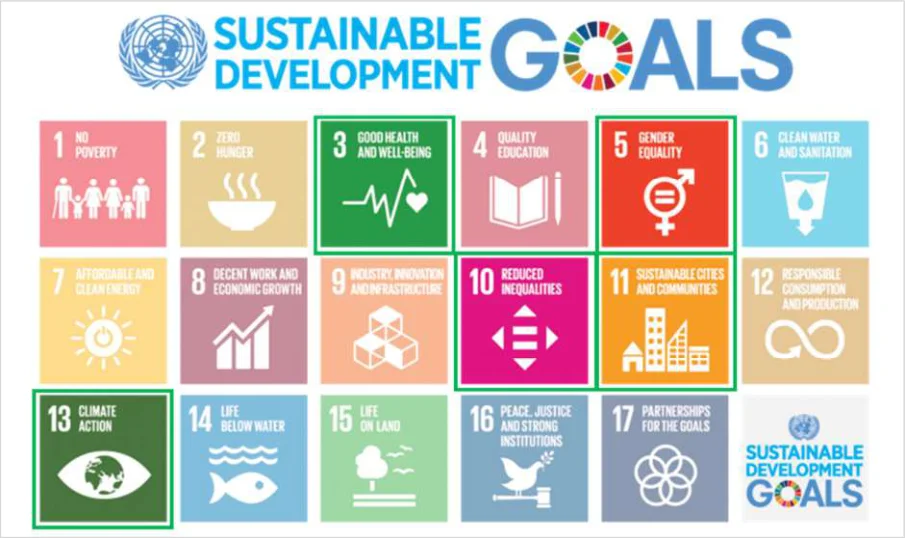
Figure from page 71
Figure A.1 : United Nations, Sustainable Development Goals (Source: www.un.org)
European Policy
European Union Sustainable and Smart Mobility Strategy (2020)
The European Green Deal (2020) includes a target to reduce transport-related greenhouse gas emissions by 90% by 2050. Central to achieving those targets is the EU Sustainable and Smart Mobility Strategy, which sets the policy agenda for Europe’s transition to a green, smart and affordable transport system that aims to change the way people and goods move across the continent and deliver the required 90% reduction.
National Cycle Network Plan - Appendices
The Sustainable and Smart Mobility Strategy is structured around three key objectives centered on the European transport system:
Sustainable mobility: involving an irreversible shift to zero-emission mobility by making all transport modes more sustainable, ensuring wide availability of the most sustainable options and giving users incentives to make sustainable choices.
Smart mobility: supporting sustainable choices by taking advantage of digitalisation and automation to achieve seamless, safe and efficient connectivity.
Resilient mobility: bouncing back from the COVID-19 pandemic by creating a Single European Transport Area that is affordable and accessible for all citizens and businesses with resilience against future crises and safety and security challenges.
Implementation of a National Cycle Network is in line with a key element of the Strategy to make alternative sustainable mode choices available, as well as proposals to promote zero-emission mobility and to increase and improve public transport and infrastructure for walking and cycling along the TEN-T network.1
National Policy
Climate Action Plan 2023
The Climate Action Plan 2023 (CAP23) is the second annual update to Ireland’s Climate Action Plan 2019. CAP23 is the first to be prepared under the Climate Action and Low Carbon Development (Amendment) Act 2021, following the introduction of economy-wide carbon budgets and sectoral emissions ceilings. CAP23 implements the carbon budgets and sectoral emissions ceilings and sets a roadmap for taking decisive action to halve Ireland’s emissions by 2030 and reach net zero no later than 2050. These targets are a key pillar of the Programme for Government.
Previous Climate Action Plan 2021 targets have been revised to meet this higher level of ambition, including a 20% reduction in total vehicle kilometres, and a 50% increase in daily active travel journeys by 2030.
An Annex to the plan outlines the specific actions to be taken to meet the targets outlined in the plan. Several actions are related to delivering cycling and walking infrastructure and encouraging an increased level of modal shift towards active travel and away from private car use, while Action TR/23/30 specifically calls for the advance rollout of the National Cycle and Greenway Networks. .
1 Trans-European Transport Network (TEN-T) https://transport.ec.europa.eu/transport-themes/infrastructure-andinvestment/trans-european-transport-network-ten-t_en
National Cycle Network Plan - Appendices
Project Ireland 2040 National Planning Framework (NPF)
The NPF 2040 document was published in February 2018 and sets out Ireland’s planning policy direction for the period up to 2040. The NPF forecasts substantial increase in population across all regions of the country which, along with associated employment and educational use, will lead to a subsequent increase in demand for travel. Within this context, several of Strategic Outcomes (highlighted in the Figure A2) are particularly relevant to the development of the NCN Plan,
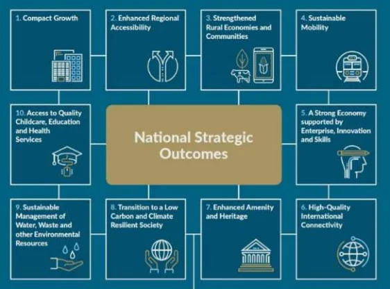
Figure from page 73
Figure A2: Project Ireland 2040 National Strategic Outcomes
Carbon and Climate Resilient Economy.
The Framework outlines a policy objective to improve accessibility between centres of scale separate from Dublin, with a focus on key routes to a number of larger and regionally distributed centres. The development of the NCN will contribute to this.
Development of the NCN Plan is also consistent with
National Policy Objective 27 (Pg. 82): “Ensure the integration of safe and convenient alternatives to the car into the design of our communities, by prioritising walking and cycling accessibility to both existing and proposed developments and integrating physical activity facilities for all age”.
National Policy Objective 64 (129): “Improve air quality and help prevent people being exposed to unacceptable levels of pollution in our urban and rural areas through integrated land use and spatial planning that supports public transport, walking and cycling as more favourable modes of transport
Project Ireland 2040 National Development Plan 2021-2030
The National Development Plan (NDP) is the most recent infrastructure investment plan adopted by the government. The Plan sets out the investment priorities of the state from 2021 to 2030, supporting the delivery of Project Ireland 2040 through public capital investment over the next nine years while guiding national, regional and local planning and investment decisions in Ireland over the next two decades.
The NDP has been developed with a strong focus on climate action and the environment, with a key aim to catalyse a shift towards accessibility-based mobility systems by encouraging people to adopt more sustainable mobility options, particularly cycling and walking.
The NDP outlines a total public investment of €165 billion over the period 2021-2030. In a step-change in the approach towards funding active travel in Ireland, over the next 10 years, approximately €360 million per annum has been earmarked by the Government for investment in walking and cycling infrastructure in cities, towns and villages across the country, including Greenways.
The NDP references the NCN Plan and highlights its role as a “valuable resource in relation to active travel connectivity around Ireland” (Pg. 84).
National Cycle Network Plan - Appendices
Programme for Government: Our Shared Future (Programme for Government, 2020)
Cycling and walking has been given a high level of prominence and ongoing importance in the October 2020, Programme for Government (PfgG) Statement. Significant funding is earmarked to improve the facilities and functions to enable people to travel by cycle (and foot), ultimately improving people’s quality of life, air quality, as well as Ireland’s commitments to sustainability and decarbonisation.
The PfG mandates that every local authority, with assistance from the National Transport Authority (NTA), adopts a high-quality cycling policy, carries out an assessment of their roads network and develops cycle network plans, which will be implemented with the help of a suitably qualified Cycling Officer with clear powers and roles. Development of the NCN Plan took cognisance of the county-level cycle network plans and the need for appropriate interface between networks.
As well as the mandated development of cycle network planning, delivery and positioning of qualified personnel, the PfG seeks more cycling to schools, widening of cycling incentives for employment (Cycle to Work) and ongoing enhancement of safety through policy and legislation review.
Development of the NCN Plan is therefore consistent with the ambitions outlined in the Programme for Government.
National Sustainable Mobility Policy (2022)
The National Sustainable Mobility Policy sets out a strategic framework to 2030 for active travel (walking and cycling) and public transport journeys to help Ireland meet its climate obligations. It is accompanied by an action plan to 2025 which contains actions to improve and expand sustainable mobility options across the country by providing safe, green, accessible and efficient alternatives to car journeys. It also includes demand management and behavioural change measures to manage daily travel demand more efficiently and to reduce the journeys taken by private car.
In line with the targets of the Climate Action Plan, the policy aims to deliver at least 500,000 additional daily active travel and public transport journeys by 2030 and a 10% reduction in the number of kilometres driven by emission producing cars.
The overall vision outlined in the Policy is “to connect people and places with sustainable mobility that is safe, green, accessible and efficient”. To this end, the policy is guided by three key principles, which are underpinned by ten high-level goals, as summarised in Figure A.3.
The NCN Plan is therefore consistent with the principles of the sustainable mobility policy and in particular, the following goals:
Goal 1 - Improve mobility safety.
Goal 4 - Expand availability of sustainable mobility in regional and rural areas.
Goal 5 - Encourage people to choose sustainable mobility over the private car.
Goal 7 - Design infrastructure according to Universal Design Principles and the Hierarchy of Road Users model.
National Cycle Network Plan - Appendices
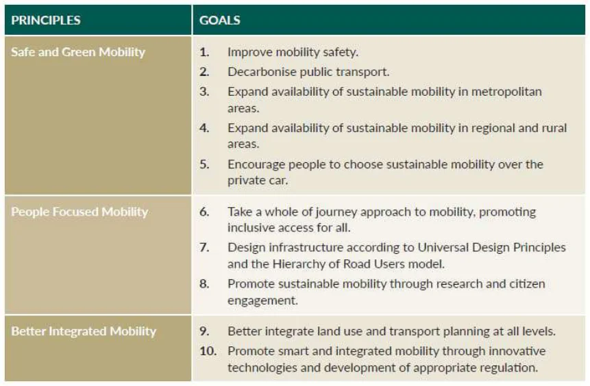
Figure from page 75
Figure A.3 : National Sustainable Mobility Policy – Principles and Goals
With specific reference to Goal 4, the policy notes that “a strategic national cycle network will be identified, providing key inter-urban links and enabling the continued development and delivery of that network”. Development of the strategic NCN is Core Action 29 in the associated Action Plan.
National Investment Framework for Transport in Ireland (NIFTI) (2021)
The purpose of NIFTI is to enable the delivery of Project Ireland 2040 by guiding the appropriate investment in Ireland’s roads, active travel and public transport infrastructure. The types of positive outcomes transport investment can deliver in support of this purpose include:
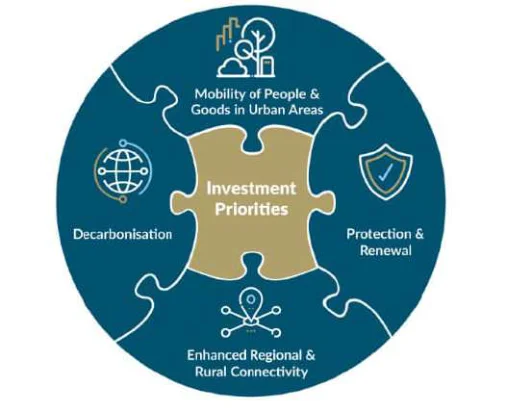
Figure from page 75
Supporting the development of a land transport network that delivers a high level of service for everyone.
Enabling the delivery of National Planning Framework objectives for where people will live and work.
Increasing Ireland’s economic competitiveness.
Realising a low-carbon, sustainable transport system in Ireland. (DoT, 2018).
NIFTI establishes four investment priorities, of which, new projects must align with at least one:
Figure A.4 : NIFTI Investment Priorities
Decarbonisation.
Protection and Renewal.
Mobility of People and Goods in Urban Areas.
Enhanced Regional and Rural Connectivity.
National Cycle Network Plan - Appendices
The NCN Plan aligns in particular, with the Decarbonisation and Enhanced Regional and Rural Connectivity priorities. These key objectives are supplemented by two principle-based hierarchies which will ensure that the most sustainable solutions are sought; these are the Modal Hierarchy and Intervention Hierarchy as presented in the figure below. The NCN Plan aligns strongly with the modal hierarchy as it aims to facilitate a shift towards active travel modes.
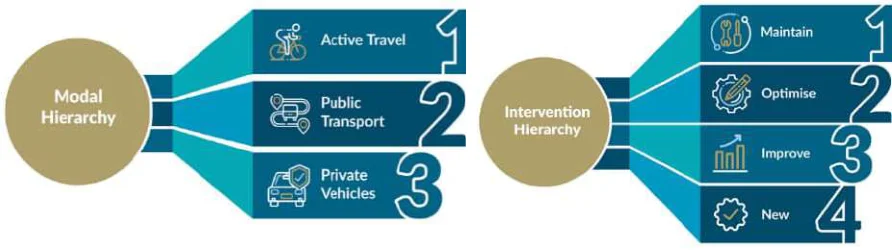
Figure from page 76
Figure A.5: NIFTI Modal Hierarchy and Intervention Hierarchy
Another key consideration for the NCN as outlined in NIFTI is the need for transport infrastructure to be “accessible by design, so that it accounts for and serves the needs of all members of our society. The United Nations Sustainable Development Goals stress the importance of providing access to safe, affordable, accessible and sustainable transport systems for all by 2030, referencing in particular the needs of women, children, persons with disabilities and older persons”.
Outdoor Recreational Plan for Public Lands and Waters in Ireland (2017-2021) (Department of Transport, Tourism and Sport, 2016)
The Outdoor Recreational Plan (ORP) sets out a strategy to revolutionise the provision of outdoor recreational facilities and services on public owned land. The plan sets out to deliver world-class outdoor infrastructure and services in Ireland by taking advantage of the potential of resources the state already owns.
Chapter 2.5 of the Plan, “Healthy Ireland”, outlines a framework for improved health and well-being and notes that goals outlined in this framework could be met by increasing the amount of public recreational space available. These goals include:
Increasing the proportion of people who are healthy at all stages of life.
Reducing health inequalities.
Providing opportunities for healthy outdoor recreation, close to people and in all parts of the country.
Development of the NCN Plan will contribute to achieving these goals by providing increased facilities for active modes.
Government Road Safety Strategy 2021–2030
The primary aim of the government’s road safety strategy is to reduce the number of deaths and serious injuries on Irish roads by 50% over the next 10 years. For the 2021–2030 strategy, seven Safe System priority intervention areas have been identified, two of which have particular relevance to the NCN:
Safe roads and roadsides - To improve the protective quality of our roads and infrastructure.
Safe and healthy modes of travel - To promote and protect road users engaging in public or active transport.
The Road Safety Strategy will feature three phases of action plans, the first of which will run from 2021- 2024 and includes two types of road safety actions: high-impact actions and support actions. Two of the high-impact actions in the Phase 1 Action Plan are:
“During 2021–2025, construct 1,000 km of segregated walking and cycling facilities to provide safe cycling and walking arrangements for users of all ages”.
National Cycle Network Plan - Appendices
“Develop a National Cycle Network plan for interurban rural cycling and walking, and an implementation plan for delivery in Phases 2 & 3”.
The NCN Plan will therefore play a significant role in supporting the goals of the Strategy.
Ireland’s 4th National Biodiversity Plan (2023-2027)
The 4thNational Biodiversity Action Plan (NBAP) will set the national biodiversity agenda for the period 2023-2027. The Plan will aim to improve the governance of biodiversity in Ireland so that we can better respond to the biodiversity crisis.
The Plan has been in development since October 2021, with a second draft of the Plan due to be issued for public consultation in the second half of 2022. The final version of the Plan will be published in early 2023.
The 4th NBAP is supported by a set of objectives, outcomes, targets, actions, and indicators which are interdependent and set out how Ireland will achieve its vision for biodiversity. These elements of NBAP will be considered in the delivery of the NCN.
Regional & Local Policy
Regional Spatial and Economic Strategies
The National Planning Framework outlines a need to manage balanced growth between the regions (The Northern & Western, Southern, and Eastern & Midland Regional Assembly areas). As such, each Regional Assembly has produced a Regional Spatial and Economic Strategy (RSES). These Strategies have been reviewed to determine the strategic alignment of the NCN Plan in the context of each. While all three RSES documents are distinct and specific to their region, there are common themes of relevance to the NCN running through them, as summarised in the table below.
Figure from page 77
Table A.1 : Common Relevant Themes in Regional Spatial and Economic Strategies
| Common | Northern & Western | Southern | Eastern & Midland | ||
|---|---|---|---|---|---|
| Theme | |||||
| Over-reliance on the private Car | This region is highly dependent on the private car for travel to work and education, with approximately 70% of the population having commuted by private car according to the Census 2016, up from 66% in 2011. | There is evidence of an overreliance on the private car for travel to work and education, with approximately 14% of the Region’s population travelling to work / education by green modes in 2016 – lower than the state average (17%) (CSO,2016). | Trends within the region indicate that there is an overreliance on the private car for travel to work and education. Approximately 46% of Dublin’s population commute by private car while approximately 65% and 69% of the populations of the Eastern and Midland SPAs respectively travel by this mode. | ||
| Enhanced Regional Accessibility | Connected Ambition: Accessibility and mobility within the region have a direct effect on the region’s economic competitiveness. It also influences the | The RSES recognises the importance of improved intra-regional connectivity between networked settlements – public transport, rail, inter-urban walking and cycling | Regional Strategic Outcome 15: Enhanced Regional Connectivity – Protect and enhance international connectivity and regional accessibility to support economic development, build |
National Cycle Network Plan - Appendices
| Common | Northern & Western | Southern | Eastern & Midland | ||
|---|---|---|---|---|---|
| Theme | |||||
| attractiveness of the region as a favourable living and visiting environment. | routes, greenways and e- mobility initiative. | economic resilience and support strengthened rural communities and economies including the blue- green economy and tourism. | |||
| Sustainable Mobility | Sustainable travel can have significant benefits for individuals, workplaces and educational facilities in terms of health and wellbeing, costs and time associated with travel. It has the potential to reduce congestion and emissions and to exploit investment in sustainable transport. | Transform our transport systems towards well- functioning, sustainable integrated public transport, walking and cycling and electric vehicles. | Investment in sustainable mobility will be delivered through local transport plans (LTPs), to be prepared by local authorities in collaboration with transport agencies. | ||
| Low Carbon, Climate Resilient and Sustainable Society | This region is willing to harness development trends, and changes in public policy, where necessary, to demonstrate our ability to be a leader in pursuing a low carbon strategy. | Safeguarding and enhancing our environment through sustainable development, prioritising action on climate change across the Region, driving the transition to a low carbon and climate resilient society. | A key challenge facing the region, along with all other regions, is the transition to a low carbon society. For the RSES this means five primary areas of transition which are at the core of the Strategy. One of these is a transition to sustainable transport systems. | ||
| Development of Cycling Facilities | Transport Priority Core Outcome 9: Develop a comprehensive network of safe cycling routes in the three cities / associated metropolitan areas, and providing similar facilities in other towns and villages, where appropriate. | Regional Planning Objective 174: Delivery of cycle routes, Greenway and Blueway corridor projects; Delivery of high-quality safe cycle route network across the Region and cycling environments; Development of a safe cycling infrastructure to cater for the needs of all groups of cyclists, especially new cyclists, school children, elderly etc. | The following walking and cycling objectives will guide investment in the EMRA: Delivery of the National Cycle Plan within the Region inclusive of the Greenway and Blueway projects Provide safe cycling routes in towns and villages across the Region |
Ireland’s Cycle Network (NTA, 2022)
The report outlines the plan for CycleConnects, outlining the steps taken in the development of this National Plan which is comprised of 22 individual cycle networks in each respective county. The plan does not prescribe any cycle infrastructure for the routes presented but mainly serves to illustrate the potential cycle connections between all major towns and cities outside the Greater Dublin Area (GDA).
The proposed network plan is comprised of interurban routes that connect settlements of over 1000 people. Existing and proposed greenways / blueways were also included in the network. Any town with a population of over 5000, as per the 2016 Census, has been developed further with a more dense urban cycle network to cater for increased cycle demand.
The development of the NCN included ongoing liaison with the CycleConnects project team to ensure that alignment of proposed interurban connections.
National Cycle Network Plan - Appendices
Greater Dublin Area Cycle Network Plan (2021)
The 2021 GDA Cycle Network Plan provides a substantial update and expansion of the previous 2013 GDA Cycle Network Plan.
Whereas the 2013 GDA Cycle Network Plan focused on identifying the links necessary for providing an adequate network for the cyclists, the2021 GDA Cycle Network Plan aims to strengthen access and local permeability within Dublin and GDA towns as well as strengthening the cycling connectivity between them.
The 2021 GDA Cycle Network Plan covers the entire Greater Dublin Area and therefore includes proposals for improvements within district centres and county towns throughout Dublin, Meath, Kildare and Wicklow.
The updated plan also outlines a new classification system for cycle routes, which represents a step change towards more tailored cycling environments. The revised classification differentiates between ‘utility’ movements and ‘leisure’ movements, acknowledging that different types of cycling facilities are appropriate for different intended uses, although it may sometimes be the case that a single route corridor would be appropriate for both uses.
These proposals and the potential for overlap / interface with the NCN were considered during the NCN Plan development.
Other Regional City Transport Strategies
The Galway Transport Strategy (GTS) was published in 2016, while the Cork Metropolitan Area Transport Strategy 2040 (CMATS) was published in 2020. A Draft Transport Strategy has been prepared for Limerick (2020), while a draft strategy is currently being prepared for Waterford.
All the regional city transport strategies include proposals for cycle networks. These proposals and the potential for overlap / interface with the NCN will be considered during the implementation phase of the NCN Plan.
Area-Based Transport Assessments (ABTAs)
The Climate Action Plan notes that “Outside of the cities, local transport plans for the regional growth centres and key towns will allow for local implementation of national and regional level land use and transport policies. These plans will be prepared based on the Area Based Transport Assessment Guidance produced by the NTA and TII”.
Work on a number of these ABTAs has already commenced, with more planned in the near future. Where relevant, the NCN Plan takes account of the need for interface between the NCN and any local cycle networks developed as part of the ABTAs.
County Development Plans and Local Area Plans
The recent trends in national policy towards recognising the role of cycling in facilitating a shift towards sustainable mobility and a low carbon, climate resilient and sustainable society has started to be reflected in recent County Development Plans and Local Area Plans. By way of examples:
The Kildare County Development Plan 2017-2023 notes that “The Council recognises the importance of both walking and cycling to the overall well being and quality of life of residents”, and that “It is policy of the Council to support green and blueway projects that promote walking and cycling in conjunction with the relevant organisations and bodies”.
The Galway County Development Plan 2022-2028 contains a Policy Objective (WC4 – Modern Network of Walking and Cycling Infrastructure) “To continue to work and engage with the National Transport Authority, the Department of Transport, Tourism, and Sport and other agencies in developing a modern network of walking and cycling infrastructure in the County”.
The County Donegal Development Plan 2018-2024 notes that “It is a policy of the Council to ensure that large scale development proposals provide walking and cycling infrastructure”.
National Cycle Network Plan - Appendices
While this presents examples from a small number of plans, this trend is becoming prevalent across all county and local development plans and, as such, development of the NCN Plan is in line with County and local level policy.
Five Cities Demand Management Study
The aim of the Five Cities Demand Study is to provide a focused and evidence-based approach to addressing the carbon, congestion and air quality challenges facing the cities of Ireland. It is the result of an ‘urgent requirement’ to reduce transport-based greenhouse gas emissions. Rather than duplicating or repeating other national or regional strategies that are in place, the Study aims to inform the direction of complementary demand management policy measures at a local and national level. As such, it outlines a number of potential measures aimed at increasing the cycling mode share, as summarised below.
PP02 (Public Health and Transport) in the strategy discusses the importance of shifting to an active mode of transport from a health perspective. It is predicted that, by 2025, 33% of Irish adults will be obese. The annual cost of treating obesity related diseases is estimated to be €2.1 billion by this time. The document stresses that reducing car dependency and replacing these trips with physical activities can play a role in the overall obesity reduction programme, as well as supporting demand management.
FM10 (Sustainable Mobility Incentives) in the document hypothesises that a reduction or elimination of VAT on cycles can be a more equitable way of reducing the cost of cycling than the cycle to work scheme. Grants could also be imposed to encourage commuters to make the switch from car to cycle.
School mobility management (BC03) plans are also outlined in the document. In 2016 nearly 60% of primary schoolchildren were driven to school in Ireland. Mobility management plans are management tools that bring together behavioural change measures and infrastructure improvements in a coordinated framework, allowing educational centres to implement measures against an agreed plan to reduce demand for and use of private cars.
Development of the NCN Plan is therefore consistent with the goals and recommendations of the Study.
Cycling Network and Design Standards
TII Rural Cycleway Design (2022)
The TII Rural Cycleway Design applies to the development and delivery of new or improved rural offline cycleways, including national and regional greenways, which are funded through Transport Infrastructure Ireland (TII) and / or when TII is the Approving Authority, unless otherwise instructed by TII.
The document outlines the principles that should be incorporated when designing rural offline cycleways / greenways in Ireland. These Principles are as follows:
Coherence. Cycleways should have a specific origin and destination.
Convenience. New cycleways should offer more benefits to existing cycleways in terms of safety and attractiveness.
Directness. The average distance a cyclist may travel must be considered. The linking of intermediate attractions and destinations are an important consideration for route design.
Safety. Cycleways must be safe for all users (cyclists and pedestrians).
Comfort. Cycleways should meet national standards of lane-width and gradient. Complex manoeuvres should not be incorporated in the design.
Attractiveness. The route should enhance the natural environment where possible. The whole experience should make cycling an attractive option.
Access. Cycleways should link trip origins and destinations along convenient and affordable routes. Cycle routes should be accessible to all types of cycles.
National Cycle Network Plan - Appendices
The document also discusses a variety of existing and disused infrastructures that may be suited to be reused as a cycleway. These include disused railway lines, canal towpaths and riverbanks, and forest trails. Consideration is also given to the use of existing local and unclassified road infrastructure as part of the rural offline cycleway.
Specifications as far as cross-sections in the cycleway, grass verged width, safety barriers, headroom are all discussed in the document. The recommended cycle width can be determined by factors such as the volume of cyclists, room to overtake, and whether the rural offline cycleway will be used by other users (pedestrians) etc.
The standards outlined in the document were considered in the development of the NCN Plan.
The National Cycle Manual (Update Pending)
The manual aims to provide a standardised procedure for designing a cycling facility in Ireland based on the five main needs of a cyclist:
Road Safety.
Coherence.
Directness.
Attractiveness.
Comfort.
It provides criteria to measure Quality of Service (QoS) which can be used to measure the degree that the cyclists’ needs are achieved in any particular design. The manual also includes the basic principles of the cycle facilities and the current policies and legislation for cycling.
The principles and standards outlined in the National Cycle Manual were considered in the development of the NCN Plan.
Strategy for the Future Development of National and Regional Greenways (Department of Transport Tourism and Sport, 2018)
The aim of the Strategy for the Future Development of National and Regional Greenways (2018) is to assist the selection of locations for potential greenways and to ensure these greenways are constructed to an appropriate standard.
The Strategy notes that greenways should have the “potential to deliver an increase of tourism to Ireland and are regularly used by overseas visitors, domestic visitors and locals nearby”. As outlined, these greenways should also “link places of interest, recreation and leisure in areas of beautiful scenery of different types with plenty to see and do”.
The Strategy outlines factors that should be considered when developing national and regional greenways as well as post-construction considerations such as cleaning and maintenance.
The guidance outlined in the Strategy was considered in the development of the NCN Plan. Consideration was also given to the selection criteria used to identify ‘national’ and ‘regional’ routes when determining an approach to network identification and classification for the NCN.
TII Sustainability Implementation Plan (2021)
TII’s Sustainability Implementation Plan outlines their commitment “to becoming a leader in delivering and operating sustainable transport infrastructure in line with Project Ireland 2040, the Programme for Government, the UN Sustainable Development Goals and the European Green Deal”.
The document establishes core sustainability principles, which are derived from national policy. The NCN Plan aligns with many of these principles, including ‘providing effective, efficient and equitable mobility’, and ‘enabling safe and resilient networks’.
National Cycle Network Plan - Appendices
Academic Literature Review
The academic review was undertaken as part of the process of developing a clear understanding of potential NCN users and their needs. The review included a range of research papers, articles, data sets. A summary of the publications included in the academic review is provided in Table A.2 below.
A more comprehensive discussion of the findings of the review is provided in the sections below, but the main items relevant to the development and implementation of the NCN Plan can be summarised as:
Commuting by cycle is increasing in popularity but is heavily dependent on where one lives – urban areas (Dublin, in particular) with a shorter distance to work have higher rates of commuting by cycle.
Recreational cycling is more popular in Ireland than commuting by cycle and has distinct infrastructure preferences compared to commuting (i.e., scenic routes and recreational infrastructure versus directness of route).
Segregated and / or traffic free cycle infrastructure encourage more trips to be taken by cycle across all cycling confidence levels.
A large gender disparity exists in cycling participation in Ireland – men are generally twice as likely to cycle – and the provision of safe cycling infrastructure is seen as a key factor to reduce this.
Table A.2 : Overview of Articles Reviewed for Market Research
| Title | Author(s) | Year of Publication | ||||||
|---|---|---|---|---|---|---|---|---|
| A Strategy for the Development of Irish Cycling Tourism: Conclusions Report | Sustrans | 2007 | ||||||
| Bike Life Dublin Metropolitan Area | NTA | 2019 | ||||||
| Commuting in Ireland | Central Statistics Office | 2016 | ||||||
| Determining Bicycle Infrastructure Preferences - A Case Study of Dublin | Brick, Caulfield, et al. | 2012 | ||||||
| Four Types of Cyclists?: Testing a Typology to Better Understanding of Bicycling Behaviour and Potential | Dill et al. | 2012 | ||||||
| Greenways and Cycle Routes Ancillary Infrastructure | Department of Transport, Tourism and Sport | 2018 | ||||||
| How Far is too Far to Cycle to Work (Article) | Bicycle 2 Work (bicycle2work.com) | No date given | ||||||
| Irish Sports Monitor: Annual Report | Sport Ireland | 2019 | ||||||
| Travelling in a Woman’s Shoes - Understanding Women’s Travel Needs in Ireland to inform the Future of Sustainable Transport Policy and Design | Transport Infrastructure Ireland (TII) | 2020 |
Current Cycle Patterns and Demographics (Commuters)
Approximately 3% of commuters cycled to work in 2016 (CSO, 2016). Cycling to work has become more popular - increasing in Ireland by 43% between 2011 to 2016.
National Cycle Network Plan - Appendices
57,000 people commuted via a cycle in Ireland in 2016, with a further 10,700 cycling to third level institutions. There is likely potential for increased levels of cycle commuting as nearly 75% of people surveyed say they would consider cycling to a new job if ‘off road’ cycle spaces were available (Caulfield, Brick et. al, 2012).
The likelihood of someone cycling to work is heavily dependent on where a person resides: 38,870 people who cycled to work in Ireland in 2016 (or 67%) lived in Dublin City or its suburbs. This represents 7.6% of Dublin’s working population. Only 3% of Cork City’s population cycled to work and only 395 people who worked in Waterford City commuted by cycle. In rural towns and areas with a population of less than 10,000 persons, less than 1% of people cycled to work (CSO, 2016).
A survey produced by the NTA found that a quarter of Dublin’s population cycles at least once a week, with 11% cycling 5 days or more per week (NTA, 2019). The survey found that there is a growing market for cyclists in Dublin with 21% saying they ‘do not cycle but would like to’.
Age plays a role in determining the likelihood of choosing to cycle to work. Those under 40 years old made up 60% of the cycling population while only representing 48% of the workforce. Socio-economic status also influenced cycle patterns. Professional workers made up 9% of the working commuting population, while they accounted for 16% of those cycling to work. Managerial and technical workers accounted for 31% of the working commuters, yet 34% of them are cyclists. Skilled manual workers were underrepresented among cyclists, possibly through the need to commute by van, or to carry tools and equipment.
The distance travelled to work also influences a person’s ability or willingness to switch to a cycle commute. In 2016, the average commute was 15km, an increase of 0.3km from 2011. At county level, the longest distances recorded were in Laois and Leitrim at 25km and 23km, respectively. Between 2011 and 2016, there was a rise of 10% of people that commuted 25km or more to work, with 238,241 persons making this journey. According to ‘bicycle2work.com’, a US based website set up by cycling enthusiasts encouraging cycling to work, 8-16km is a reasonable distance to cycle to work (Bicycle 2 Work, n.d.). A journey to work should take 30-60 minutes for a person of average fitness.
Current Cycle Patterns (Recreational Cyclists)
Although only 3% of people in Ireland use cycling as their main form of transport (less than the EU average of 14%), 10% cycle regularly (Sport Ireland, 2019). This figure includes recreational cyclists who generally cycle longer distances than commuters. Although greenways for recreational and commuting cyclists can be shared, these two types of cyclists generally have different needs. Recreational cyclists generally prefer scenic routes and recreational infrastructure (picnic areas, resting places, etc.), while commuters value parameters such as ‘directness’ and journey time.
The inclusion of ancillary infrastructure may entice tourists and other recreational groups to use a greenway (Department of Transport, Tourism and Sport, 2018). Ancillary Infrastructure of a greenway refers to route furniture (rest, shelter, and stores), signage (interpretive and directional), technical supporting information for the route, and pocket facilities (cycle, play, study spaces). Greenways are often constructed to cater for tourists with longer routes and more facilities than a cycleway built specifically for commuting.
Cycling Confidence and Route Choice
A study conducted by Trinity College Dublin and AECOM (Caulfield, Brick et. al, 2012) investigated the preferences cyclists have in terms of infrastructure. It was discovered that cycling confidence had little bearing on infrastructure preference. The study found that “facilities segregated from traffic” is the preferred form of infrastructure, followed by cycling through residential streets and parks - where no infrastructure was implemented except for sufficient facilities for wayfinding.
The study also asked what would encourage respondents to cycle to work if they hypothetically started a new job within cycling distance. Nearly 75% reported that more off-road cycle tracks would influence them to take a cycle commute. 56% of respondents stated that more connected on-road cycle lanes would encourage them to cycle to work. 69% said that less traffic was unlikely to encourage them to
National Cycle Network Plan - Appendices
cycle to work. Signage and improved information available had little influence on encouraging people to cycle to work.
The study found that short journey times and directness were the most important variables for both existing cyclists and non-cyclists in determining route choice. This was followed by infrastructure type (i.e., off-road cycle tracks), number of junctions along the route, traffic speed, and volume of cyclists.
Similar findings were observed in the Bike Life survey undertaken by the NTA and Sustrans, which found that 70% of people would find traffic-free routes away from roads useful to help them cycle more and 69% would find cycle tracks, physically separated from traffic and pedestrians, useful to help them cycle more (NTA, 2019). 84% of residents supported building more physically separated on-road cycle tracks, even when this would mean less space for other road traffic.
A study by Portland State University (Dill et al., 2012) investigated a typology developed for the city of Portland that includes four categories of cyclists: ‘strong and the fearless’, ‘enthused and confident’, ‘interested but concerned’, and ‘no way no how’. Adults were placed into these four categories based on answers given to scenarios hypothesised by the surveyors, ranking each on a scale of 1 through 4 (1 being very uncomfortable, 4 being very comfortable). The analysis of the study concluded that reducing traffic speeds and increasing segregation between cyclists and other road users may increase levels of comfort and cycling rates.
Gender Influence
Men are generally twice as likely to cycle in Ireland compared to women while there is an even greater discrepancy between some age brackets (CSO, 2016). Between the ages of 16-19, 31% of men cycle in comparison to just 11% of women.
One of the reasons for this difference is the lack of ‘social safety’ on cycleways. 23% of women in the UK feel safe cycling in hours of darkness, compared to 37% of men (SUSTRANS, 2018). This is a problem particularly during the winter period when commuting hours may be in total darkness. The same study found 57% of women stated they feel safe during daylights hours, in comparison with 65% of men.
Travelling in a Woman’s Shoes, a study commissioned by TII (TII, 2020) explores the factors of car dependency for women that include transport infrastructure, caregiving responsibilities, safety concerns and equality of access to quality services. The study found that 95% and 79% of women outside of Dublin and in Dublin, respectively, consider the car to be a necessity. The study also recognises that the lack of safe cycling infrastructure negates the appeal of health benefits for women. Women feel that, without adequate infrastructure and experience, cycling is a stressful and unappealing proposition, ultimately outweighing any health benefits. Many women interviewed for the study enjoy cycling for leisure on the weekend but do not consider it appropriate for commuting due to a lack of safe cycling infrastructure. In Dublin, 11% of women felt safe cycling compared to 62% who responded that they feel safe walking.
Appendix B
International Case Studies
National Cycle Network Plan - Appendices
B.1 Network Planning Case Studies
As part of the development of the NCN Plan, a review was undertaken of international best practices. A detailed assessment of cycle networks currently in place in Denmark, the United Kingdom (UK), and Hungary was completed. These case studies include relevant details regarding the development of cycle infrastructure, implementation, and impact where available, as well as lessons learnt that may be applicable to the NCN Plan.
Denmark
Denmark was selected as an example of ‘best in class’ for both cycle culture (cycling accounts for 26% of trips under 5km) and the quality of cycle infrastructure provided, while also being of a comparable geographic size to Ireland.
Two different cycle projects in Denmark are of note in relation to developing the NCN in Ireland: the development of national cycle routes, and the creation of Super Cycle Highways (Super Cykelstier).
National Cycle Routes
The first ten national cycle routes were established in 1993 with an additional route added in 2002. They are all long routes (each over 200km) crossing the country north-south and east-west, primarily aimed at tourist and recreational cyclists. In more recent years, a number of these routes have been further developed with the aim of increasing cycle tourism.
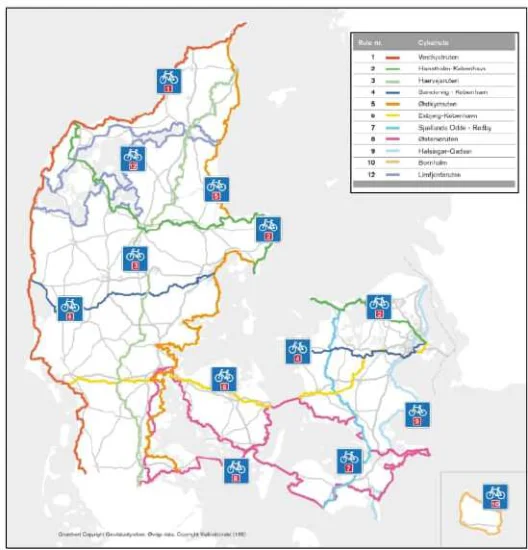
Figure from page 86
Figure B.1 : National Cycle Routes
Similar work has now been completed on other national routes. After route signage the focus is on developing services along the route in cooperation with public and private stakeholders, especially to make the longer routes more attractive to cyclists in search of day trips.
This approach, along with various promotional campaigns, appears to have been successful – Denmark welcomed 1.7 million cycle tourists in 2017, an increase of approximately 70% in less than 10 years. These shorter routes are also ideal for local recreational cycling. 39% of cycle trips made within Denmark are for leisure purposes (Cycling Embassy of Denmark, 2018).
National Cycle Network Plan - Appendices
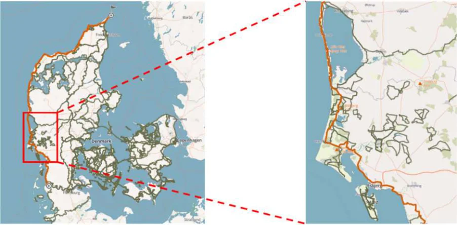
Figure from page 87
Figure B.2 : National Cycle Route 1 (with zoom in to show shorter local routes and loops)
Cooperation on such projects is a high priority in Denmark and there are several key organisations in this space, including:
The Danish Cyclists’ Federation – NGO founded in 1905 to promote cycling and cycling safety with approximately 16,000 members across approximately40 branches. It has over 20 staff members and is represented on the Cycling Embassy of Denmark, the Municipal Cycling Council, the European Cyclists Federation (ECF), the Danish Road Safety Council, and the Danish Road Safety Commission.
The Municipal Cycling Council / Cycling Council – Professional forum for Danish local authorities to actively promote cycling. Previously published the newsletter Cykelviden describing in detail a number of municipal projects in the years 2013-2017. Ensures cooperation across local authorities.
The Cycling Embassy of Denmark – Network established in 2009 to promote cycling as a means of transport and Denmark as a cycling nation. It provides services targeting professional planners in public administrations and private companies, local and national policy makers, students, researchers, and civil society organisations. Members include private consultants, manufacturers, municipalities, public organisations, and non-governmental organisations.
Danish Cycling Tourism – Established in 2014 (after the completion of the above-mentioned projects on national routes 1 and 2) with the purpose of developing and coordinating cycling tourism in Denmark. The association’s members are local authorities, destinations, organisations, and private enterprises. Since 2016 Danish Cycling Tourism has been the EuroVelo coordination center in Denmark. The association has four full-time co-workers and a number of affiliated consultants.
Super Cycle Highways (Super Cykelstier)
Cycling accounts for 26% of trips under 5km and 16% of all trips throughout Denmark (Cycling Embassy of Denmark, 2018). The Super Cycle Highways are primarily aimed at shorter trips and, commuters across the Capital Region in particular.
In 2008, analysis from the City of Copenhagen identified potential for increasing cycle commutes across municipalities in the Capital Region (Cycle Superhighways, 2019). Copenhagen joined forces with 15 municipalities and the Capital Region to form what would become the Cycle Superhighway Collaboration. This was followed by an initial investment of €140 million to develop the cycle highways
National Cycle Network Plan - Appendices
by the state. In 2011, the Office for Cycle Superhighways was created to facilitate the collaboration between municipalities for these projects. By 2013, two Cycle Highways had been launched
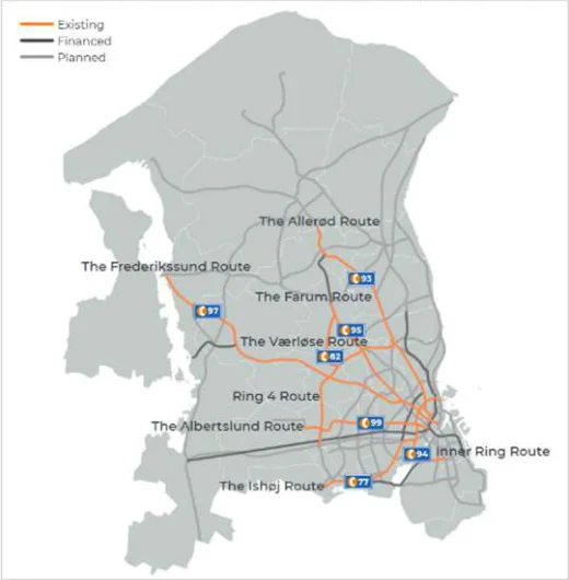
Figure from page 88
Figure B.3 : Super Cycle Highways (Super Cykelstier) Network (as of 2019)
direct and are built with the intention of having as few stops as possible (Secretary of Cycle Superhighways, 2018). The aim of these routes is to establish a competitive alternative to cars and increase the number of cyclists in the region. 60% of cycle commutes on the network are less than 10km.
Super Cycle Highways are designed to be:
Accessible – The Super Cycle Highways should link areas where people work, study and live and provide access to transport hubs. They should be cohesive and easy for commuters to navigate.
Direct – They should provide the user with the fastest route between home, work or education. They should have as few stops as possible and have enough space for cyclists to maintain speed without delays.
Comfortable – The routes should have an even surface, be well-maintained and enhance the cycling experience.
Safe – They should provide the cyclist with safe cycling conditions and reduce the number of fatalities.
A design manual for Super Cycle Highways is available in Danish (Supercykelstier_Koncept-2018-1.pdf (idekatalogforcykeltrafik.dk)). It should be noted that they are not all new cycle tracks, many are upgraded existing routes.
Based on a 2018 study, the Super Cycle Highways are credited with increasing the number of cyclists along the measured corridors by 23% after implementation (C40, 2019). Furthermore, 14% of new cyclists now using the Super Cycle Highway would have previously travelled by car. The same study found health benefits to the value of €616m were attributable to the project and these make up the vast majority of the estimated €765m socio-economic surplus attributable to the highways. This compares
National Cycle Network Plan - Appendices
with the estimated cost of €295m for development of the complete network of superhighways (Cycle Superhighways, 2019).
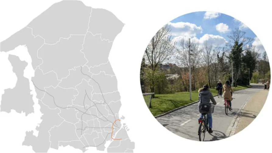
Figure from page 89
Figure B.4 : Inner Ring Route C94
There are plans to further upgrade the network of Super Cycle Highways. A total of 45 cycle highways are expected to be built by 2045 in response to the increasing levels of congestion experienced in Copenhagen, particularly during weekdays (C40, 2019). The capital region of Denmark covers over 2,500km2 and comprises of 29 individual municipalities. Currently, the cycle highways link 19 of these municipalities. However, with the introduction of the new cycle highways all 29 municipalities will be linked. The network will then total more than 750km. The total cost of building these new routes is projected to cost €295 million (C40, 2019). The new routes are also expected to facilitate 6 million new cycling trips annually and replace 1 million car journeys. 70% of funding of the cycle highways comes from the Government of the Capital Region of Denmark with the remaining 30% coming from the neighbouring municipalities.
Lessons Learnt: Use of and Integration with Existing Cycle Infrastructure
Many parts of the Super Cycle Highway network were based on existing infrastructure which was upgraded. The first step was identifying what infrastructure was already in place, followed by identifying the gaps in infrastructure. These gaps were filled and upgraded to form a complete section of the cycle highway. Possible improvements to an already existing cycle path include intersection / signalling improvements, integrating bus platforms, upgrading lighting, and upgrading signage. Using the existing cycle infrastructure also allowed for deeper integration with other cycle networks providing more access points to the Super Cycle Highways.
Lessons Learnt: Integration with Transport Hubs
Since 2016, Denmark has implemented a ‘door-to-door’ strategy to allow Danes take their cycles on public transport. In 2019, 30% of all trips taken on trains in Copenhagen featured a cycle ride at one or both ends of the trip (Gehl Architecht, 2019). Many of the Cycle Superhighways were built in coordination with the S-Train Network to give easy access to its stations. These flexible travel options allow users to cycle and take the train home or cycle to another station if they don’t want to change trains.
National Cycle Network Plan - Appendices
Lessons Learnt: Route Selection and Design
The 11 National Cycle Routes were designed with the requirements of recreational cyclists in mind. Selection of these routes was aided by tourist and cycling organisations. Different routes have different requirements: For example, it is acceptable to have gravel paths where the route’s primary attraction is its scenery, while a route in urban areas should have smooth asphalt paths and focus on safe and accessible crossing of roads. It is recommended that areas with steep climbs should be avoided.
In the case of the Super Cycle Highways, traffic engineers from each individual municipality discussed which routes they wanted to implement in their locality. These were all combined in one map and resulted in cycle superhighways being placed through nearly every municipality. From this, a heat map was created to identify the most popular segments and routes were selected. Site visits were undertaken including a comprehensive analysis of current cycle infrastructure (from YouTube video WEBINAR: Cycle Superhighways, Lessons from Copenhagen (September 2021))
UK
The UK was selected as a case study based on planned integration with the NCN (with the Northern Ireland network), as well as having similar weather, geography, pre-existing infrastructure, and propensity to cycle.
The UK’s National Cycle Network (UK NCN) was established to encourage cycling and walking throughout the UK, as well as promoting cycle touring. Sustrans is the custodian of the network and has aided the project since 1979 when the first traffic-free path was built on a disused railway path (SUSTRANS, n.d.). Sustrans is a charity with the mission to make it easier for people to walk and cycle.
In 1995, Sustrans was granted £42.5 million from the National Lottery to create a UK wide network of routes for walking and cycling. Stemming from this, in 1996, the UK NCN’s goals were revised to increase the number of cyclists in the UK to levels seen in other European Countries such as the Netherlands and Denmark (Hugh McClintock, 2002). A strategy was implemented, focusing on those who didn’t cycle rather than those who already did. Many routes on the UK NCN were built prior to the introduction of the first set of UK cycling guidelines in 1996, as up to this point Sustrans had built short lengths of route all over the country and had opened just one long route.
With secured funding and a revised goal, Sustrans now had targeted to provide an additional 4,000km of cycle paths by 2000. Sustrans exceeded its goal by a further 4,000km bringing the total distance of new cycle routes to 8,000km. The network continued to expand and reached a peak of nearly 27,000km in 2018. It comprises shared paths, disused railways, minor roads, canal towpaths and quiet ways in towns, cities, and rural areas throughout the UK.
The UK NCN aims to be safe and traffic-free: it should be ‘safe for a sensible 12-year-old travelling alone’. Nine principles are considered when designing routes, which are considered ‘key elements that make the Network distinctive’. The UK NCN should:
Be traffic-free or a quiet-way.
Where it is not traffic-free it should either be on a quiet-way section of road or be fully separated from the adjacent carriageway.
Be wide enough to accommodate all users.
Be designed to minimise maintenance.
A maintenance plan should be put in place as part of the development process.
Have a smooth surface that is well drained.
Be fully accessible to all legitimate users.
All routes should accommodate a cycle design vehicle of 2.8m long and 1.2m wide.
National Cycle Network Plan - Appendices
Be signed clearly and consistently.
Feel like a safe place to be.
Route alignments should avoid creating places that are enclosed or not overlooked.
Enable all users to crossroads safely and step-free.
Road crossings should be designed in line with current guidance.
Be attractive and interesting.
In 2018, Sustrans completed a detailed review of the entire network (Paths for Everyone). This review concluded that vast sections of the network were of ‘poor’ or ‘very poor’ standard. It also concluded that much of these sections were not accessible to all legitimate users (see principles above). Based on the findings of this review and further analysis, almost one quarter of the network (approximately 7,000 miles) was reclassified and / or removed from the network. (In Northern Ireland this reduction was even more severe going from a network of approximately 1,000 miles to approximately 150 miles.)
Roughly 5 per cent of the UK NCN, comprising 753 miles on busy roads shared with motor traffic, was removed entirely from the network map and will have signage removed as they “they fall too far short of the quality standards Sustrans aspires to” (MacMichael, 2020). Over 3,000 miles were reclassified to suit ‘more experienced’ cyclists due to difficulty levels and safety concerns on various routes. These include routes such as the ‘Sea to Sea’ Route spanning over 140 miles from Whitehaven on the Irish Sea to Tynemouth on the North-East Coast. Other on-road sections remain on the UK NCN map but are listed as “Not on the National Cycle Network”. Since the reclassification Sustrans has stated that the UK NCN is now “more accessible and provides a consistent user experience.”
Two strategic priorities were identified following on from the 2018 report:
Strategic Priority 1 aims to make the UK NCN safer for everyone by making more of the network traffic-free. Where this is not possible, considerations to changing the character of minor roads to quiet-ways should be made. Cycling on major roads also needs attention. The solution here may be to re-route to an off-road section or create new segregated infrastructure.
Strategic Priority 2 aims to make the UK NCN accessible for everyone. This includes widening the paths where they are unsuitable for the volume of users, improving path surfaces and improving signage and wayfinding across the Network.
In some cases, where a route was removed but is of importance to tourism and is of a significant distance, the route may be reclassified as a named route. This means that although the route will not be identified as part of the UK NCN or appear on mapping, the entirety of the route will continue to be mapped by Ordinance Survey and continue to be published online. They will also continue to be promoted by Sustrans as a dedicated named route (HiTrans, 2020).
Today, the UK NCN consists of over 20,000km of signed routes. In 2019-2020 it was estimated that 4.2 million individuals used the network reducing the number of car trips in the UK by 70.9 million. Furthermore, Sustrans estimates that £1.6 billion has been brought to local economies and £21.5 million was saved by the NHS through the Network’s impact on people’s health.
The Sustrans website gives guidelines for designing traffic-free routes and greenways. Specifications around space requirements, geometric design and accessibility to routes are given and have been implemented into traffic-free routes within the UK NCN. These design specifications are in line with the UK’s Department of Transport’s ‘Cycle Infrastructure Design Guidelines’ published in July 2020.
Sustrans aims to have all its routes of a ‘good’ or ‘very-good’ standard by 2040 with a further 8,000km of traffic-free roads also expected to be built by then. The charity estimates that an investment of £2.8 billion is needed to meet these targets by 2040.
National Cycle Network Plan - Appendices
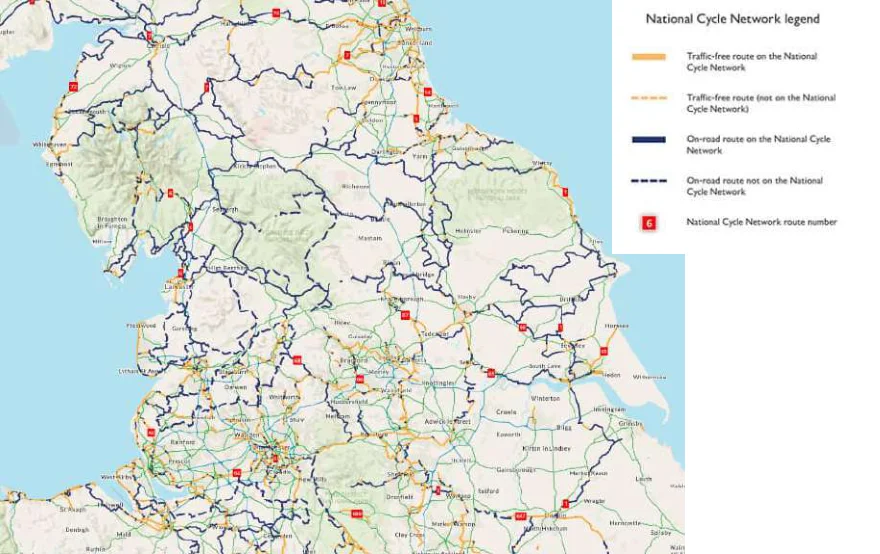
Figure from page 92
Figure B.5 : The UK NCN in the North of England
Lessons Learnt: Funding
Funding for the UK NCN comes from a variety of sources and varies by geography and year. For example, in 2018 £7 million was granted by the Scottish Government, which was double the previous year, yet there was no grant from the English Government. A large amount of funding also comes from private donors throughout the UK to fuel ongoing projects.
In the year ending 2021, ‘charitable activities’ raised nearly £63 million for Sustrans (SUSTRANS, 2021). This figure includes £45 million donated from Transport Scotland, £4.6 million from the Department of Transport, £360k from the Coronavirus Job Retention Support, and £154k from other local governments. During the same year £35 million was paid out to various institutions as reimbursement for project delivery. For example, £5.3 million was paid to Glasgow City Council to support ‘social distancing schemes’ in public places to supress COVID-19. Fundraisers such as ‘The National Cycle Network Challenge’, that challenges participants to ‘run, walk or cycle’ 10, 25 or 100miles also helps raise money for the charity.
Lessons Learnt: Integration with Local Networks
Although the UK NCN spans the entire length of the county, there is a lack of integration with local networks. For example, the ‘Bee Network’ (Greater Manchester’s cycle Network) has no connections with the greater UK NCN. Local networks often offer a superior connection for commuters to travel from home to work. There are some notable exceptions such as the ‘Liverpool Loop Line’ on the UK NCN that links with various cycle paths within the Liverpool area. However, this route is advertised as a cycle for leisure purposes and an ‘escape from the city’.
Lessons Learnt: Quality Versus Quantity
As noted above, many of the routes that were previously on the UK NCN were reclassified and / or removed due to being of ‘poor’ or ‘very poor’ standard. In July 2020, Sustrans removed a quarter of its roads from the UK NCN as part of an ongoing plan to improve safety standards on the network (Guardian, 2020). In addition, on-road parts of the Network were identified where motor traffic speeds exceeded a
National Cycle Network Plan - Appendices
median speed of 40mph, or 35mph in the case of A-roads (where a high volume of traffic could be assumed) (HiTrans, 2020).
In 2020, 80% of the UK NCN in Northern Ireland and 30% in Scotland was reclassified. This was prompted by the 2018 Paths for Everyone report that noted that routes with poor access should be removed from the network. The aim of reclassification was to remove the worst parts of the UK NCN based on road classifications, Sustrans’ standards of acceptable levels of traffic volumes and maximum allowed speeds. The construction of these routes in such a short space of time has led to problems down the line with ‘poor’ and ‘very poor’ infrastructure being a problem today based on measures of surface, flow, signage, and traffic safety.
The CEO of Sustrans, Xavier Brice, has said that the ‘rush for miles’ damaged the reputation of the charity and the UK NCN. Sustrans is currently funding 55 ‘activation projects’, in conjunction with landowners to improve missing links, nine of which were completed by July 2020 (the rest aim to be completed in 2023). Activation projects include improving signage on routes, upgrading minor-roads to quiet-ways, improving quality of path surface, and completing gaps in routes and / or adding new routes. These activation projects are estimated to cost £60 million.
Lessons Learnt: Maintenance
As previously mentioned, the 2018 Sustrans report identified 46% of the Network as ‘poor’ or ‘verypoor’. This was in part due to the lack of ongoing maintenance. Sustrans only owns 1.5% of the UK NCN (the rest being situated on private or state-owned land) and other landowners are not obligated to improve the network. However, plans have been put in place to contact landowners and assist where necessary with the help of the charity’s volunteers.
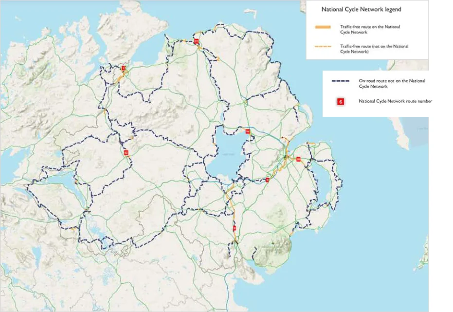
Figure from page 93
Figure B.6 : Reclassified Routes of the UK NCN in Northern Ireland
National Cycle Network Plan - Appendices
Hungary
Hungary was selected as an example of a network currently in development and being developed at a stage marginally ahead of Ireland.
Hungary’s cycle infrastructure was previously developed on an ad hoc basis with isolated developments across the country. Where longer and / or more dense networks exist, they are located primarily around regional hubs and national infrastructure (e.g., forestry trails, agricultural roads and greenways alongside rivers and dams).
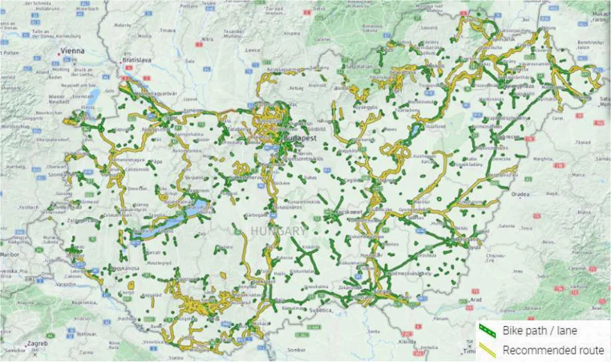
Figure from page 94
Figure B.7: Map of Current Hungarian Cycle Networks
The Cycle Route Network (CRN) aims to provide a coherent network across four specific route types: European, National, Regional and Local. The CRN as a whole aims to serve many users ranging from utility to recreational cyclists, however, each route type focuses on a different target audience:
European routes are defined by Eurovelo and cater more towards cycle touring and tourist needs.
National core network focuses on tourist needs.
Regional networks focus on leisure and commuting needs.
Local networks focus on commuting needs.
Four EuroVelo routes make up the European routes and are managed by the Hungarian Cycling Tourism Organisation Marketusz (ECF, 2020). These provide cross country routes and connections to neighbouring countries. Regional routes are operated and maintained by the local government, while Local routes are shorter, usually spanning from 5 to 10km, and are also maintained by the local / city government.
Of most relevance to the Irish NCN is Hungary’s national core network. This is determined by a spatial planning act of parliament originally introduced in 1996. It is legally binding and can only be modified every 2 years. The proposed National Network is now included in the act. This network is identified at a corridor level – corridors are 25km wide bands within which the final route must adhere. These corridors were determined based on tourist needs at a national level, but also considered recommendations from local municipalities and communities. There is a regular review of the proposed network, but any
National Cycle Network Plan - Appendices
segments located outside of the 25km wide band must be incorporated into the planning act during a modification period (once every two years as noted above).
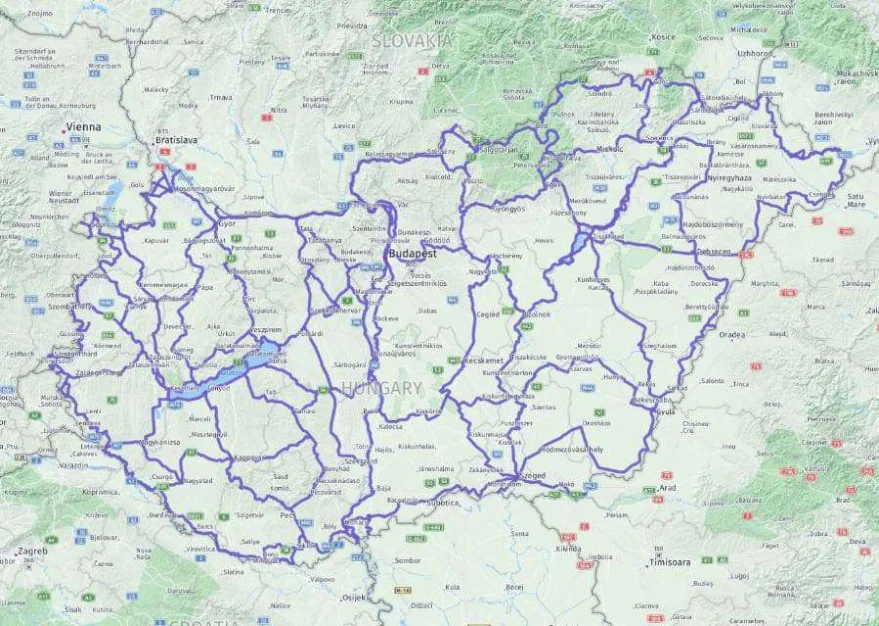
Figure from page 95
Figure B.8: Map of Proposed National Network of CRN
National routes are generally comprised of wide cycle ways, catering for up to 3-4 cyclists to travel in parallel at their widest points along some sections of EuroVelo routes. The national routes span long sections of the country and generally cater towards tourists’ needs as previously noted. They must be 2.8m wide and are maintained by the Hungarian Government. Both the European and National routes follow strict guidelines. A budget is also assigned to maintain and upgrade these cycle paths when necessary. Roughly 50% of the CRN is paved and closed from other forms of traffic.
Hungary aims to have a total of 15,000km of cycle network completed by 2030. €136.7 million has been granted by the Hungarian Ministry of Innovation and Technology (ITM) for the construction of 850km of the network (Hungary Today, 2021). The three main upcoming construction projects are the Győr- Budapest section of EuroVelo 6, the Budapest-Lake Balaton route and the Balaton Cycle Ring. The Budapest-Lake Balaton cycle path will span 108km costing roughly €38 million, where nearly every section of path is being constructed in 2021 and 2022 (Daily News Hungary, 2021). There are other investments at a regional level, which are mostly funded by the Hungarian government. These are helping aid over 400 projects currently ongoing to improve local networks. An example of a regional project includes an upgrade to a cycle track around Lake Tisza that involves a development of four bridges in the area (Hungary Today, 2020).
In Hungary, 71% of people said they cycled ‘regularly or occasionally’ (Pongratz, 2020). Budapest in particular has seen an increase in cycling. Five traffic-counters throughout the city recorded over 2.7 million trips throughout 2020. Although this figure might be somewhat inflated due to the pandemic, this number has steadily increased since the introduction of these counters in 2017 (ECF, 2021). This increase could be attributed to new cycle lanes installed on several traffic arteries within the city, as well as a revamp of the city’s cycle sharing scheme, among other factors.
National Cycle Network Plan - Appendices
Lessons Learnt: Legal Framework
As noted above, the Hungary CRN is officially legislated. While this does provide an impetus for progress and completion, it also means that any deviations to the original plan must be sanctioned by a modification which is only allowed every two years.
Lessons Learnt: Promotion
Active Hungary (a state funded organisation) has been set up to help promote and encourage active travel and the use of Hungary’s CRN (aktivmagyarorszag.hu). The Euro Velo website also has a Hungarian section that allows users to find more information on each respective EV route (eurovelo.hu). Here, an ECF GIS platform fully integrated with the European System has been implemented, allowing for automatic updates if any section of the route changes. An interactive map that shows all the different route types within the Hungarian Cycle Network has also been published (kozut.hu). Points of interest and alternative routes can also be displayed. This map has been set up with help from surveys and data from municipalities and local developers.
Recently, a budget has been allocated to promote the cycle network. A YouTube channel, pages on social media and websites (mentioned above) have all been set up. Various Hungarian influencers have been involved in these projects to reach a wider audience.
Lessons Learnt: Monitoring
The cycle network is constantly being upgraded and improved. Fifty-one automatic counters are set up in Hungary in the countryside alone with more being implemented in urban areas. Manual counting is also conducted annually at 100-150 points throughout the country. The counters help indicate trends and aid in route selection for urban planners. With the help of automatic counters, it was estimated that over 2.75 million cycling trips were undertaken in Budapest in 2020 (Cian Delaney (ECF), 2021).
Lessons Learnt: Safety Elements
Safety is a concern for the Hungarian NCN as it is aimed to appeal to as many users as possible. Route lighting is obligatory on national, regional, and local cycle spaces in urban areas. Reducing car speeds is considered the most impactful safety element when the cycle paths are integrated with roads. Within the guidelines produced, it was discussed that low traffic roads (roads with less than 500 vehicles per day and with a maximum speed limit of 50kmph) are suited to cycle usage. Roads above this threshold must segregate cyclists from traffic. The width of the cycle lane is important and must be kept over 2.5m.
B.2 Network Design Case Studies
In the development of the NCN Plan, cycle network design guidelines / requirements currently in place in Germany, the United Kingdom (UK), and the Netherlands were reviewed. These case studies include relevant details regarding existing cycle infrastructure and cycle trips, cycle policy, and examples of specific design requirements (focusing on link types), as well as lessons learnt that may be applicable to the NCN Plan.
Germany
Germany was selected as an example of successfully providing cycle infrastructure at a national level and promoting a modal shift. There are some 72 million cycles and 2.5 million e-cycles in Germany – 30% of households in German cities use cycling as their sole means of transport (deutschalnd.de, 2017). Many German cities offer segregated cycle paths and / or ensure safety standards are met on mixedmotor traffic streets. In rural areas, the two types of long-distance cycling routes areRadnetz Deutschland (the German Cycling Network) and Radschnellwegen (cycle highways).
National Cycle Network Plan - Appendices
Radnetz Deutschland (the German Cycling Network) comprises of 12 long-distance cycle routes, called D-Routes, and the‘Germany Unity Cycle Route’, connecting all regions of Germany (Radnetz Deutschland - the German Cycle Network, 2022). These cycling routes existed prior to being designated as D-Routes over a ten-year period from 2002-2012. The routes are primarily intended for tourism purposes, are well signposted and have the D-Route logo painted at intervals throughout the network. Some of these routes overlap with the EuroVelo network2.
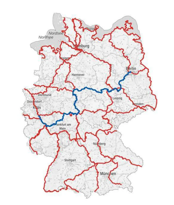
Figure from page 97
Figure B.9 : Map of D- Routes (Red) and the Germany Unity Cycle Route (Blue)
Radschnellwegen (cycle highways) offer a more direct route to commuters (radschnellwege.nrw, 2022). They are generally part of the cycling network of a municipality connecting important areas such as town centres, industrial estates, and workplaces with residential areas, shopping / cultural centres, and public transportation hubs. By definition, they should be at least 5km long and allow for travel speeds of at least 20km/h. They can consist of a mixture of cycle paths, cycle lanes, and wide cycle streets (designated roads for cyclists in German towns and cities). Many high-speed cycling highways are currently under construction. One showcase project is the RS1 in the Ruhr Region, which will link Duisburg in the west and Hamm in the east (deutschalnd.de, 2017). When completed, the 102km long route is expected to replace 55,000 car journeys a day.
German National Cycling Plan 3.0
The German National Cycling Plan (NCP) 3.0 is a document published by the German Ministry of Transport and Digital Infrastructure to promote cycling in Germany up to 2030. It includes concepts,
2 https://www.radroutenplaner-deutschland.de/veraDNetz_EN.asp
National Cycle Network Plan - Appendices
focus points and concrete objectives to be used by the Federal Government, federal states, and local authorities.
All actions and objectives of the NCP were collected through dialogues with professional associations, representatives from federal states and local authorities, as well as an online public consultation.
Although the Federal Government is responsible for the construction of cycle paths along federal highways, it is primarily the regional states and local authorities that are responsible for local cycling infrastructure and promoting cycling in local communities.
The NCP has several overarching objectives:
-
Create more seamless cycling infrastructure in Germany
-
Ensure Germany becomes a country of cycling commuters
-
Make cycling at the heart of modern mobility systems
-
Allow cycling to become ubiquitous in urban and rural areas
-
Adopt a ‘Vision Zero’ for cycling
-
Allow urban cargo transport by bicycle
-
Make Germany a country of cyclists
-
Ensure cycling becomes intelligent, smart, and connected
The NCP dedicates a full chapter to promoting cycling infrastructure. It stresses the importance of creating a ‘seamless network of safe paths and roads that can be intuitively and conveniently used’ to make cycling the transport mode of choice for people of all ages and abilities. On top of the overarching objectives listed above, the NCP lists several objectives with a ‘What’s Most Important’ section for each to aid Germany in becoming a ‘Cycling Nation’ by 2030.
Table B.1 : 2030 Objectives and Most Important Elements for the NCP
| Objectives - By 2030: | What’s Most Important | ||||
|---|---|---|---|---|---|
| All federal states and districts will have cycling network plans that will be coordinated with each other and with the cities and municipalities, allowing cyclists to reach their destinations conveniently in and outside of cities, on interconnected ‘everyday’ and tourist routes | Develop and build closed, hierarchical cycling networks | ||||
| Plan for vulnerable road users by giving priority to separated and barrier-free cycling infrastructure | |||||
| Mix traffic only at low speeds and low motor vehicle density | |||||
| In cities: Create space for good cycling infrastructure | |||||
| Ensure at least 75% of cyclists will feel safe in road traffic. Independent signalling and segregation of cycling from motor traffic will be natural elements of urban cycling networks. Intersections will be intuitively understandable and self-explanatory for all road users and will offer a high level of safety and accessibility for vulnerable road users | Constantly update technical guidance and rules on cycling infrastructure in ordinance with recent developments | ||||
| Ensure cycling infrastructure appears uniform nationwide | |||||
| Pay attention to future developments and rising populations | |||||
| Rapidly redesign inadequate cycling infrastructure by developing a decision support tool for evaluating existing infrastructure | |||||
| Maintain and service existing infrastructure |
National Cycle Network Plan - Appendices
| Objectives - By 2030: | What’s Most Important | ||||
|---|---|---|---|---|---|
| Offer cyclists readily accessible and user-friendly bicycle parking facilities at their destinations and homes, while taking cargo and special cycles into account | Plan strategically: Integrate cycle parking concepts into urban developments. | ||||
| Advise municipalities to work towards the conversion of car parking spaces and redistributing space for cyclists. | |||||
| No new construction without accessible cycling parking: Adapt new building codes and regulations that make it necessary to build cycling parking. | |||||
| Facilitate the demand for cycling parking in and at existing buildings. | |||||
| Construct adequately sized Bike & Ride facilities at stations and stops to strengthen the cycle as an intermodal means of transport | Identify demand and the specific need for parking facilities at stops and stations and quantify them in local transport plans | ||||
| Roll out Bike & Ride facilities nationwide. The Federal Government will develop a programme of bicycle parking facilities at railway stations and provide funding | |||||
| Expand the offerings for taking bicycles on long-distance trains | |||||
| Make railway stations barrier-free | |||||
| Make public bike rental schemes a natural part of urban and regional mobility concepts and link them to each other by fare systems and digitally to local and long-distance public transport | Work with the federal states, public transport authorities, transport companies and operators of public bicycle rental schemes to promote fare and digital integration | ||||
| Use data: Obligate operators of cycle rental schemes to provide an open, standardised interface of real-time information regarding bicycle locations and status |
The Research Society for Roads and Traffic (FGSV) is a non-profit research group that has been producing guidelines on roadway design since the 1920s. The main objective of the FGSV is to advance technical knowledge in all areas of road and transportation (FGSV, 2022). The group engages with academia, public and private sectors and updates technical guidance regularly. The group has published design guidelines such as the Recommendations for Cycling Facilities 2010 (ERA 2010) and the Directives for the Design of Urban Roads (RASt).
The Directives for the Design of Urban Roads (RASt)
The Directives for the Design of Urban Roads (RASt) is a set of guidelines produced by the FGSV. A full chapter in this document has been dedicated to aiding federal states and local authorities in designing infrastructure for cyclists. These guidelines have been adopted and integrated into the StVO3 (Road Traffic Regulations in Germany) by the German Ministry for Transport and Technology as minimum standards throughout most federal states in Germany. In some federal states, such as North Rhine- Westphalia, the application of the RASt is a mandatory requirement for financial support from the Federal Government.
3 General Administrative Regulation on road traffic regulations (VwV-StVO) (verwaltungsvorschriften-im-internet.de)
National Cycle Network Plan - Appendices
The RASt gives basic considerations when designing for cycle traffic. Firstly, a decision must be made on what type of cycling infrastructure should be installed. Possible design interventions are listed in Table B.2 and described in more detail below.
Table B.2 : Design Standards of Varying Cycling Infrastructures4
| Cycle Route Type | Motor- Speed (km/h) | Direction | Peak hour cycle | Desirable minimum width* (m) | Absolute minimum at constraints (m) | ||
|---|---|---|---|---|---|---|---|
| flow (either one way | |||||||
| or two-way | |||||||
| depending on cycle | |||||||
| route type) | |||||||
| Mixed-traffic roads | <30km/h | 1 or 2 way | <500 | N/A | N/A | ||
| ‘Advisory Lanes’ | <50km/h | 1 or 2 way | 500-1000 | 1.5m | 1.25m | ||
| Cycle Lane | >50km/h | 1 or 2 way | >1000 | 1.9m | 1.5m | ||
| Cycle Path | >50km/h | 1 way | >1000 | 2.0m | 1.6m | ||
| >50km/h | 2 way | >1000 | 2.5m | 2.0m | |||
| One-way contra flow | <30km/h | 1 way | N/A | 1.9m | 1.5m |
Pages 56–100 · View in original PDF