13 Roads
- Roads
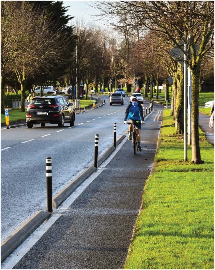
Figure from page 167
13.1 Introduction
Roads form the main transport arteries across the State and provide the corridors by which public transport (buses, taxis and some sections of Luas), cycling, walking, freight and car movements operate. As such they are a critical part of an effective and sustainable transport system.
The Greater Dublin Area has a large network of national, regional and local roads and streets, which includes not only the roads themselves but also bridges and a tunnel, cycle facilities, footpaths, signposting and markings, traffic signals and sophisticated traffic and transport management systems.
A key focus of the Transport Strategy is the provision of safe, resilient road transport routes and liveable streets within the context of the need to support sustainable development principles and legislative commitments to decarbonise the transport sector in Ireland.
The first priority for road investment will be the expenditure required to maintain, renew, manage and operate that extensive infrastructure. It is also proposed to undertake a limited number of new projects, details of which are set out in the following sections.
All road schemes are required to abide by the Department of Transport’s guidance on the alignment of appraisals with the NIFTI.
As such, they will be required to demonstrate that the scheme objectives align with the NIFTI Investment Priorities and that the consideration of alternatives for intervention is aligned with the NIFTI Modal and Intervention Hierarchies.
(a)alternative solutions, such as public transport provision, traffic management and/or demand management measures, cannot effectively address the circumstances prompting the proposed road scheme or (b) that these alternative solutions are not applicable or appropriate in the particular circumstances
13.2 Principles for Road Development
Given that national transport policy seeks an increase in the use of public transport, cycling and walking, and a reduction in the growth in car travel, it is important that certain principles are reflected in the development of individual road projects within the GDA. Accordingly, it is intended that road development in the GDA will be undertaken in accordance with the following principles:
-
That road schemes, other than a motorway or protected road, will be designed will be designed to provide safe and appropriate arrangements to facilitate walking, cycling and public transport provision, including as applicable, the delivery of walking and cycling facilities off line where this is considered to be a more attractive solution for these modes;
-
That where a road scheme comprises an urban bypass, measures must be proposed and implemented to reallocate road space within the bypassed area to sustainable transport and/or public realm improvements;
Measure ROAD1 – Principles of Road Development
-
That there will be no significant increase in capacity for private car trips on radial roads within the Metropolitan Area, except where re-alignments or junction changes are necessary for safety reasons;
-
That the travel demand or the development needs giving rise to the road proposal are in accordance with regional and national policies related to transport, land use and development planning; and
-
Provision will be made for steady state investment in the GDA’s road network;
-
That the development of the road scheme does not diminish in any significant way the expected beneficial outcomes of the Transport Strategy.
-
That a proposed road scheme will only proceed where it has been satisfactorily demonstrated that
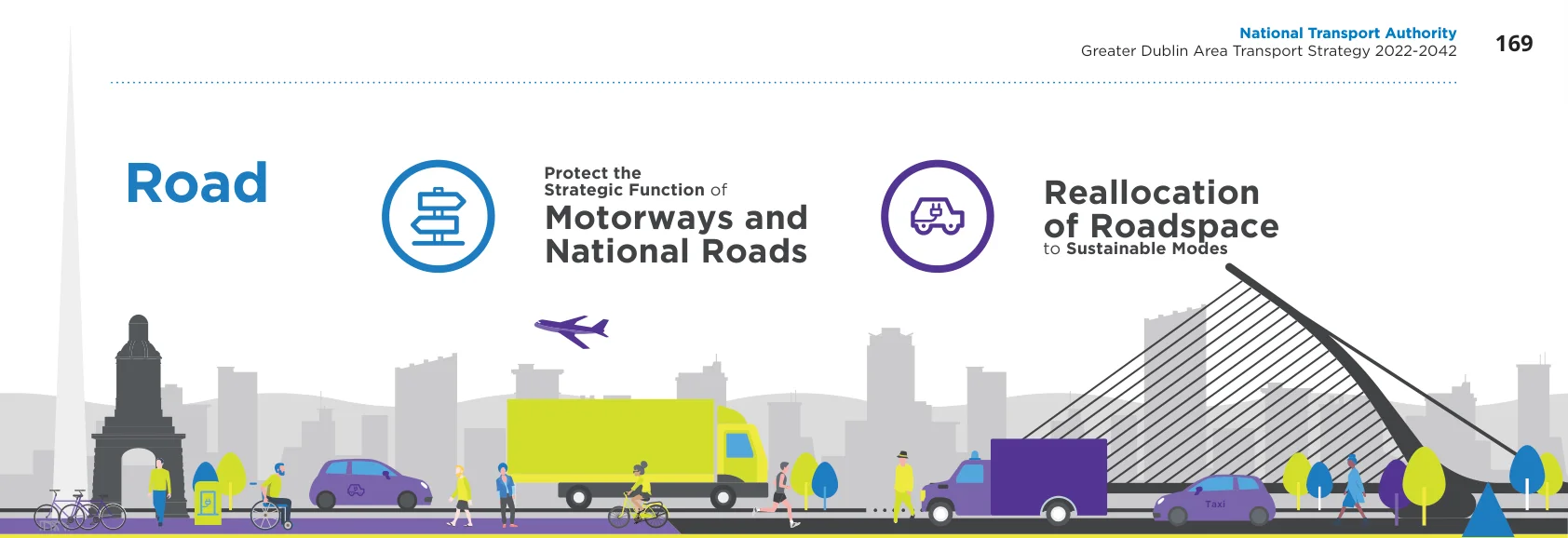
Figure from page 169
Road
Protect the Strategic Function of Motorways and National Roads
Reallocation of Roadspace to Sustainable Modes
Taxi
| Deliver N2 N/M11 N3-N4 Upgrade Upgrade Link BUS | |||||
|---|---|---|---|---|---|
| Delivery Online Improvements Improved of Southern Port Access Route for Orbital Traffic Resilience for National Road Network TFI BUS | |||||
| Taxi |

Figure from page 169

Figure from page 169
13.3 National Roads
Measure ROAD2 – National Roads Requirements
There is a clear need to minimise the impacts of increased congestion on the national road network and keep these vital national transport arteries operating satisfactorily at all times in so far as practicable. To facilitate the delivery of the National Planning Frameworks NSO2 (Enhanced Regional Accessibility) and NS06 (High-Quality International Connectivity) within the GDA, improving the resilience and safety of the national road network in order to maintain its reliability and functionality will be critical. The approach taken will be to extend the life and optimise the use of the existing network and, where appropriate, minimise the need to build new infrastructure.
-
The primary function of national roads is to cater for strategic traffic and this function must be protected;
-
Strategic traffic, in the context of national roads, is primarily comprised of inter-urban and interregional traffic. This includes vehicles involved in the transportation of goods and products, especially those travelling to and from the main ports and airports, both freight and passenger related. It also includes buses, other public service vehicles and cars which contribute to national and regional economic development;
13.3.1 National Roads Requirements
- Within the GDA, the asset value, reliability and functionality of the national road network will be protected and maintained;
With the above in mind, the requirements for the GDA national road network are set out below. These are complementary to the Section 28 Spatial Planning and National Roads Guidelines for Planning Authorities (2012):
-
4Secondary local functions should not be encouraged, or planned for, on national roads in the GDA;
-
National roads are not to be developed or planned, to support the continued urban expansion through the zoning of residential land uses adjacent to or within national road corridors;
-
Secondary local function traffic on national roads can be accommodated insofar as it does not impact on the primary function, which is to cater for strategic traffic;
-
If secondary functions impact on the primary function of national roads, then demand management measures should be considered to mitigate this impact;
N2 Slane Bypass and associated public realm and sustainable transport enhancements in Slane Village;
N2 Upgrade from the M2 Rath Roundabout to Kilmoon Cross to address safety issues;
- Network resilience will be delivered by enhancing Motorway Operation Services within the GDA, as appropriate; and
Junction enhancements and lane layout changes, including bus lane provision, to enhance safety, legibility and bus priority along the N3 between Junction 1 and Junction 4;
- The primary functions of the Dublin Tunnel will be maintained and protected. These functions are to facilitate the movement of goods vehicles between Dublin Port and the national road network and to facilitate access to the City Centre for public transport service vehicles , whilst also facilitating the ‘strategic’ movement of goods to and from Dublin City Centre, subject to appropriate vehicle size and time restrictions. It is also essential that the structural integrity of the Tunnel from incompatible over ground development is ensured.
Improvements to junctions 5, 6 and 7 on the M4 in order to address queuing onto the mainline and associated traffic safety issues plus the provision of bus priority between Junctions 5 and 7;
The removal of all direct uncontrolled accesses onto the N7 between the M50 and Naas, in accordance with the EU Guidelines for the Development of the Trans-European Transport network and the implementation of measures to facilitate efficient bus operations;
Safety, alignment and bus priority enhancements to the N81;
13.3.2 National Roads Projects
The provision of bus priority on the N/M11 corridor and the implementation of measures which protect the capacity of the mainline for strategic traffic;
During the period of the Strategy it is intended to further manage, develop and enhance the national road network including the delivery of the following projects:
Various enhancements and measures to protect the strategic function of the M50 for the efficient movement of people and freight; and
Improvements to the Lissenhall junction on the M1, supporting the delivery of a Metrolink Park and Ride facility at this location;
Various projects and schemes to protect the steady-state condition of the national road network and to improve safety.
Measure ROAD3 – National Roads Projects
It is the intention of the NTA and TII to deliver the national road schemes listed in the Transport Strategy, subject to their appraisal against national and regional policies and objectives.
13.3.3 Eastern Bypass
The Eastern Bypass scheme would comprise an extension of the M50 from the Dublin Tunnel to Sandyford completing a full orbital motorway around Dublin. Dating back many decades, updated assessment work, taking account of current transport policies, has identified that the scheme is no longer required to be developed. Accordingly, it is not intended to progress this project as part of this Transport Strategy
Subject to the retention of a corridor reservation for the South Port Access Route (detailed later), the lands reserved for this scheme in the Dublin City Development Plan, Poolbeg Strategic Development Zone Planning Scheme and Dún Laoghaire Rathdown County Development Plan can be released for development. In relation to the southern section, the NTA is of the view that the lands reserved in the Dún Laoghaire Rathdown County Development Plan for this scheme should be reserved, pending the outcome of an assessment for its potential use as a transport corridor accommodating sustainable transport modes.
Measure ROAD5 – Southern Port Access Route
Measure ROAD4 – Lands Reserved for the Eastern Bypass
A new public road which links from the national road network at the Dublin Tunnel to serve the south port lands and adjoining areas will be delivered. A reservation for such development should be included in the Dublin City Development Plan.
The NTA will collaborate with Dún Laoghaire Rathdown County Council in undertaking an assessment of the potential for the southern section of the former Eastern Bypass corridor reservation – as provided for in the County Development Plan – to accommodate a sustainable transport link. Pending completion of this assessment the existing reservation should be retained.
13.3.5 Leinster Orbital Route
The Leinster Orbital Route comprises an orbital road proposal extending from Drogheda to the Naas/Newbridge area with intermediate links to Navan and other towns. Given the above road principles and Government policy related to reducing transport’s contribution to emissions, this project will not be progressed in its existing form. Instead it is proposed to provide online, or mainly online, improvements to the existing road network to cater for orbital demand along these corridors.
13.3.4 Access to Dublin Port
As set out in section 10.3, it is a requirement of the NTA, TII and other agencies to facilitate the efficient and sustainable operations of Dublin Port. One of the key issues relating to the port is the difficulty in accessing the south port estate from the national road network, in particular the connection to the Dublin Tunnel. It is proposed to address this by means of the delivery of the Southern Port Access Route, a new public road extending from the national road network at the M50 Dublin Tunnel to serve the south port lands and adjoining areas.
Measure ROAD6 – Catering for Orbital Movement in Leinster

Figure from page 173
TII and the local authorities will deliver online improvements to existing road carriageways, and localised schemes on national and regional roads, to cater for orbital traffic movement, where issues related to the safety and capacity of the network have been identified.
13.4 National Road Network Resilience
To address these issues, it is intended to undertake design and analyses to assess the benefits and implications of a road link between the N3 and N4 national roads, which could provide critical infrastructure resilience in the event of incidents arising on the M50 between Junctions 6 and 7, in addition to providing potential orbital public transport corridor.
The M50 corridor provides for strategic traffic distribution throughout the GDA for private, freight and public transport vehicles.
In relation to the Dublin Tunnel, it is intended that a route on the existing road network will be identified and designated which will provide surface connectivity for HGV traffic from the M50/M1 Junction to Dublin Port and its surrounding area in the event of a prolonged closure of the Dublin Tunnel. This surface route will be the Dublin Tunnel Emergency Diversion Route. Provision for use of this route will require that existing bye laws related to the Bus lanes and HGV Cordon be reviewed and amended if necessary. Operational arrangements will be developed to activate this Emergency Diversion Route, including measures to ensure that the route has sufficient available capacity to operate satisfactorily during periods of HGV diversion.
In particular, the Dublin Tunnel section of the M50 provides a dedicated access route for freight traffic to Dublin Port and area as well as being a significant corridor for public transport to/from the city centre and a connection with other transport modes including Luas and DART.
Given the critical contribution that motorways make to the overall transportation network, major traffic incidents requiring a motorway closure can cause widespread traffic congestion which can quickly impact a significant part of the GDA. Accordingly, it is important that an appropriate level of resilience is provided for such critical infrastructure.
13.4.1 M50 Motorway Resilience
While arrangements are in place to deal with unplanned closures of the M50 due to incidents such as road traffic collisions, there is a lack of adequate resilience along the section of the M50 between Junctions 6 and 7. In addition, there is a need to have clearer designated routes available in the event of a closure of the Dublin Tunnel, given its strategic significance in Dublin’s transport system.
Measure ROAD7 – Dublin Tunnel Emergency Diversion Route
It is intended that a route on the existing road network will be identified and designated which will provide surface connectivity for HGV traffic from the M50/M1 Junction to Dublin Port and its surrounding area in the event of an emergency or prolonged closure of the Dublin Tunnel.
Measure ROAD8 – Emergency Diversion Routes
The relevant local authorities, in collaboration with TII, will undertake design and analyses to assess the benefits and implications of a road link between the N3 and N4 national roads, which could provide critical infrastructure resilience in the event of incidents arising on the M50 between Junctions 6 and 7, in addition to providing potential orbital public transport corridor.
13.5 Regional and Local Roads
Measure ROAD9 - Regional and Local Roads Policy
Regional and local roads make up the vast majority of the road network in the Greater Dublin Area. In relation to the elements of this network outside urban areas, and in accordance with any associated measures set out in previous chapters, it is intended to implement the following measure to guide the development of regional and local roads in the GDA.
-
Implement necessary upgrades to the regional and local road network in line with the Principles of Road Development set out above;
-
Enhance orbital movement between the N3, the N4 and N7 national roads, by improving existing roads and/or the development of new road links where deemed appropriate, for the purpose of providing resilience to the operation of the M50 and incorporating provision for sustainable transport;
Given that many of the proposed road schemes are relatively small and localised it is not intended to establish an exhaustive list of such schemes for development over the period of the Transport Strategy. Instead, it is intended that each road scheme is developed in accordance with the principles of road development set out at the beginning of this chapter and in accordance with the general objectives of this strategy.
- Where part of a sustainable mobility plan, to develop orbital roads around towns, accompanied by, and facilitating, enhanced public transport, cycling and pedestrian facilities in the relevant centre;
It is recommended that confirmation of consistency with the Transport Strategy is obtained from the NTA in advance of a road authority seeking development consent for a particular road scheme. Exchequer grants should only be provided for road schemes which are in accordance with the principles set out above.
-
Develop appropriate road links to service development areas, including the provision of public transport (where required) and active travel facilities;
-
Enhance pedestrian and cycle safety through the provision of safer road junctions, improved pedestrian crossing facilities and the incorporation of appropriate cycle measures including signalised crossings where necessary; and
-
Implement various junction improvements, realignments and local reconfigurations on the regional and local road network to address safety deficiencies and/or support integrated transport proposals catering for all road users.
13.6 Urban Roads and Streets
13.7 Road Maintenance
Within urban areas, the function of roads extends beyond transport and movement to serve economic, social and environmental needs. Compact, denser, more interconnected layouts, particularly where served by good quality bus or rail services, will help to consolidate cities, towns and villages making them viable for reliable public transport and amenable to higher rates of walking and cycling.
The performance of the road network is dependent upon the quality of the service provided. As such, it is essential that the physical road network, including supporting infrastructure, is maintained to a high standard in order that it operates efficiently for goods movement, buses, bicycles and private cars.
Measure ROAD11 – Road Maintenance
Place-making focuses on the interaction between people and the urban environment and achieving a high quality of life, sense of place and belonging. Planning and urban design play a central role in realising quality places. Well-designed streets, which make up a key element of the public realm, can create connected physical, social and transport networks
The local authorities in the GDA and TII will ensure that the road network is maintained to a high standard and renewal works to road markings, signals and signage will be undertaken when required.
namely walking, cycling or public transport, that promote real alternatives to car journeys. High quality, integrated street design can be effective in cost and efficiency by managing traffic speeds and through fostering a greater understanding between users of all transport modes.
Measure ROAD12 – Street Signage
The local authorities in the GDA will undertake periodic audits of street name signs in order to ensure that adequate signage is provided; illegible signs are removed; and that inconsistencies are addressed.
Measure ROAD10 – Urban Roads and Streets
The implementation of the Transport Strategy will support and facilitate a place based approach to urban roads and streets, based on the measures in Chapter 14.
13.8 Roadspace Reallocation
public realm.
MEASURE ROAD13 – Roadspace Reallocation
In line with transport policies and objectives to reduce cardependency and to favour sustainable modes over the private car, and as a means of achieving reductions in carbon emissions, it is the intention to reallocate roadspace from its current use for general traffic to the exclusive use by walking, cycling and public transport.
The local authorities and the NTA will implement a programme of roadspace reallocation from use by general traffic or as parking to exclusive use by sustainable modes as appropriate, as a means of achieving the following:
Providing sufficient capacity for sustainable modes;
This approach is applicable generally across the GDA, and in addition to the reallocation proposed under BusConnects or that which will occur as a result of the development of further Luas lines.
Improving safety for pedestrians and cyclists; and
Encouraging mode shift from the private car and reducing emissions.
Roadspace reallocation can take many forms but generally refers to the following:
Converting general traffic lanes to public transport lanes including lanes on the main radial routes approaching urban centres;
Converting general traffic lanes to cycle lanes;
Converting on-street parking to other sustainable transport and related uses;
Pedestrianising streets;
Removing motorised traffic from streets;
Redesigning junctions to provide greater capacity for cyclists and public transport; and
Urban design and placemaking schemes which extend the
Figure from page 180
14. Traffic Management and Travel Options
- Traffic Management and Travel Options
14.1 Introduction
“The desire for safe, attractive and vibrant streets is reflected in a range of existing transport, planning and environmental policies and objectives. These policies and objectives address how neighbourhoods, villages and towns are created and protected. They relate not only to road safety and civil engineering, but also to town planning, urban design, architecture, landscape architecture and conservation.
The preceding chapters have set out an ambitious vision for the supply of public transport, walking and cycling infrastructure and a broad range of integration measures. These measures, even when combined, will not be sufficient to reduce emissions from transport in the GDA to the extent required under national policy. They are a necessity in terms of supplying the infrastructure and services required to meet demand, but they must be augmented by measures which seek to manage the manner in which traffic can move around the region, and by measures which seek to directly influence people’s travel behaviour. This chapter sets out those measures which will apply at the regional level in the GDA and which will be implemented by the NTA, TII and the local authorities in accordance with current Government policy.
“More significantly, they bear directly on broad societal issues, ranging from economic development, employment, tourism and recreation, through health, crime and security and onto education, social inclusion, energy efficiency and climate change.”
Design Manual for Urban Roads and Streets, Government of Ireland, 2013
The main objective of Traffic Management is to ensure that the regional transport system continues to operate in an efficient manner, i.e., that the movement of people by public transport, walking and cycling, and the movement of goods, is not adversely affected by private car traffic, and that the impacts of traffic congestion can be minimised. Measures which confer an advantage on sustainable modes can help meet this objective. Many of these are set out in the Walking, Cycling and Bus sections of the strategy, but those aimed specifically at managing private vehicular traffic are included here.
This chapter sets out a broad range of measures that aim to manage the transport supply network in a way which places sustainable modes at the top of the road user hierarchy (as set out in Figure 8.4), and which seek to rebalance the cost of travel (in its broadest sense) towards these modes.
Pages 167–181 · View in original PDF