8.3 Framework for the Integration of Transport planning with Spatial Planning Policies
8.3 Framework for the Integration of Transport planning with Spatial Planning Policies
Given the diverse character of the EMRA area, the RSES encompasses the demand for transport and associated movement patterns from regional down to local level.
| Table 8.1 Hierarchy of Plans and Policies | |
|---|---|
| International | The Trans-European Transport Network (TEN-T) |
| National | National Planning Framework, Smarter Travel – A Sustainable Transport Future, Planning Land Use and Transport Outlook – PLUTO 2040 |
| Regional Level | Transport Strategy for the Greater Dublin Area 2016-2035. Transport Plans for Athlone (multiple regions), Dundalk (cross border) and Drogheda (multi county) Dublin- Belfast Economic Corridor. |
| Metropolitan Area | Transport Strategy for the Greater Dublin Area 2016-2035. |
| County Level | Development plans, county cycling and walking strategies. |
| Settlement Level | Settlement walking and cycling strategies, local area plans, Local Transport Plans, Local Link Rural Transport Programme, Mobility management plans. |
The NTA’s Transport Strategy for the Greater Dublin Area (GDA) provides a framework for the planning and delivery of transport infrastructure and services over the period 2016 - 2035. This Transport Strategy has informed this chapter of the RSES. The RSES is required by legislation to be consistent with the National Transport Authority’s Transportation Strategy for the Greater Dublin Area.
Transport policies and objectives for the Midlands and County Louth, as well as the GDA are set out in this chapter, with a focus on:
• The on-going management and enhancement of the national and strategic road networks to address the Region’s intra-regional, interregional and international connectivity
• The maintenance of an appropriate level of rail service and enhancements
• Provision for enhanced regional and local bus services
• Improvements to walking and cycling provision in towns and villages; and
• Improvements to public transport provision in rural areas.
At the most strategic level, the transport objectives underpinning the RSES are based on two complementary elements with the overarching goal of prioritising sustainable transport modes in order to achieve improvements in air quality, reduction in CO2 emissions and noise reduction:
Table 8.1 sets out the hierarchy of policies and plans, against which transport policy in the EMRA area is formulated and implemented.
• The effective integration of transport planning with spatial planning policies, from regional down to local level; and
The role of the transport system is to meet the travel needs resulting from existing and future land uses in a manner that is consistent with the policies of the National Planning Framework and the Transport Strategy for the Greater Dublin Area.
• Associated transport investment priorities.
Key targets set out in the Government’s Smarter Travel Policy in terms of modal share include a reduction of the total share of car commuting from 65% to 45% while alternatives such as walking, cycling and public transport will be supported and provided to the extent that these will rise to 55% of total commuter journeys to work.

Figure from page 186
Regional Spatial & Economic Strategy
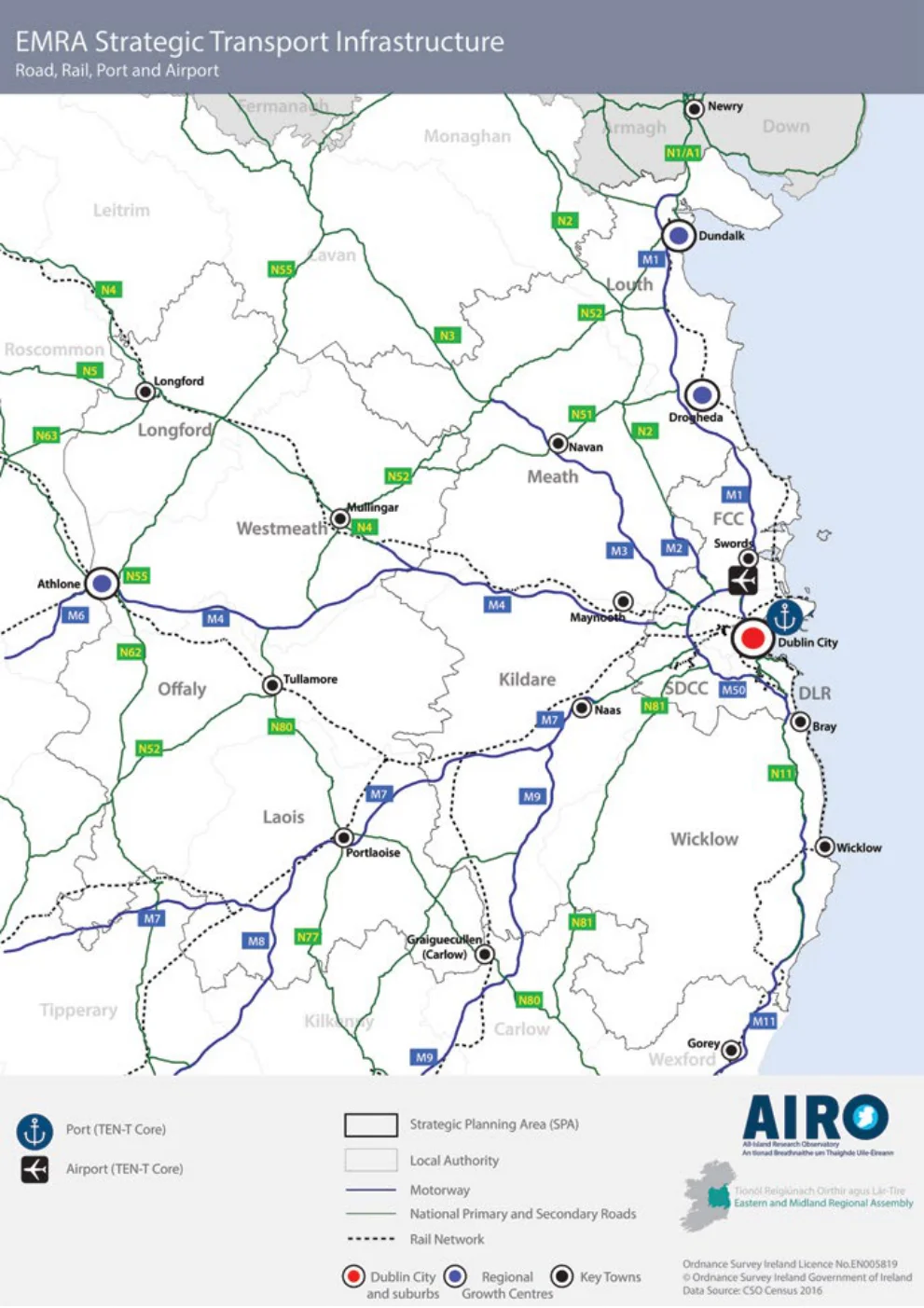
Figure 8.1: EMRA Strategic Transport Infrastructure

Figure from page 187
Connectivity
| GUIDING PRINCIPLES | |
|---|---|
| Integration of Land Use and Transport | |
| The RSES provides the basis for the integration of land use and transport planning in the Region, informing the preparation and implementation of plans, programmes and projects at all levels. To achieve this the EMRA, in conjunction with local authorities, the NTA and other agencies, will seek to apply the following Guiding Principles in statutory land use plans, taking into consideration the requirements of both urban and rural areas across the Region. | |
| • For urban-generated development, the development of lands within or contiguous with existing urban areas should be prioritised over development in less accessible locations. Residential development should be carried out sequentially, whereby lands which are, or will be, most accessible by walking, cycling and public transport – including infill and brownfield sites – are prioritised. | • Support the ’10 minute’ settlement concept, whereby a range of community facilities and services are accessible in short walking and cycling timeframes from homes or accessible by high quality public transport to these services in larger settlements. |
| • New development areas, including peripheral areas, | |
| • City and county development plans shall undergo | should be permeable for walking and cycling and the retrospective implementation of walking and |
| assessment of their impact on carbon reduction targets in their preparation, and shall include measures to monitor and review progress towards carbon reduction targets. | cycling facilities should be undertaken in existing neighbourhoods, in order to a give competitive advantage to these modes. Where possible, |
| • Larger scale, trip intensive developments, such as high | developments shall provide for filtered permeability. |
| employee dense offices and retail, should in the first instance be focused into central urban locations. | • Proposals for right of way extinguishments should |
| only be considered where these do not result in | |
| • Within the Dublin Metropolitan Area, except in | more circuitous trips for local residents accessing |
| limited planned circumstances, trip intensive developments or significant levels of development should not occur in locations not well served by existing or proposed high capacity public transport. | public transport, or local destinations. |
| • Cycle parking should be appropriately designed | |
| into the urban realm and new developments at an early stage to ensure that adequate | |
| • The strategic transport function of national roads and | cycle parking facilities are provided. |
| associated junctions should be maintained and protected. | • Support investment in infrastructure and behavioural |
| • All non-residential development proposals should | change interventions to encourage and support |
| be subject to maximum parking standards; | a shift to sustainable modes of transport and |
| • In locations where the highest intensity of | support the use of design solutions and innovative approaches to reduce car dependency. Development |
| development occurs, an approach that caps car parking on an area-wide basis should be applied. | will have regard to the Design Manual for Urban Roads and Streets, where appropriate. |
| • The management of space in town and village centres | |
| • Where additional road capacity is provided within | |
| should deliver a high level of priority and permeability for walking, cycling and public transport modes to create accessible, attractive, vibrant and safe, places to work, live, shop and engage in community life. Accessibility by car does need to be provided for, but in a manner, which complements the alternative available modes. Local traffic management and the location / management of destination car parking should be carefully provided. | or around any town which has an objective to cater for traffic that currently uses the road network in central areas and their immediate environs, that this additional capacity would be used for the improvement of the public transport, walking and cycling networks within the towns through the reallocation of road space to these modes. |
| • Planning at the local level should prioritise walking, | • Ensure the protection of Natura 2000 networks |
| and associated ecological linkages. Plans and | |
| cycling and public transport by maximising the projects that have the potential to negatively number of people living within walking and impact on Natura 2000 sites should be subject cycling distance of their neighbourhood or district to the requirements of the Habitats Directive. centres, public transport services, and other services at the local level such as schools. | projects that have the potential to negatively impact on Natura 2000 sites should be subject to the requirements of the Habitats Directive. |

Figure from page 188
Regional Spatial & Economic Strategy
Local Transport Plans (LTP)
REGIONAL POLICY OBJECTIVES:
Local Transport Plans (LTP) will represent the lowest tier of the NPF’s framework for the integration of land use and transport planning and the achievement of the NPF’s objective of ‘compact smart growth’, they will be subject to further environmental assessment at local level as appropriate.
Integration of Transport and Land Use Planning
RPO 8.1: The integration of transport and land use planning in the Region shall be consistent with the guiding principles expressed in the transport strategy of the RSES.
RPO 8.2: The capacity and safety of the Region’s strategic land transport networks will be managed and enhanced, including through the management of travel demand in order to ensure their optimal use.
LTPs will be based on a clear set of objectives and the most recent demographic and travel information taking into account the policies and objectives of the local authorities, insofar as they align with those of National and Regional Policy. LTPs will include the transport priorities for each settlement in terms of public transport infrastructure and services; cycle investment; improvements to the pedestrian environment; and road enhancements. Local Link Offices (Transport Coordination Units) will be consulted in the development of LTPs.
RPO 8.3: That future development is planned and designed in a manner which maximises the efficiency and protects the strategic capacity of the metropolitan area transport network, both existing and planned and to protect and maintain regional accessibility.
RPO 8.4: Land use plans within the GDA shall demonstrate a consistency with the NTA’s Transport Strategy for the Greater Dublin Area and plans with or outside of the GDA shall be consistent with the guiding principles expressed in the RSES.
The policies, objectives and measures which emerge from the LTPs shall be incorporated into the relevant statutory land use plans pertaining to each settlement.
The settlements for which Local Transport Plans will be made will include, but will not be limited to, Athlone, Dundalk, Drogheda, Arklow, Ashbourne, Balbriggan, Longford, Mullingar, Portlaoise, Naas, Navan, Newbridge, Tullamore, and Wicklow-Rathnew and certain large settlements or development areas within the Dublin Metropolitan Area.
REGIONAL POLICY OBJECTIVE:
Regional Strategy for Freight Transport
RPO 8.5: To support the preparation of a regional strategy for freight transport in collaboration with the relevant transport agencies and the other Assemblies.
REGIONAL POLICY OBJECTIVE:
Local Transport Plans
RPO 8.6: In order to give local expression to the regional level Transport Strategy within the Region in conjunction with the NTA, Local Transport Plans (LTP) will be prepared for selected settlements in the Region.

Figure from page 189
Connectivity
Mobility Management Plan (MMP)
The Role of Transport in Rural Development
A Mobility Management Plan (MMP) is a management tool that brings together transport and other staff and site management issues in a coordinated manner. It normally brings together a package of measures tailored to the needs of an individual work site or a collection of work sites.
The importance of development which supports the rural economy and the rural social fabric is of fundamental importance to the future development of the Region.
The rural economy and the rural social fabric should be supported through the provision of better local connectivity and connectivity to services and commercial activities located in cities and towns. In addition to this, urban-generated development in rural areas needs to be managed in such a way so as to safeguard the integrity of rural areas and to support the accommodation of urban-generated development within urban areas.
This package generally includes measures to promote and improve the attractiveness of using public transport, cycling, walking, car sharing, flexible working or a combination of these as alternatives to drive-alone journeys to work. It can consider all travel associated with the work-site, including business travel, fleet management, customer access and deliveries. A MMP is not a plan for physical transport infrastructure such as cycle and pedestrian routes.
The Role of Transport in enabling Access for All
The planning process affords an opportunity to facilitate and deliver a more socially inclusive society through the mitigation of the built environment through better design, greater integration and accessibility across all societal needs and disabilities. Transport is one of a number of key policy areas through which social inclusion can be effectively addressed in this manner. Transport policies and investments will be developed to assist the greatest number of people with mobility, sensory and cognitive impairments in the shortest possible time with a particular focus on meeting the needs and opportunities of an ageing population.
REGIONAL POLICY OBJECTIVE:
Mobility Management and Travel Plans
RPO 8.7: To promote the use of mobility management and travel plans to bring about behaviour change and more sustainable transport use.
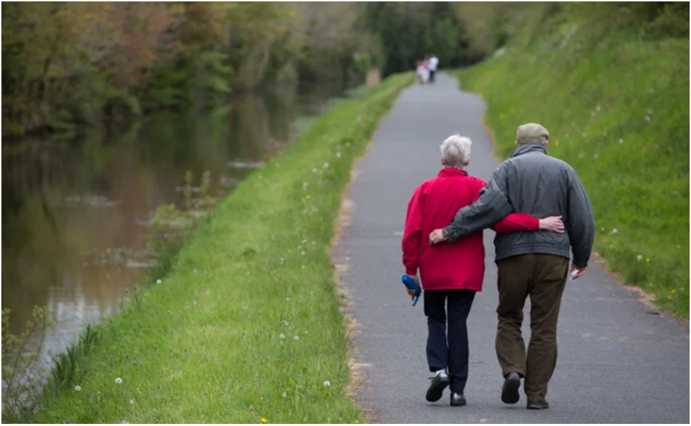
Figure from page 189

Table 8.2: Rail Projects for the Region
Regional Spatial & Economic Strategy
Pages 185–190 · View in original PDF