4.6 Key Towns
4.6 Key Towns
Key Towns are large towns which are economically active towns that provide employment for their surrounding areas. They have high-quality transport links and the capacity to act as regional drivers to complement the Regional Growth Centres.
Key Towns, given their historic significance and performance as settlements within a regional context, have potential to accommodate commensurate levels of population and employment growth, facilitated by their location on high quality public transport corridors and aligned with requisite investment in services, amenities and sustainable transport.
REGIONAL POLICY OBJECTIVES:
Key Towns
RPO 4.26: Core strategies in local authority development plans shall support objectives to achieve a minimum of 30% of housing in Key Towns by way of compact growth through the identification of key sites for regeneration.
Development plans should provide for the sustainable, compact, sequential growth and urban regeneration in the town core of Key Towns by consolidating the built footprint through a focus on regeneration and development of identified key town centre infill / brownfield sites.
RPO 4.27: Key Towns shall act as economic drivers and provide for strategic employment locations to improve their economic base by increasing the ratio of jobs to workers.
A significant proportion of future urban development should be accommodated on infill/brownfield sites by encouraging development, including renewal and regeneration of underused, vacant or derelict town centre lands for residential development to facilitate population growth.
The Key Towns for the Region are;
• Swords, Maynooth and Bray in the Metropolitan Area
• Navan, Naas and Wicklow-Rathnew in the Core Region
• Longford, Mullingar, Tullamore, Portlaoise and Graiguecullen (Carlow) in the Gateway Region.

Figure from page 72
Regional Spatial & Economic Strategy
METROPOLITAN KEY TOWNS
Metropolitan Key Towns are large economically active service towns located within the Dublin Metropolitan Area, with high quality transport links and capacity for increased residential and employment densities at strategic transport nodes. These should be read in conjunction with the MASP, Chapter 5. The Key Metropolitan Towns of Swords, Maynooth and Bray are important in a regional and in a county context and they have the capacity and future growth potential to accommodate above average growth in the Region with the requisite investment in employment creation, services, amenities and sustainable transport. The details and prioritisation of this delivery is set out in the MASP, Chapter 5.
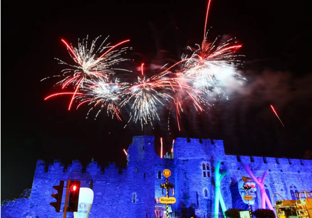
Figure from page 72
Swords
Due to its strategic location in proximity to Dublin City, the airport, national road network and with the planned Metrolink, Swords acts as a Key Town for the metropolitan area. Swords is the County Town in Fingal, and is a major town with a young and growing population of over 39,000 people in 2016, and which provides a strong economic and service function for its catchment. Key priorities are to promote compact growth and enhanced public realm in the town centre along with the planned sequential development of Swords.
Swords is located in the Dublin Metropolitan Area and is included in the MASP (see Chapter 5 MASP) and is located on the Metrolink Corridor.

Figure from page 73
People & Place
Regeneration:
The Sustainable Swords Project will consolidate and strengthen Swords historic town centre. The identity of the town centre will be enhanced through the development of Swords Civic Centre and Cultural Centre, the delivery of the conservation plan for Swords Castle, and the delivery of an enhanced public realm in the town centre, in accordance with a new healthy placemaking strategy. Additionally, core recreational and amenity spaces will be promoted, in particular Ward River Valley Park, Swords Cultural Quarter including Town Park, and Ward River Walk, west of Main Street.
REGIONAL POLICY OBJECTIVES:
Swords Key Town
RPO 4.28: Support the continued development of Swords as a vibrant Key Town with a thriving economy; an integrated public transport network; an attractive and highly accessible built environment with the highest standards of housing, employment, services, recreational amenities and community facilities.
Residential Development:
RPO 4.29: Support the regeneration of underused town centre lands along with the planned and sequential infill opportunities to provide for high density and people intensive uses in accessible locations that are accessible to high quality transport, existing and planned, and to support the preparation of a local area plan for the strategic landbank at Lissenhall for the longer-term development of Swords.
Key to the success of Swords will be the strengthening of the role of Main Street, with a focus on compact growth and targeting infill development. Residential development, in the shorter term, is mainly directed to the western and southern areas of the town, with longer term development of Lissenhall. This strategic landbank offers the opportunity for the development of a well-connected mixed-use urban district on the northern side of Swords within 1 km of the Metrolink corridor. The development of the area follows the sequential development of Swords and is in keeping with the Council’s long-term strategic vision for the town.
RPO 4.30: Facilitate the strategic regeneration of Swords to build on the resilience of the local economy and provide for an enhanced urban environment with a particular focus on the development of Swords Civic Centre and Cultural Centre, the delivery of the conservation plan for Swords Castle, and the delivery of an enhanced public realm in the town centre and to promote recreational and amenity uses in accordance with a healthy placemaking strategy.
Economic Development:
The strategic regeneration of Swords offers an opportunity to build on the existing resilience of the local economy. There are opportunities to create a strategic employment node maximising opportunity presented by Sword’s strategic location well served by air, Metrolink and the national road network. Furthermore, Swords-Dublin Airport has developed as a key location for industry and employment generating activities. Ensuring high skilled employment opportunities for residents of Swords is a key objective. Airport related activities will continue to be of major importance, along with the protection and enhancement of access to Dublin Airport as a global gateway to the Region and the State.
RPO 4.31: Support Swords-Dublin Airport as a key location for airport related economic development and employment provision linked to the protection and enhancement of access to Dublin Airport lands including the delivery of Metrolink.
RPO 4.32: Encourage transition towards sustainable and low carbon transport modes in Swords through the provision of high quality walking and cycling permeability offering direct routes to local destination and public transportation hubs.
Enabling Infratructure:
The delivery of Metrolink in co-ordination with other public transport proposals, including the Bus Rapid Transport/ Busconnects and Park and Ride programmes and electric vehicle charging infrastructure, is crucial for the future sustainable development of Swords. There is significant potential to transition towards sustainable and low carbon transport modes through the provision of high-quality walking and cycling permeability offering direct routes to local destinations and public transportation hubs. Improvements to the road and cycle network are required to capitalise on this, together with the delivery of new road infrastructure. Swords was identified in the Fingal Spatial Energy Demand Analysis as having heat densities high enough to be feasible for connection to district heating systems.

Figure from page 74
Regional Spatial & Economic Strategy
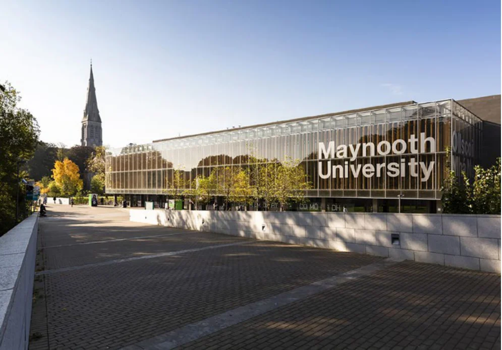
Figure from page 74
Maynooth
Maynooth, with a population of 14,600 people in 2016, is a large active town in north-east Kildare, and which is strategically located on the Dublin to Sligo railway line, M4 motorway and the Royal Canal. Maynooth provides a significant level of employment at Maynooth University, the M4 Business Park and local business in the town centre. A number of higher order services are located in the town including education, health, cultural, leisure and recreational facilities. The town has experienced significant population growth and has a young demographic with many university students living in and travelling to the town. St. Patrick’s College, the Royal Canal, Maynooth Castle and the nearby demesne landscape of Carton House are key assets and attractions.
Regeneration:
To enhance co-ordination of development in Maynooth, including its environs in County Meath, the preparation and adoption of a Joint Local Area Plan (LAP) should be carried out by Kildare and Meath County Councils.
Opportunities exist for the expansion of the town centre by utilising backlands in the Harbour area and at Carton Park, to maximise synergies with the existing core retail area. The Canal Harbour regeneration lands comprise of a number of brownfield sites, some vacant buildings/sites and a substantial public park with playing pitches and a playground. The town has relatively high rates of sustainable transport, with potential to capitalise on existing tourism assets with connections to the Royal Canal and its designation as Euro Velo Route 2, a Pan-European walking and cycling route. Alleviating traffic congestion will further enhance the attractiveness of Maynooth, which has potential to act as a major shopping destination for the surrounding area.
Maynooth is located in the Dublin Metropolitan Area on the North-West Corridor and is included in the MASP (see Chapter 5 MASP).

Figure from page 75
People & Place
Residential Development:
Maynooth has seen significant population growth along the Moyglare, Dunboyne and Dublin Roads with further land designated for residential development to the south east of the town at Greenfield and at Railpark. The Railpark lands are subject to a new relief road and bridge over the railway line together with the provision of linkages to the Royal Canal towpath and town centre. There is further potential for the consolidation of the built form of Maynooth to the northwest and southwest of the town to provide for significant residential development.
REGIONAL POLICY OBJECTIVES:
Maynooth Key Town
RPO 4.33: Support the continued development of Maynooth, co-ordinated with the delivery of strategic infrastructure including pedestrian and cycle linkages within the town and to the Royal Canal Greenway, DART expansion and road linkages forming part of the Maynooth Outer Orbital Route in a manner which supports future development and population growth and builds on synergies with Maynooth University promoting a knowledge-based economy.
Economic Development:
While the number of people at work within the town is relatively high, a significant number of residents commute to Dublin. There are significant opportunities to further develop knowledge-based employment focusing on ICT and manufacturing through the development of a research and technology campus to the west of the existing university campus. The further development of Maynooth University as a leading third level research and educational facility is critical for the economic development of the town and the region with potential synergies to large established employers such as Intel and Hewlett Packard. Lands at Moygaddy within the Maynooth Environs of County Meath have also been identified for Science and Technology based employment.
RPO 4.34: Support Maynooth as a key town to act as an economic driver for north Kildare and provide for strategic employment at key locations to improve the economic base of the town and provide for an increased number of local jobs.
RPO 4.35: A cross boundary Joint Local Area Plan (LAP) shall be prepared by Kildare County Council and Meath County Council to provide a co-ordinated planning framework for the Maynooth area. The Joint LAP shall identify a boundary for the plan area, strategic housing and employment development areas and infrastructure investment requirements and promote greater co-ordination and sequential delivery of serviced lands for development.
Enabling infrastructure:
Planned infrastructure upgrades include the M4 from Maynooth to Leixlip and for a bridge and relief road to the south east of the town. The DART Expansion project and proposed electrification of the rail line to Maynooth represents a significant opportunity for sequential growth in Maynooth. A new sewer connection for the Railpark lands, in association with the relief road will also unlock significant development potential, along with the development of an Outer Orbital Route connecting the east of the town and lands within the Maynooth Environs of Meath and to the west of the town with the provision of new roads connecting the Moyglare Road to the Kilcock Road. The provision of additional road capacity around the town offers an opportunity for improved public transport walking and cycling networks, through relocation of road space within the town.
RPO 4.36: To promote the consolidation of the town centre with a focus on the regeneration of underused buildings and strategic sites and the establishment of residential uses to encourage greater vibrancy outside of business hours and the enhancement of the public realm.

Figure from page 76
Regional Spatial & Economic Strategy
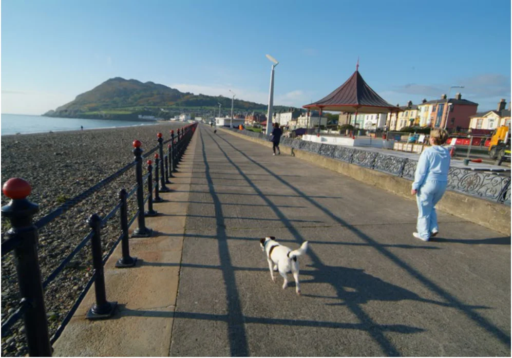
Figure from page 76
Bray
Bray is the largest town in County Wicklow, with a population of 32,600 in 2016, and strategically located at the eastern gateway to the County, with access to the N/M11 corridor (including M50), DART/rail line and quality bus service. It is a strong active town that provides higher order services, including tertiary education, health, cultural and leisure facilities and is a major retail and shopping destination, attracting people from the surrounding towns and villages. While many residents commute to Dublin, there is potential to provide for significant local employment growth for both its residents and its extensive surrounding catchment. Bray is a visitor and tourism destination benefitting from its natural setting on the coast with the backdrop of the Wicklow Mountains.
Bray is located in the Dublin Metropolitan Area and is included in the MASP (see Chapter 5 MASP) and is located as a key node on the North-South (DART) corridor.

Figure from page 77
People & Place
Regeneration:
REGIONAL POLICY OBJECTIVES:
There is significant potential for new development in the established town centre and built up area, particularly since the completion of the River Dargle Flood Defence Scheme. The former Bray Golf course and Harbour Lands are designated for high density new mixed-use development with improved town centre functions, which will be significantly enhanced through the construction of the Florentine Centre on the Main Street along with the development of the seafront. Bray is well located for tourist access to the Wicklow mountains and with attractions such as Bray Seafront, the Bray-Greystones Cliff Walk, Bray Head, Bray Sea Life centre and Kilruddery House.
Bray Key Town
RPO 4.37: Support the continued development of Bray including the enhancement of town centre functions, development of major schemes at the former Bray golf course and Bray harbour, along with increased employment opportunities and co-ordination between Wicklow County Council, Dún Laoghaire-Rathdown County Council, and the transport agencies to facilitate the delivery of key infrastructure required for the westward extension of the town, including Bray-Fassaroe public transport links and road improvements.
Residential Development:
RPO 4.38: Support the development of Bray as a strategic employment location with a particular focus on attracting high value investment in ‘people’ based industries at accessible locations, in order to increase the number of local jobs.
Population growth in Bray has been modest compared to other settlements as expansion of the town is constrained by the coast to the east, Bray Head/Sugarloaf mountains to the south and the N/M11 to the east. In order for Bray to fulfill its growth potential, lands at Fassaroe to the west of the N/ M11 are targeted for new housing, employment and major community and sports facilities, along with development of lands at Old Connaught (Conna)-Fassaroe, which are within Dún Laoghaire-Rathdown. The delivery of new mixed-use development of Bray Golf course and Harbour Lands will provide for consolidation within the established town.
RPO 4.39: To promote the consolidation of the town centre with a focus on placemaking and the regeneration of strategic sites to provide for enhanced town centre functions and public realm, in order to increase Bray’s attractiveness as a place to live, work, visit and invest in.
RPO 4.40: To support ongoing investment in public transport infrastructure, including the appraisal, planning and design of the LUAS extension to Bray. The development of Bray-Fassaroe should be undertaken in collaboration between Wicklow County Council, Dún Laoghaire-Rathdown County Council and the transport agencies to ensure the delivery of enabling transportation infrastructure and services.
Economic Development:
Bray has a highly concentrated and diversified employment base and provides employment for its residents and surrounding towns as far as Wicklow, Arklow and Gorey. Due to Ardmore Studios, the town has been at the centre of the Irish Film Industry for 60 years. The town aims to attract major employment generating investment in the retail, services and industrial sectors with a particular focus on promoting Bray as a destination for high value investment in people-based industries, at accessible locations to public transport. There is also scope for employment growth at Fassaroe to improve the local employment base in Bray.
RPO 4.41: Encourage transition towards sustainable and low carbon transport modes through the promotion of alternative modes of transport and ‘walkable communities’ whereby a range of facilities and services will be accessible within short walking or cycling distance.
Enabling infrastructure:
Bray has access to high quality public transport including DART services and is at the terminus of the proposed Luas Green Line extension, with excellent potential to promote sustainable mobility and achieve the vision of ‘walkable’ communities. The development of a new centre at Fassaroe is largely dependent on the delivery of transportation infrastructure including upgrades to the N/M11 and the delivery of highquality public transport connections to Bray. The development of Bray-Fassaroe should be undertaken in collaboration between Wicklow County Council, Dún Laoghaire- Rathdown County Council and the transport agencies to ensure the delivery of roads and public transportation infrastructure to support the westward expansion of the town.

Figure from page 78
Regional Spatial & Economic Strategy
CORE REGION KEY TOWNS
The Key Towns of Navan, Naas and Wicklow-Rathnew are located within the Core Region and are important within a regional and county context. These towns have capacity and future growth potential to accommodate above average growth coupled with the requisite investment in employment creation, services, amenities and sustainable transport.
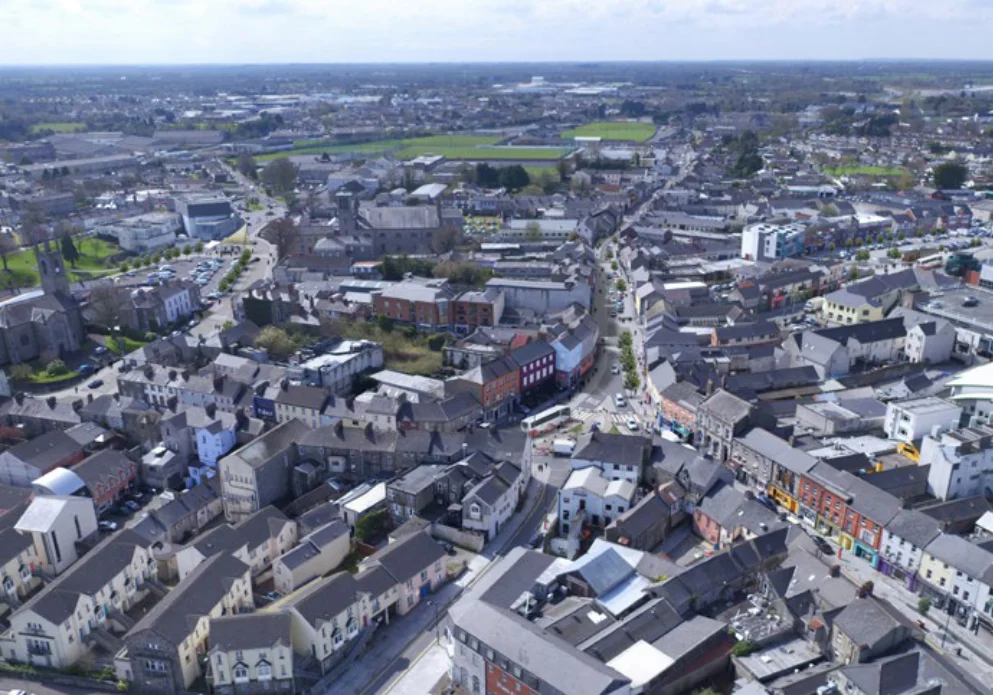
Figure from page 78
Navan
Navan is a key town located in the Core Region, functioning as a dynamic urban centre and the focal point for the economic, cultural and social development of County Meath. It is one of the Country’s fastest growing towns, with a young and diverse population of over 30,000 people in 2016. Navan is located on the M3 corridor and is well served by a local and regional public transport bus service including a frequent express service to Dublin. As the County Town, Navan acts as a key employment centre with potential to further strengthen the retail, employment and service functions of the town through the consolidation and expansion of the town centre along with new strategic development areas, and to improve connectivity, sustainable transport and public realm.
Regeneration:
In addition to economic growth, there is also a need to create a modern and attractive urban environment in Navan. This will be delivered through the implementation of the Public Realm Strategy ‘Navan 2030’ and the Active Land Management Strategy for the town. The funding recently allocated to Navan through the Urban Regeneration and Development Fund will assist in the rejuvenation of the urban core and built fabric of the town including the Flowerhill and Railway Street Regeneration Projects. Key parts of the town that have suffered from underinvestment and have high levels of vacancy will be targeted for renewal and regeneration. This will make town centre living a more attractive option, will improve vibrancy in the urban core, and will assist in the creation of a more compact settlement.

Figure from page 79
People & Place
Residential Development:
Enabling infrastructure:
Navan has a compact and walkable town centre surrounded by residential areas. The consolidation of residential development proximate to social and community infrastructure will be promoted. The sustainable development of vacant residential and regeneration sites in the town centre in conjunction with the implementation of the public realm and movement plan ‘Navan 2030’ will assist in reinvigorating the urban core of the town and making it a location of choice to live and do business. Navan has a number of strategic sites including the former County Council Offices at Railway Street, which are located in a key position between the cultural quarter, the town centre to the north, which has potential for mixed use development, and the town expansion area to the south, which has also been identified as the preferred location for a future train station. Other strategic lands include a residential Strategic Development Zone (SDZ) at Clonmagadden and a development opportunity at Farganstown. The LIHAF funded link road at Farganstown will facilitate the creation of a ‘live-work’ community at this location.
Navan is strategically located on the M3 to Dublin with national road connections to Drogheda and Mullingar. Planned infrastructure upgrades include the delivery of the LIHAF funded distributor road at Farganstown, a link road between the Dublin and Trim Roads and a new road and Blackwater bridge linking the SDZ lands at Clonmagadden, along with a new bridge over the Boyne and the southwestern section of the Navan outer orbital subject to feasibility. There is potential to improve public transport as part of the delivery of Phase 2 of Navan Rail project, subject to feasibility and for further investment in walking and cycling both in the town and regionally. The provision of additional road capacity around the town offers an opportunity for improved public transport, walking and cycling networks, through relocation of road space within the town. The confluence of the Rivers Boyne and Blackwater in the town offer potential to improve amenity and recreational use including the further development of the Boyne and Navan Greenways.
REGIONAL POLICY OBJECTIVES:
Economic Development:
Navan is the primary centre of employment in the County with a range of retail and services including two retail parks, an acute hospital, health centres, court service and a number of primary and post primary schools. Whilst the industrial and business parks in the town are performing well, outbound commuting for employment remains an issue. Navan is promoted as a strategic centre for employment in the County to address this issue and improve the ratio of jobs to resident workers. There are a number of industrial estates, including an IDA Business and Technology Park providing employment in sectors such as manufacturing, logistics, medical devices, services and communication. In addition, the Boyne Valley Food Hub, with approved state funding, aims to develop an innovation-rich enterprise support system in Navan to intensify growth of food and drink entrepreneurs. The continued success of Navan Enterprise Centre illustrates the growing demand for workspaces by entrepreneurs, start-ups and established businesses. The planned consolidation and expansion of existing business parks along with the town centre offers an opportunity to broaden the employment base while the delivery of a distributor road at Farganstown has potential to attract new investment in high quality intensive employment uses. Strategic lands are also reserved for the future development of a Regional Hospital for the north east of the country. The future re-development of Páirc Táilteann will be an important economic, sporting and cultural asset for the County and the Region and is significant in the context of Navan 2030 and the vision of an enhanced town centre.
Navan Key Town
RPO 4.42: Support the delivery of road infrastructure to release strategic residential and employment lands for sustainable development and to improve connectivity and the efficient movement of people and services in the town.
RPO 4.43: Support the implementation of the Public Realm Plan ‘Navan 2030’ to make the town a more attractive place to live, shop, visit, and do business.
RPO 4.44: Support development of a regional hospital to serve the north east of the country.
RPO 4.45: Support the extension of the Boyne Greenway to include Navan to promote sustainable transport choices and as a recreation asset for the town, subject to the outcome of the planning process and environmental assessments.
RPO 4.46: Key Towns shall act as economic drivers and provide for strategic employment locations to improve their economic base by increasing the ratio of jobs to workers.
RPO 4.47 : Support the development of strategic employment lands on the Trim Rd in Navan, subject to the outcome of appropriate environmental assessment and the planning process.

Figure from page 80
Regional Spatial & Economic Strategy
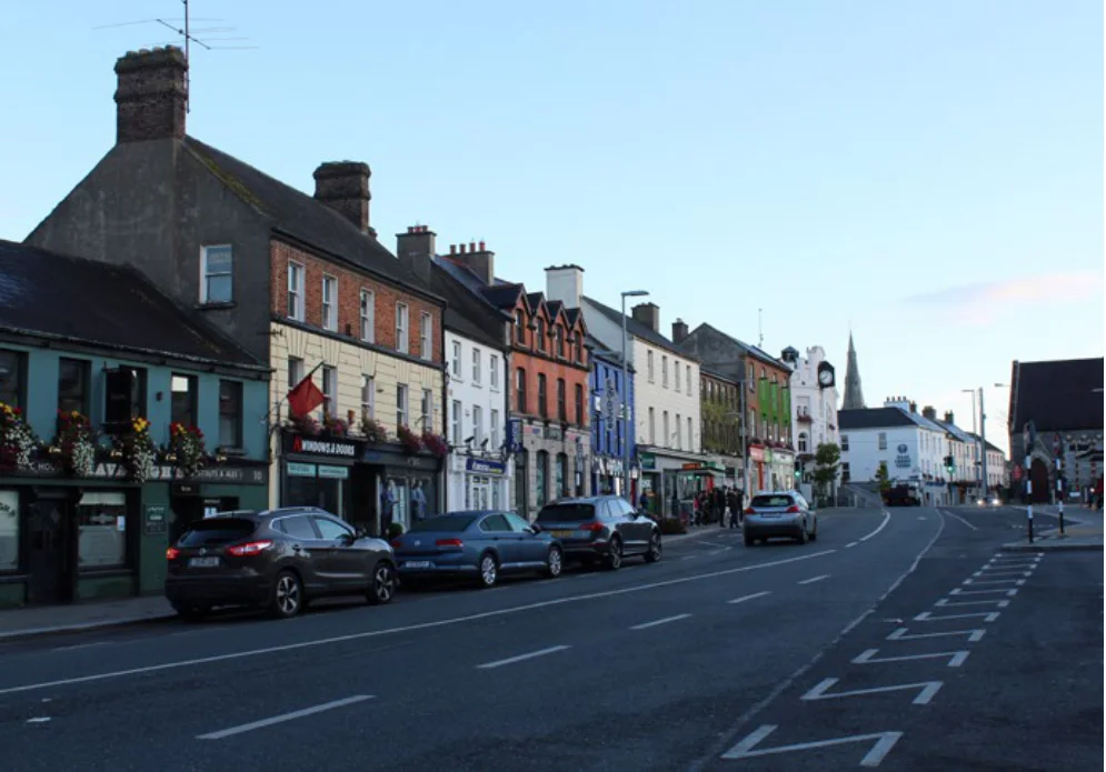
Figure from page 80
Naas
Naas is a Key Town located in the Core Region, well served by the M7 motorway with good road connections to the rest of the Country and a commuter rail service to Dublin. Naas has a population of 21,597 people in 2016 with a highly skilled workforce and plays a key role as a County Town in providing employment and services for a wide catchment. There are strong links between Naas and the nearby settlements of Sallins and Newbridge, with a strong interrelationship of services, employment and education between Naas and Newbridge. There is potential to capitalise on the significant infrastructure investment which has taken place in Naas, to further strengthen the local employment base, promote regeneration and consolidation of the town centre and surrounding residential and employment areas, with improved permeability and sustainable transport links and to build on assets including the historic centre, Naas Racecourse and Grand Canal.
Regeneration:
Residential Development:
A key priority for Naas is the regeneration of the historic town centre with enhancement of retail and commercial functions and consolidation of strategic development areas including the Castle Quarter, Devoy Quarter, Corban’s Lane and the Canal Quarter, along with the further development of Millennium Park in the Northwest Quadrant and regeneration of industrial lands in the north east of the town. The regeneration by the adaptive re-use of existing buildings, the sensitive infill of vacant sites and the creation of new urban form will be promoted as part of the core regeneration areas. There is also a need to improve pedestrian permeability and connectivity within the town centre and linking to surrounding residential and employment areas with peripheral development at Monread in particular, to Sallins-Naas Railway Station.
There is a need to redress past legacies of rapid housing growth to ensure the delivery of further appropriately and easily accessible social, education, recreation, sports and amenity spaces to ensure that facilities grow to meet the needs of the increasing population and keep pace with development. The sustainable growth of Naas should be carefully managed to promote the concept of a compact town by encouraging appropriate densities in suitable locations and by resisting sporadic isolated developments which do not integrate with the surrounding urban fabric. Promoting placemaking and more mixed tenure and the delivery of lifetime adaptable homes that can accommodate the changing needs of a household over time should be encouraged thereby helping to create integrated communities.

Figure from page 81
People & Place
Economic Development:
Naas has a high jobs ratio providing a large employment base for resident workers and attracting inward commuting from a wide catchment of north Kildare and west Wicklow. The regeneration of the town centre along with the opening of Corban’s Lane Shopping Centre positions Naas to provide significant retail and commercial functions. The local employment base will be strengthened through the development of the Mid Eastern Region Innovation Think Space (MERITS) extending and enhancing the technology environment in the region. There is also potential for highquality high-density indigenous and Foreign Direct Investment within the Millennium Park in the Northwest Quadrant and for re-intensification of industrial lands in the north east of the town. Naas is well serviced in terms of healthcare with Naas General Hospital, Vista Primary Care Centre and Enable Ireland Kildare Children’s Services while McAuley Place provides alternative residential and social care for older people in the town. Historic assets include the historic centre, St. David’s Castle, Leinster Mills and Jigginstown Castle.
REGIONAL POLICY OBJECTIVES:
Naas Key Town
RPO 4.48: Promote the improvement of the transport network within and serving Naas town, including delivery of a robust and efficient walking, cycling and bus network with strong links to Sallins Railway Station, key destinations within the town and to the North West Quadrant and town centre area.
RPO 4.49: Support the development of the Grand Canal for amenity, recreation and sustainable transport purposes including the Naas to Sallins and Naas to Corbally harbour greenways and linking these to the national Grand Canal Greenway.
RPO 4.50: Regeneration and consolidation of the historic centre to improve the retail and commercial functions of the town core, with enhanced permeability and sustainable mobility within the town centre and improve links between the core and surrounding residential and employment areas through the further development of walking and cycling routes and improved public transport.
Enabling Infrastructure:
Naas is bound by the M7 motorway and has high levels of car dependency, congestion and commuting to Dublin along with a strong interrelationship of services, employment and education between the settlements of Naas, Sallins and Newbridge. Naas has a high level of internal trips, however further investment is needed in public transport and active travel connections within the town linking residential areas and the Northwest Quadrant to Sallins-Naas railway station. The Naas Branch of the Grand Canal runs southwards from Sallins to the canal harbour in the heart of the town and then branching off to Corbally Harbour. There is potential to develop the amenity, recreation and sustainable transport potential of the canal including the development of greenways from Naas to Sallins and Corbally Harbour and linking to the cross regional Grand Canal Greenway. Through targeted investment, the town can achieve a walkable and cycle friendly connected environment underpinned by a sustainable transport network. The delivery of new and enhanced public transport infrastructure in Naas and Sallins including Park and Ride and Interchange facilities will be supported as identified by the NTA and Kildare County Council.
RPO 4.51: Strengthen the local employment base including through the development of MERITS, Millennium Park in the North West Quadrant and the regeneration of underutilised lands including industrial lands in the north east of the town.
RPO 4.52: Support the delivery of new and enhanced public transport infrastructure in Naas and Sallins, including Park and Ride and interchange facilities as identified by the NTA and Kildare County Council.
RPO 4.53: Support an enhanced role and function of Naas as the County town of Kildare, particularly as a hub for high quality employment, residential and amenities.

Figure from page 82
Regional Spatial & Economic Strategy
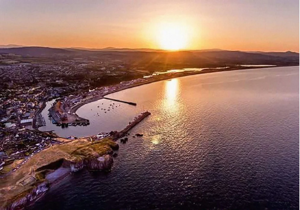
Figure from page 82
Wicklow – Rathnew
Wicklow-Rathnew includes both the Ccounty Town of Wicklow and the town of Rathnew, with a combined population of c. 14,000 people in 2016 and is a key settlement within the Core Region. It has a strategically important location on the M/N11 and rail corridor, and at the centre point of the coastal area of the County. Wicklow has an important position as the County Town, providing higher order services and facilities for the residents and its catchment. Rathnew has a distinct identity and functions as a local service centre for its local community. Key priorities are to strengthen the local employment base, improve sustainable transport and promote compact growth with a focus on regeneration, development of the port and harbour area, and to expand Wicklow-Rathnew’s role as a hub for tourism, training and education.
Regeneration:
Residential Development:
Key regeneration opportunities include the development of Wicklow Port and Harbour, served by the port access road, to expand commercial berthing and pleasure craft capacity subject to feasibility and protection of European Sites such as the Murrough, a coastal wetland which is popular with walkers with views of the town and coastline. There are opportunities for the densification and enhancement of residential and retail uses in the two town centres of Wicklow and Rathnew and to improve pedestrian mobility and connectivity. There is also potential for further development of the Wicklow County Campus as a third level education facility for enterprise, education, training, research and development.
Wicklow Town – Rathnew enjoys rail and road access to Dublin City and the wider region, and an abundance of recreational amenities close by including the coast, the harbour and the Wicklow Mountains; as a result there is a high demand for housing in this settlement. Redevelopment and opportunity sites within the core areas of Wicklow-Rathnew will be promoted in the first instance for new residential development, with sites close to transport infrastructure, recreational and education amenities and employment being prioritised thereafter.

Figure from page 83
People & Place
Economic Development:
Enabling Infrastructure:
Wicklow-Rathnew is a major employment hub, with a strong employment base attracting inflows of workers from around the County. The largest sectors in the settlement are commerce, manufacturing and education/ health/ public administration. There are a number of active business and industrial parks, with potential for expansion, as well as a supply of undeveloped zoned employment land available for growth. Wicklow Town plays a significant role in the provision of administrative services, delivering the functions of local government from Wicklow County Council, the provision of tertiary educational facilities at the Wicklow County Campus at Rathnew (in conjunction with Carlow IT) and higher order health facilities at Knockrobin Primary Health Centre. The settlement aims to capitalise on its existing assets such as the commercial port, a third level college campus at Rathnew-Clermont, as well as its location on the M/N11 corridor. There is potential for the town centre to strengthen and promote economic development associated with retail and commerce, the expansion of port and harbour activities and the nearby Ashford Studios. Wicklow Port is home to commercial businesses and fishing as well as providing an important leisure amenity with tourism potential. Wicklow Port is well positioned to become a hub for the service of the off-shore wind energy sector in particular. Wicklow has a long maritime tradition with leisure events such as the Wicklow Regatta and the Round Ireland Yacht race which starts and ends in Wicklow Port. There is potential to develop Wicklow-Rathnew as a recreation and tourism hub due to its attractive coastal location and its proximity to key destinations such as the Wicklow Mountains, Glendalough and Brittas Bay and the key attractions within the town including the Wicklow Gaol, the Murrough, coastal walks, beaches, architectural heritage, sports facilities and as a terminus of the planned Greystones – Wicklow Coastal Route. Wicklow is also situated between the protected conservation sites of the Murrough cSAC/SPA and Wicklow Head SPA. While the ecological protection of these sites is a priority, there is potential to expand the range of recreational and tourist facilities associated with its coastal location.
Wicklow-Rathnew has high levels of car-based commuting to Dublin with issues in relation to public transport capacity, particularly rail, and traffic congestion on the M/N11. Significant investment has occurred with construction of the port access and town relief roads and a new wastewater treatment plan, with planned infrastructure upgrades on the M11 from the M50 to Kilmacanogue. While there are good pedestrian and cycling facilities on new roads, there is potential for further investment in walking and cycling within the town and to enhance connections to surrounding urban centres and regional trails. There is potential to improve sustainable mobility through the enhancement of bus and rail services. Public transport improvements would improve the accessibility of Wicklow-Rathnew to Dublin and the wider area, and would likely contribute to population and economic growth.
REGIONAL POLICY OBJECTIVES:
Wicklow-Rathnew Key Town
RPO 4.54: Support an enhanced role and function of Wicklow-Rathnew as the County Town, particularly as a hub for employment, training and education.
RPO 4.55: Support Wicklow-Rathnew’s role in the provision of third level education at the Wicklow County Campus Rathnew (in association with Institute of Technology Carlow) and in particular, to support the development of the campus as a hub for the Film Industry and Screen Content Creation Sector.
RPO 4.56: Support enhancement and expansion of Wicklow Port and Harbour, to expand commercial berthing and pleasure craft capacity subject to a feasibility study with particular focus on avoiding adverse impacts on the integrity of adjacent European Sites.
RPO 4.57: Support the development of Wicklow- Rathnew as a tourism hub having regard to its accessibility to key tourist destinations in the Region.
RPO: 4.58: To support ongoing investment in rail infrastructure to ensure its continued renewal, maintenance and improvement to a high level to ensure high quality of frequency, safety, service, accessibility and connectivity.

Figure from page 84
Regional Spatial & Economic Strategy
GATEWAY REGION KEY TOWNS
Longford Town, Mullingar, Tullamore, Portlaoise and Graiguecullen (Carlow), are large economically active towns located within the Gateway Region. These towns provide important connections with adjoining regions and have the capacity and future growth potential to accommodate above average growth in tandem with the requisite investment in employment creation, services, amenities and sustainable transport.

Figure from page 84
Longford
The County Town of Longford, is strategically located on the N4/M4 motorway and the Dublin to Sligo rail line, acting as a portal to the Northern and Western Region and providing a supporting role to the Regional Growth Centre of Athlone.
Longford acts as a key employment centre with strong retail, administrative and service functions that serve a wide catchment. The town has a young, diverse and growing population of 10,000 people and a growth rate of 13% in the ten years to 2016. Key priorities are to promote compact growth, the regeneration of the town centre and to expand Longford’s role as a hub for enterprise, employment and tourism.

Figure from page 85
People & Place
Regeneration:
Enabling infrastructure:
Longford Town has a number of strategic areas that can act as regenerative catalysts increasing the residential, economic and leisure potential of the town centre, whilst also addressing vacancy, derelict buildings and enhancing the vibrancy of the town. Key areas include the Camlin Quarter and Ballyminion Areas with further strategic sites throughout, including possibilities within the southern quarter of the town. The Longford Flood Relief Scheme will address flood considerations and support appropriate use of riverside locations. There are opportunities for improved links between both ends of the town and enhanced rejuvenation of, and connections between, the Royal Canal Greenway and the former location of the canal harbour around the Market Square.
Longford is strategically located on the N4/M4 from Dublin to Sligo, with national roads including the N55 to Athlone, N5 to Castlebar and N63 to Roscommon. Planned infrastructure upgrades include the N4 from Mullingar to Carrick-on- Shannon and there is further potential to provide for enhanced rail service on the Sligo rail line and improve connections to Athlone. Potential exists to stimulate economic development through the provision of broadband and natural gas within the town. Delivering on Longford’s walking and cycling strategy will improve sustainable travel and provide links to national and cross regional walking and cycling trails.
REGIONAL POLICY OBJECTIVES:
Residential Development:
Longford Key Town
The delivery of housing in Longford Town is essential to support the overall role and success of the settlement. A key focus for the settlement is to encourage the provision of high quality housing development at the right locations over the coming years in order to ensure wider societal benefits and the sustainability and enhancement of facilities such as schools, shops, recreation facilities and open spaces. Central to this is the requirement to provide high quality housing products that meet a variety of housing needs, including those required by employees of existing and potential industry and enterprises within the town.
RPO 4.59: To enhance accessibility and sustainable mobility within the town centre by improving links between the core and surrounding areas through the further integration of public transport, walking and cycling facilities.
RPO 4.60: Support the development of Longford as a tourism hub having regard to its accessibility to key tourist destinations in the Region including Center Parcs, and proximity to natural amenities, recreational opportunities and the town’s location on the Rebel Longford Trail.
Economic Development:
RPO 4.61: Support social inclusion measures including the revitalisation of areas by physical regeneration, planning, investment and community development and measures to improve educational attainment levels, up skilling in key competencies and skills acquisition.
The town has a particularly high ratio of jobs to resident workers with significant in-commuting and employment in sectors such as advanced manufacturing, pharma and agrifood. The planned development of a creative and innovation hub and co-working space on the Main Street offers a further opportunity to drive enterprise development and entrepreneurship in the town. There is also potential to build on significant investment in the nearby flagship Centre Parcs holiday village and the investment by the local authority in tourism and recreational infrastructure. The Upper Shannon Erne Future Economic Project, which is a collaboration between the Cavan, Leitrim, Longford and Roscommon local authorities with ESB and Bord na Móna, provides the opportunity to deliver cross regional economic projects.
RPO 4.62: Support the plan-led development and regeneration of publicly owned land banks in the town for residential, employment, education, community, cultural and recreational opportunities and the consolidation of the town centre and the enhancement and linking of brownfield and outlying sites to the town centre, with a focus on the regeneration of underused buildings and strategic sites.
RPO 4.63: Support Longford Town as a strategic portal to the northwest and south in recognition of its location at the junction of the N55; M4/N4 Dublin/Sligo and N5; due to its proximity to the regional growth centre of Athlone; and support its role as a strategic employment centre.
Services and Amenities:
Longford has a rich cultural heritage with potential to develop as a recreation and tourism hub, building on its proximity to attractions such as Centre Parcs, the Royal Canal, The Dublin-Westport Greenway and Mid Shannon Wilderness Park and key assets within the town such as St Mel’s Cathedral, the River Camlin, a theatre and walking routes such as the Rebel Trail and Literary Trail. Social inclusion will be key to supporting greater participation in local community and economic development and to addressing higher levels of unemployment and relative deprivation in the town.

Figure from page 86
Regional Spatial & Economic Strategy
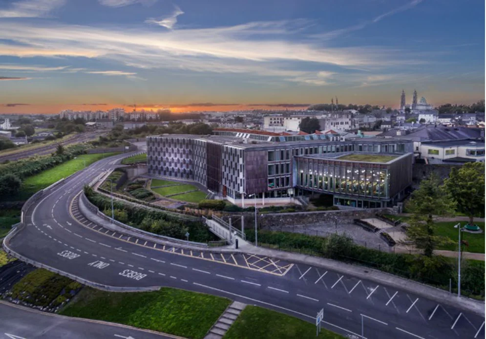
Figure from page 86
Mullingar
The town of Mullingar, with a population of 20,928 in 2016 is located on the Dublin to Sligo rail line and M4 motorway, provides an essential role in supporting population and job growth and in this regard acts as a crucial centre for the surrounding hinterland.
Residential Development:
The advancement of Mullingar includes the promotion of economic development and employment creation; support for the development of the town’s assets in built and natural heritage; encourages the continued investment in arts, culture and outdoor recreational activities including walking, cycling, fishing, boating, eventing and sports; and provides for the continued development of the tourist economy.
The provision of housing plays a fundamental role in the overall economic, social and environmental success of the settlement. It is essential to ensure an effective supply of land for the provision of housing and that high quality development is secured in the right place at the right time. A range of well-designed housing types that meet the needs of a variety of households will help to sustain and enhance the settlement, contributing to the creation of a high quality place.
Regeneration:
The consolidation and regeneration of Mullingar is a key priority to support the overall role and function of the town. Strategic sites that provide opportunity include Columb Barracks and St. Loman’s as major opportunity sites and the town centre sites of Blackhall, Grove Street, the Harbour Street Car Park and the Dunnes Stores Car Park. The promotion of town centre enhancements and public realm improvements will contribute to the sustainability of the town centre and improve opportunities for sustainable transport choices.

Figure from page 87
People & Place
Economic Development:
Enabling infrastructure:
Mullingar operates as a strong economic driver covering a relatively wide catchment, with opportunity to capitalise upon and augment the high ratio of jobs to resident workers. The economic role of Mullingar can be supported through mechanisms such as realising the potential of the existing IDA presence and property, advance development of high quality enterprise and employment zones including existing business parks; and support and promotion within sectors such as engineering and ICT, consumer products, financial services, shared services (multi-lingual), R&D, robotics and advanced manufacturing. Recognition of the settlement’s potential for tourism and eventing is also supported.
Mullingar is strategically located on the N4/M4 from Dublin to Sligo, with a national road the N55 to Athlone in proximity. Planned infrastructure upgrades include the N4 from Mullingar to Longford and there is further potential to provide for an enhanced rail service on the Sligo rail line. The RSES supports the preparation of a Local Transport Plan for Mullingar.
Significant Government spending in recent years has seen the Mullingar Main Drainage Scheme upgraded at a cost of €39m. Water supply to the town is currently sourced from Lough Owel, but in the long-term will be provided by the South Westmeath Scheme which will provide an interconnector between Athlone and Mullingar or through connection to a feeder from the Dublin Water Supply Scheme. The RSES promotes maximising return on existing and planned infrastructural investments in keeping with Mullingar’s role as a Key Town and County Town for Westmeath.
Services and Amenities:
Mullingar has a rich built heritage in keeping with its historic commercial importance as a market town. It has significant protected structures and six architectural conservation areas. Mulingar also has significant amenity resources. The Royal Canal is a significant amenity and resource for the town as are Lough Ennell and Lough Owel. The Royal Canal Greenway from Spencer Dock through Maynooth and on to Mullingar has the potential to support recreational tourism and may provide a link into the Dublin to Galway Eurovelo route. The Old Rail Trail between Athlone and Mullingar is a considerable greenway asset. The greenway from Mullingar to Lough Owel is nearing completion and it is intended to extend this to Lough Ennell. Other visitor attractions in proximity to Mullingar that can be built upon include Belvedere House and Gardens.
REGIONAL POLICY OBJECTIVES:
Mullingar Key Town
RPO 4.64: Support Mullingar’s role as a tourism hub having regard to its accessibility to key tourist destinations in the Region including proximity to natural amenities and recreational opportunities including the Galway to Dublin Greenway.
RPO 4.65: Promote the plan led development and regeneration of publicly owned land banks in the town for employment, education, community, cultural and recreational opportunities and to support the economic development and regeneration of the town centre.
RPO 4.66: Support the development and expansion of the Midlands Regional Hospital including any necessary supporting infrastructure.
RPO 4.67: Support Mullingar’s role as an important employment hub by promoting economic development and clustering of related enterprises.

Figure from page 88
Regional Spatial & Economic Strategy
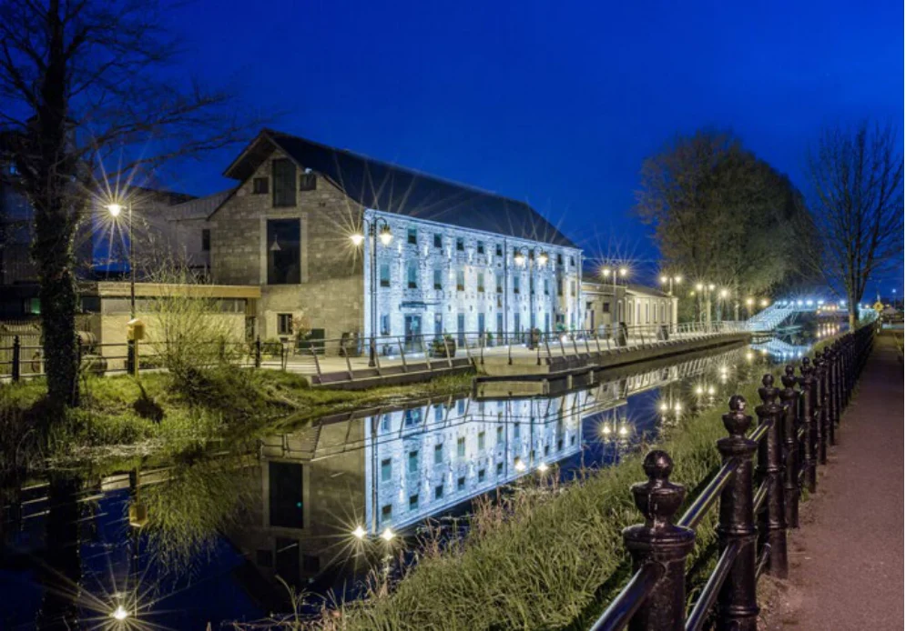
Figure from page 88
Tullamore
Tullamore acts as a key population and employment centre for the surrounding hinterland. It is located on the Dublin to Galway rail line, in close proximity to the M6 Dublin/Galway Motorway with the N80 and N52 providing important and essential intra-regional linkages to motorways, the Regional Growth Centre of Athlone and key towns of Portlaoise, Mullingar and Longford. Flanked by the Slieve Bloom Mountains to the south and Lough Boora Discovery Park to the west, which is to be connected by a greenway along the Grand Canal by 2020, the town offers significant quality of life advantages. The town has a high ratio of jobs to resident workers, reflecting its role as an employment centre and the extent of its area of influence. Continued employment and population growth coupled with placemaking and regeneration are key priorities for the settlement.
Regeneration:
Residential Development:
Tullamore has a number of opportunity sites supporting regeneration and redevelopment, focusing on compact growth, place making and transition to a low carbon society/ economy. Key sites include the Grand Canal Harbour, the former ‘Texas’ site, Tanyard and former ‘Carrolls’ site, former ‘Coens’ site and the railway node. The redevelopment of the Grand Canal Harbour has potential for enterprise, recreation, residential, public realm and tourism related development.
Relevant to the delivery of housing in Tullamore is support for a range of housing types which are well designed with consideration to tenures and density, integrated green infrastructure, active travel links and renewable energy options. The provision of housing at the right locations will play a fundamental role in the overall economic, social and environmental success of the settlement.

Figure from page 89
People & Place
Economic Development:
An upgrade to the wastewater network is required to enable the future development of the town. Irish Water have completed a Drainage Area Plan of the town, which will be used to inform proposals into the future.
The further development of the med-tech cluster centred on the IDA business park in Srah provides opportunity to drive development within the town. Opportunity also exists for the town, and indeed County, in light of the existing industry based on energy supply to provide a centre of excellence related to energy retrofitting. Economic development in particular that compensates for the loss of employment in the peat production business, with particular reference to the rural communities which were founded and supported by this industry since the 1930s, will be supported. Tullamore Regional Hospital also provides the potential for linkages to existing and new med-tech businesses and research. Desirable economic investment for Tullamore would be in the form of green jobs and green technologies, innovation, digital technologies, circular bioeconomy, food & beverage (in particular its distilling heritage), advanced manufacturing, tourism, recreation & amenity and high quality town centre retail development. A continued emphasis on placemaking is required in order to attract inward investment and expansion of existing businesses.
Improved walking and cycling permeability together with the provisions of green and blue infrastructure, through enhancing linkages and connectivity, will enable the further development of tourism opportunities, particularly for the Shannon Area, thus augmenting economic opportunity.
REGIONAL POLICY OBJECTIVES:
Tullamore Key Town
RPO 4.68: Support Tullamore’s role as a tourism hub and development as a Tourism Destination Town having particular regard to its distilling heritage and industry and accessibility to key tourist destinations, natural amenities and recreational opportunities including the Grand Canal Greenways, Lough Boora Discovery Park, Slieve Bloom Mountains and peatlands. This is coupled with support for Tullamore as a service hub for the ‘Midlands Cycle destination – Offaly’ and the recognition of the settlement’s potential as a conferencing and event hub, given the town’s central location, accessibility and experience of event provision.
Services and Amenities:
Tullamore has a rich cultural heritage with potential to develop as a recreation and tourism hub, building on its proximity to attractions such as the Grand Canal Greenways, Blueways and Lough Boora Discovery Park, Charleville Castle Demesne, Durrow High Cross, peatways, the planned Midlands Cycle Destination – Offaly and the Slieve Bloom Mountains, including the national mountain bike trail (MTB) centre. The shared vision document, Spirit Level - Lough Ree and the Mid-Shannon and the Shannon Masterplan represents an indication of the potential for green and blue tourism in the wider area. The presence of the Tullamore Dew visitor centre, particularly in the context of the potential linkages to the development of ‘Whiskey Trails’ throughout the Region and beyond, represents a further area for development.
RPO 4.69: Support the role of Tullamore as a major employment centre with key assets being its existing positive jobs to resident employee ratio, excellent quality of life and future strategic development sites, with support for the provision of enabling and facilitative infrastructural development to complement this role.
RPO 4.70: To examine the need for complementary third level outreach educational facilities at Tullamore, particularly with regard to support for Tullamore Regional Hospital and where appropriate, its continued development as a Teaching/University Hospital, together with potential for linkages to existing and new med-tech businesses and research facilities.
Enabling infrastructure:
The enhancement of Tullamore’s accessibility as a key node between the M4/6 and M7 motorways is important. The improvement of capacity and journey times on the N80, N52/N62 National secondary routes and the R420 to the M7 and the R402 to the M4 will enable greater intra-regional connectivity and improve the cohesiveness of the Midland area. Furthermore, the R420 Tullamore to Monasterevin and R402 Edenderry to Enfield roads perform functions akin to National Secondary Routes, supporting Tullamore’s linkages to other Key Towns and the Regional Growth Centre of Athlone and these should be considered for upgraded status in the future.

Figure from page 90
Regional Spatial & Economic Strategy
Figure from page 90
Portlaoise
Portlaoise is a strategically located settlement that provides important inter-regional links to the south and south-west, maximising its situation on the Dublin to Cork/ Limerick rail line and M7/M8 Motorway. Likewise, the N80 provides an essential link accessing Carlow, Waterford and Rosslare to the southeast and Tullamore, Mullingar and Athlone to the northwest.
Regeneration:
Job creation and the facilitation of economic development are central priorities for the settlement over the coming years, in order to support the significant population growth levels experienced and recognition that the settlement was one of the fastest growing towns between 1996 and 2016. In tandem with this, the sustainability, vitality and vibrancy of the settlement can be enriched through a major focus on the regeneration of the town centre, balancing and consolidating housing and retail development located adjoining the town core. The NPF has identified the need for a self-sustaining and community driven renewal and regeneration project for the town as a demonstration project to be part funded under the Urban Regeneration and Development Fund.
The regeneration of the town comprises a number of opportunity sites including James Fintan Lalor Avenue, Lyster Square and laneways connection with the Main Street, Fort Protector and Fitzmaurice Place, Schools site and the former Bank of Ireland Branch/Prison Officer’s Club. “2040 and Beyond – A Vision for Portlaoise, A strategy for a Better Town Centre” completed in 2017 sets out principles and a programme of regeneration of the town.
The Portlaoise Regeneration Demonstration Project aims to focus on regenerating the original town centre with a view to the creation of a place that people want to live and spend time in. It is anticipated that this will be a demonstrator project to show how the best quality planning, urban design and implementation can create rejuvenated towns, tied with opportunity to become a ‘Low Carbon Town Centre’ through reducing the impacts of the car on the public realm and improving the mix of uses within the town centre.

Figure from page 91
People & Place
Residential Development:
Enabling Infrastructure:
Over the coming years focus will be on proactively encouraging housing delivery in a sustainable manner that acknowledges economic and market conditions, whilst ensuring housing need is met including the housing needs of younger people, families, private renters and the ageing population. The provision of a mixture of well-designed housing types at appropriate locations will facilitate and contribute to the ongoing regeneration, consolidation and renewal of the town.
Given the strategic location of Portlaoise, the maintenance and upgrading, where appropriate, of transport links are required to enhance connectivity within and beyond the region, facilitate economic potential and enhance quality of life. This includes the motorway network, as Portlaoise benefits from direct access via two Junctions onto the M7 namely junctions 16 and 17, and the national road networks including the N77 and N80 routes.
A number of opportunity sites offer potential to deliver consolidated residential development over the short, medium and long term, such as the Maltings Site on Mountmellick Road, Centrepoint Site on the Mountrath Road, and the former Schools sites within the town centre.
The service provided by the Dublin-Cork rail line is required within the settlement and provides regular daily services to Cork, Killarney and Limerick to the south and Dublin to the north. High frequency commuter trains to and from Dublin, during morning and evening peaks, offer an important sustainable transport option for people within the settlement.
Economic Development:
Portlaoise has a strong economic base, significant talent and success spread across various sectors including the Global Business and ICT Service sectors, agri-business sector and the public services sector. This has attracted internationally renowned companies and provides a solid foundation for economic growth and employment into the future.
REGIONAL POLICY OBJECTIVES:
Portlaoise Key Town
RPO 4.71: Support delivery of the Portlaoise Regeneration and Development Demonstration Project and assist the local authority in seeking funding opportunities for delivery of regeneration development.
The J17 National Enterprise Park (formerly Togher Inland Port) is a c. 121 hectare site located to the southwest of Portlaoise town centre. It is bounded by the M7 motorway and includes the existing IDA Park on the Mountrath Road. This area has significant potential for the development of the economic base of Portlaoise. A masterplan prepared in 2018 sets out to achieve objectives which will contribute to the future prosperity of Portlaoise and will facilitate industrial, commercial and enterprise developments having regard to the proper planning and sustainable development of the area, that includes environmental and transportation requirements.
RPO 4.72: Support transition of Portlaoise to a low carbon town centre by reducing car use and promoting walking and cycling and improving the mix of uses within the town centre.
RPO 4.73: Support the vision and objectives of the J17 National Enterprise Park Masterplan, where appropriate, which aims to deliver a viable economic zone within Portlaoise which will accommodate a range of potential businesses and industries whilst having regard to spatial planning, infrastructural, environmental and transportation requirements and compatibility with adjoining land uses. This is subject to compliance with the requirements of the SEA, Habitats and Floods Directive.
Services and Aamenities:
Portlaoise has a rich architectural heritage with the town centre designated as an Architectural Conservation Area. Portlaoise was successful in obtaining funding through the Urban Regeneration and Development Fund for a new Cultural Quarter, focusing on landmark buildings such as the Fort Protector and Old St. Peter’s Church.
RPO 4.74: Support the development and expansion of the Midlands Regional Hospital at Portlaoise.
In terms of natural heritage the development of the River Triogue Blueway will be a considerable amenity and tourism resource for the town, linking the People’s Park in the south to the Linear Park in the north. The accessibility of the Slieve Bloom Mountains from Portlaoise is also a key asset.
The Midland Regional Hospital at Portlaoise is an acute hospital that serves the catchment areas of Laois, Offaly, Kildare, Carlow and Tipperary.

Figure from page 92
Regional Spatial & Economic Strategy
Graiguecullen – Carlow
Whilst Carlow is largely located within the Southern Regional Assembly’s functional area, part of the town around Graiguecullen is located within County Laois and so within the functional area of the EMRA.
In order to enhance co-ordination of development in Carlow where the town and its environs lie within the combined functional area of two local authorities, the preparation and adoption of a joint local area plan shall be a priority for Carlow County Council and Laois County Council to provide a coordinated planning framework to identify and deliver strategic sites and regeneration areas so that a minimum of 30% compact growth can be achieved. This requires a focused approach and coordinated action amongst local authorities and other agencies. The distribution of population between the two local authorities should be decided by both local authorities in the joint local area plan and this distribution should be commensurate with existing population levels.
REGIONAL POLICY OBJECTIVES:
Graiguecullen – Carlow Key Town
RPO 4.75: A cross-boundary Joint Local Area Plan (LAP) shall be prepared for Carlow by Carlow County Council and Laois County Council having regard to its location within the combined functional area of both local authorities. The Joint LAP shall provide a coordinated planning framework to identify and deliver strategic sites and regeneration areas for the future physical, economic and social development of Carlow/Graiguecullen to ensure it achieves targeted compact growth of a minimum of 30% and ensure a co-ordinated approach is taken to the future growth and development of the combined urban area, ensuring that it has the capacity to grow sustainably and secure investment as a Key Town. The Joint LAP shall identify a boundary for the plan area and strategic housing and employment development areas and infrastructure investment requirements to promote greater co-ordination and sequential delivery of serviced lands for development. Regard shall be had to the respective housing, retail and other local authority strategies that may be in place.
Carlow is home to two well established institutions, the Institute of Technology Carlow (ITC) and Carlow College (St. Patrick’s), both of which have substantial links with the surrounding regions.
Population targets apply for settlements in the first instance and then are to be prescribed for each county within the context of the revised Joint Spatial Plan for the Greater Carlow- Graiguecullen Urban Area 2012 -2018.
RPO 4.76: Support the sustainable development of environmentally sensitive, low intensity amenity development associated with the Barrow Blueway subject to compliance with the Habitats and Birds Directive and Floods Directive.

Figure from page 93
People & Place
Pages 71–93 · View in original PDF