3.2 Growth Enablers for the Region
3.2 Growth Enablers for the Region
The places where people live and work often extend across local or regional administrative boundaries. The Growth Enablers for the Region are underpinned by spatial mapping of these ‘functional urban areas’ (FUAs), which help us better plan for the provision of infrastructure, transport, housing and services in our Region (See also Chapter 2 Strategic Vision), and aligned with the settlement strategy for the Region as set out in Chapter 4 People and Place.
These Functional Urban Areas support and augment the Strategic Planning Areas (SPAs), which provide for a subregional planning remit, through recognising spatial, social and economic similarities and differences within each SPA.
The mapping of FUAs in the Region shows the relative dominance of Dublin but also highlights the importance of larger towns and county towns that play a key role in providing employment and services for a large catchment population.
| GROWTH ENABLERS FOR THE REGION | |
|---|---|
| The key enablers for growth across the Region align with the Growth Strategy and state the priorities for each part of the Region to meet its potential. | |
| • Promote global connectivity and regional accessibility as part of an integrated land use and transport strategy, with a focus on protecting national assets and enhanced inter-regional connectivity. | • Embed a network of Key Towns throughout the Region, which have the capacity to deliver sustainable compact growth and employment for their catchments in tandem with enabling |
| • Support the future success of Dublin as Ireland’s | public transport, infrastructure and services. |
| leading global city of scale by better managing strategic assets to increase opportunity and sustain national economic growth and competitiveness. | • Promote balanced growth in a limited number of |
| economically active settlements which have the identified capacity and potential for self-sustaining growth. | |
| • Deliver strategic development areas identified in the | • Promote targeted ‘catch up’ investment to support |
| Dublin Metropolitan Area Strategic Plan (MASP) to ensure a steady supply of serviced development lands to support Dublin’s sustainable growth. | self-sustaining local employment, and in services, sustainable transport and amenities in places that have experienced rapid commuter driven population growth. |
| • Facilitate collaboration to support the development | • Promote regeneration and revitalisation of small |
| of the Dublin-Belfast Economic Corridor, to drive synergy in the Drogheda-Dundalk-Newry cross border network and strengthen economic links with the south east extending to Rosslare Europort. | towns and villages and support local enterprise and employment opportunities to ensure their viability as service centres for their surrounding rural areas. |
| • Support rural areas by harnessing natural resources | |
| • Target significant growth in the Regional Growth Centres | to develop renewables, recreation and tourism |
| of Athlone, Drogheda and Dundalk to enable them to act as regional drivers, with a focus on improving local economies and quality of life to attract investment and the preparation of urban area plans (UAPs). | opportunities including green infrastructure planning and the development of an integrated network of greenways, blueways and peatways. |
| • Promote compact urban growth to realise | |
| targets of at least 50% of all new homes to be built, to be within or contiguous to the existing built up area of Dublin city and suburbs and a target of at least 30% for other urban areas. |

Figure from page 34
Regional Spatial & Economic Strategy
Dublin City and Metropolitan Area
The wider Dublin Metropolitan Area (DMA) metropolitan area, home to 1.4 million people in 2016, covers the continuous built up city area and includes the highly urbanised settlements of Swords, Malahide, Maynooth, Leixlip, Celbridge, Bray and Greystones, which have strong connections with the city.
With a total population of nearly 1.2 million people in 2016, Dublin city and suburbs accounts for about half of the Region’s population or a quarter of the national population, as well as being the largest economic contributor in the state. As Ireland’s only international city of scale, Dublin acts as the global gateway to Ireland and its influence extends well beyond its administrative boundaries.
Dublin plays a key role in attracting internationally mobile talent and investment and combines vibrant urban living, a rich heritage and character and access to nature including Dublin Bay, the coastline and Dublin-Wicklow mountains. The Metropolitan Area Strategic Plan (MASP) in Chapter 5 sets out a strategy to achieve growth of 1.4 million people in Dublin City and suburbs and 1.65 million people in the Dublin Metropolitan Area by 2031 through the delivery of large-scale strategic development areas.
| Growth Enablers for Dublin City and Metropolitan Area (See also Section 5.3) include; | |
|---|---|
| • To sustainably manage Dublin’s growth as critical to Ireland’s competitiveness, achieving growth to 1.4 million people in Dublin City and Suburbs and 1.65 million people in the Dublin Metropolitan Area by 2031. | • To increase employment in strategic locations, providing for people intensive employment at other sustainable locations near high quality public transport nodes, building on commercial and research synergies in |
| • To realise ambitious compact growth targets of at | proximity to large employers, industry clusters and smart |
| least 50% of all new homes to be built, to be within or contiguous to the existing built up area of Dublin city and suburbs and a target of at least 30% for other metropolitan settlements, with a focus on healthy placemaking and improved quality of life. | specialisation and activating strategic sites to strengthen the local employment base in commuter towns. |
| • Enhance co-ordination across local authorities and | |
| relevant agencies to promote more active land management and achieve compact growth targets | |
| • To deliver strategic development areas identified in the | through the development of infill, brownfield and |
| MASP, located at key nodes along high-quality public transport corridors in tandem with the delivery of infrastructure and enabling services to ensure a steady supply of serviced sites and to support accelerated delivery of housing. | public lands, with a focus on social as well as physical regeneration and improved sustainability. |
| • Protect and improve access to the global gateways of | |
| Dublin Airport and Dublin Port for the Region and to serve the Nation, and safeguard and improve regional accessibility and service by rail, road and communication, with a key focus on the Dublin-Belfast Economic Corridor. |
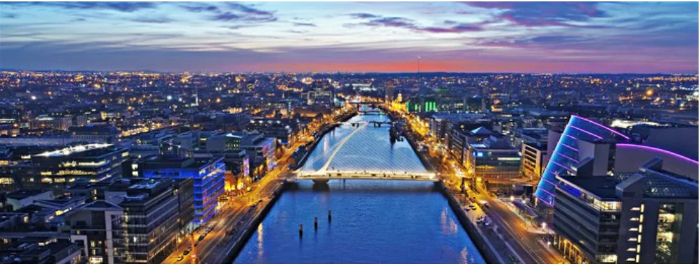
Figure from page 34

Figure from page 35
Growth Strategy
The Dublin – Belfast Economic Corridor
The Dublin to Belfast Corridor is the largest economic agglomeration on the island of Ireland, with the cities and towns along the Corridor home to a population of around 2 million people. The Eastern Seaboard has seen the highest growth and highest internal migration of our population. The Corridor links the two largest cities and the large towns of Drogheda, Dundalk and Newry on the island by highcapacity road and national rail links and plays a critical role in supporting economic growth and competitiveness.
Growth Enablers for the Dublin- Belfast Economic Corridor include;
• Compact and focused growth in the Regional Growth Centres of Drogheda and Dundalk to grow to city scale.
• Drive in the linkage between Dundalk and Newry to strengthen a cross border synergy in services and functions.
• Improve accessibility and service by rail, road and communication between Dublin and Belfast.
The Corridor is also the national entry point to the island through its airports and ports. Three major airports, Dublin Airport, Belfast International Airport and Belfast City Airport, and significant ports in Belfast and Dublin, with complimentary ports along the Corridor.
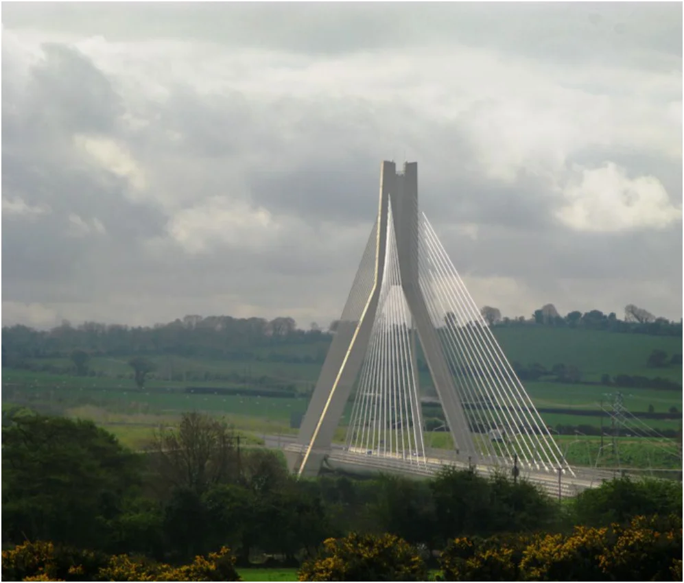
Figure from page 35

Figure from page 36
Regional Spatial & Economic Strategy
The Core Region
The Core Region includes the peri-urban ‘hinterlands’ in the commuter catchment around Dublin, which covers the Mid-East counties of Louth, Meath, Kildare and Wicklow, extending down the East Coast and into parts of the Midlands. More than 550,000 people reside in the Core Region in 2016. The Mid-East has seen the highest ten year population growth to 2016 in the Region and contains some of the youngest and fastest growing towns in the state. The Core Region enjoys access to a high-quality environment, rich heritage and key tourism assets and attractions such as the coastline, the Royal and Grand Canals, the Boyne and Barrow Blueways, Tayto Park, UNESCO site at Bru na Boinne and Wicklow Mountains National Park.
The Core Region contains a strong network of county and market towns that have a good level of local employment, services and amenities, which serve not just their resident populations but a wider catchment area. These include Arklow, Balbriggan, Drogheda, Navan, Naas, Newbridge and Wicklow. These towns have capacity for continued commensurate growth to become more self-sustaining and to attract high quality knowledgebased employment at strategic accessible locations.
Growth Enablers for the Core Region include;
• To promote continued growth at more sustainable rates, while providing for increased employment and improved local economies, services and functions to allow towns become more self-sustaining and to create the quality of life to attract investment.
• Drogheda to realise its potential to grow to city scale and secure investment to become a self-sustaining Regional Growth Centre on the Dublin-Belfast Economic Corridor, driving synergies between the Drogheda - Dundalk - Newry cross border network.
Some areas in the Core Region have emerged mainly as commuting towns, experiencing high rates of population growth but with a weak level of services and functions for their resident populations. These towns will require ‘catch up’ investment in local employment and services in order to become more self-sustaining and to improve sustainable mobility, particularly in those places where there are high levels of car dependency.
• Commensurate population and employment growth in Key towns, coupled with investment in enabling transport, infrastructure and services to facilitate the achievement of compact growth targets of at least 30% of all new homes to be within the existing built up area of settlements.
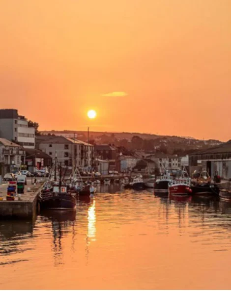
Figure from page 36
• ‘Catch up’ investment to promote consolidation and improvement in the sustainability of those areas that have experienced significant population growth but have a weak level of services and employment for their residents.
• Diversification and specialisation of local economies with a focus on clustering, smart specialisation, place making and urban regeneration to create the quality of life to attract FDI and indigenous investment and increase high value knowledge-based employment including second site and relocation opportunities.
• Promote the Region for tourism, leisure and recreational activities including development of an integrated greenway network while ensuring that high value assets and amenities are protected and enhanced.

Figure from page 37
Growth Strategy
The Gateway Region
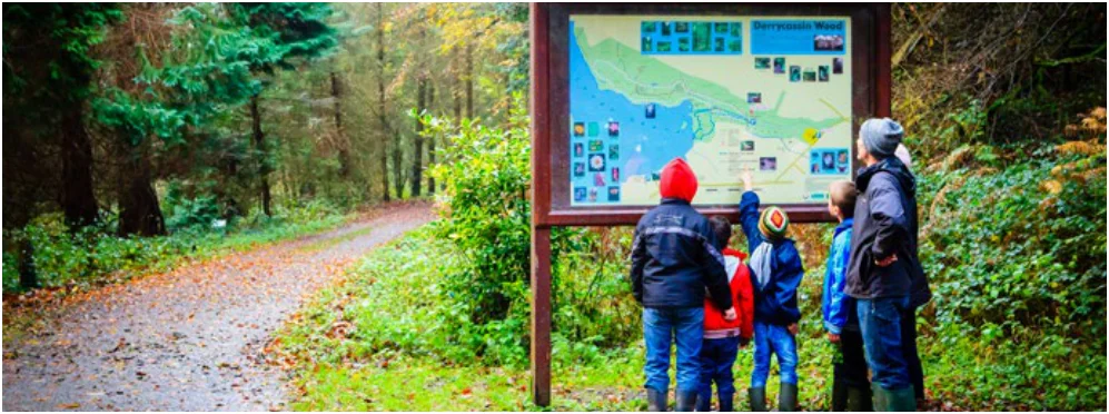
Figure from page 37
The Gateway Region includes the midlands and border areas which act as interregional gateways to the rest of the island, and parts of southwest Wicklow. More than 370,000 people reside in the Gateway Region in 2016, which includes the Regional Growth Centres of Athlone and Dundalk, as well as an extensive network of county and sub county towns and small towns and villages, which support the wider rural and agricultural area where the population is more dispersed. The area contains many key natural resources and tourism assets under the Hidden Heartlands brand, including the River Shannon and inland waterways, Carlingford and the Cooley Peninsula, Slieve Blooms, Lakelands and midland peatlands including Lough Boora.
Growth Enablers for the Gateway Region area include;
• Support continued growth of Athlone, with a focus on quality of life and securing the investment to fulfil its role as a key Regional Growth Centre and economic driver in the centre of Ireland.
• Support compact growth in the Regional Growth Centre of Dundalk to grow to city scale, capitalising on its location on the Dublin- Belfast Economic Corridor to drive the linkage between Dundalk and Newry to strengthen cross border synergy in services and functions.
• ‘Catch up’ investment to promote consolidation and improvement in the sustainability of those areas that have experienced significant population growth but have a weak level of services and employment for their residents.
The location of the Midlands is strategically important, with an influence that extends to all three Regional Assembly areas. Towns that straddle regional boundaries and act as gateways to the south, west and northwest include Carlow- Craigucullen, Athlone and Longford. Like Mullingar, Portlaoise and Tullamore, these towns provide functions at a much higher level than their resident population, providing key employment and services for their own extensive hinterlands.
• Regeneration of small towns and villages, with a focus on the identification of rural town, village and rural regeneration priorities to bring vibrancy to these areas.
• Diversification and growth of smart specialisation of local economies with a strong focus on clustering including sustainable farming and food production, tourism, marine, energy and renewables, bioeconomy and circular economy, with a focus on publicly owned peatlands in the midlands, to support a ‘Just’ transition and realise the benefits of green technologies.
The northeast includes County Louth and parts of Meath, which are strategically located in proximity to the Dublin- Belfast cross-border network, focussed on Drogheda, Dundalk and Newry and which is the largest economic agglomeration on the island of Ireland, and will become more important post Brexit, acting as national entry point to the island through its airports and ports.
• Promote the Region as a key destination for tourism, leisure and recreation activities and support the development of an integrated network of greenways, blueways and peatways while ensuring that high value assets and amenities are protected and enhanced.

Figure from page 38
Regional Spatial & Economic Strategy
Collaboration
Compact Growth
The RSES identifies enablers for the Region, however it is recognised that to deliver on this strategy there is a need for collaboration and coordination, across boundaries, sectors and organisations. The Assembly will foster collaboration in the allocation of funds to maximise the value for money and delivery of RSES policy. Furthermore, the RSES will enable cross boundary collaboration between local and regional bodies in relation to enterprise and employment, transport, education, retail and service delivery.
A key National Strategic Outcome (NSO 1) in the NPF and Regional Strategic Outcome (RSO 2) in the RSES is the need to achieve ambitious targets for compact growth in our urban areas. Urban regeneration and infill sites can contribute to sustainable compact growth and revitalisation of existing settlements of all scales. This will help to address National Policy Objective 3a, 3b and 3c of the NPF which targets the delivery of new homes within the footprint of existing settlements8.
Cross boundary coordination is a significant element of the Strategy and will be even more so with the onset of Brexit which is likely to have a direct impact upon the border. This will affect movement of people and goods, will have direct economic impact upon the Region and will lead to environmental concerns. Post – Brexit consideration should be given to a process that can firmly establish protocols for environmental protection and trans-boundary communication. Further coordination will be fostered by the Assembly in the establishment of a relevant structure to address complex policy areas such as the preparation of a Maritime Spatial Plan for the Region.
Achieving this target will require active land management responses to ensure that land and building resources within existing settlements are used to their full potential. As part of this approach, preparing sites within urban contexts for regeneration will require consideration of historic industrial uses and processes that could have impacted on ground conditions. This will require forward planning for how legacy issues such as removing or treating contaminated soil and remediating the ground on-site appropriately is factored into the regeneration process.
This is a necessary part of the assessment of the potential of brownfield sites as the removal and treatment of contaminated soils can prove problematic and could hinder the delivery of otherwise suitable sites in an urban context.
More effective strategic planning and co-ordination of the future development of nationally and regionally strategic locations that straddle inter- or intra-regional boundaries, for example Athlone, Carlow, Drogheda and Dundalk / Newry, is required. The Regional Assembly will ensure that joint urban area plans are delivered for the Regional Growth Centres by the relevant local authorities to deliver regional centres of scale.
It is considered that a set of Guiding Principles are necessary to deal with the complexities of brownfield regeneration.
8 NPO 3a Deliver at least 40% of all new homes nationally, within the built-up footprint of existing settlements.
NPO 3b Deliver at least half (50%) of all new homes that are targeted in the five Cities and suburbs of Dublin, Cork, Limerick, Galway and Waterford, within their existing built-up footprints.
NPO 3c Deliver at least 30% of all new homes that are targeted in settlements other than the five Cities and their suburbs, within their existing built-up footprints.

Figure from page 39
Growth Strategy
GUIDING PRINCIPLES
REGIONAL POLICY OBJECTIVES:
Compact Growth
Local authorities, in the preparation of the core strategies of their development plans, shall consider the following Guiding Principles to deal with the complexities of brownfield and infill sites;
RPO 3.2: Local authorities, in their core strategies shall set out measures to achieve compact urban development targets of at least 50% of all new homes within or contiguous to the built up area of Dublin city and suburbs and a target of at least 30% for other urban areas.
• The establishment of a database of strategic brownfield and infill sites as part of the active land management process, that identifies the development capacity and any constraints on sites that are zoned for development including potential contamination and incorporating other relevant databases such as the Derelict Sites Register and the Vacant Sites Register. The database should be spatially referenced and searchable to allow for regular updating and monitoring and so that brownfield re-use can be managed and co-ordinated across multiple stakeholders.
RPO 3.3: Local authorities shall, in their core strategies, identify regeneration areas within existing urban settlements and set out specific objectives relating to the delivery of development on urban infill and brownfield regeneration sites in line with the Guiding Principles set out in the RSES and to provide for increased densities as set out in the ‘Sustainable Residential Development in Urban Areas’, ‘Sustainable Urban Housing; Design Standards for new Apartments Guidelines’ and the ‘Urban Development and Building Heights Guidelines for Planning Authorities’.
• Proposals for strategic brownfield and infill sites should be accompanied by a site brief and/or masterplan that sets out a phased programme for the regeneration of the site and demonstrates how the proposal will comply with National Guidelines that seek to achieve sustainable compact development and to integrate principles of good urban design and placemaking9.
• Local authorities should liaise with the Regional Waste Management Office when considering proposals for the development of brownfield sites that require the offsite disposal of contaminated waste, so that a programme for site remediation can be identified early and considered by all stakeholders. Proposals for brownfield regeneration in strategic locations should be accompanied by a site risk statement and waste plan and for the disposal of any wastes arising including any hazardous or contaminated material.
• Encourage pilot projects for the re-use of brownfield sites and encourage active temporary uses where feasible and as far as practicable to encourage activation of vacant sites that require longer lead in time regeneration processes.
• Set out measures to reduce vacancy and the underuse of existing building stock and support initiatives that promote the reuse, refurbishment and retrofitting of existing buildings within urban centres.
• Explore opportunities for biodiversity enhancement to improve ecological connectivity as part of the strategic re-intensification of urban infill and brownfield sites.
9 DHPLG Guidelines ‘Urban Development and Building Heights’ and ‘Sustainable Urban Housing; Design Standards for New Apartments’, 2018, ‘Design Manual for Urban Roads and Streets (DMURS)’, 2013, ‘Sustainable Residential Development in Urban Areas’, 2009.

Figure from page 40
Regional Spatial & Economic Strategy
Environmental Assessment
At the project level, all applications for development consents for projects emanating from any policies that may give rise to likely significant effects on the environment will need to be accompanied by one or more of the following, as relevant:
The RSES is a tier within a planning framework which is guided by the NPF and will be supported by further robust tiering of county and local level plans within an overall hierarchy. As detail is developed down through the hierarchy, further opportunity for focused assessment will be required to inform decision making at a level of greater granularity. It is therefore important that where other strategies and plans undergo review or changes to reflect the national and regional policy objectives and outcomes of both the NPF, and subsequently the RSES, they should also consider any relevant environmental requirements.
• An Ecological Impact Assessment Report (EcIA),
• Environmental Report (ER) including Flood Risk Assessment (FRA)
• An Environmental Impact Assessment Report (EIAR) if deemed necessary under the relevant legislation (statutory document),
Feasibility studies will be carried out to support decision making in relation to policy base for this RSES and this will include an environmental appraisal which considers the potential effects on the wider environment, including specifically, the Natura 2000 Network. Furthermore, feasibility studies will be supported by robust site / route selection processes which consider a full range of alternative modes and technologies.
• Natura Impact Statement if deemed necessary (NIS) under the relevant legislation (statutory document).
The RSES recognises that at the project consent stage if it appears that any element of the RSES cannot be implemented without adverse impacts which cannot be adequately mitigated or compensated then the proposals will only make provision for the level and location of development for which it can be concluded that there will be no adverse effect.
Figure from page 40

Figure from page 41
Growth Strategy
Assessment of Proposals for Greenhouse Gas Emissions (GHGs)
Sustainable Growth
In line with RSO 9 EMRA supports the plans and projects for climate action from local authorities and the Department of Communication Climate Action and Environment aimed at accelerating the transition to a low carbon and circular economy. Chapter 7 Environment elaborates on the approach the RSES adopts to achieve sustainability for the Region.
Local authorities, in preparing their development plans, are required to include objectives for the promotion of sustainable settlement and transportation strategies in urban and rural areas. This is to include the promotion of measures to reduce energy demand in response to the likelihood of increases in energy and other costs due to long-term decline in non-renewable resources, reduce anthropogenic greenhouse gas emissions and address the necessity of adaptation to climate change.
REGIONAL POLICY OBJECTIVE:
Sustainable Growth
Guidelines, prepared by The Department of Housing, Planning and Local Government (DHPLG), will provide clarification around the development of a suitable methodology for measuring carbon emissions, appropriate to strategic land use designation and related transport infrastructure in the context of the preparation of city/county development plans.
RPO 3.7: Local authorities shall have regard to environmental and sustainability considerations for meeting sustainable development targets and climate action commitments, in accordance with the National Adaptation Framework. In order to recognise the potential for impacts on the environment, local authorities shall address the proper site/route selection of any new development and examine environmental constraints including but not limited to biodiversity, flooding, landscape, cultural heritage, material assets, including the capacity of services to serve any new development.
It is not the intention of the RSES to render approval of land use designation or transport infrastructure, conditional on consistency with GHG emissions reductions targets in the absence of an agreed methodology at national level. In the interim, the RSES will support the development of a methodology to assess the impact of city and county development plan strategies on carbon reduction targets.
REGIONAL POLICY OBJECTIVES:
Environmental Assessment and Assessment of Greenhouse Gas (GHG) Emissions
RPO 3.4: Ensure that all plans, projects and activities requiring consent arising from the Regional Spatial and Economic Strategy are subject to the relevant environmental assessment requirements including SEA, EIA and AA as appropriate. In addition the future strategic development of settlements throughout the Region will have full cognisance of the legal requirements pertaining to sites of International Nature Conservation Interest.
RPO 3.5: Identification of suitable employment and residential lands and suitable sites for infrastructure should be supported by a quality site selection process that addresses environmental concerns such as landscape, cultural heritage, ensuring the protection of water quality, flood risks and biodiversity as a minimum.
RPO 3.6: City and county development plans shall undergo assessment of their impact on carbon reduction targets and shall include measures to monitor and review progress towards carbon reduction targets.
Regional Spatial & Economic Strategy
4 People & Place
Pages 33–42 · View in original PDF