5 Proposed County Cycle Networks
This project is one network plan comprised of 22 networks. Following comprehensive data collection, and liaising with county councils, the NTA Cycle Design Office developed the CycleConnects cycle network plans. The network was developed by looking at each county and ensuring that as many settlements as possible are connected. Additionally, it was important to ensure that there is intercounty connectivity, by allowing for interurban connections across the county borders.
The proposed CycleConnects cycle network plans are comprised of 22 county maps and 57 urban maps. These urban maps were developed for the towns with a population over 5,000 people (2016 Census Data). This was considered as there would be a sufficiently large population to facilitate a denser network. The urban maps consist of primary and secondary routes. The primary routes connect to the main trip attractors and ideally will provide a high level of service. These will be supplemented by the secondary routes which will serve residential areas and areas of employment. Table 5.1 below outlines the complete list of each County and Urban Cycle Network which was developed as part of the overall CycleConnects Plan.
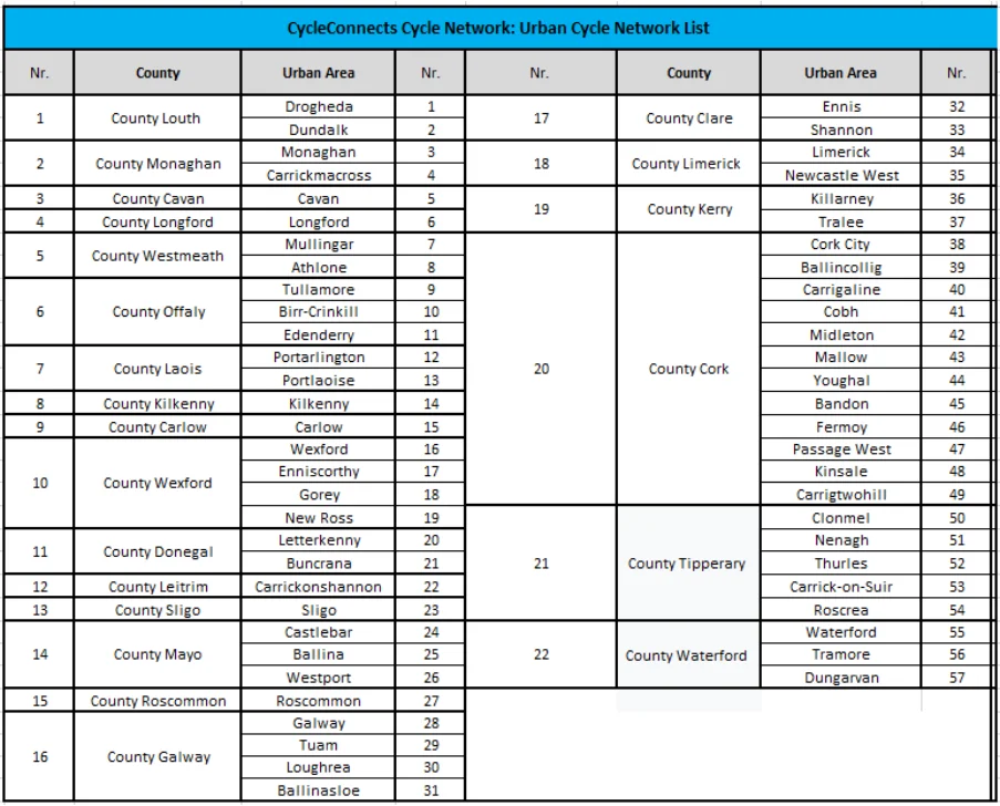
Table 5.1: CycleConnects Urban Network List
Page 10 · View in original PDF